You must be logged in to view this content. Click Here to become a member of IndyWX.com for full access. Already a member of IndyWx.com All-Access? Log-in here.
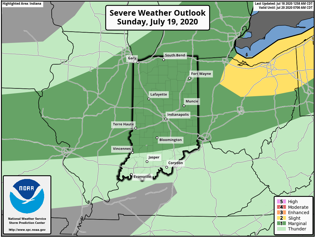
II. Keeping eyes to the sky for periods of gusty storms.
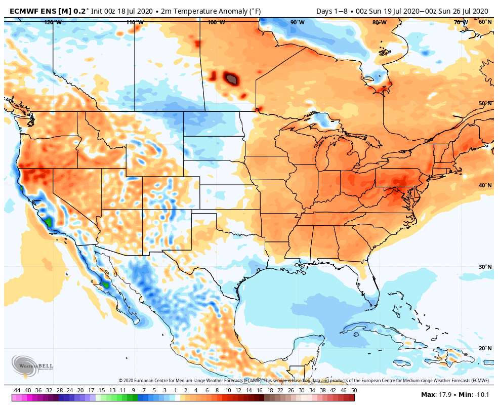
Temperatures will run above average across the eastern half of the country through the period.
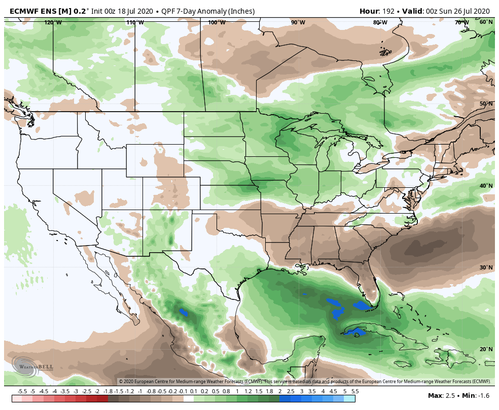
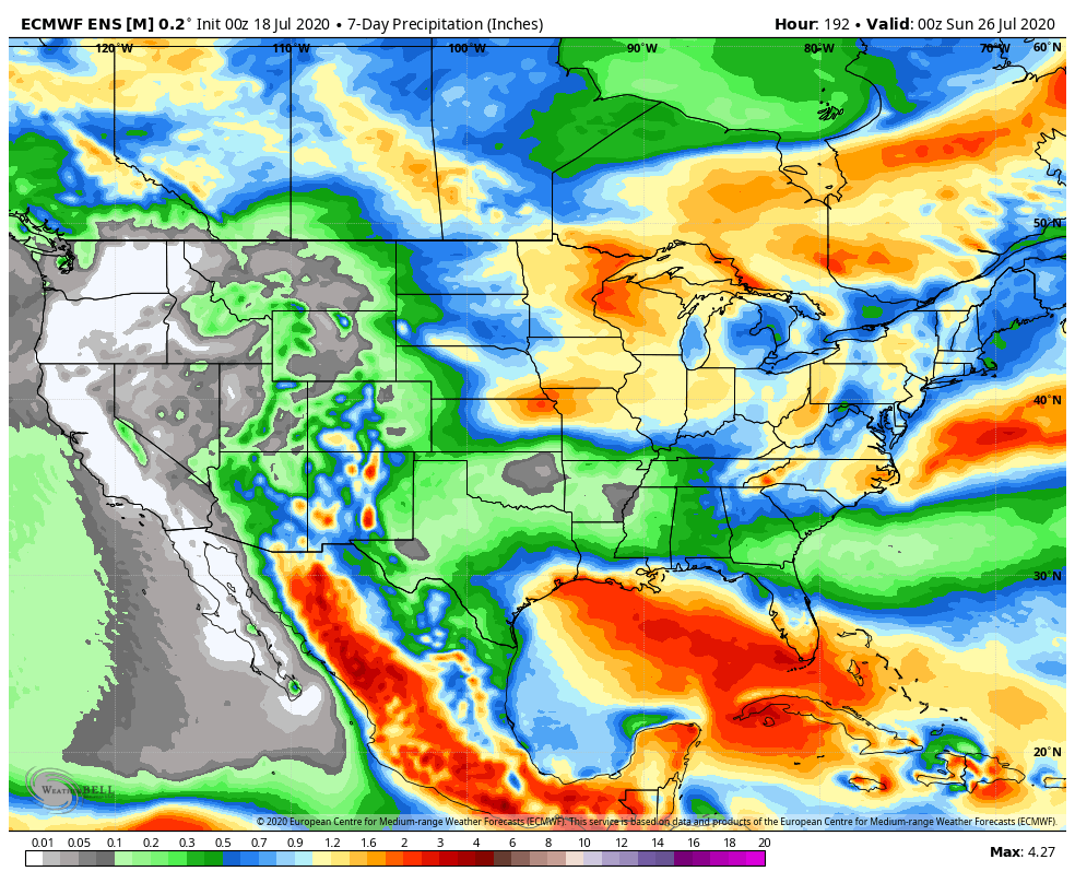
Above average rainfall is expected from the Northern Plains into the western Great Lakes and Ohio Valley through the period. The Southeast will run drier than normal.
Specific to central Indiana, we expect 7-day rainfall numbers to be very close to 1″ with locally heavier amounts.
A threat of severe weather is present Sunday (damaging winds are the greatest concern).
Forecast Period: 07.18.20 through 07.25.20
A hot and humid stretch of weather will dominate the upcoming forecast period, including another multi-day stretch with highs in the lower 90s and lows in the lower 70s. The saving grace? Timely rains. After a mostly dry Saturday (only isolated storm coverage expected), more widespread storms are expected Sunday. Some of these could become strong to severe Sunday afternoon, including the threat of damaging winds as a complex moves south through the state. This unsettled theme will continue into the 1st half of the work week with each day offering up scattered showers and storms. Drier air will briefly nudge into the Ohio Valley Thursday and Friday before storm chances return next weekend.
You must be logged in to view this content. Click Here to become a member of IndyWX.com for full access. Already a member of IndyWx.com All-Access? Log-in here.
You must be logged in to view this content. Click Here to become a member of IndyWX.com for full access. Already a member of IndyWx.com All-Access? Log-in here.
High pressure will supply another fantastic day of weather including plentiful sunshine. Humidity levels will remain low today as highs top out in the upper 80s (in case you’re wondering, the average high for July 14th is 85°). Most of our Wednesday will also be nice, but that begins to change Wednesday night…
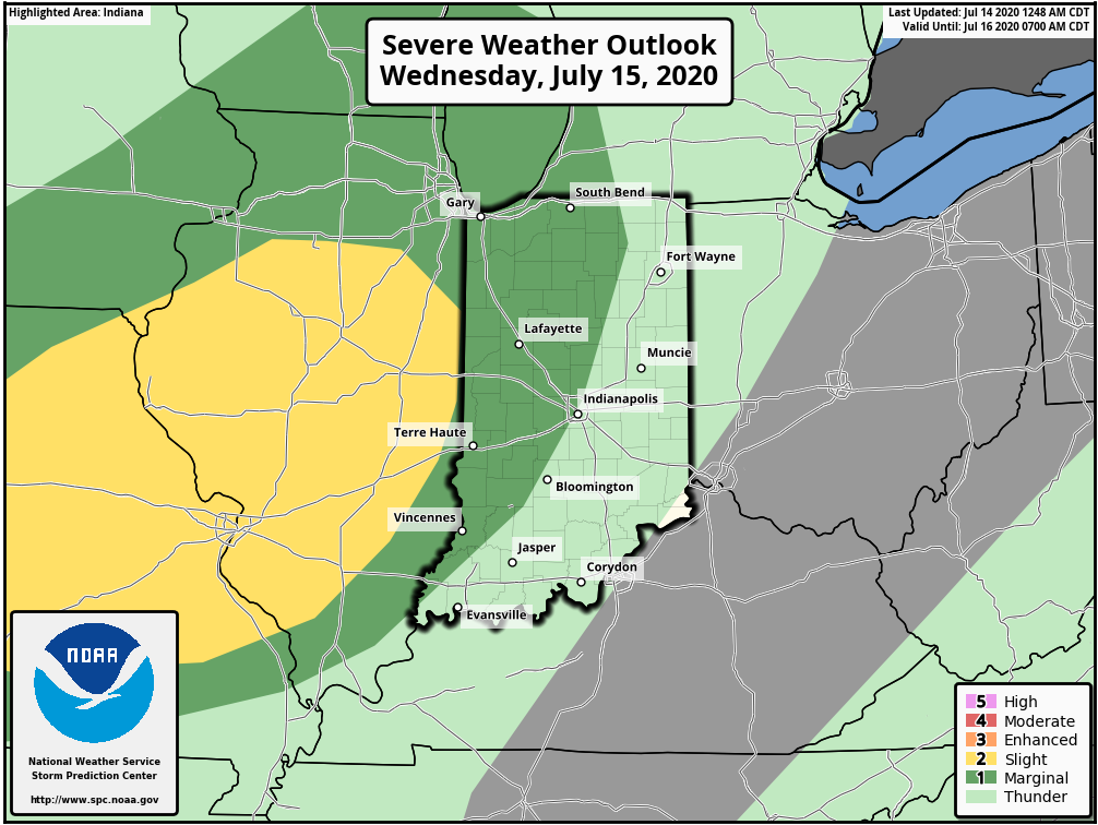
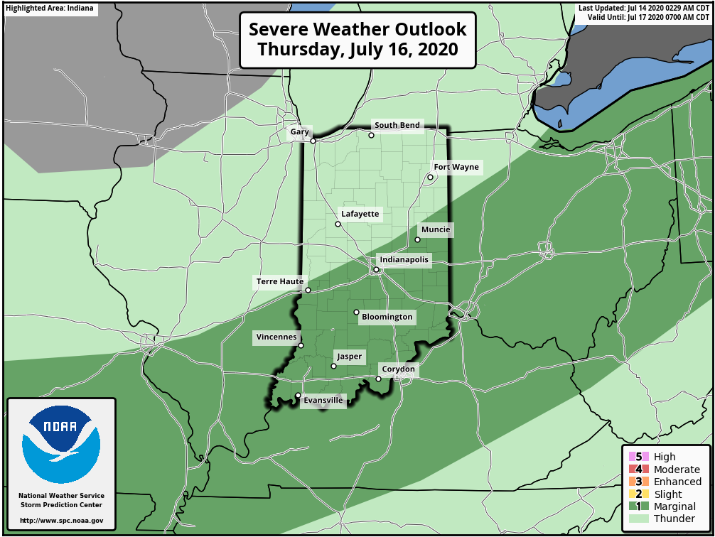
The Storm Prediction Center includes central Indiana in a ‘marginal’ risk of severe weather both Wednesday and Thursday. This is to account for the potential of a strong-to-severe complex of thunderstorms moving across the state during the overnight period.
This is all thanks to an approaching low pressure system and associated frontal boundary. Eventually, the low pressure system will “wash out” but the boundary will linger in the vicinity, keeping the threat of strong to severe storms across southern and southeastern Indiana during the daytime Thursday.
The vast majority of central Indiana will likely have to deal with thunderstorms late Wednesday night into the predawn Thursday. Given the ingredients in place (50 knot low level jet and dew points that should be approaching 70°) Wednesday night, embedded strong-to-severe thunderstorms are expected. The biggest concerns will be damaging straight line wind potential with these storms.
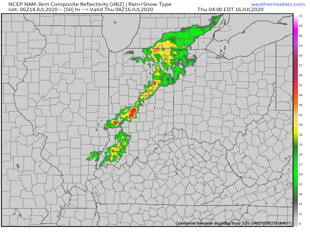
Forecast radar 4a Thursday.
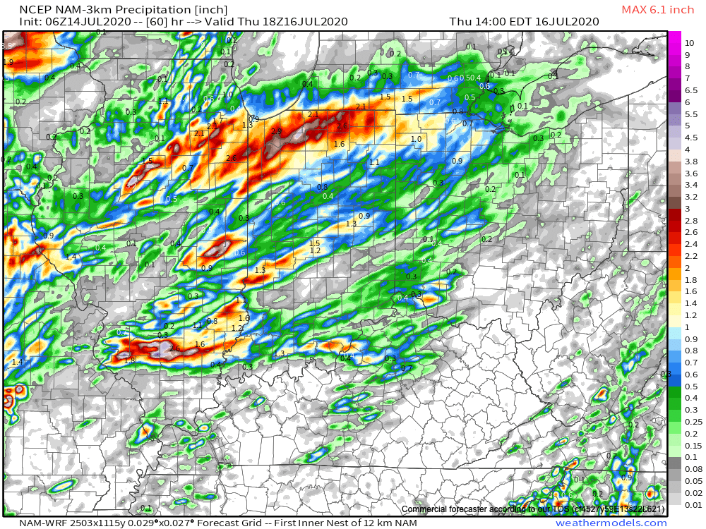
Locally heavy rain will also be likely as moisture levels rise overnight into Thursday. A quick 1″ of rain can be expected for most of central Indiana with locally heavier amounts where the stronger storms track.
We’ll have more on this and the pattern ahead with our evening video update a bit later. Make it a great Tuesday!