Category: Rain

Tuesday Evening Video Brief; The Cool Down Is On!

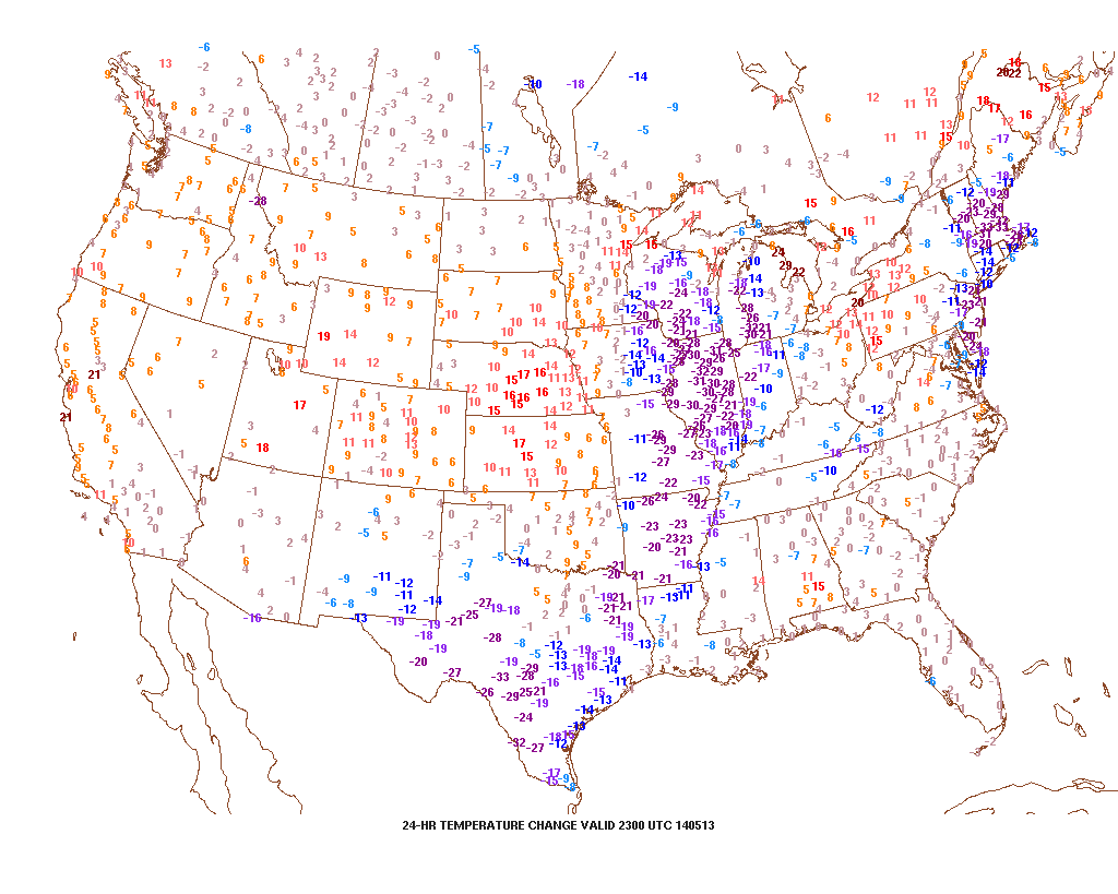
Note how dramatic of a temperature shift is occurring to our west- temperatures are down more than 30 degrees from this same time last night.

t0

That cool air will filter into our region tonight and Wednesday.  As a matter of fact, we still think Thursday has the potential to remain in the 40s for the better part of the day.  The video below has more details on this and a look ahead to continued rainy times.

Permanent link to this article: https://indywx.com/tuesday-evening-video-brief-the-cool-down-is-on/

Showers And Storms Then MUCH Cooler…

Tue.

Wed.

Thr.

Fri.

Sat.

Sun.

Mon.

 Status-weather-showers-day-icon

 Status-weather-storm-night-icon

 Status-weather-showers-scattered-icon

 Status-weather-showers-day-icon

 Status-weather-showers-day-icon

 Status-weather-clouds-icon

 Status-weather-clouds-icon

67/ 80

50/ 67

45/ 52

40/ 56

41/ 57

39/ 62

43/ 65 

Light

Moderate

Light

Light

Light

– – –

– – –

Stepping outside this morning you would think it was July or August.  Unseasonably warm conditions are coupling with dew points in the middle to upper 60s to help create quite the muggy feel to the central Indiana air mass once again.  This will help fuel showers and heavy rain producing thunderstorms today, especially during the PM.  Perhaps the most widespread rain and thunderstorms will arrive Wednesday into early Thursday as a wave of low pressure moves up along a cold front that will be just east of our region by that time frame.  We still forecast locally heavy rainfall amounts during the course of the next 48 hours, including widespread additional 1.25″-1.50″ totals.  The other big story will be the dramatically cooler temperatures that filter in tomorrow.  We’ve called Wednesday our transition day and that remains our idea now, as well.  Temperatures will likely fall through the afternoon and evening hours.  Speaking of cool, temperatures will remain in the 40s for the better part of your Thursday (hope you haven’t put those jackets and sweaters away just yet)!  We’ll slowly begin to shake the showers and clouds over the weekend and have trended more optimistic for Sunday’s forecast into early next week.

Most widespread shower and thunderstorm activity will likely occur Wednesday into early Thursday.

Most widespread shower and thunderstorm activity will likely occur Wednesday into early Thursday.

Permanent link to this article: https://indywx.com/showers-and-storms-then-much-cooler/

Smorgasbord Of Weather!

Posts this weekend will be a bit “off schedule” as I celebrate my brother’s graduation.  That said, posts will hit the site over the weekend and we’ll also keep you updated on our Twitter feed- @indywx.  A busy time of things lies ahead and a very active weather pattern will carry us into this time next week.  Let’s get into some of the details!

1.) (2) rounds of showers and thunderstorms will be likely Friday.  Weakening showers and embedded thunder will dissipate moving into central Indiana Friday morning.  That said, depending on the amount of clearing that takes place behind the first wave of showers and storms will go a long way into determining the severity of round two Friday evening.  The SPC (Storm Prediction Center) continues to highlight our area for a Slight Risk of severe weather (primary threats are large hail and damaging straight line winds) Friday evening.  We also note the latest high resolution NAM simulated radar shows potential strong to severe thunderstorms moving in tomorrow evening.

hires_ref_indy_24

2.) A second heavy rain and storm maker will arrive early next week. The Gulf of Mexico is open for business and suggests some locally heavy downpours are a good bet with both storms.  This isn’t bad news as it’s been dry as of late.  We’re now on day 9 without measurable precipitation and that will be changing in a big way over the upcoming 7 day period.  Widespread 2″-2.5″ rains are a good bet over the upcoming week, including some locally heavier totals.
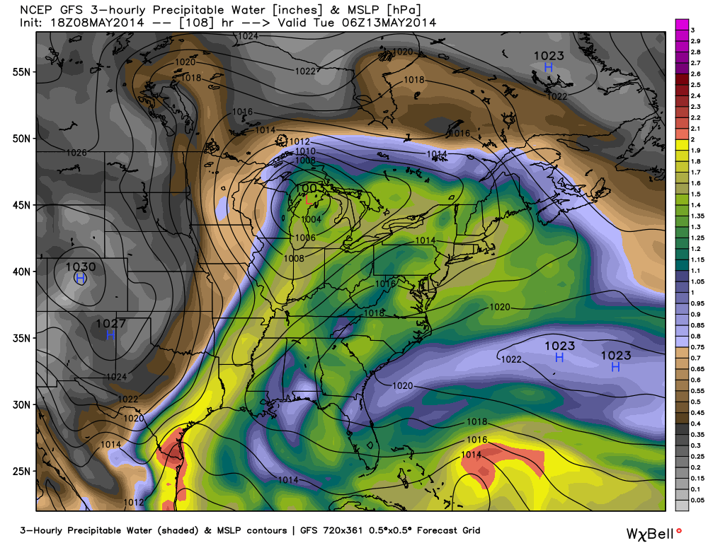
gfs_pwat_mslp_east_37

The detailed video discussion below covers more on the severe chances, heavy rain threat, and a much cooler pattern ahead!

Permanent link to this article: https://indywx.com/smorgasbord-of-weather/

Another Hot Day Today; Busy Pattern On Deck…

Thr. Fri. Sat. Sun. Mon. Tue. Wed.               63/ 84 64/ 70 59/ 73 57/ 81 66/ 80 49/ 67 43/ 59  – –…

You must be logged in to view this content. Click Here to become a member of IndyWX.com for full access.  Already a member of IndyWx.com All-Access?  Log-in here.

Permanent link to this article: https://indywx.com/another-hot-day-today-busy-pattern-on-deck/

Summer-Like Today & Thursday; Storms By Friday.

Wed. Thr. Fri. Sat. Sun. Mon. Tue.               58/ 86 63/ 87 62/ 69 60/ 75 60/ 81 64/ 77 46/ 64  – –…

You must be logged in to view this content. Click Here to become a member of IndyWX.com for full access.  Already a member of IndyWx.com All-Access?  Log-in here.

Permanent link to this article: https://indywx.com/summer-like-today-storms-by-friday/