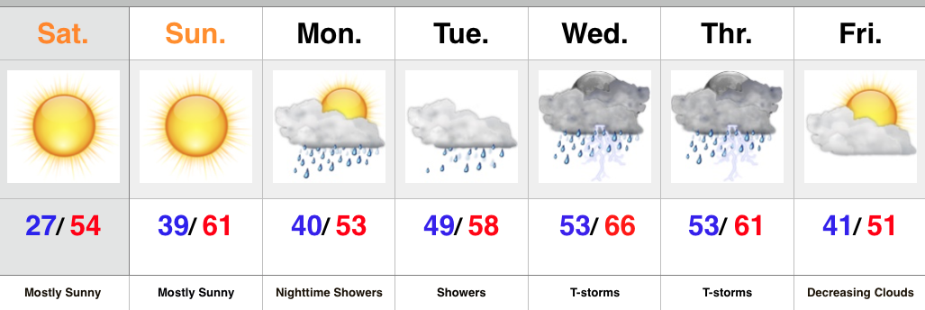
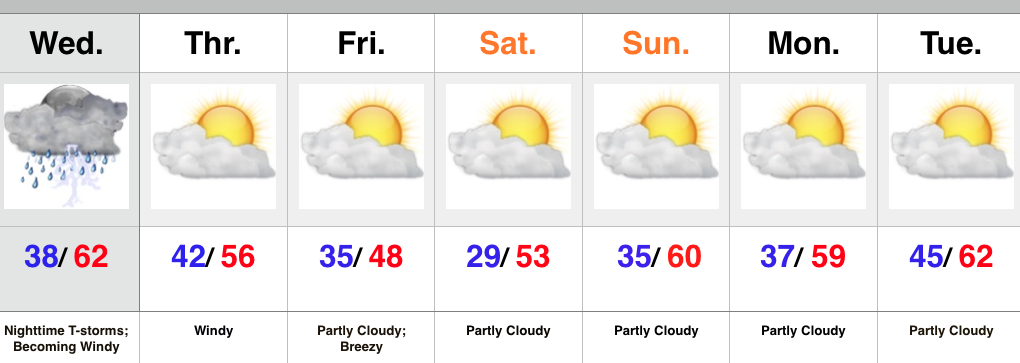
Big, Wet Storm System Sitting On Deck…
Enjoy the weekend, my friends, as a big and wet storm system awaits on deck to impact early to mid week across the region.
November, so far, has followed suit of the past few months in a much drier than normal regime. Over the past (7) days heaviest rains fell across SE portions of the state. On the month so far, IND sits around 1″ below normal.
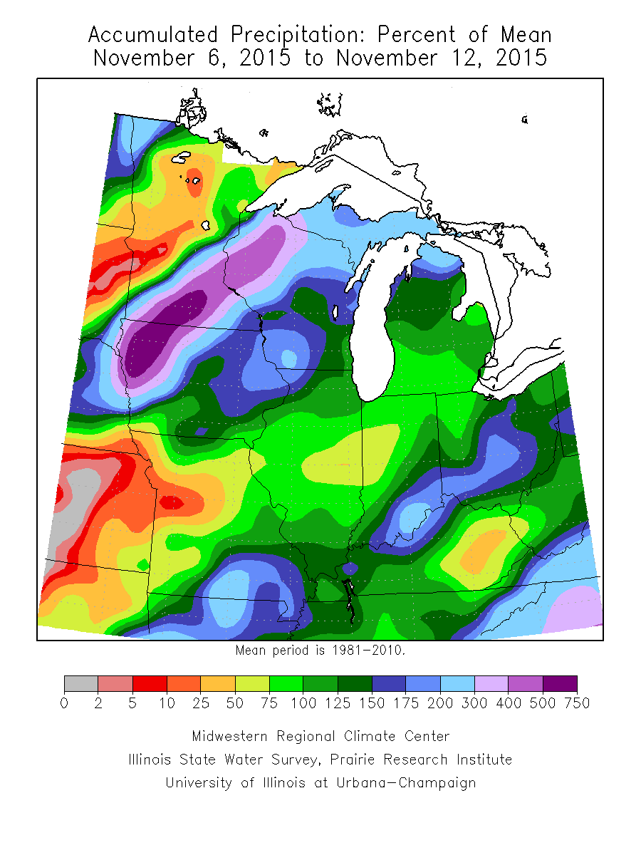
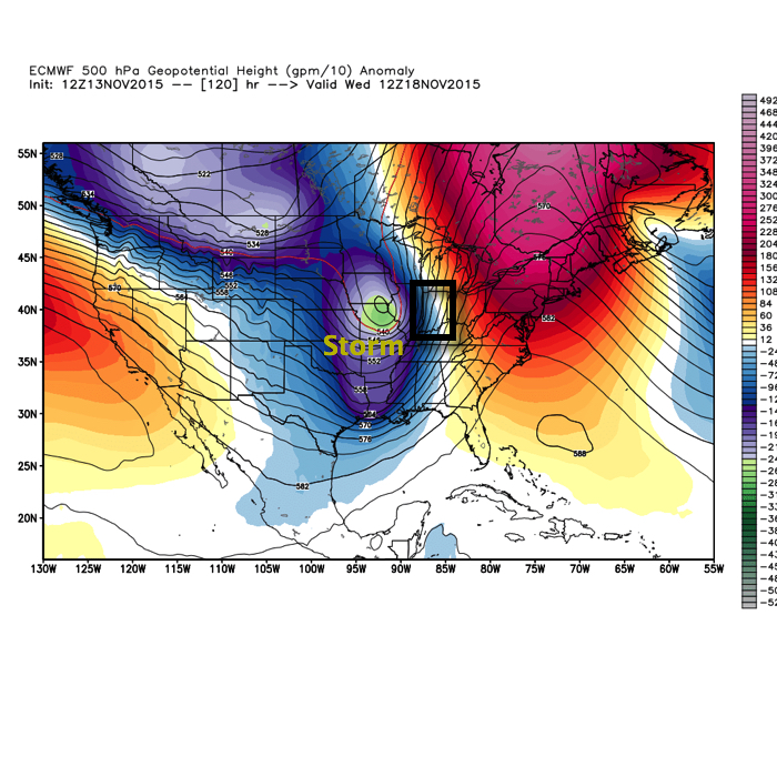
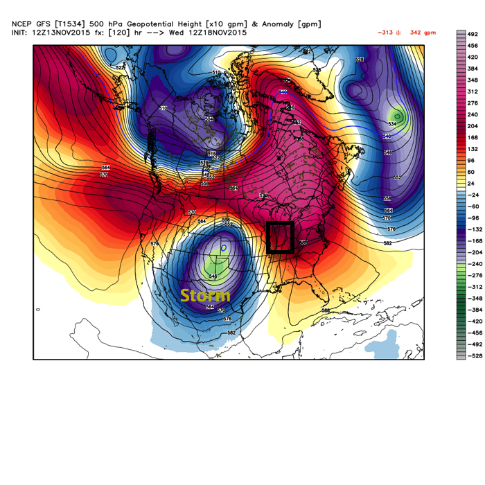
That rainfall deficit may be eaten up over the course of a couple days as our next storm system rolls off the Rockies and into the Plains. (Track sound familiar)?
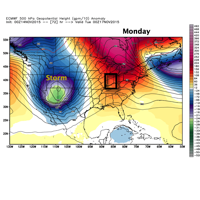
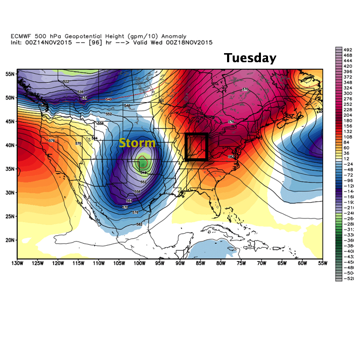
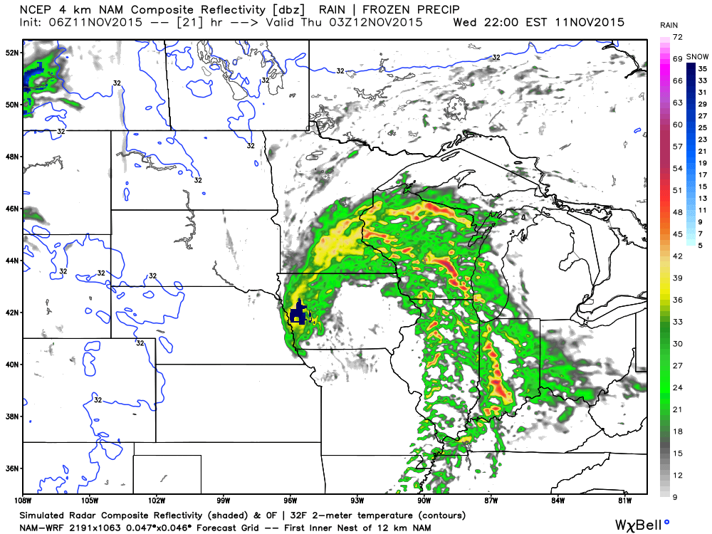
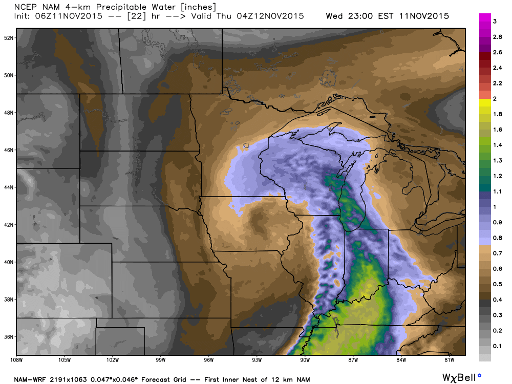
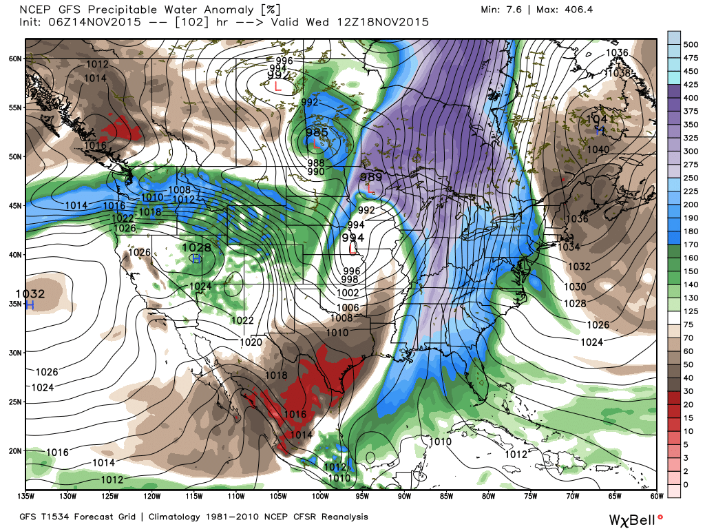
 The storm will tap into the Gulf of Mexico and include a deep southerly flow plenty capable of producing a heavy rain event across the region. Note PWATs (precipitable water) nearly 300% of normal.
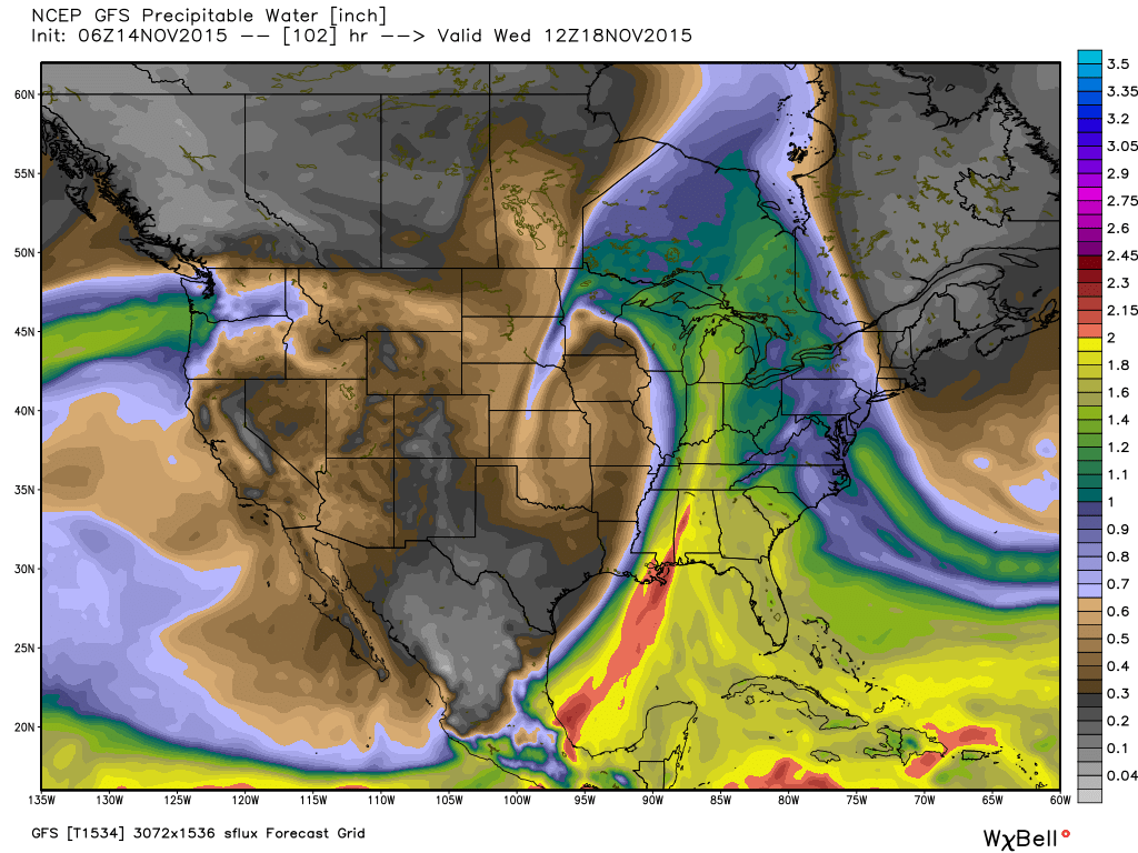
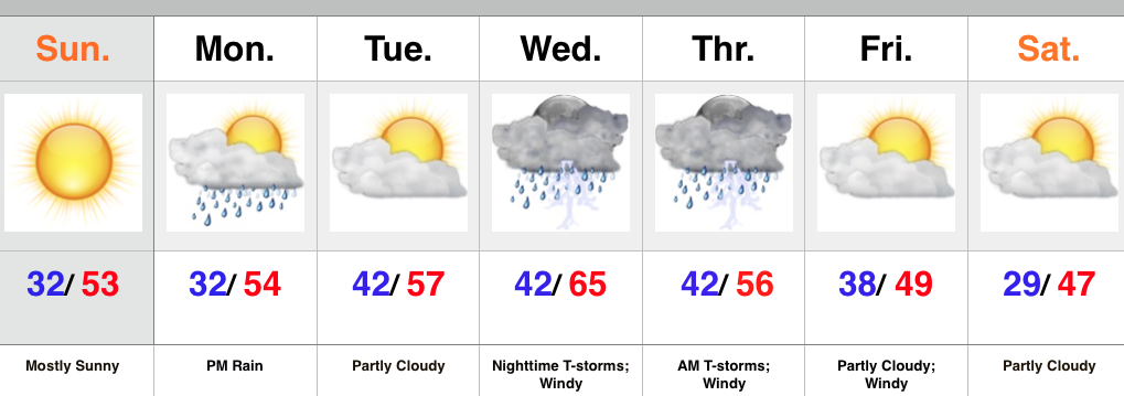
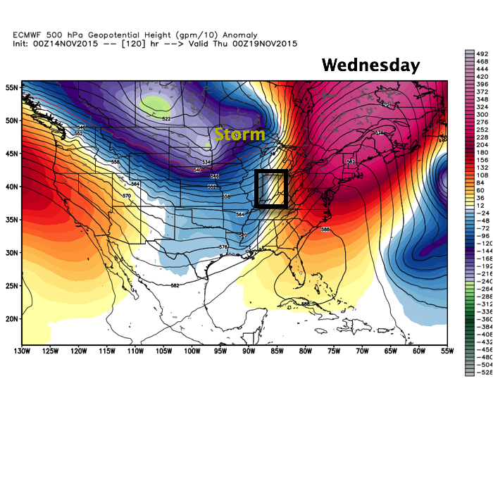
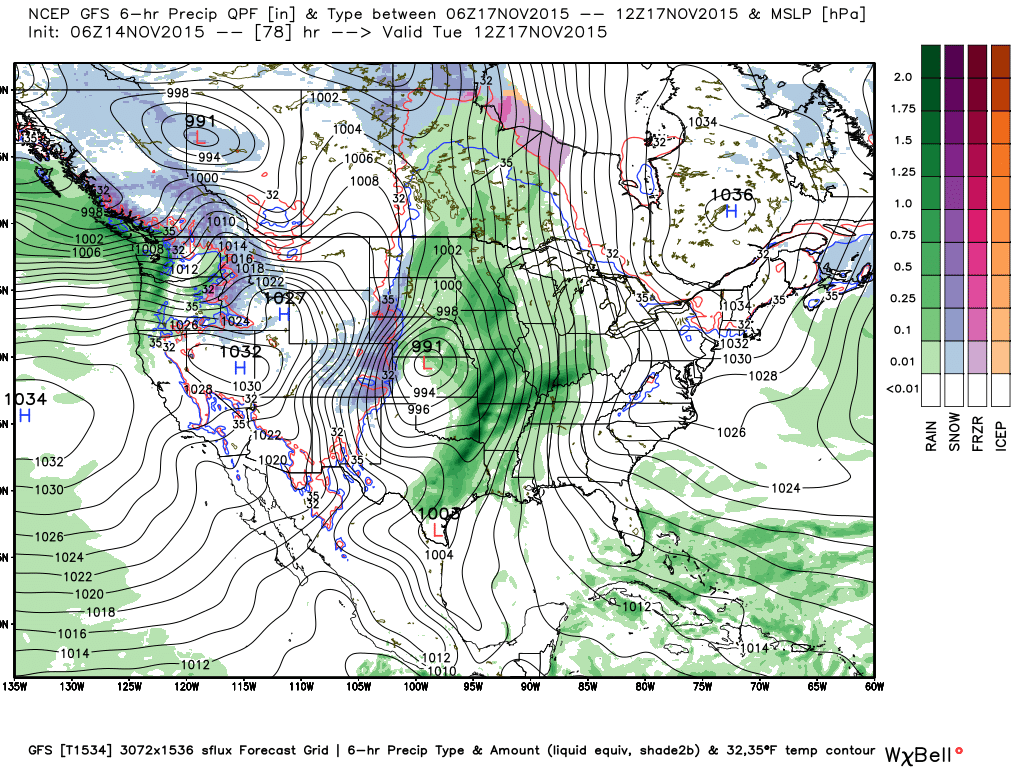
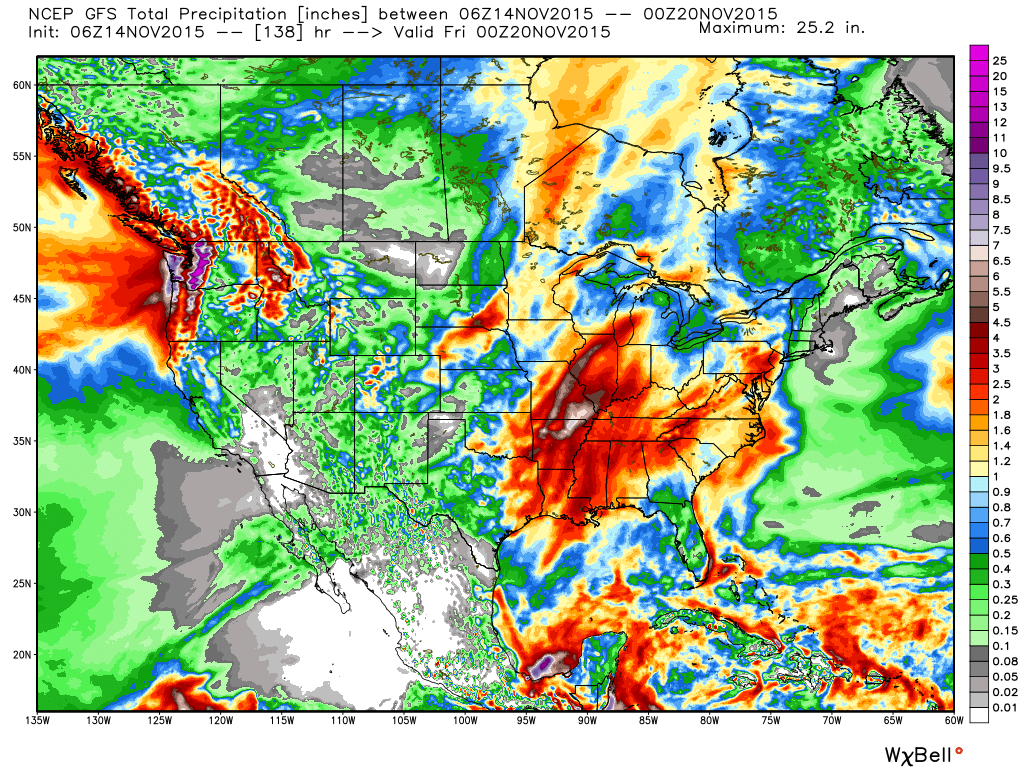
We target Tuesday night-Wednesday as the focal point for heaviest rain potential and model data remains firm on general consensus of 2″-3″ falling with this next storm system, including locally heavier totals.
 After this next storm, attention will begin to shift towards a colder pattern setting up for late November, including Thanksgiving…