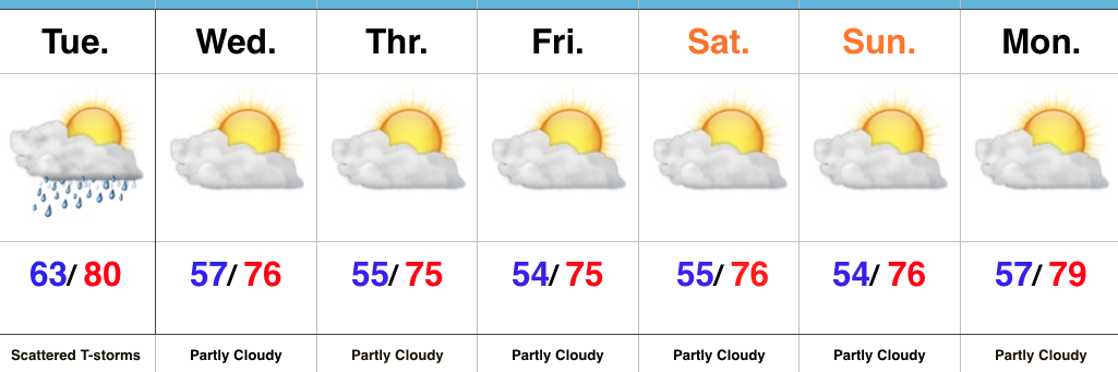
Tuesday Storms Then Much Cooler…
 Highlights:
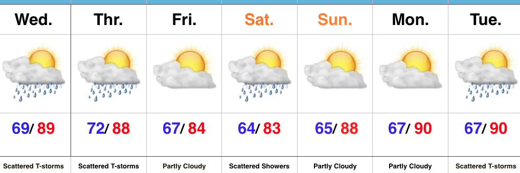
- Scattered storms with locally heavy rain
- Early fall-like feel arrives
- Dry weather returns
Cold Front Arrives…A cold front is pressing into the state today and generating unsettled weather across the region. Widespread heavy rains fell overnight across northern parts of the state (areas just west of Lafayette have picked up 3″-4″ of rain during the past 24 hours). Scattered to numerous showers and thunderstorms can be expected through early evening before a much drier and cooler air mass arrives tonight behind the frontal passage.
That drier and cooler regime will set the tone for the rest of the week and weekend. High pressure will settle in and provide plentiful sunshine. Additionally, cool, Canadian air will pour south as we progress through the second half of the week. This will result in well below normal temperatures and conditions that will feel more like mid to late September rather than late August.
Tropics: Harvey is likely to stage a comeback over the next few days once he emerges into the southwest Gulf of Mexico. Folks with interests along the Texas coastline should certainly monitor Harvey for tropical implications as the weekend approaches. An interior heavy rain/ flood threat will result, as well.
Upcoming 7-Day Precipitation Forecast:
- Snowfall: 0.00″
- Rainfall: 0.25″ – 0.75″
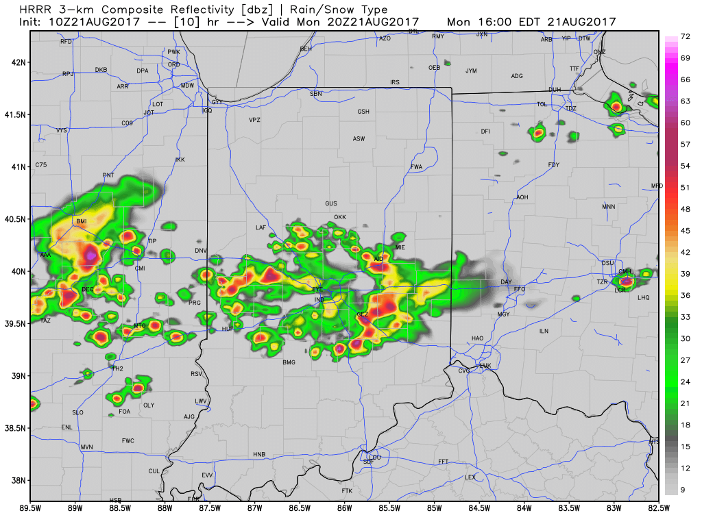
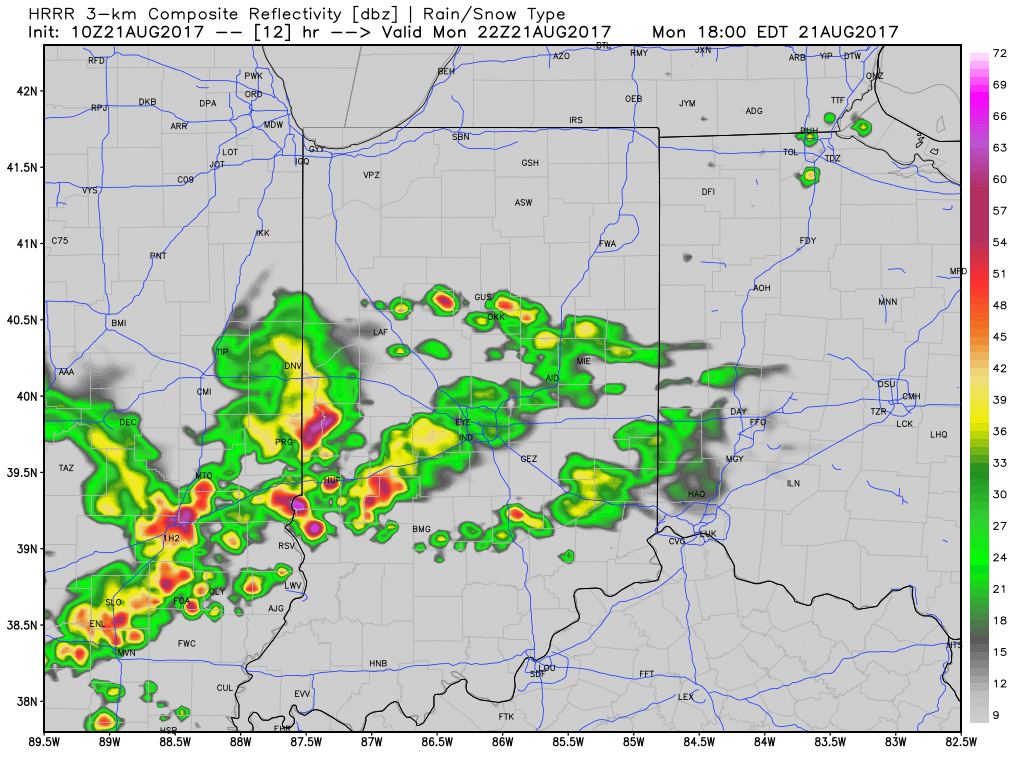
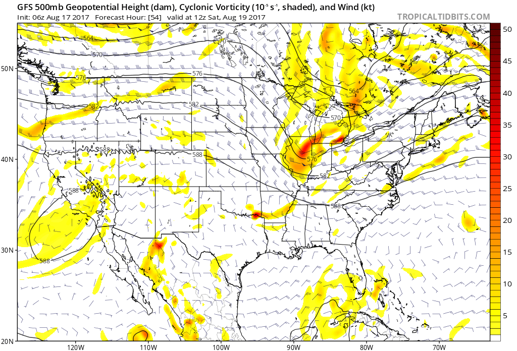
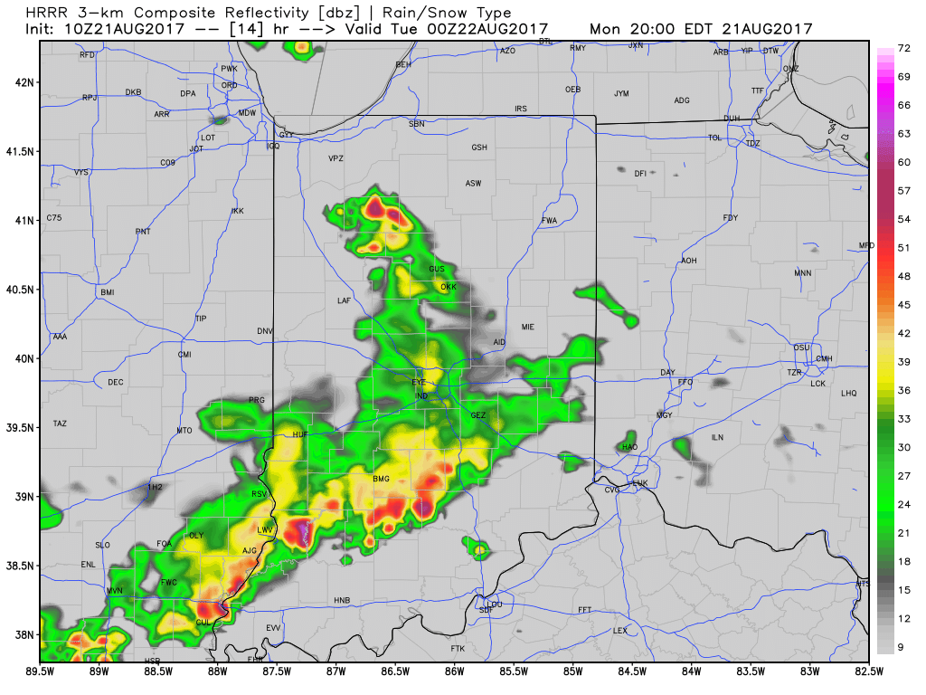 With leftover boundaries from early morning storms across northern parts of the state (likely will serve as a “trigger” for PM storm development), combined with a hot and muggy airmass, confidence is increasing on numerous showers and thunderstorms across central Indiana this afternoon and evening. Widespread heavy rain isn’t expected this afternoon, but localized hefty downpours are a good bet with precipitable water values (PWATs) approaching 2″ this afternoon.
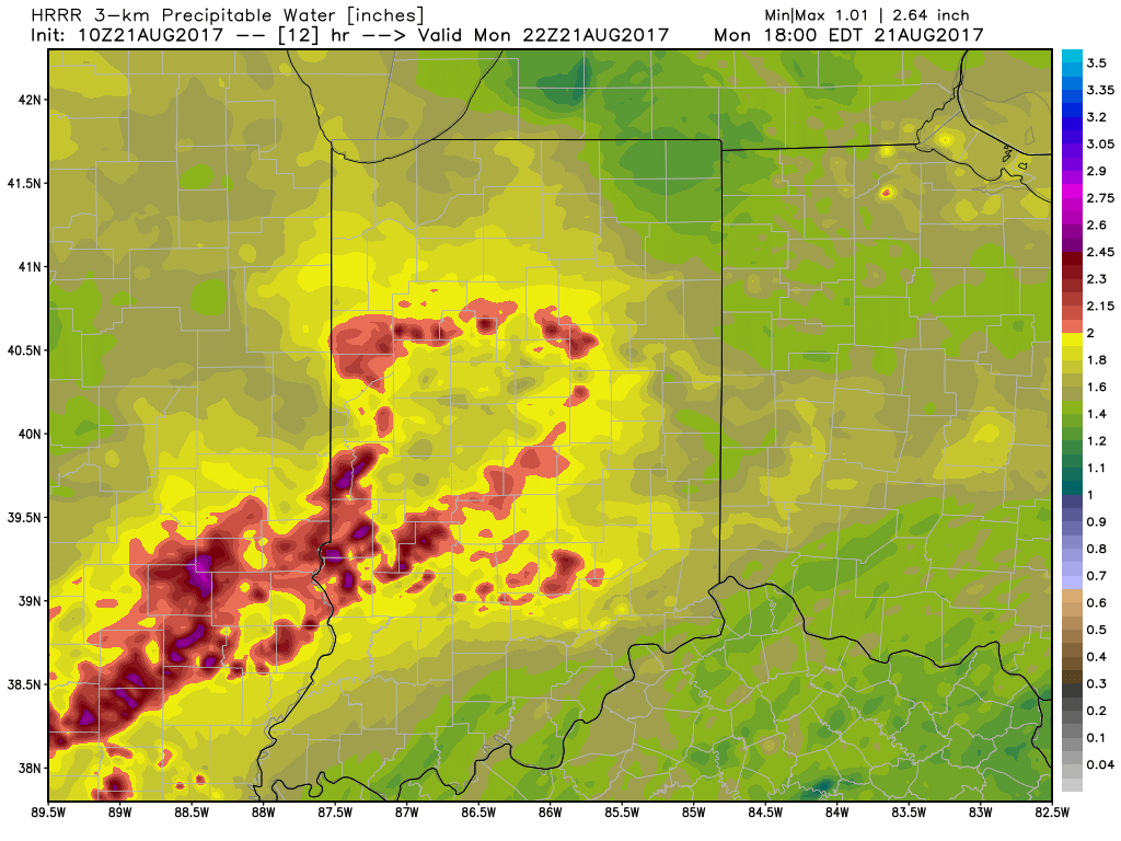 Unsettled times remain Tuesday before a much cooler regime looms for the second half of the week…
 Highlights:
 III. Ridging will return early next week and, though brief, a shot of late-summer heat will eject northeast across the Mid West and Ohio Valley. Sunday through Tuesday will feature temperatures that top out in the upper 80s to around 90°.
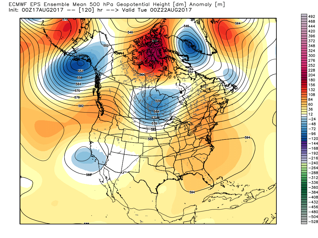 IV. A cold front will drop in by the middle of next week. Scattered showers and thunderstorms will accompany the frontal boundary, but the bigger story will be a dramatic change to a much cooler regime as we get set to put a wrap on the month of August. In fact, temperatures may grow cool enough to allow some 40s to develop across central and northern parts of the state at night. Meteorological summer sure looks like it’ll end with more of a fall-like feel…
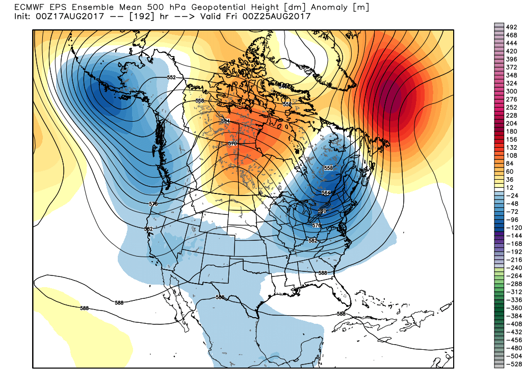
 Highlights: