Feeling Like Fall…
 Highlights:
- Increasing sunshine
- Scattered showers Wednesday
- Cooler than average
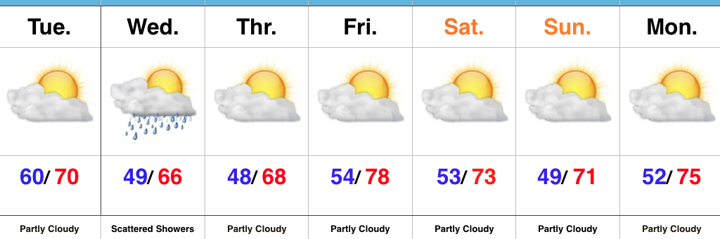
More Like October Than September…A cold front moved through the region last night. As expected, there were “haves and have nots” with the frontal passage, including some rainfall totals over 2″ (especially north and east of the city) while other neighborhoods barely picked up a tenth of an inch.
Northwest winds are blowing now and ushering in much cooler temperatures that will be with us through the forecast period. In fact, temperatures will turn so cool it’ll feel more like October (especially Wednesday and Thursday) than September. Additionally, upper level energy will help create scattered showers Wednesday (not a big deal).
Dry conditions will return as we wrap up the work week and head into early next week. Reinforcing cool air will arrive this weekend and we’ll also note a gusty easterly wind at times, thanks to the circulation between a high off to our northeast and Irma pushing north across the southeast region.
Tropics: Speaking of Irma, she continues to strengthen this morning and very near category 5 status. Preparations should be underway across the Florida peninsula now. We still have time to watch things unfold, but it’s looking increasingly likely that southern Florida will begin to feel tropical storm force winds as early as Friday, followed by a potential landfalling major hurricane over the weekend.
Upcoming 7-Day Precipitation Forecast:
- Snowfall: 0.00″
- Rainfall: 0.00″ – 0.10″
 MUCH cooler air will descend into the region as we progress through the week. Temperatures will be so cool, it’ll feel more like October rather than September, including multiple nights with lows settling into the 40s and highs not making it out of the 60s.
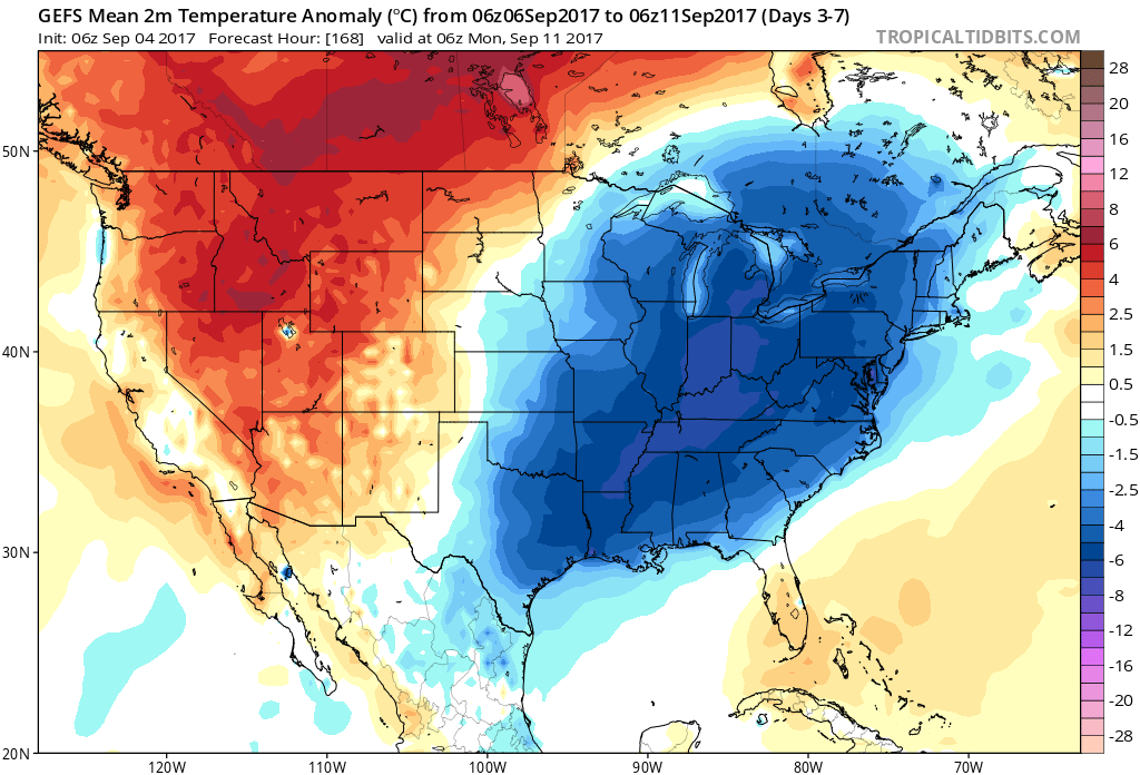
 Highlights:
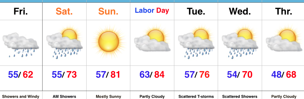 Highlights: