Mild And Relatively Quiet Week Before Cold Changes For Christmas…
 Highlights:
- Light showers later today
- Mostly quiet weather week awaits
- Much colder as Christmas nears
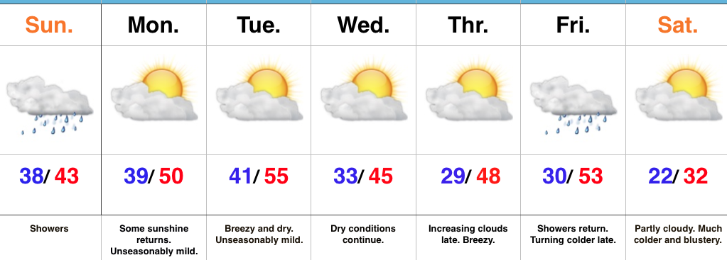
Sunday Showers…A weak weather system is approaching the state as we type this forecast update. That system will deliver light showers through the afternoon hours, but this won’t be a major weather event by any stretch of the imagination- more of a nuisance than anything.
Our next “event” will come Tuesday night in the form of a dry frontal passage. This will trend us cooler Wednesday, but still above seasonal norms. Quiet times will persist with sunshine through midweek, allowing last minute shoppers (no finger pointing here :-)) to at least not have any weather worries as they finish checking off the list!
A more significant cold front will approach as we close the work week. This will provide showers and gusty winds, followed by a colder feel late in the day.
Looking ahead towards Christmas Eve and Christmas Day, confidence continues to remain high on a much colder pattern taking hold. However, it’s purely speculative at this point whether we’ll be enjoying “white” for the big day. Stay tuned.
Upcoming 7-Day Precipitation Forecast:
- Snowfall: 0.00″
- Rainfall: 0.20″ – 0.40″
 Highlights:
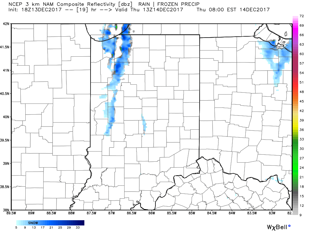
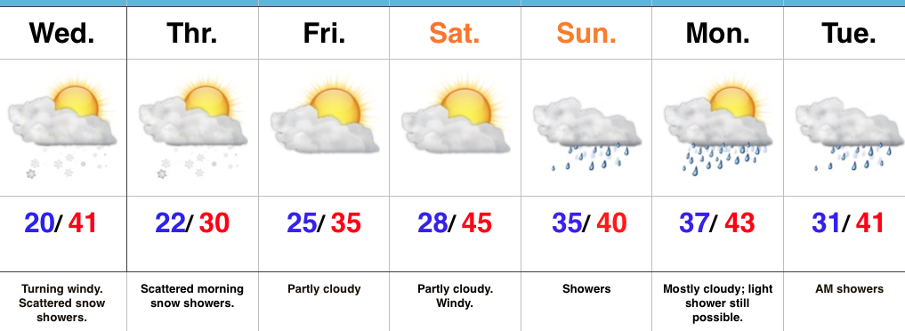
 II. While the sticking snows will miss us this go around, scattered snow showers will impact central IN overnight into early Thursday morning. There’s also still the potential of a skinny lake effect snow band to impact a narrow portion of western and north-central IN early Thursday.
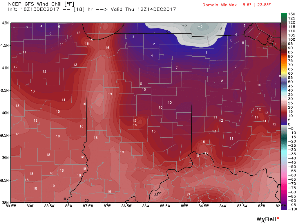
 III. Reinforcing cold air will plunge south Thursday. Highs will remain below freezing along with wind chill values in the 10s most of the day.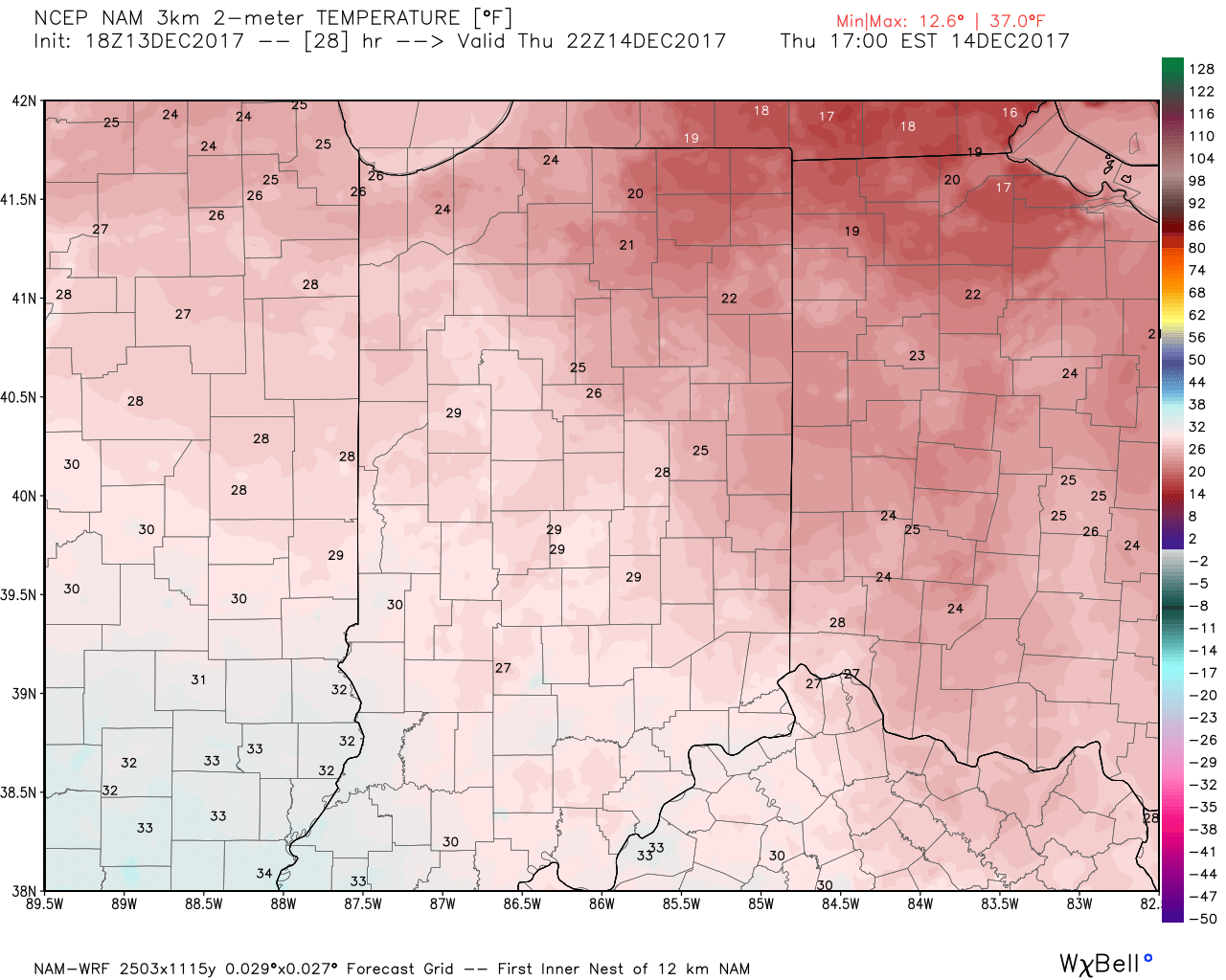
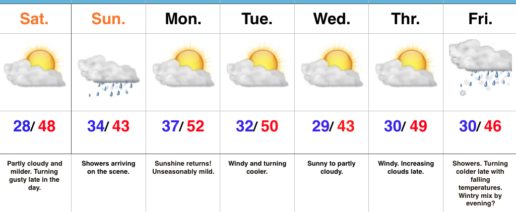
 IV: A milder southwesterly air flow will result in slightly “warmer” temperatures this weekend (mid 40s for highs Saturday) before showers arrive to close the weekend. Despite the slight relaxation of the cold, this will come with a gusty breeze over the weekend.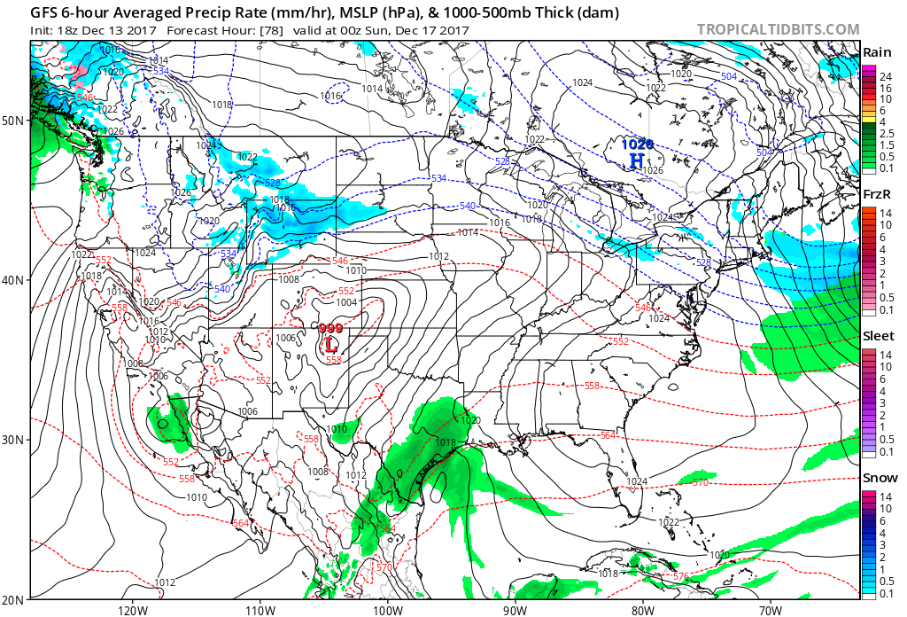
 Highlights:
 Highlights: