VIDEO: Late Evening Update On Storms; Looking Ahead Into Next Week…
You must be logged in to view this content. Click Here to become a member of IndyWX.com for full access. Already a member of IndyWx.com All-Access? Log-in here.
You must be logged in to view this content. Click Here to become a member of IndyWX.com for full access. Already a member of IndyWx.com All-Access? Log-in here.
We continue to monitor things closely for the potential of strong to severe thunderstorms this evening into tonight. As of this morning, we still believe greatest threats of severe weather…
You must be logged in to view this content. Click Here to become a member of IndyWX.com for full access. Already a member of IndyWx.com All-Access? Log-in here.
You must be logged in to view this content. Click Here to become a member of IndyWX.com for full access. Already a member of IndyWx.com All-Access? Log-in here.
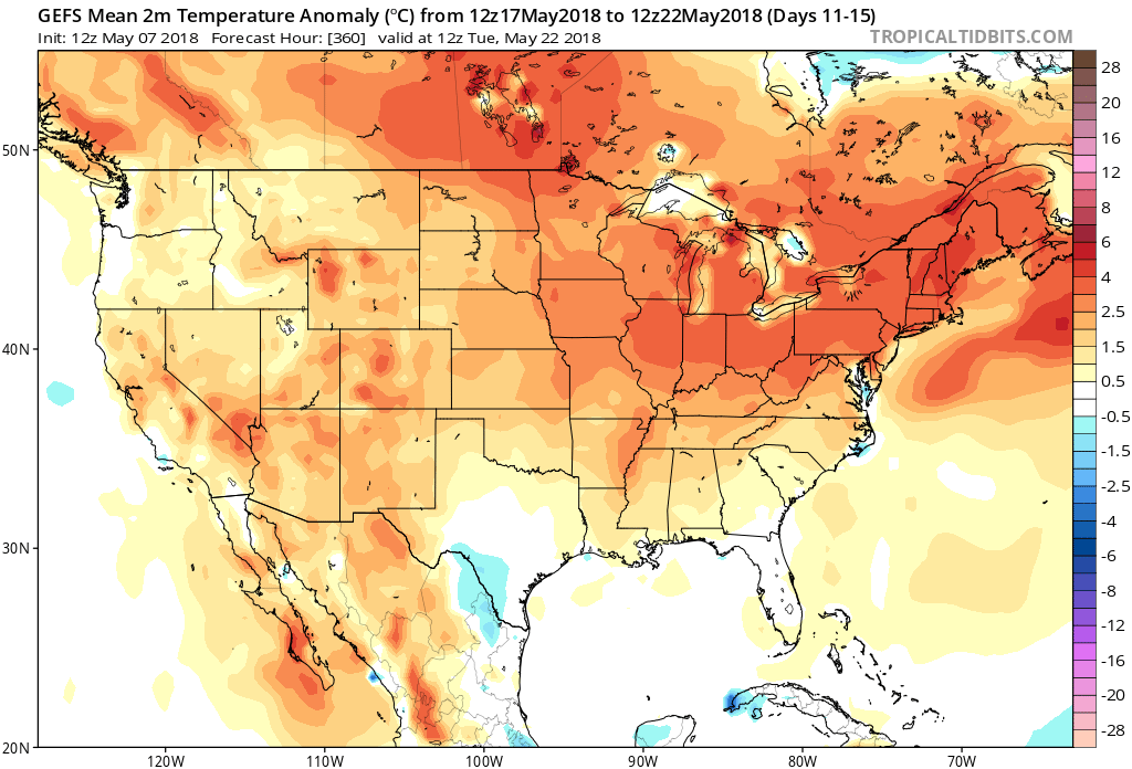
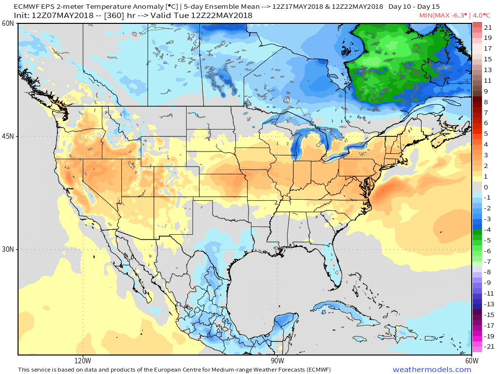
As we look over the 12z long range guidance, we see a common theme: warmer (dare I say “hotter”) than average. Additionally, most data paints a drier than normal trend Days 10-20, as well.
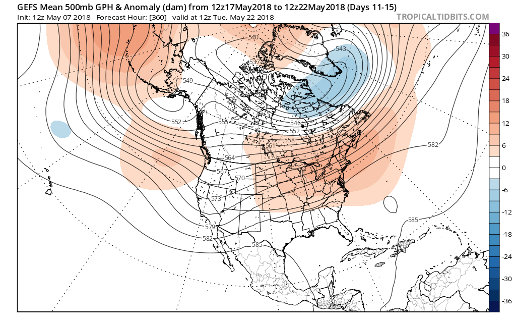
The GEFS shows eastern ridging gaining control during the period which favors a warmer than normal pattern. Consensus of other data is similar in the upper levels.
 At the surface, all three major global models agree on warmth in the long range period, including the GEFS, EPS, and CFSv2:
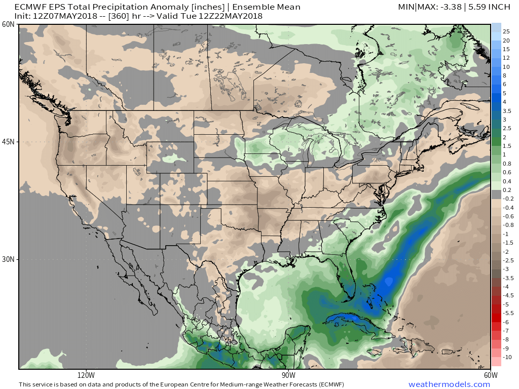
 Guidance suggests below average precipitation during the period. With broad scale ridging in place, we agree on a drier theme compared to normal. While trying to put our finger on the flip from the prolonged cold to warmer was difficult to nail down from March and April, May always looked like a drier than average month from several weeks out. (One note is the potential of active times across the Great Lakes region as “sudden summer” gains steam to the south and stubborn chill refuses to let go to our north. The gradient would promote heavier than normal precipitation relative to average).
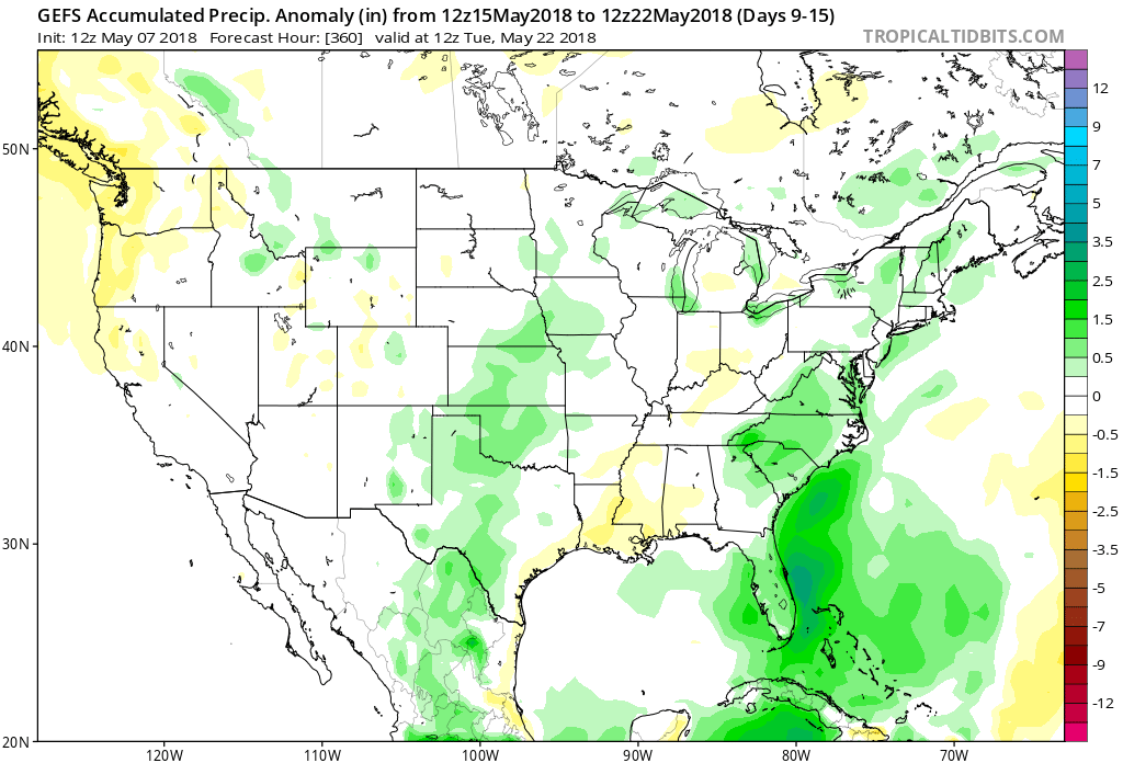 Given the agreement in the data, along with some additional pattern drivers, we continue to believe the medium to longer term period (including mid and late May) will feature an overall warmer than average pattern along with drier than normal conditions.
More on the short-term in the morning, including what will be a summer-like feel by late week.
You must be logged in to view this content. Click Here to become a member of IndyWX.com for full access. Already a member of IndyWx.com All-Access? Log-in here.