VIDEO: Active Week Of Weather Ahead…
You must be logged in to view this content. Click Here to become a member of IndyWX.com for full access. Already a member of IndyWx.com All-Access? Log-in here.
You must be logged in to view this content. Click Here to become a member of IndyWX.com for full access. Already a member of IndyWx.com All-Access? Log-in here.
You must be logged in to view this content. Click Here to become a member of IndyWX.com for full access. Already a member of IndyWx.com All-Access? Log-in here.
High pressure is building in and will supply a gorgeous early-March weekend. Look for plentiful sunshine. Gusty winds this morning will begin to diminish as we rumble into the weekend. While a bit chilly today, that increasingly powerful early-March sun angle will have things feeling mighty nice over the weekend. We suggest finding a patio and enjoying!
 Our next storm system will arrive Monday. Clouds will increase overnight and showers (mostly light) will arrive on the scene during the day. Rainfall amounts aren’t expected to be significant this go around (in general, 0.25″ to 0.40″ for most). Winds will turn strong and gusty during the day Monday, continuing Tuesday and Wednesday.
 Colder air will get pulled into the Ohio Valley Tuesday evening and as upper level energy moves overhead, mixed rain and snow showers will develop Tuesday night through Thursday morning.

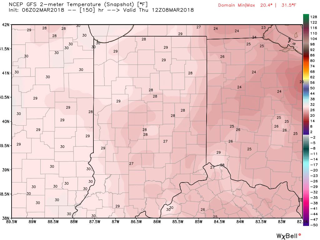
 By next Thursday morning, widespread lows in the 20s can be expected.
You must be logged in to view this content. Click Here to become a member of IndyWX.com for full access. Already a member of IndyWx.com All-Access? Log-in here.
You must be logged in to view this content. Click Here to become a member of IndyWX.com for full access. Already a member of IndyWx.com All-Access? Log-in here.