VIDEO: Analyzing Rainfall Totals; 1st Half Of June Look Ahead…
You must be logged in to view this content. Click Here to become a member of IndyWX.com for full access. Already a member of IndyWx.com All-Access? Log-in here.
You must be logged in to view this content. Click Here to become a member of IndyWX.com for full access. Already a member of IndyWx.com All-Access? Log-in here.
The Storm Prediction Center has placed southwestern Indiana under a Slight risk of severe weather, with extreme southern Indiana now included in an Enhanced risk.
 Upper level energy will push east this afternoon and combine with an unstable air mass, along with unseasonably hot and humid air (highs today will reach the lower 90s across the southern half of the state with dew points around 70°), resulting in explosive thunderstorm development this evening. Storms will rumble east during the nighttime hours before exiting off to the east and diminishing during the early morning hours.
 We target the time frame of 6p to midnight for greatest storm coverage and the possibility of severe weather. While the greatest threat of severe is just south of the city, itself, I think all of central IN is in play for the possibility of strong to severe thunderstorms tonight. In addition to locally heavy rain, stronger storms could pose a damaging straight line wind threat along with large hail.
A couple of storms may still fire Friday afternoon in the warm and humid air mass, but a boundary will pass Friday evening, allowing less humid air to arrive Saturday. On that note, even cooler and less humid air awaits early next week.
You must be logged in to view this content. Click Here to become a member of IndyWX.com for full access. Already a member of IndyWx.com All-Access? Log-in here.
In our JMA Weekly recap from last week, we noted the model was transitioning towards a wetter pattern for early and mid June.
It’s encouraging to see the latest ensemble data from the American GFS and European (courtesy of TropicalTidbits.com) support this idea, as well.
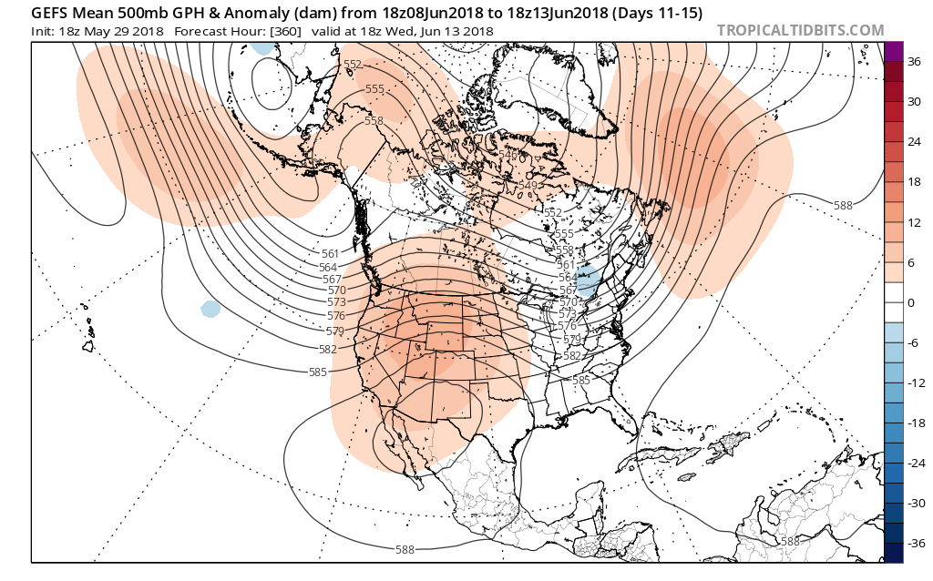
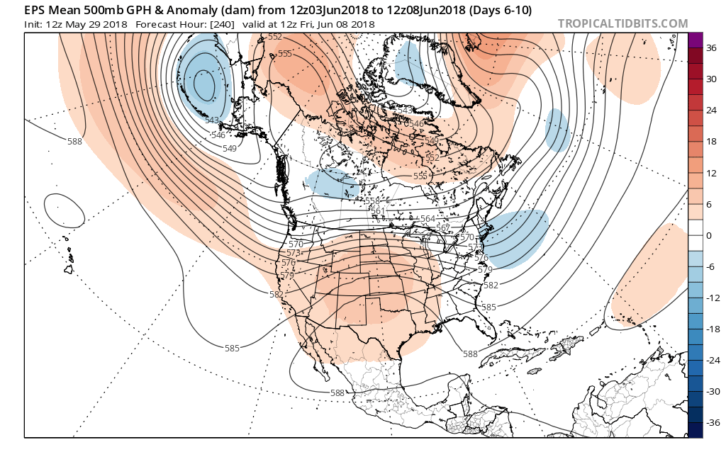 In addition to a wetter pattern, we would also want to pay attention to the potential of a gusty storm complex or two riding southeast around the hot dome off to our southwest.
After an unusually dry May (- 3.44″ as of this post), Alberto’s remnant moisture will help us, at the very least, cut into the rainfall deficit tomorrow. Longer term, it sure is nice to see the medium range guidance in agreement on a wetter time of things. As we’re all aware, this is a crucial time to determine the overall long-standing summer pattern. Dry ground and early warmth can easily “feedback” on itself, and it’s easy to understand some of the concern, particularly AG-related over the past few weeks. With that said, it’s certainly not too late to try and at least ease some of the worry a bit.
When we look at the MJO, we note the amplitude and it’s forecast to swing through the wetter phases, at least locally, (4,5,6) through the month of June:

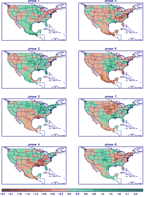 In closing, the JMA Weeklies led the charge in the idea of more active times returning in June, and the combination of GFS and European ensemble data suggests they had merit. With the added bonus of having the MJO on our side, it’ll be hard to avoid a change of the guard towards an overall wetter pattern in the weeks ahead. Perhaps Alberto’s remnant moisture is only the beginning…
You must be logged in to view this content. Click Here to become a member of IndyWX.com for full access. Already a member of IndyWx.com All-Access? Log-in here.