VIDEO: Refreshing Now, But Heat And Humidity Set To Return…
You must be logged in to view this content. Click Here to become a member of IndyWX.com for full access. Already a member of IndyWx.com All-Access? Log-in here.
You must be logged in to view this content. Click Here to become a member of IndyWX.com for full access. Already a member of IndyWx.com All-Access? Log-in here.
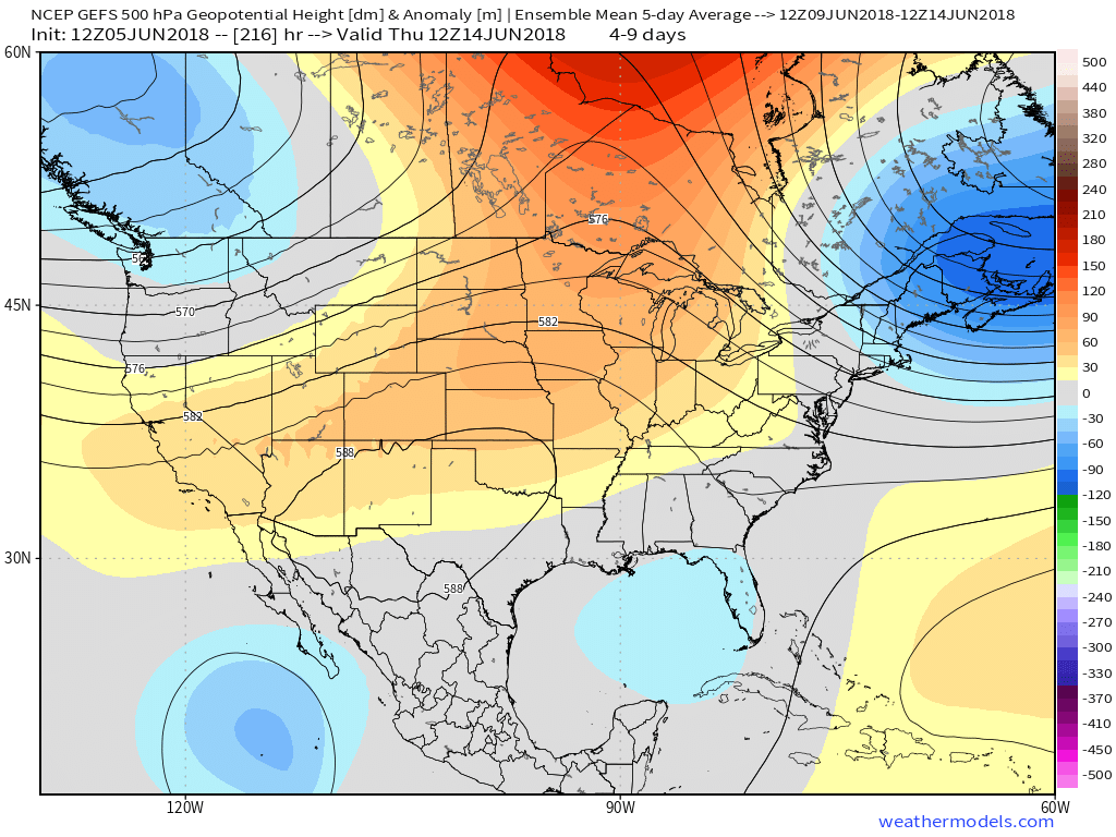
Models have been suggesting that the middle of June (roughly June 10th-20th) would turn increasingly stormy and wet. The JMA led the charge several weeks ago with this idea. The GFS and it’s ensemble data has, for the most part, been on board with this line of thought, as well. On the flip side, more times than not, the powerful European forecast model has suggested we shouldn’t “hold our breath” on the prospects of a wetter shift. With the target period now only a few days out, it’s time to “put up or shut up.” I was chatting with a good friend of mine Tuesday evening concerning the recent dry conditions for the heart of central Indiana and that we’re heading into a “telling time” starting as early as this weekend. Should the wetter scenarios pan out I think it’ll be enough to keep the worst of the heat and droughty conditions west of Indiana for the balance of the summer. (Please know that’s not us saying it won’t turn dry at times, but instead just that the worst of the heat and dry conditions would be placed to our west).
While the all-important surface results differ, it’s encouraging to see that at least from the perspective of an upper air pattern standpoint, both models are rather similar. More significantly, this pattern would support rounds of thunderstorm complexes tracking southeast into the Ohio Valley this weekend and into early next week.

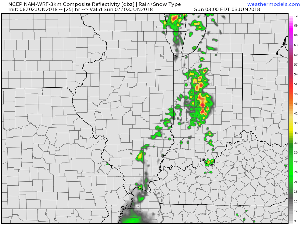
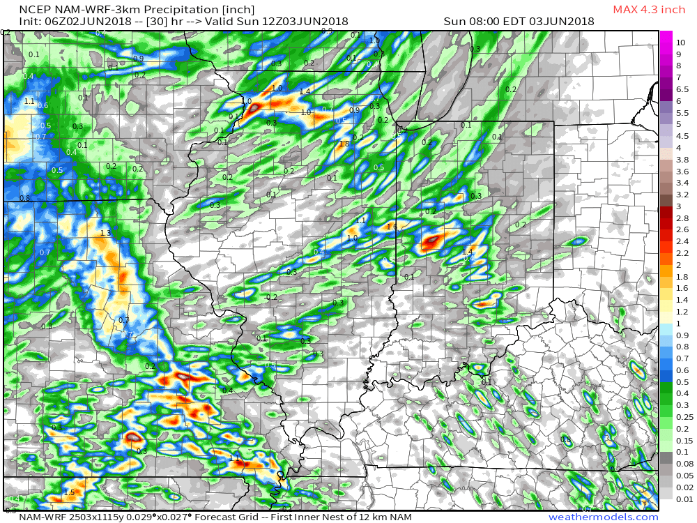
 While impossible to nail down exactly which back yards would see beneficial rainfall, it would be an overall more conducive pattern for widespread showers and thunderstorms for our general region. We’ll have to lean on high resolution, shorter-term models as time draws closer to gain more insight around more precise timing and track details, but we continue to trend our forecast wetter Friday through Sunday than we’ve been over the past couple weeks- Alberto remnants excluded.
Come this time next week we’ll have a much better idea of where the balance of the summer is going, locally. Should beneficial rains fall, it’s still not too late in the season to have a significant longer term impact on summer as a whole. In fact, if we can get water in the ground, it would be easier to buy into the cooler regime the models are currently showing late-June. At the very least, an interesting weekend lies ahead…
You must be logged in to view this content. Click Here to become a member of IndyWX.com for full access. Already a member of IndyWx.com All-Access? Log-in here.
You must be logged in to view this content. Click Here to become a member of IndyWX.com for full access. Already a member of IndyWx.com All-Access? Log-in here.
The morning is starting off on a beautiful note- brilliant blue skies (aside from a little patchy fog for northwestern ‘burbs early on), lower humidity, and temperatures around 60°. Pleasant conditions will continue today with plentiful sunshine and highs topping out in the middle 80s.
A cold front will approach late tonight, passing through central Indiana Sunday morning. This will deliver scattered thunderstorms during the overnight and pre dawn hours Sunday.
 Unfortunately, this won’t be a widespread soaking rain, but there will be a few neighborhoods that cash in on locally heavy downpours. Where thunderstorms track, a couple of 1″+ reports can be expected.
 A pleasant air mass will arrive on the scene for the second half of the weekend and remain with us into early next week. With lower humidity in place, overnight lows will fall into the 50s early next week.
Dry conditions will remain as high pressure gains control before thunderstorm chances return by the middle of next week.
