VIDEO: Gordon Takes Aim On The N-Central Gulf Coast; Unsettled Close To The Week…
You must be logged in to view this content. Click Here to become a member of IndyWX.com for full access. Already a member of IndyWx.com All-Access? Log-in here.
You must be logged in to view this content. Click Here to become a member of IndyWX.com for full access. Already a member of IndyWx.com All-Access? Log-in here.
To no surprise as the traditional peak of the hurricane season approaches (September 10th), the tropics are beginning to turn more active. In addition to Florence, new disturbed weather, currently in the Caribbean, may spin up on it’s journey northwest into the Gulf of Mexico early this week.

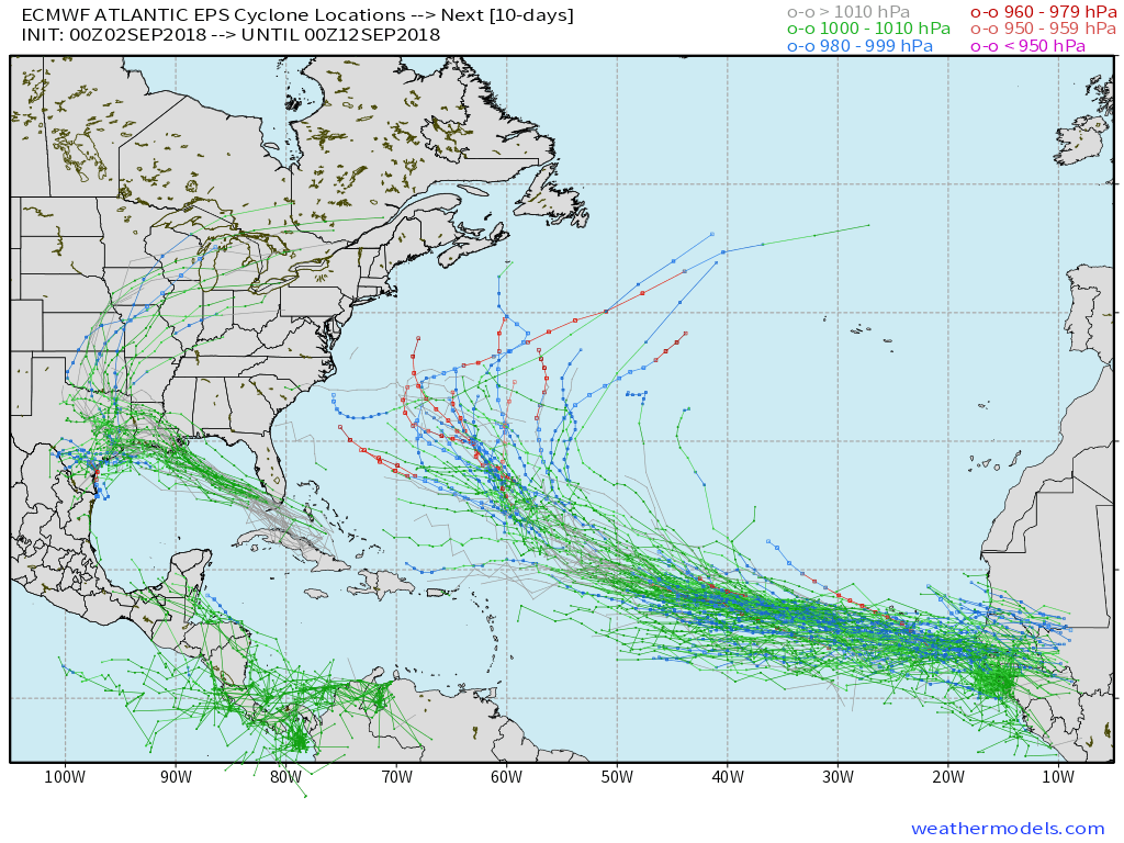 The tropical disturbance entering the GOM (Gulf of Mexico) early week will begin to find a more favorable upper level environment for further strengthening. While we always have to be cautious with any sort of tropical entity in the Gulf of Mexico this time of year, the greatest immediate concern is for locally heavy rain along the northern Gulf Coast early and middle parts of the week.
Then attention will shift to the potential of remnant tropical moisture “curling” around the periphery of the eastern ridge during the latter half of the week. While far too early to get specific, chances are there for elevated hefty rain chances for areas from the MS Valley into the Mid West as we get set to close the shortened work week and head into next weekend.
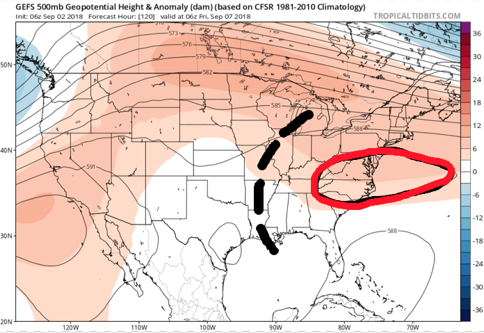
 While the axis of heaviest rainfall will have to be fine tuned, confidence is high on unsettled times returning around these parts beginning Wednesday- thanks to the combination of an approaching cold front and remnant tropical moisture.
You must be logged in to view this content. Click Here to become a member of IndyWX.com for full access. Already a member of IndyWx.com All-Access? Log-in here.
You must be logged in to view this content. Click Here to become a member of IndyWX.com for full access. Already a member of IndyWx.com All-Access? Log-in here.
Thursday features updated weekly products from both the JMA (morning) and European (evening). We’ll update this post tonight once the European Weeklies are in.
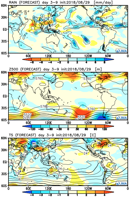
The updated JMA Weeklies show a hot open to September as a significant upper ridge takes up residence over the eastern portion of the country. While the upper Mid West gets in on heavy rain, it’s a rather dry pattern, locally. Sure we’ll have typical “splash and dash” variety of storms through the Labor Day weekend, but nothing worth cancelling any of your outdoor plans. In fact, we recommend incorporating a visit (or two) to the pool over the weekend as well above average warmth and humidity dominate.
Week 1
 “Transitional period” summarizes this timeframe. The upper ridge begins to retrograde during Week 2, but it’s still a warmer than average pattern. It’s a rather dry pattern, as well.
Week 2
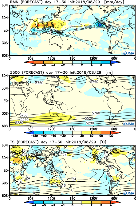
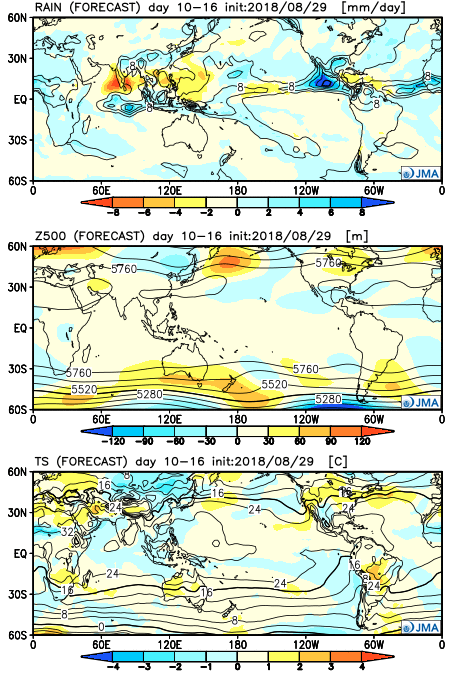 Craving a more “fall-ish” regime? The model says you’re in luck towards the middle of September and would make sense with some of the larger pattern drivers we’re beginning to see behind the scenes. The ridge axis shifts west and allows a cooler than normal pattern to descend into the central part of the country.
Weeks 3-4