 I. Slow-moving showers and thunderstorms will begin to dissipate this evening and tonight with the loss of daytime heating. Some area rain gauges have already picked up between 0.50″ and 1″ of rain this afternoon and this will only serve to lay the ground work for further problems moving forward.
II. A growing shield of rain will engulf northern and central parts of the state Friday afternoon. Initially, this will mostly be of the light to, at times, moderate variety. Additionally, we’ll notice an increasingly stiff easterly flow as the afternoon and evening wear on. Temperatures will fall from a high in the middle 70s into the 60s late Friday afternoon and evening.
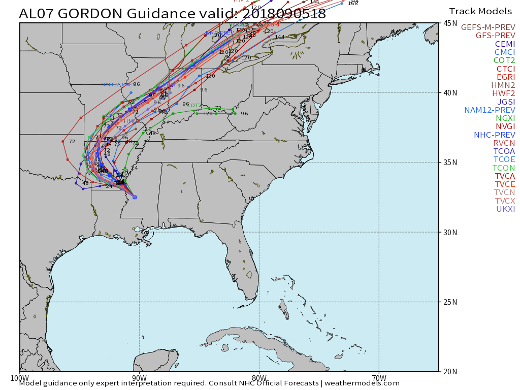
III. A frontal boundary will remain draped across central parts of the state Saturday while the remnant circulation of what once was Tropical Storm Gordon pushes closer. As such, rainfall intensity will increase as we move through the day Saturday- particularly by evening into the overnight, on into Sunday morning. Periods of heavy rain can be expected during this time frame. Rainfall rates will begin to diminish Sunday PM before moisture exits stage right Sunday evening.
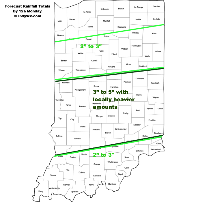
By the time all is said and done, widespread 3″ to 5″ rainfall totals can be expected through the heart of the state, including Indianapolis, but there will be locally heavier totals upwards of 6″ to 7″ in spots. Flooding, unfortunately, will result. If you live near water ways please ensure to keep close tabs on water levels and expect rapid rises Saturday into Sunday. Have a plan in place to escape to higher ground.
IV. After a week of excessive heat and humidity, the coming cooler regime will be welcome by most. Temperatures most of Saturday and Sunday will remain in the 60s. At times, “wind chills” (haven’t used that term in a while) will fall into the 50s.
Warmer times will return late next week as ridging re-establishes itself.