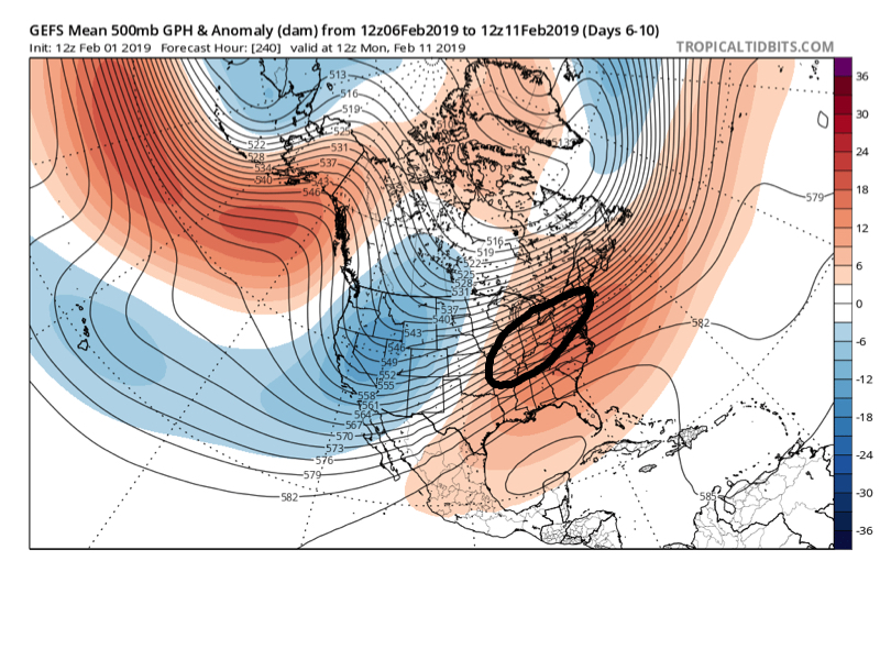
While we’re in the process of pulling out of the bitterly cold air mass, there’s no shortage of action when we look ahead at the upcoming couple of weeks.
Confidence remains high that the upcoming short-term period (Days 2-6) will flip to much warmer than average. A couple days that at least flirt with the 60 degree mark can be expected Sunday and Monday.
While rain will return to the forecast Monday, the milder air sure will be a nice change of pace from the bitterness of the past several days. Enjoy it!
With that said, there are continued indications that the warmth won’t hold.
As we look at the latest medium range ensemble guidance (Days 6-10), the GEFS and EPS are in relatively good agreement.
We note this is a pattern conducive for above normal precipitation during the period. With cold air likely to be “pressing” towards the region, it’s a pattern that has to raise an eyebrow for at least the potential of a wintry threat during this time frame. There should be plenty of low level cold air available late next week and next weekend. With the resistance shown from the SE ridge, potential “fun and games” are on the table during this timeframe as waves of energy likely ride along a slow (at times stalled) frontal boundary.
Keep an eye on the 2/7 through 2/10 window for possible wintry impacts, locally…