+ AO Supports Current Warmth; Active Pattern Shows No Signs Of Letting Up Into Early March…
After the record-setting cold that gripped the Mid West and Ohio Valley for a few days, the recent “spring fling” has been welcomed with open arms by many! There are multiple reasons behind the warmth, especially with such a strong Arctic Oscillation (AO) in place.
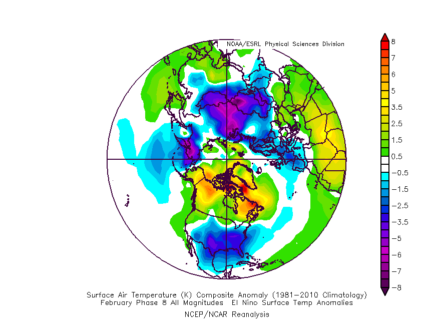
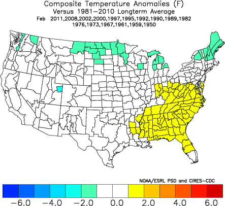
We note the strongly positive AO (image 1) and the respective temperature anomalies that should result (image 2).

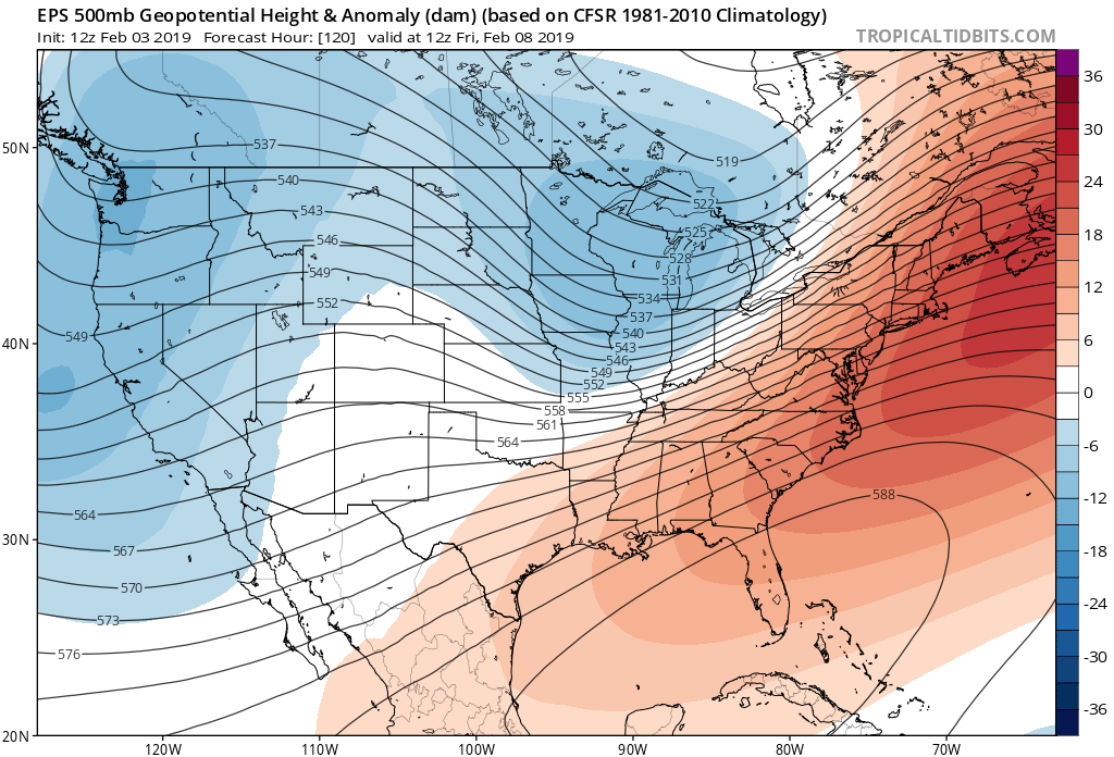
To no surprise, model data is bullish on the southeastern ridge holding firm this week.
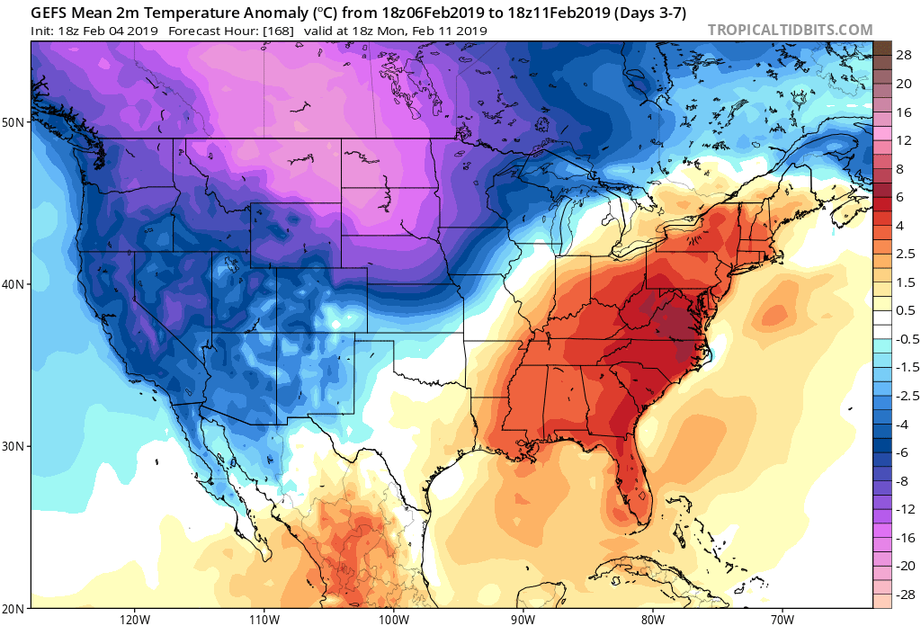
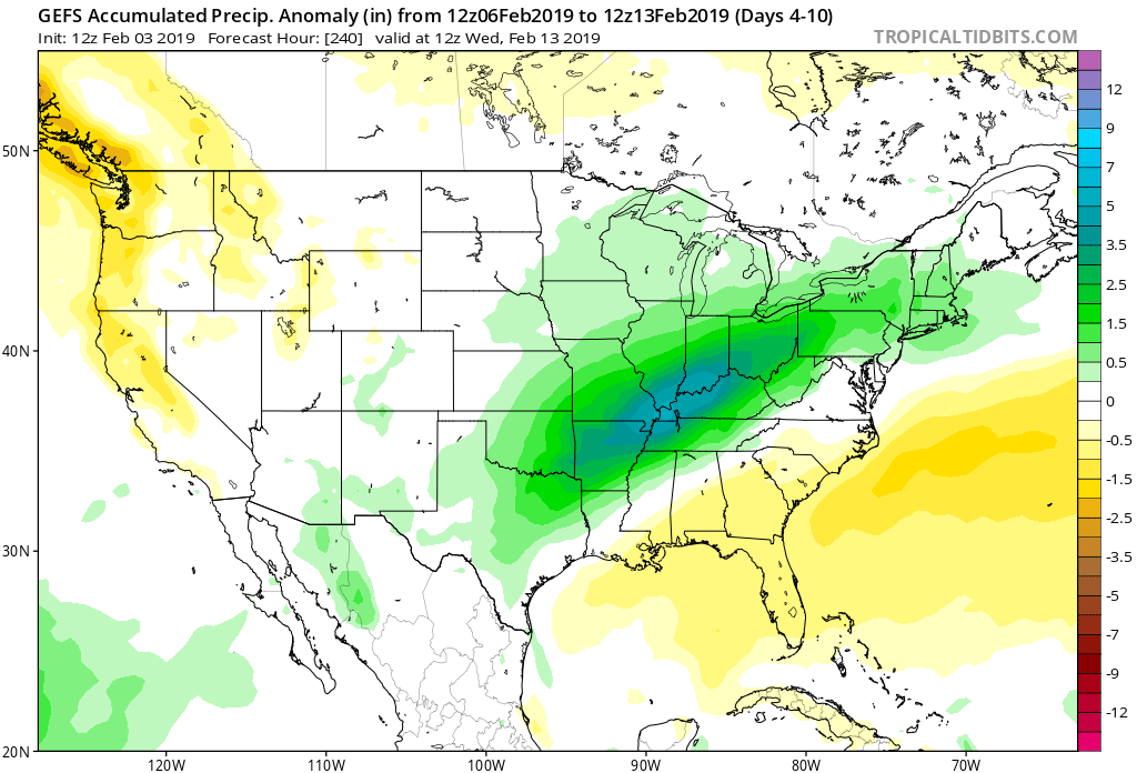
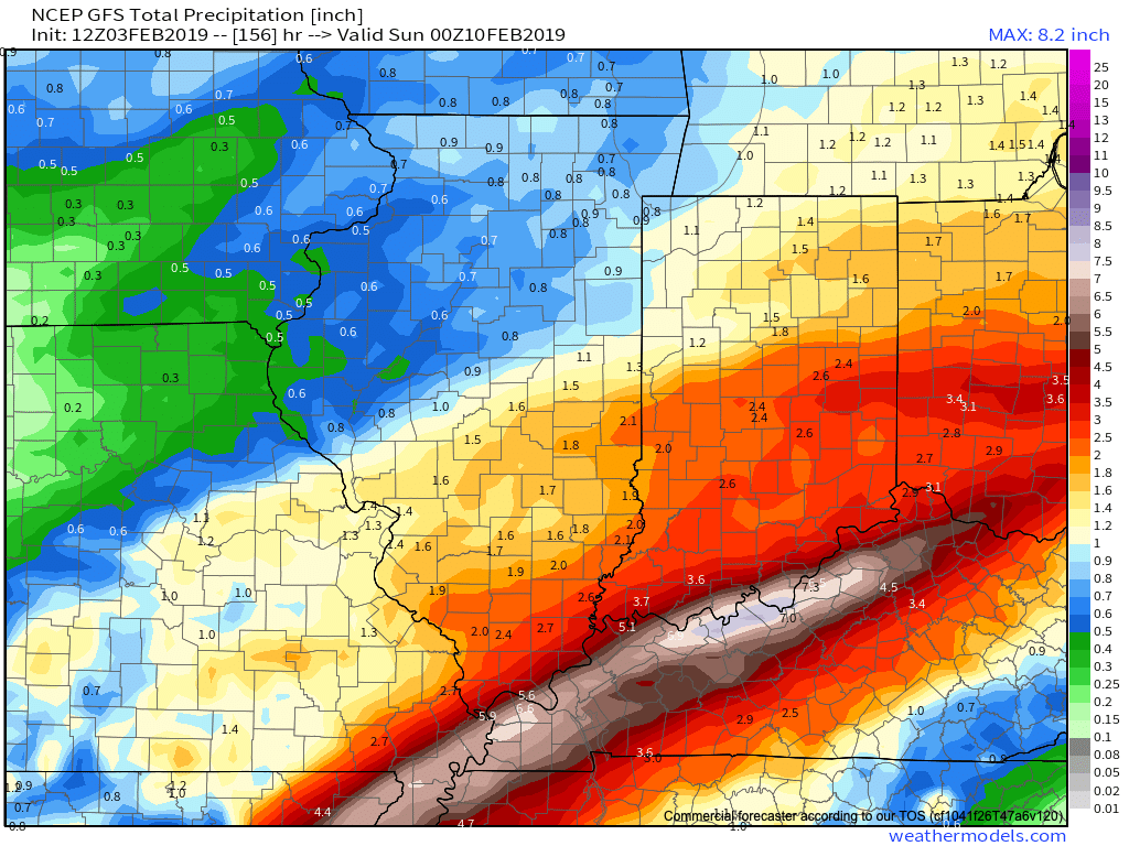
The resistance put forth by the southeast ridge, combined with the renewed arctic air building across the Northern Rockies/ Northern Plains will continue to yield a very active storm track through the Ohio Valley. We expect precipitation to remain well above normal through month’s end, continuing into early March.
As we look ahead, we note modeling is trending the AO neutral and negative for mid and late month.

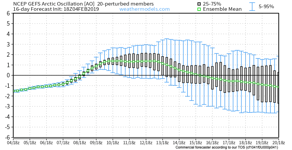
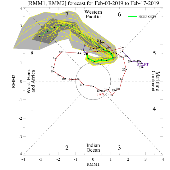
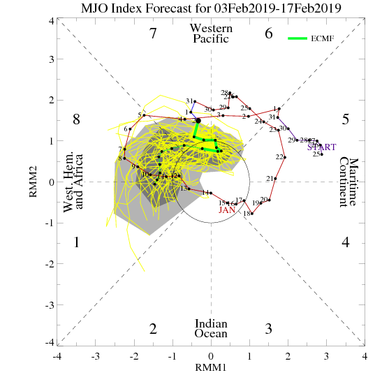
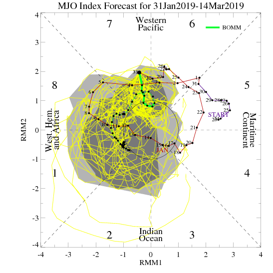
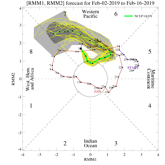
As this is taking place, the MJO is forecast to swing into Phase 8.

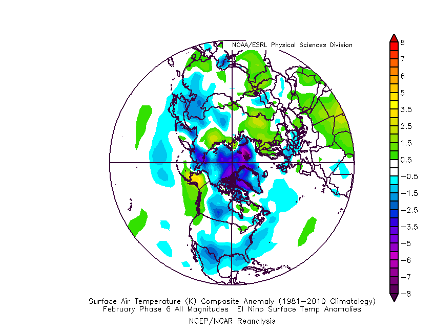
Phase 8 in mid to late February is a very cold phase.
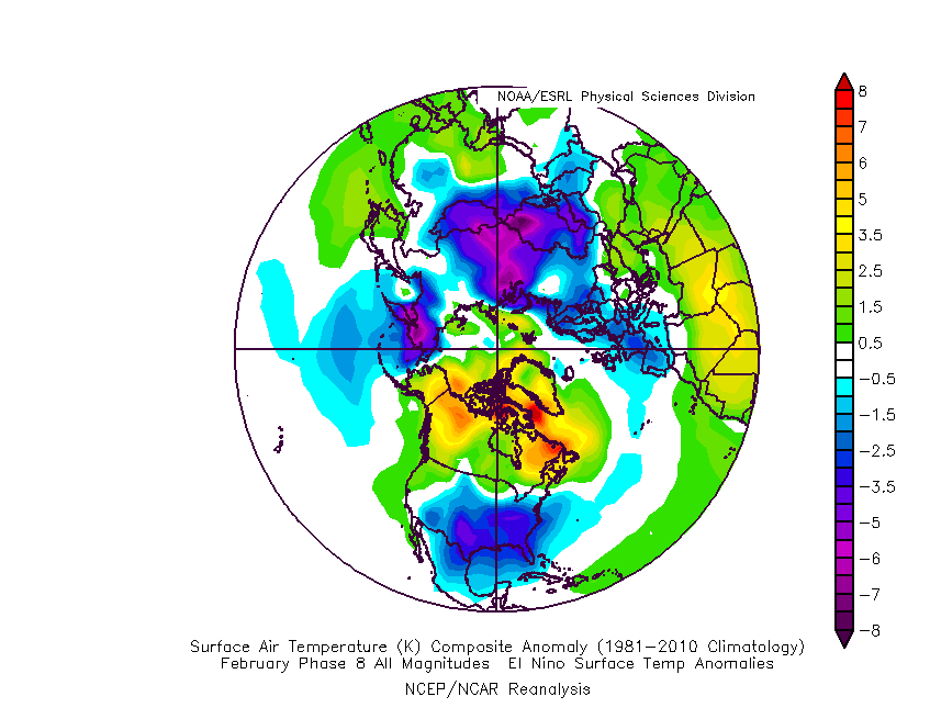
Should the AO continue to trend negative, that will only raise confidence that cold will return.
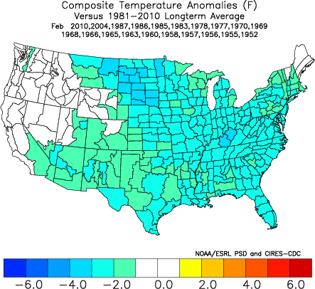
Warmth (relative to normal) will continue to rule the day through midweek before we go into more of a transitional period this weekend into next week. Though certainly colder than this week, I’m not quite ready to buy into the idea that the southeast ridge will go quietly into the night. A couple of winter threats loom late weekend into next week, but confidence is low in the specifics. It’s when we get to the last (2) weeks of the month that we think cold will regain control, along with more widespread wintry threats of significance…