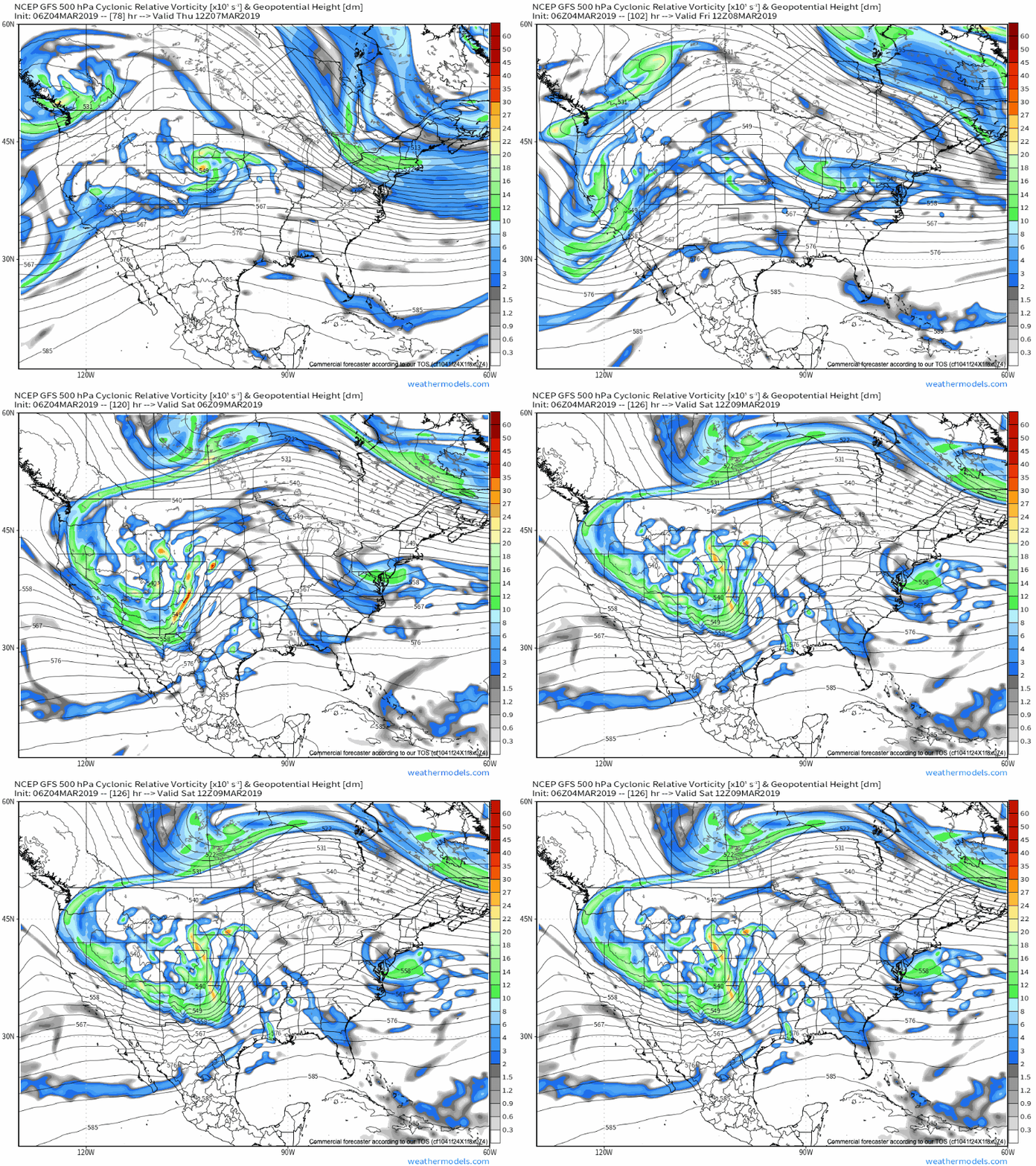
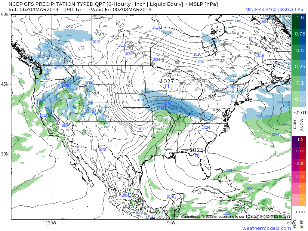
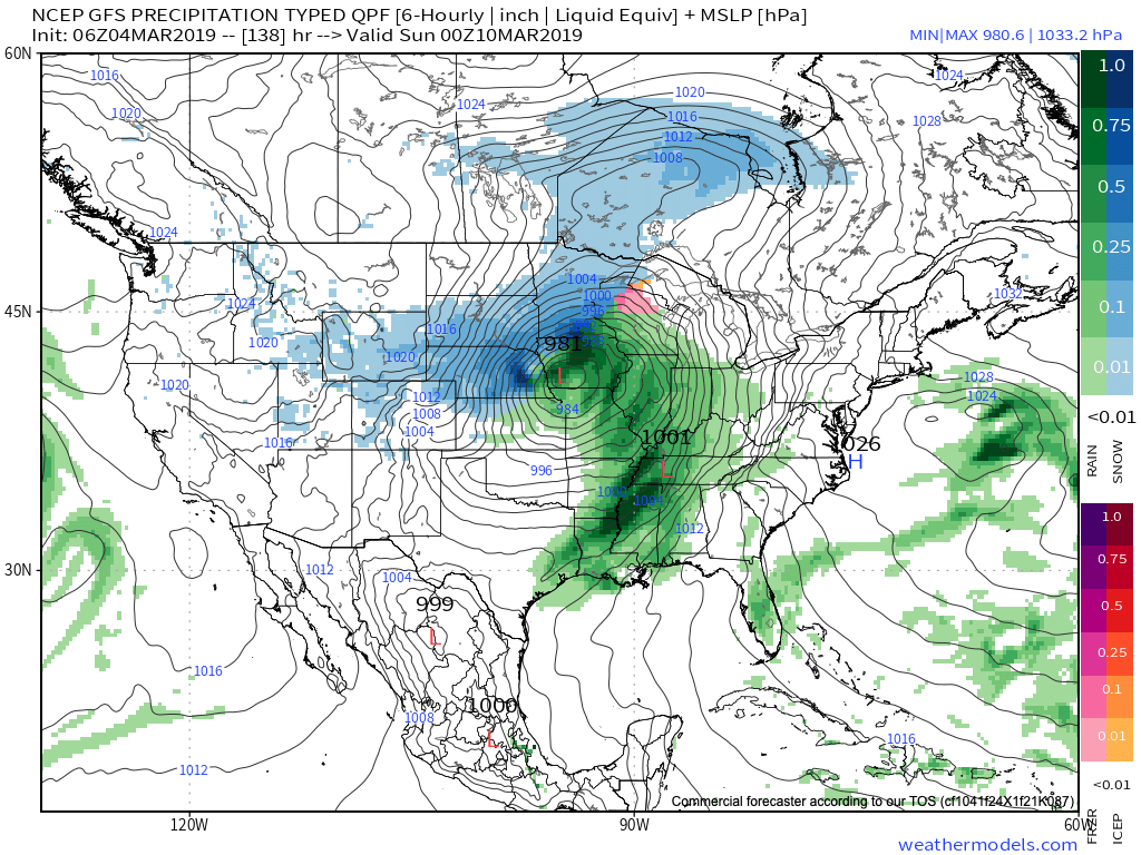
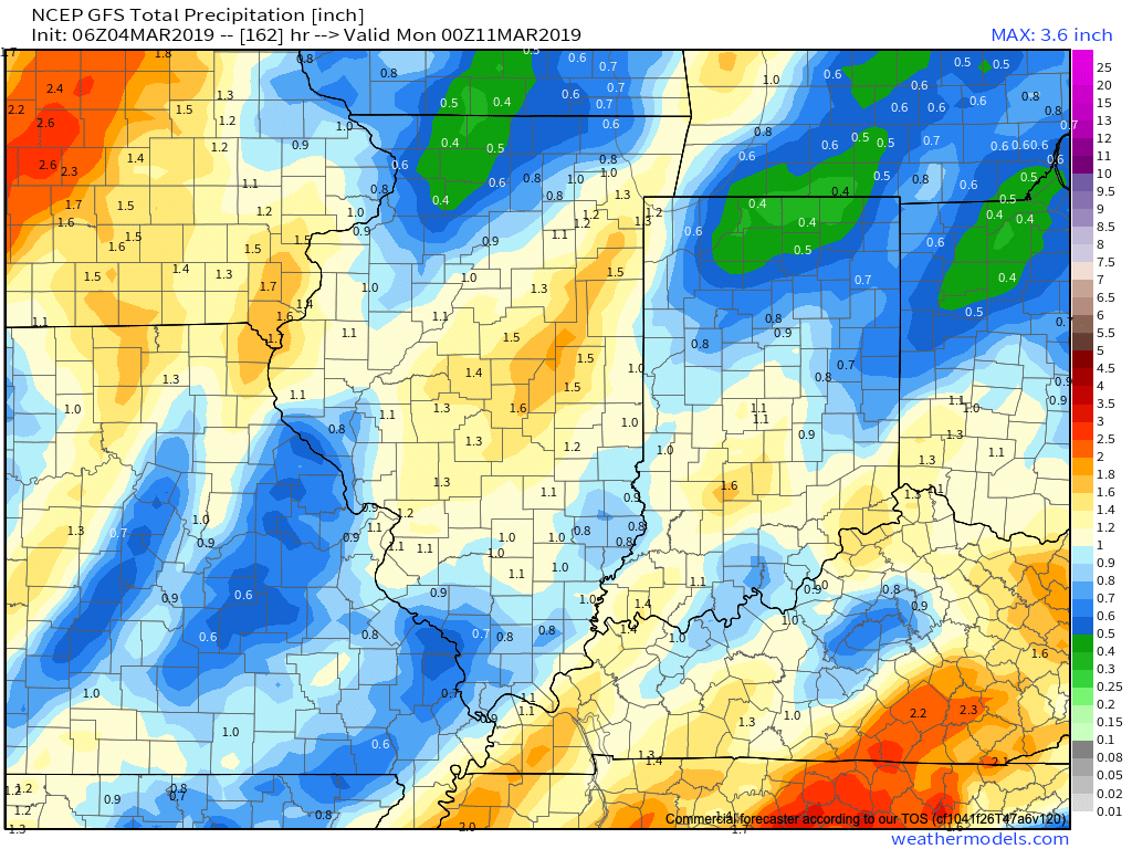
An active pattern continues with accumulating snow arriving Thursday and the chance of a couple of heavy rain events this weekend into the middle of next week…
You must be logged in to view this content. Click Here to become a member of IndyWX.com for full access. Already a member of IndyWx.com All-Access? Log-in here.
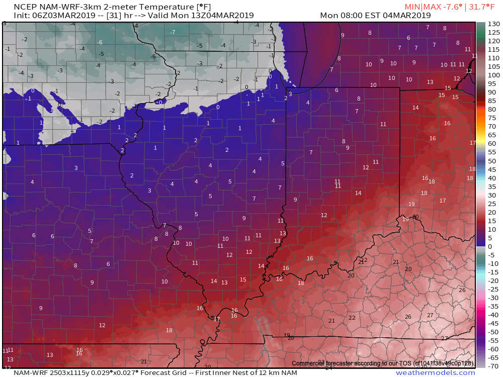
It’s a frigid start to the day, especially by March standards. With a fresh snow cover down, many reporting sites are now approaching zero. Officially, Indianapolis is down to 4 (F) as of this update at the 7a hour. For the most part, dry conditions will prevail today, but we could notice a couple of very light snow showers/ flurries at times this morning.
An upper level disturbance will pass through here Tuesday and again could be enough to ignite light snow showers.
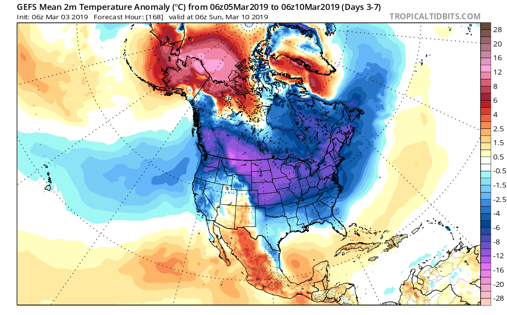
The primary story through midweek is the cold as highs don’t make it above freezing until Friday afternoon. With the increasingly high and more powerful March sun angle, that’s another impressive feat.
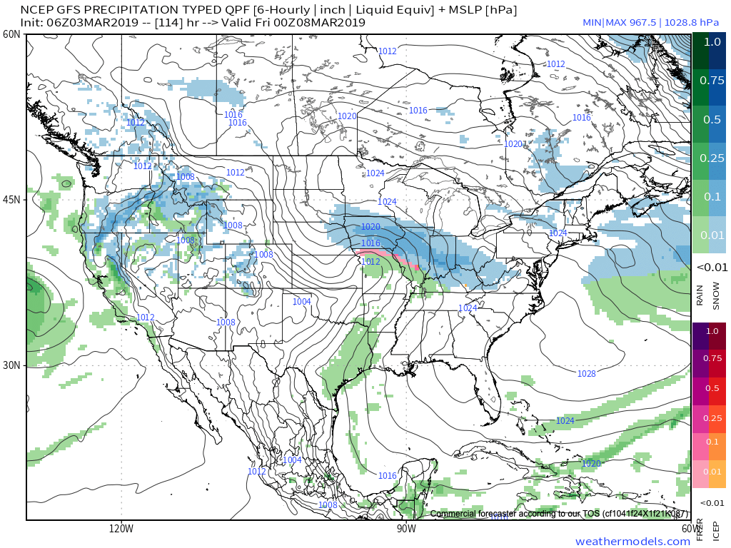
Attention will shift to the threat of a stripe of accumulating snow Thursday evening into Friday.
As this upper level wave scoots southeast out of the central Plains and across the Ohio Valley, a band of accumulating snow will occur to the north and northeast of the track. As things stand now, we expect snow to build in here Thursday evening, continuing into Friday. While we still have time to watch things unfold, this is the kind of system that could deposit a few/ several inches of wet snow. Stay tuned.
Just as soon as we get rid of our late week snow maker, a new storm system will approach this weekend with the threat of heavier rain and embedded thunder late Saturday into early Sunday.
Rainfall totals of 0.75″ to 1.25″ are possible with our weekend system before precipitation ends as wet snow showers/ flurries next Sunday.
We’ll have an updated video discussion this evening looking more in-depth at the long range pattern… Make it a great Monday!
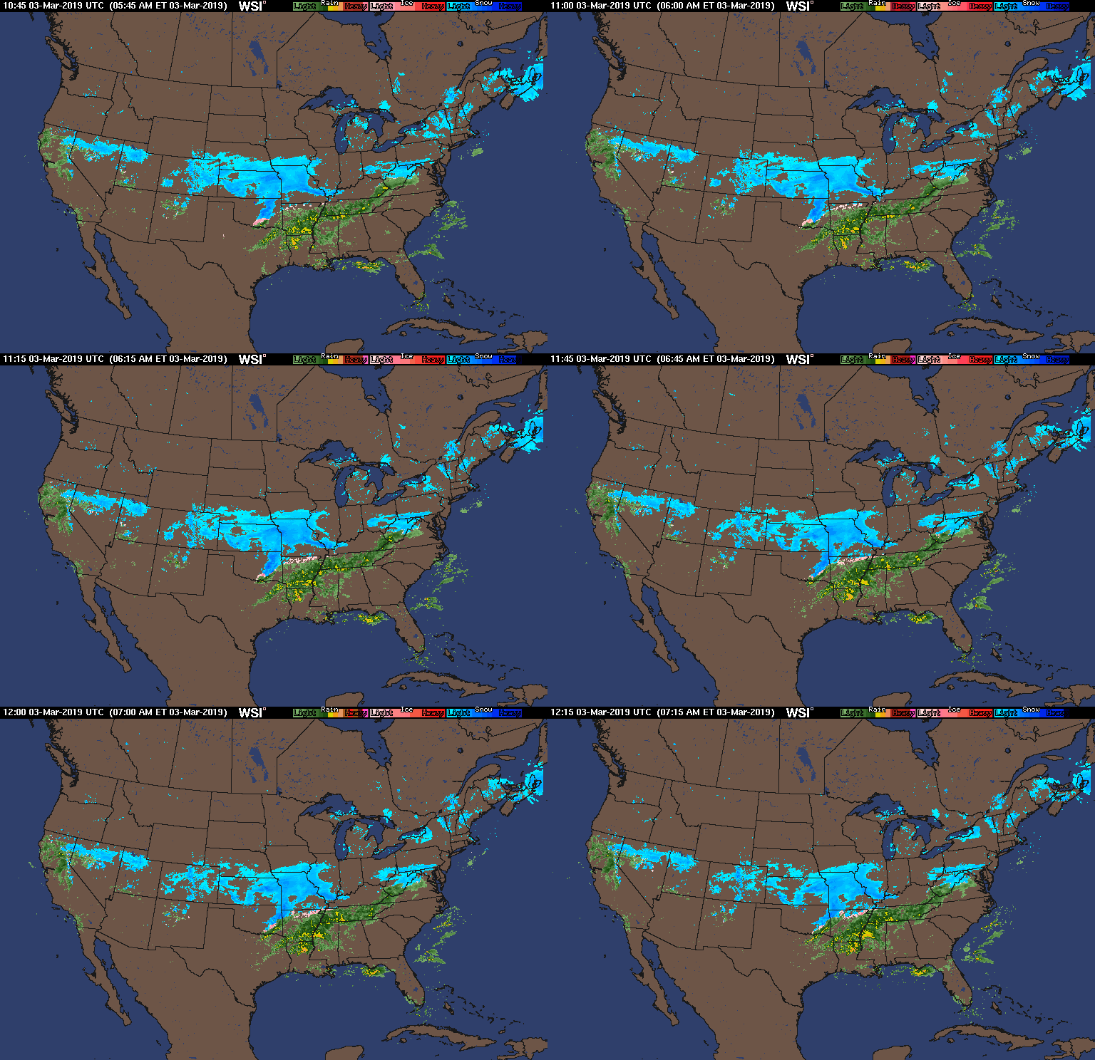
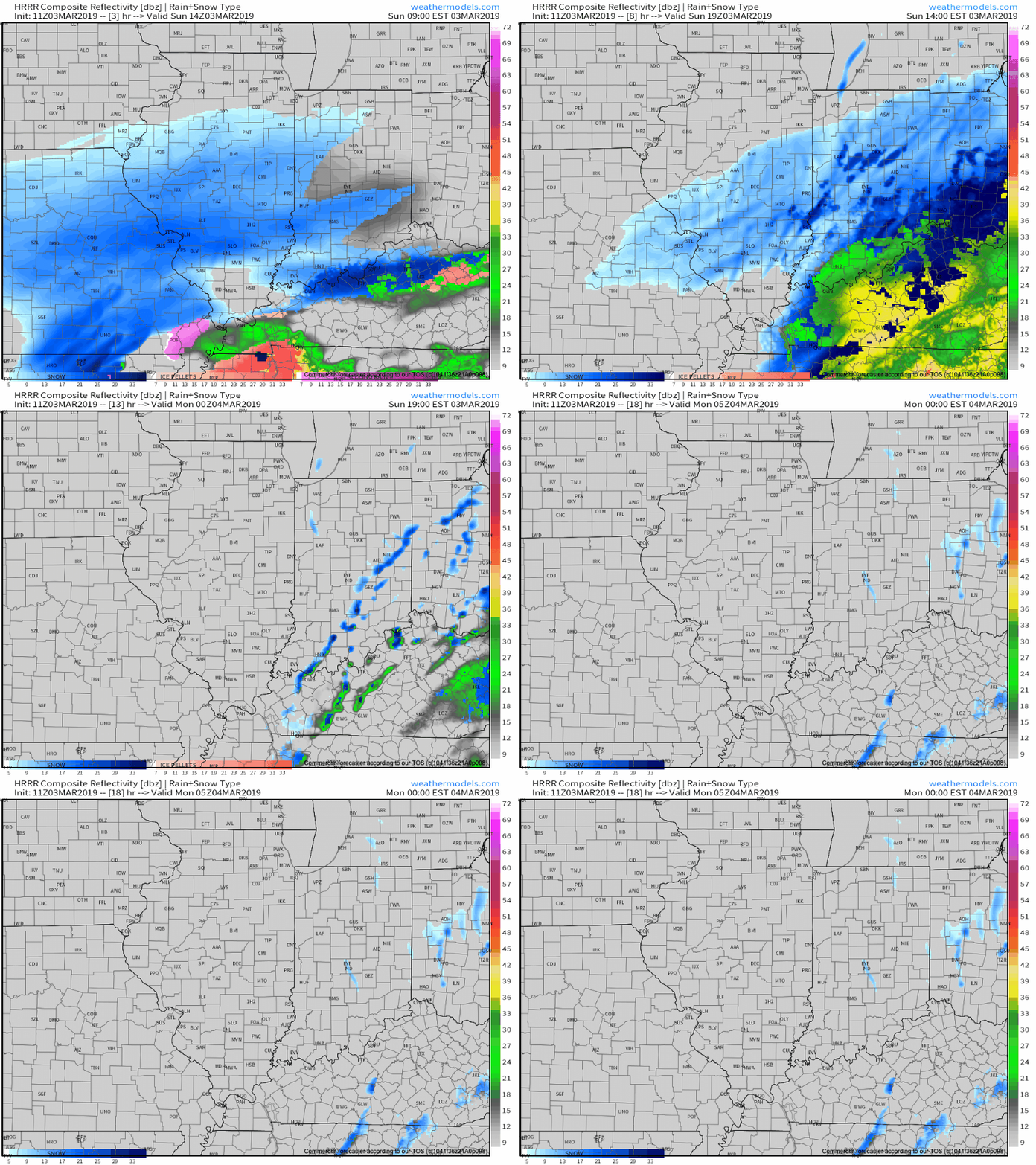
Snow will overspread central Indiana through the late morning hours into the afternoon.
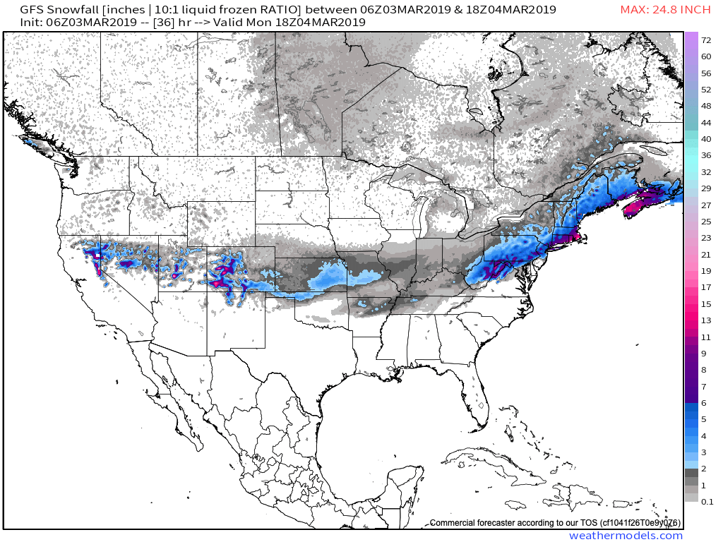
While the overall idea where the accumulating snow would fall was a good one from early week, our initial expected amounts won’t come to fruition. The reason? The storm system is much weaker and faster moving than originally modeled.
Accordingly, this is a 1″ to 2″ type event for most of the area. The majority of the snow will fall from noon to 5p.
A period of snow will scoot across central Indiana from late morning into the early evening hours.
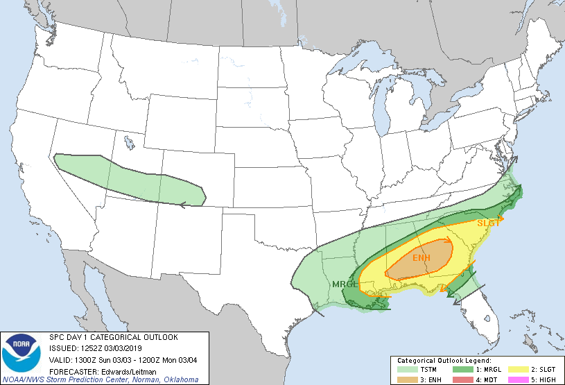
This same storm system will be responsible for a severe weather outbreak, including the possibility of a couple of strong tornadoes, across the Deep South this afternoon.
Back here on the home front, MUCH colder air will pour into the region this evening, remaining in place into the new work week. Back-to-back nights with lows in the upper 0s to lower 10s can be expected across central Indiana Monday and Tuesday mornings.
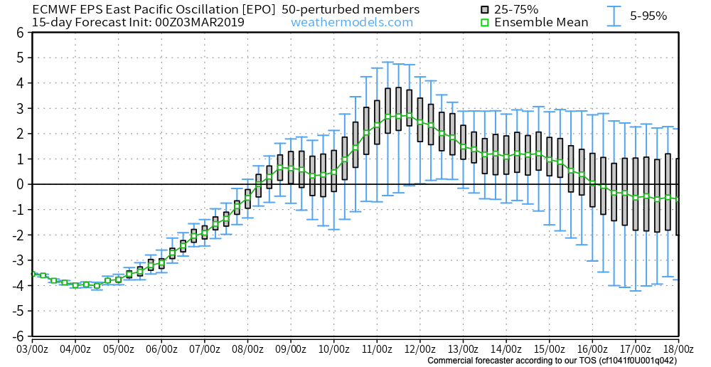
This is all part of the overall colder than normal first half of March, powered by the SOI crash (several week ago), deeply negative EPO, and MJO rumbling through the cold phases.
Additional storm dates to keep note off include Thursday night into Friday (more of a wintry threat with the 3/7-3/8 system) and Saturday into Sunday (potential strong thunderstorms with the system on 3/9-3/10).
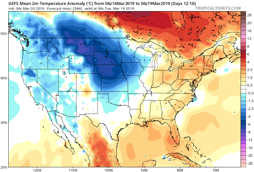
Looking ahead, it still appears the mid-March warm-up is on track as the EPO flips to positive.
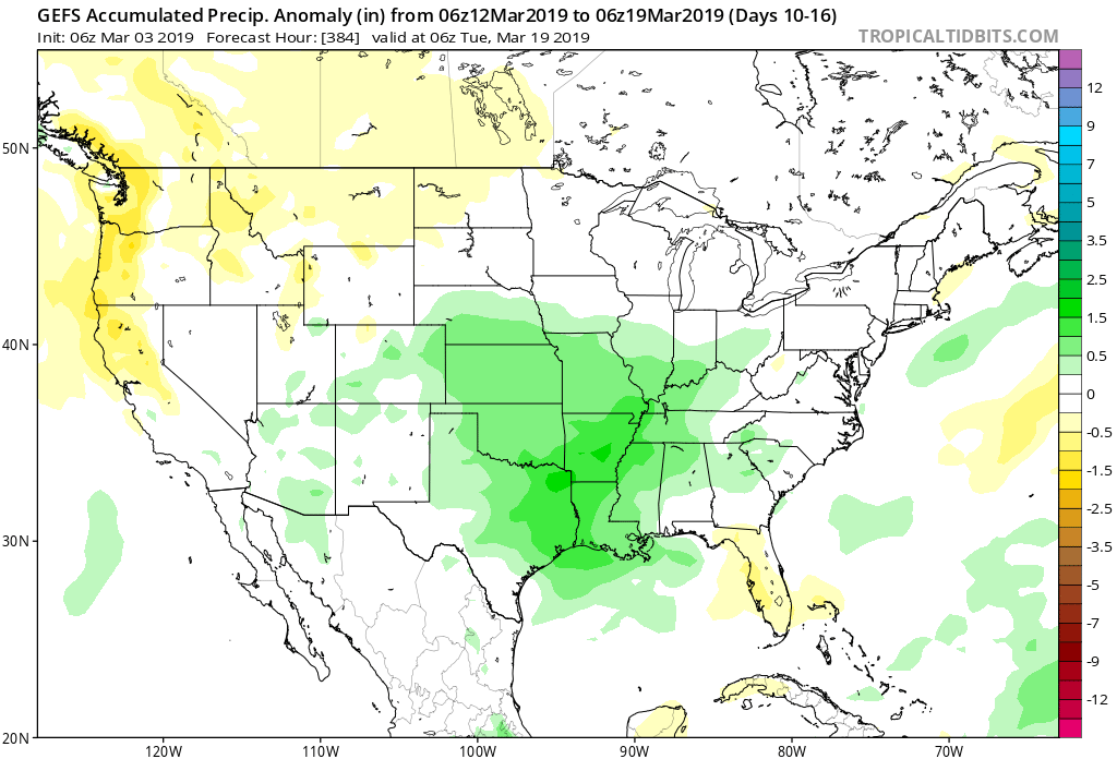
With that warm-up will also come a return of heavier precipitation events and a continued overall active storm track across the region. Precipitation looks to run above average for the mid-month stretch.
We’ll dig deeper early week on what lies ahead as we close the month of March and look ahead towards April…
The updated JMA Weeklies are in and we wanted to take a moment to review those with you this morning. A more extensive long range post will arrive tonight. In addition, we’ll also have an updated video discussion around the potential (and increasing likelihood) of a winter storm this weekend later this evening.
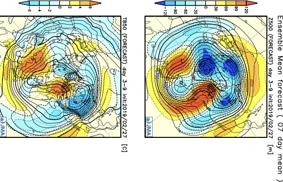
Week 1
In agreement with the majority of the other data, the model overwhelms the pattern with unseasonably cold air. Note the anomalous pattern, including strong AK ridge that is helping “dislodge” the late season arctic air. The other item that stands out? The southeast ridge is no longer (for now).
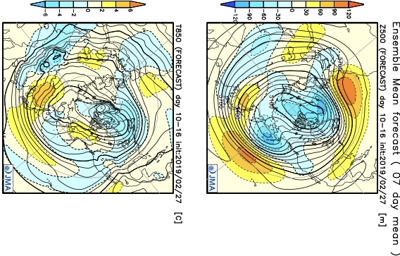
Week 2
Cold is forecast to linger in the Week 2 timeframe, but it’s beginning to modify from the early month bitter shot. Secondly, the high latitude pattern has completely reversed from Week 1 (note the lower heights) and the southeast ridge is showing signs of re-emerging.
Weeks 3-4
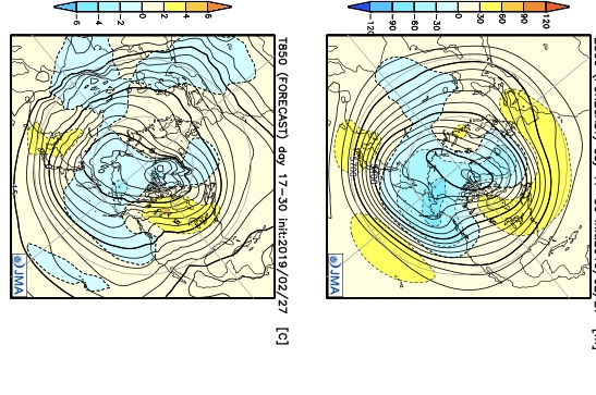
Eastern ridging is shown during the mid to late month stretch and gives further reason to believe our mid month warm-up idea has merit. With this, the model also delivers an overall wetter pattern for the 2nd half of the month.
You must be logged in to view this content. Click Here to become a member of IndyWX.com for full access. Already a member of IndyWx.com All-Access? Log-in here.