Updated 09.10.21 @ 6a
You must be logged in to view this content. Click Here to become a member of IndyWX.com for full access. Already a member of IndyWx.com All-Access? Log-in here.

Sep 10
Updated 09.10.21 @ 6a
You must be logged in to view this content. Click Here to become a member of IndyWX.com for full access. Already a member of IndyWx.com All-Access? Log-in here.
Permanent link to this article: https://indywx.com/video-long-range-outlook-into-late-september/
Jul 27
Updated 07.27.21 @ 7:37a
You must be logged in to view this content. Click Here to become a member of IndyWX.com for full access. Already a member of IndyWx.com All-Access? Log-in here.
Permanent link to this article: https://indywx.com/hot-now-but-a-hint-of-fall-is-on-deck/
Jun 11
Updated 06.11.21 @ 7:50a
Before we look ahead to the 2nd half of this month and early July, our weekend will start off with the same oppressive humidity and tropical feel we’ve dealt with all week. Additionally, another round of “splash and dash” thunderstorms can be expected today and Saturday — most notably occurring during the afternoon and evening hours. With all of that said, coverage of storms should be less today and Saturday than what the rest of the week has included.

While some neighborhoods won’t see a drop of rain, others could see a quick 0.50″ to 1″ due to the moisture rich environment in place across the region. Officially, we’ll call for most central Indiana rain gauges to pick up between 0.25″ and 0.75″ over the course of the upcoming 48 hours. Sunday continues to look like a mostly dry and very warm day (remember, you can always see our most up-to-date 7-day outlook for central Indiana on the home page). We continue to target a frontal passage Tuesday that will offer up a surge of much lower humidity for the balance of the upcoming week.
As we look ahead, there are a few interesting drivers that should battle it out as we progress through the 2nd half of June and look ahead to the Independence Day holiday (where is time going?).

I. East Pacific Oscillation (EPO)- forecast predominantly negative over the upcoming couple of weeks. Cool signal.
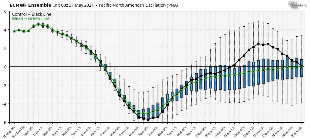
II. Pacific North American Pattern (PNA)- pops positive in the short-term (cool signal) before returning negative late month (warm signal).
III. Madden-Julian Oscillation (MJO)- forecast in the “null” phase in the short-term, but does look to get a bit more amplified as we close out the month of June and open up July. Phase 1 late June correlates to near/ slightly above normal temperatures across the Ohio Valley. Phase 2 in early July features widespread cool weather from the central Plains and points east and south.
Given the above, it would seem the cooler period next week will moderate as we move into Week 2, but given the fight between the PNA and EPO, I don’t envision any sort of significant or long-lasting heat, locally, as we wrap up the month of June. A combination of ensemble guidance would tend to agree with this.
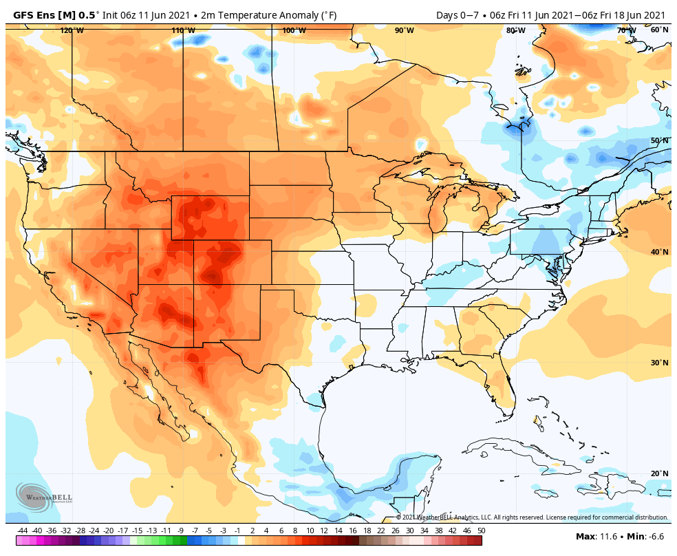
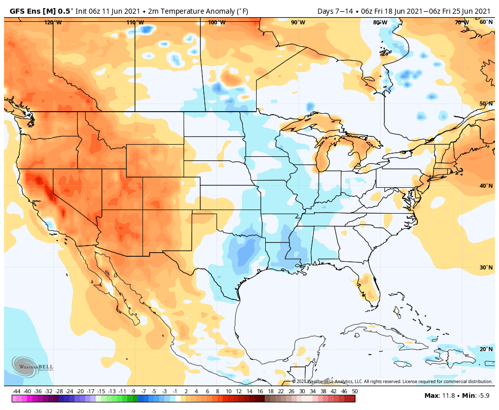
After a drier stretch through the short-term, it looks like the pattern will turn more active to close out the month. On that note, we’re also continuing to keep close eyes on potential tropical “mischief” next week in the Gulf of Mexico. The general consensus early on is that tropical moisture would potentially impact the central and eastern Gulf and interior South late next week/ next weekend, but this is still early.
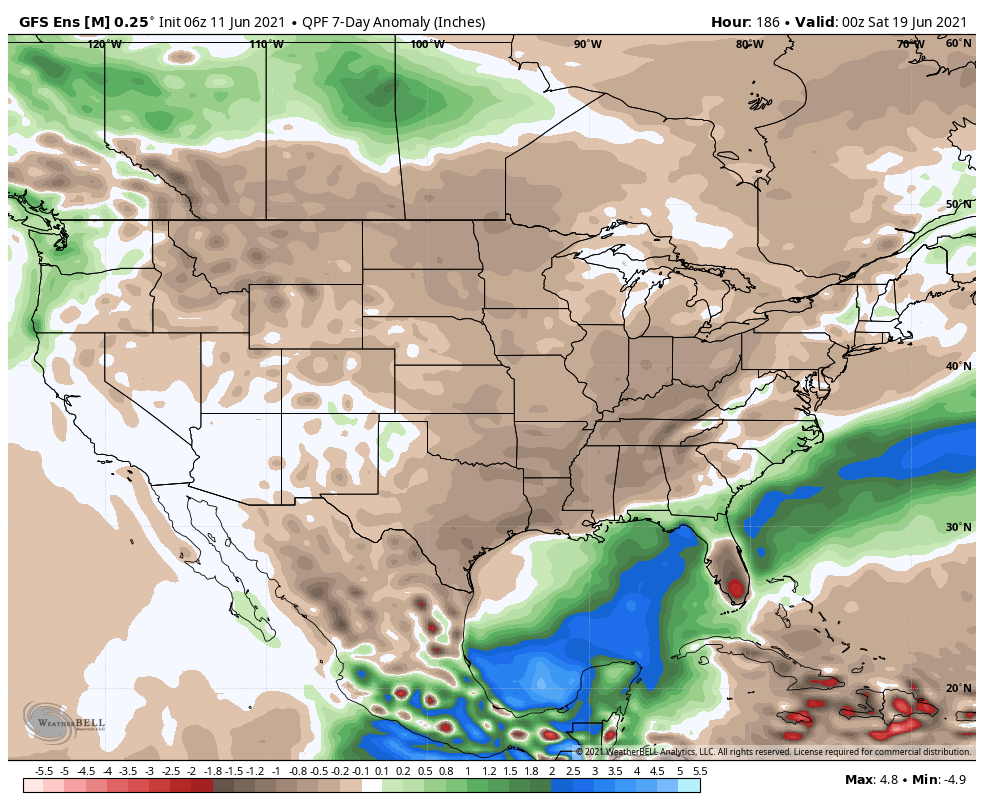
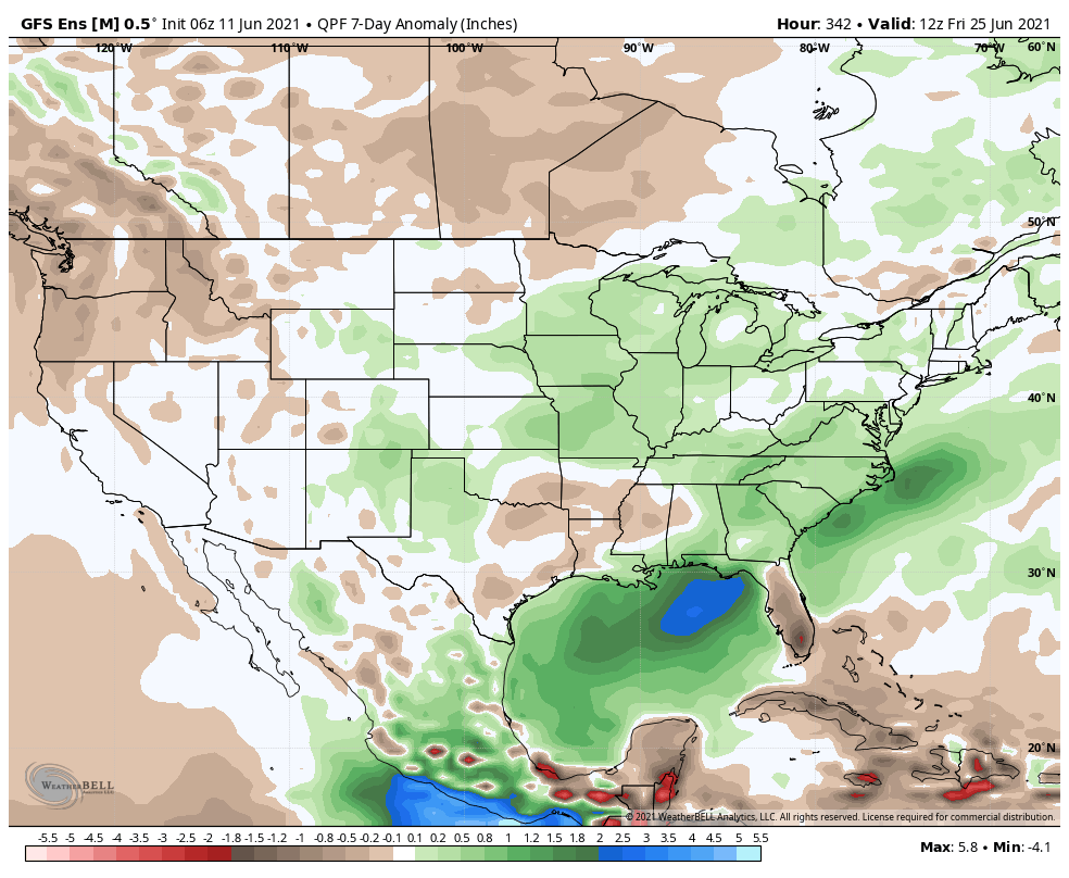
As we move forward, we’ll keep close eyes on the MJO activity. Should things get into Phase 2 (as suggested above), this will lead to a large part of the country cooler than normal for the Independence Day holiday… Stay tuned.
Permanent link to this article: https://indywx.com/long-range-update-2nd-half-of-june-and-looking-ahead-towards-independence-day/
May 31
Updated 05.31.21 @ 9a
With the exception of the far Southwest and Northeast, May 2021 has been a relatively cool month, overall:

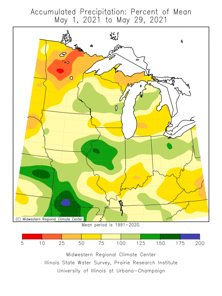
More closely to home, May featured “haves and have nots” in the precipitation department. Officially, (as of 5/30), Indianapolis is running more than 2.6° below normal on the month and 1.03″ below normal in the precipitation department.
As we look to June, the first week, overall, should open with slightly below normal temperatures, but there are changes in the offing that will promote significant warming in the Week 2 time frame (June 7-14). Note how the trough providing the cooler air in the immediate term is replaced with the expanding ridge over the Great Lakes.
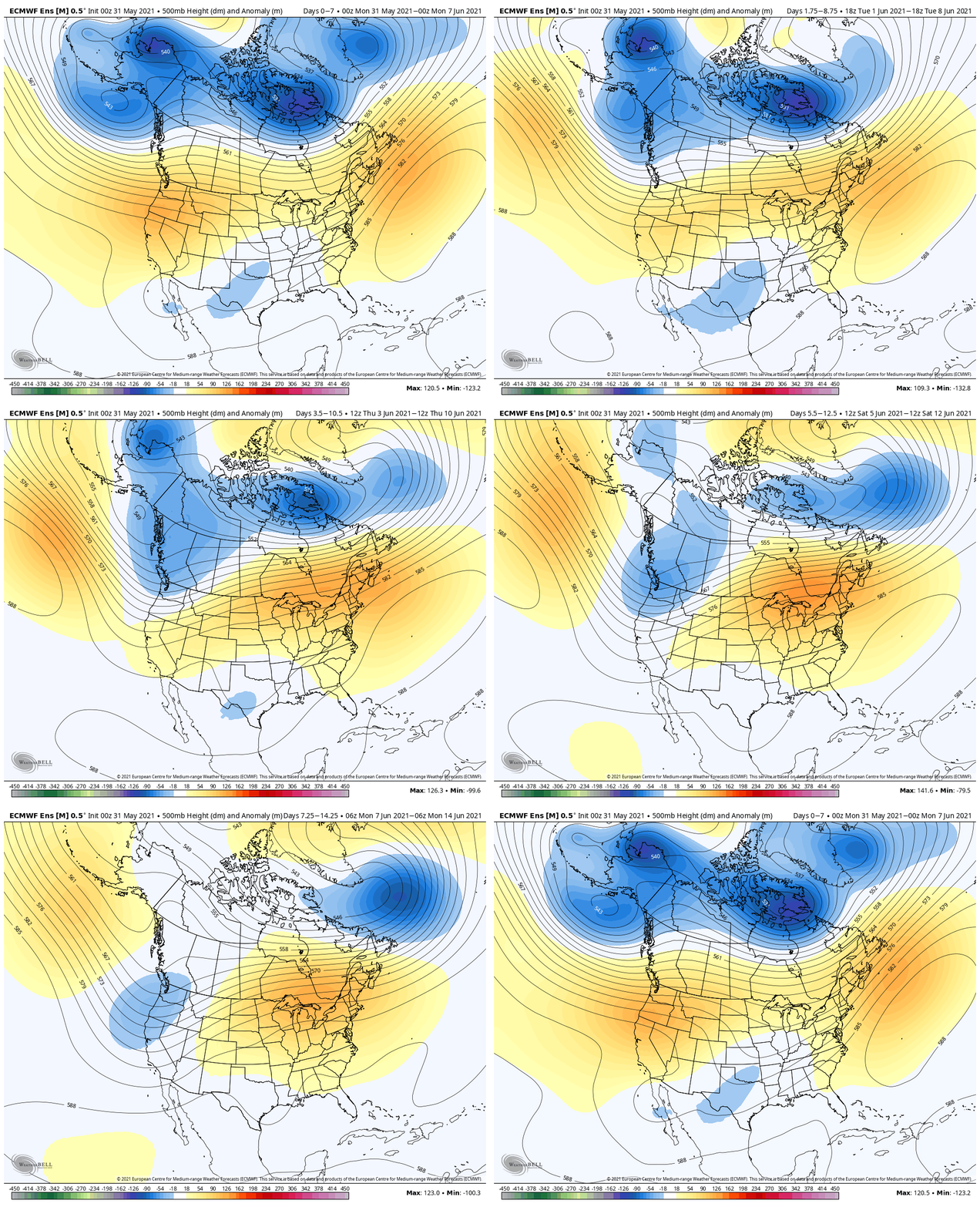
This should provide us a shot to touch the 90° mark during the aforementioned period at least on a couple of days. Regardless, we can expect rising humidity levels and a more summer-like feel. (I suppose that’s appropriate here on the first day of the unofficial start of summer).
Longer term, we need to keep close tabs on the MJO. Longer range data suggests the amplitude we’ve seen as of late will collapse.
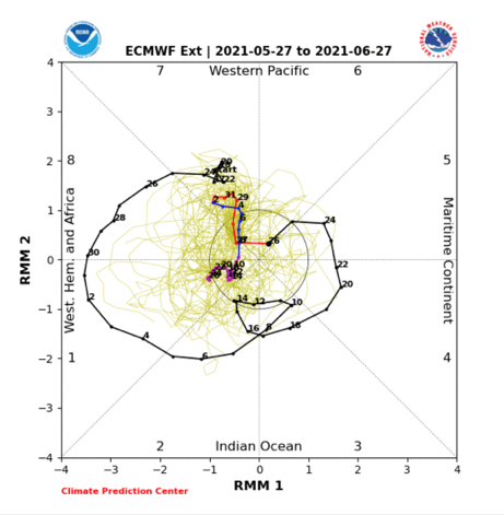

A big drop negative in the PNA will promote the Week 2 heat that we mentioned above. Thereafter, it appears as if the PNA will want to rebound closer to neutral (heat shouldn’t hold).
As a whole, we believe the drought-stricken West will be the breeding ground for big time heat while things are much more transitional across the East (leading to near seasonal temperatures. As for precipitation, we’re expecting a wetter pattern to emerge for the Deep South, TN Valley, and into the eastern Ohio Valley in the month ahead. Meanwhile, the already dry ground across the West is likely to only worsen, unfortunately.
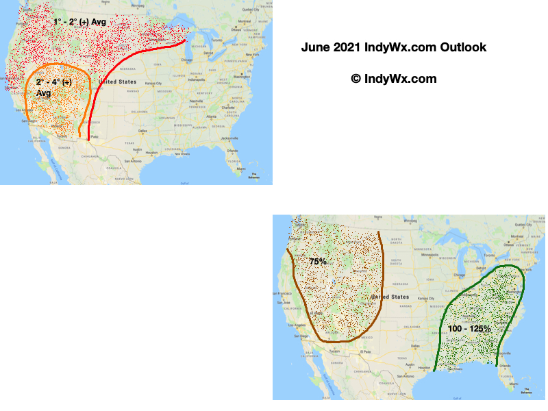
For perspective, averages for the month of June here in central Indiana include highs in the lower 80s (82.0° at IND), lows in the lower 60s (62.9° at IND), and nearly 5″ (4.95″ at IND) of rain.
Permanent link to this article: https://indywx.com/june-2021-outlook/
Apr 29
Updated: 04.29.21 @ 7:42a
Before we dig into some of the wetter trends being shown on the majority of forecast models, let’s review the basis of the medium to longer range forecast through the 1st half of May.
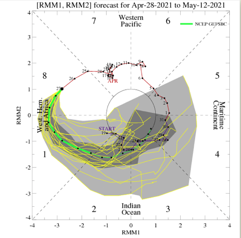
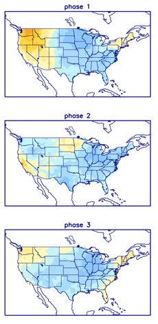
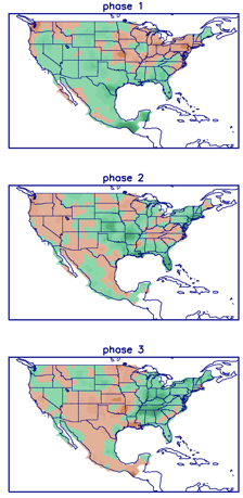
We’ll start with the MJO (Madden-Julian Oscillation). This is forecast to be quite amplified into May, swinging through Phases 1, 2, and 3. These are cooler than normal phases this time of year. Phases 2 and especially 3 are wet.
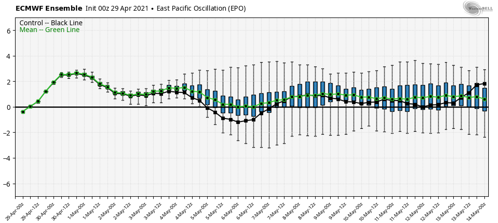
The 2 primary teleconnections we lean on this time of year include the EPO (East Pacific Oscillation) and PNA (Pacific North American pattern). While we still keep close tabs on the NAO, the influence it has begins to wane compared to late winter into mid spring. In any event, the EPO is largely forecast positive (a warm signal) while the PNA is forecast negative (also a warm signal).

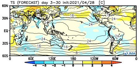
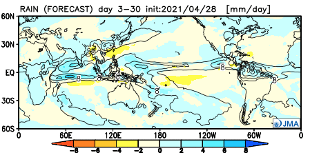
Let’s dig into the data. As it’s Thursday, we’ll start by taking a look at the new JMA Weeklies. Wetter than normal with seasonal temperatures sum up the upcoming 3-4 weeks.
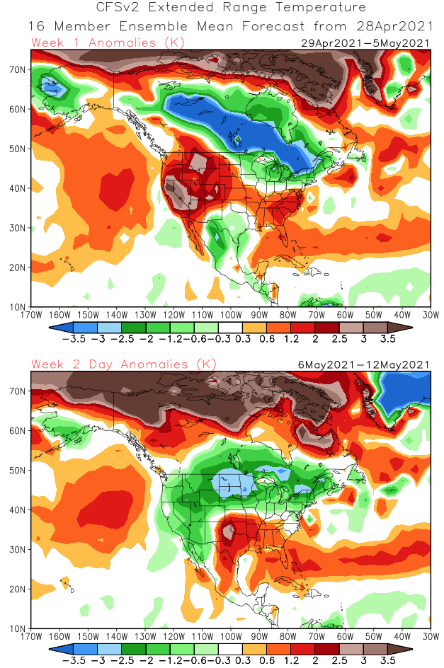
The CFSv2 Weeklies show a wet, cool (compared to normal) theme for our neck of the woods. Warmth is constant across the Southeast.
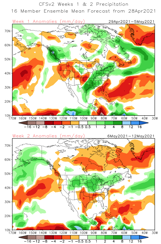
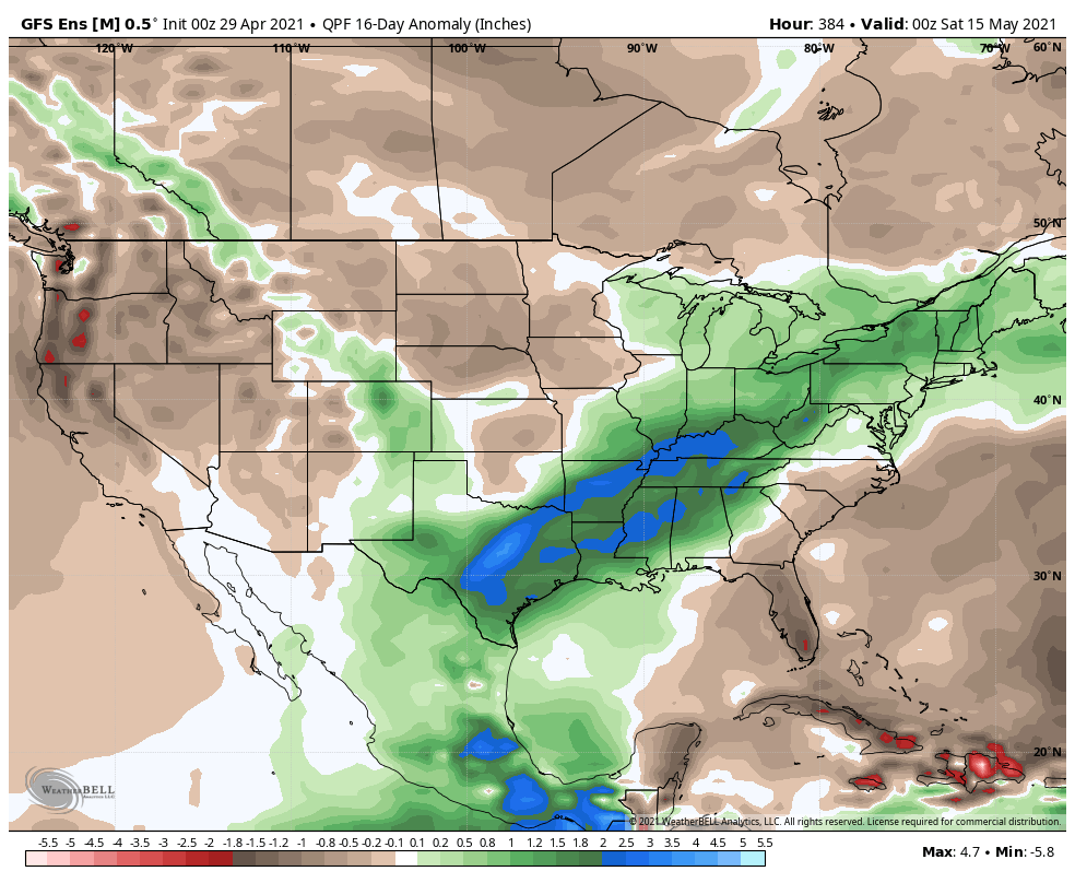
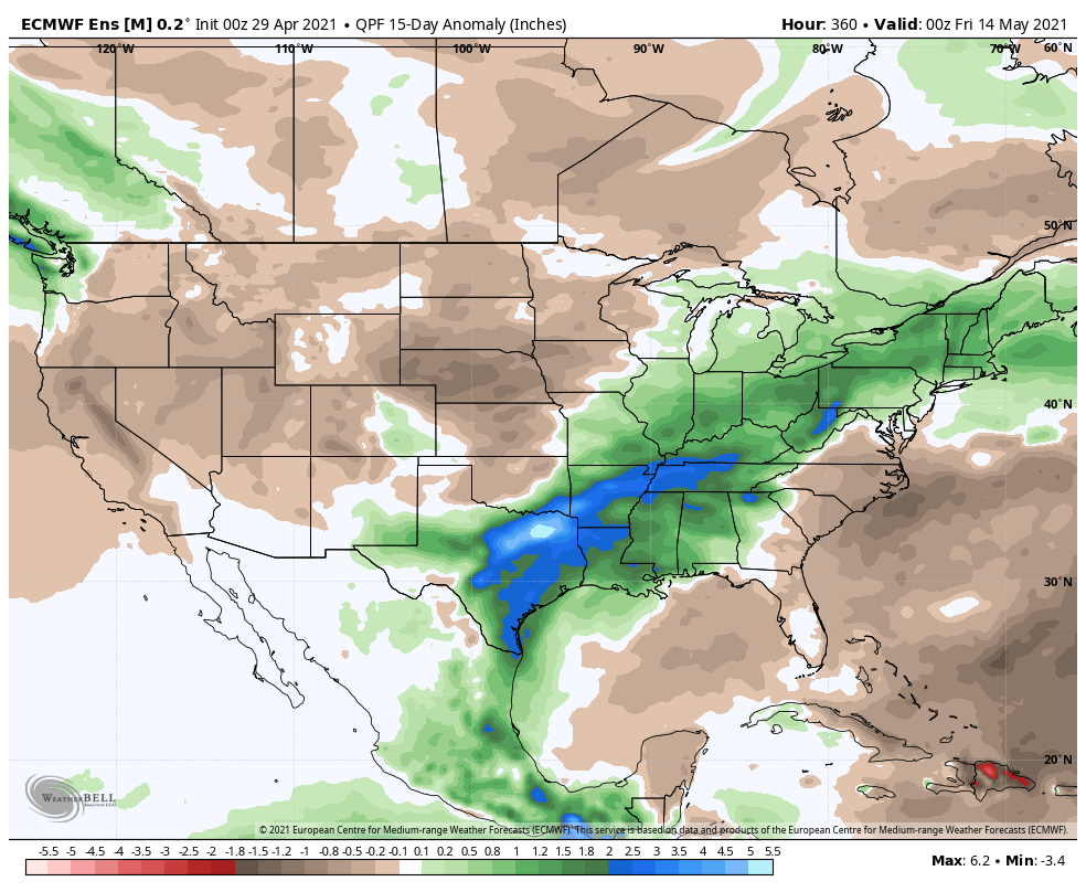
The GEFS and EPS are in relatively good agreement as we look at the upcoming couple of weeks. Both show a wetter than normal pattern from TX into the Northeast, including the Ohio Valley and Great Lakes.
The GEFS is trending significantly cooler in the Week 2 timeframe and given where the MJO is heading, it wouldn’t surprise us if other models cool from where they currently are during this time period.
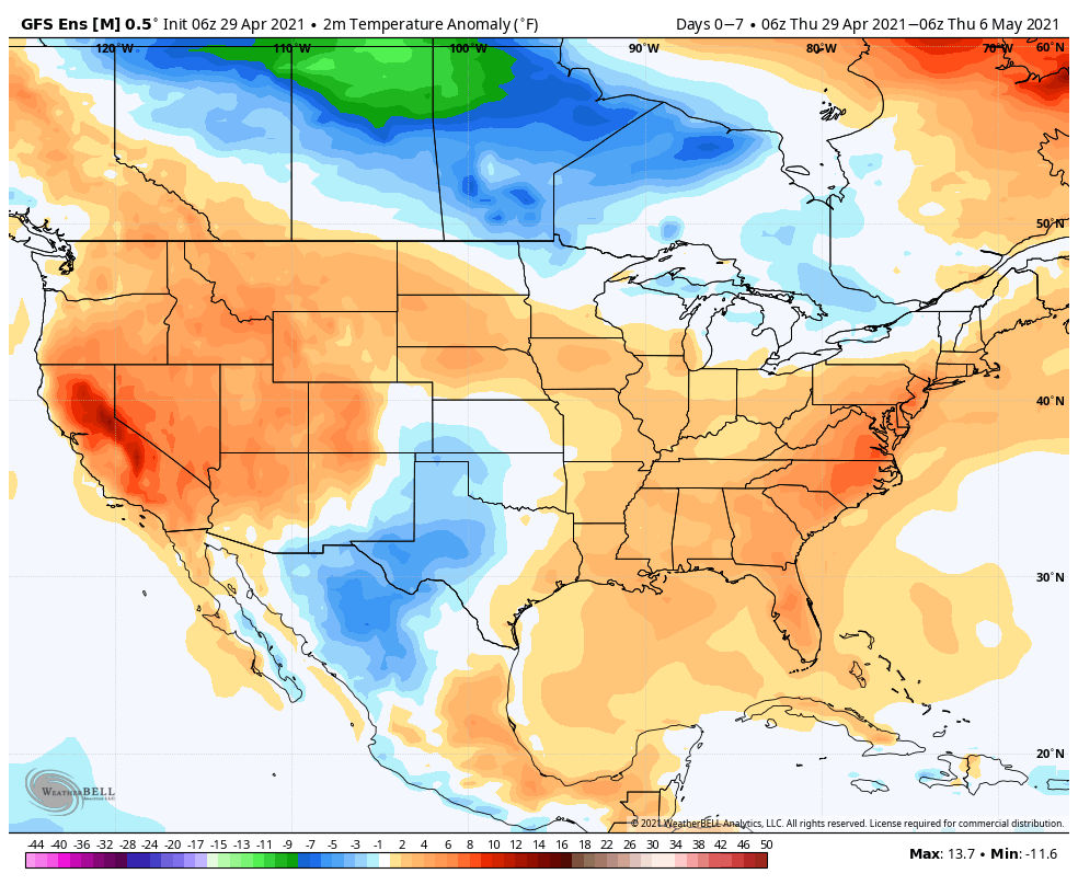
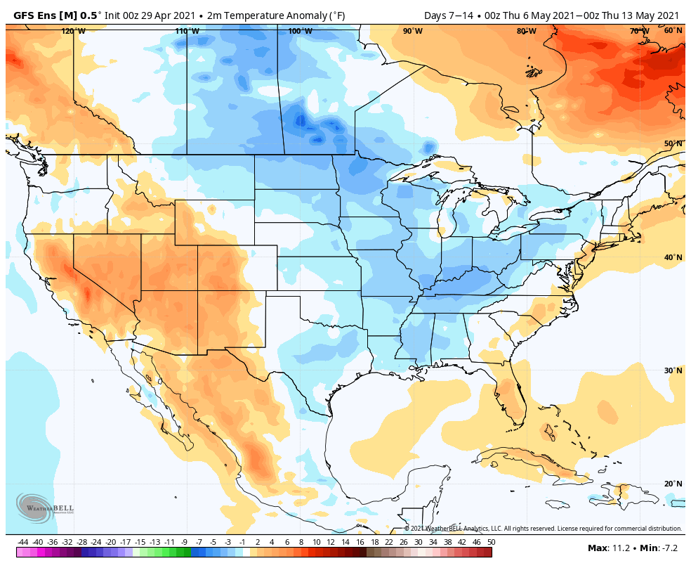
While the EPS is trending cooler Week 2, it’s not nearly to the magnitude of what the GEFS shows above.
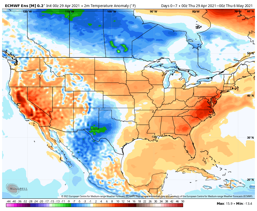
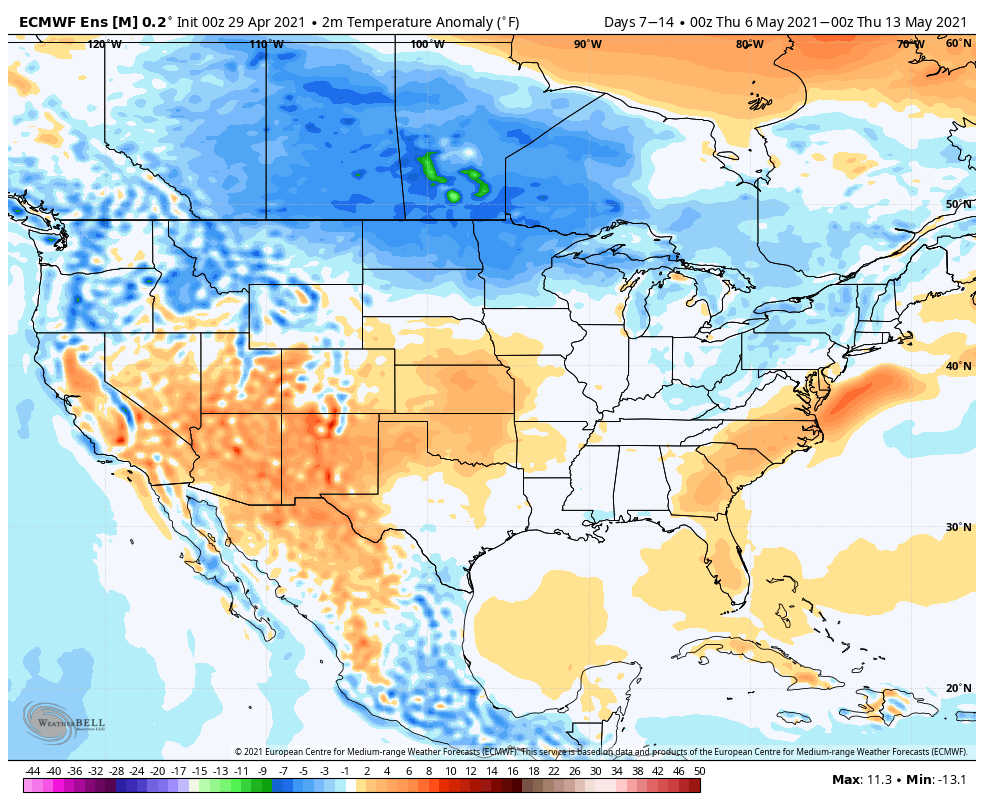
Given the pattern drivers discussed to start, we should enter a rather active weather pattern into the 1st couple weeks of May. While these are likely to be fast moving storm systems (usually not depositing excessive rainfall amounts), the frequency of the systems will likely add up over time (above normal rainfall). The wetter trends depicted on the modeling are hard to ignore. I would also keep close tabs on that Week 2 timeframe for the potential of cooler trends to show up and feel the GEFS is doing the best job from this distance.
Permanent link to this article: https://indywx.com/long-range-update-wetter-may-trends-and-mjo-influence/