Long Range Update: Wetter May Trends And MJO Influence…

Updated: 04.29.21 @ 7:42a

Before we dig into some of the wetter trends being shown on the majority of forecast models, let’s review the basis of the medium to longer range forecast through the 1st half of May.

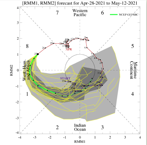
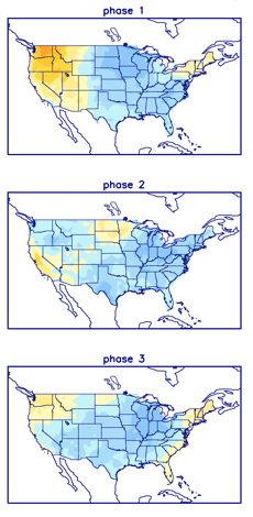
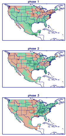
We’ll start with the MJO (Madden-Julian Oscillation). This is forecast to be quite amplified into May, swinging through Phases 1, 2, and 3. These are cooler than normal phases this time of year. Phases 2 and especially 3 are wet.

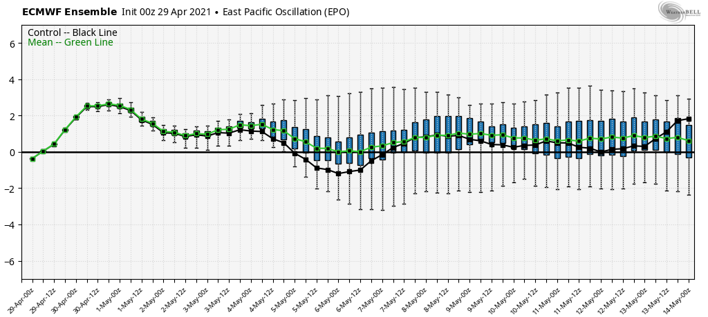
The 2 primary teleconnections we lean on this time of year include the EPO (East Pacific Oscillation) and PNA (Pacific North American pattern). While we still keep close tabs on the NAO, the influence it has begins to wane compared to late winter into mid spring. In any event, the EPO is largely forecast positive (a warm signal) while the PNA is forecast negative (also a warm signal).

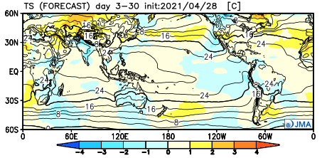
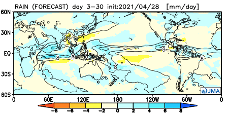
Let’s dig into the data. As it’s Thursday, we’ll start by taking a look at the new JMA Weeklies. Wetter than normal with seasonal temperatures sum up the upcoming 3-4 weeks.

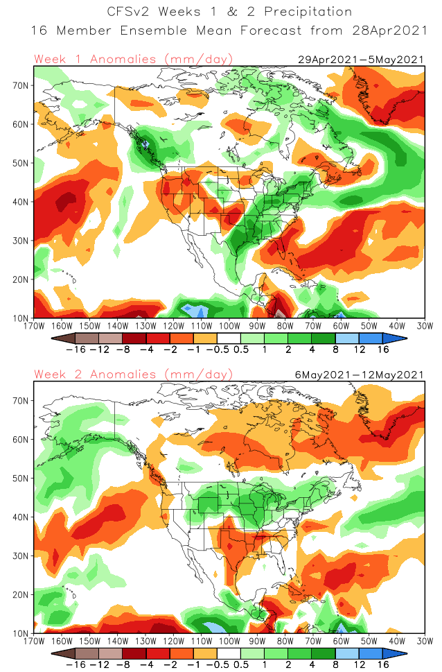
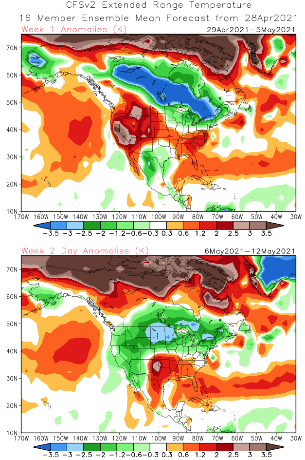
The CFSv2 Weeklies show a wet, cool (compared to normal) theme for our neck of the woods. Warmth is constant across the Southeast.

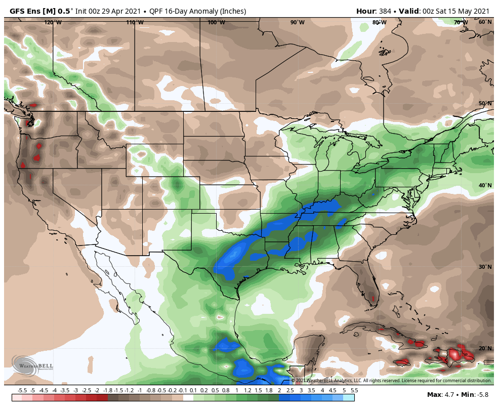
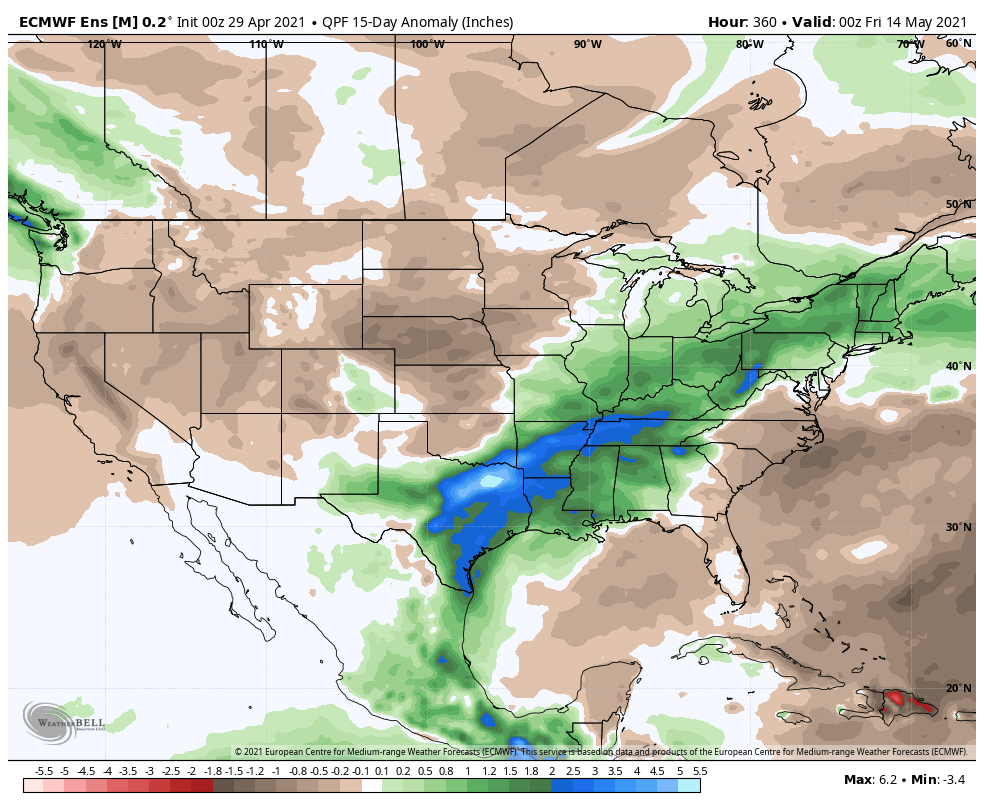
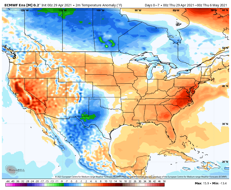
The GEFS and EPS are in relatively good agreement as we look at the upcoming couple of weeks. Both show a wetter than normal pattern from TX into the Northeast, including the Ohio Valley and Great Lakes.

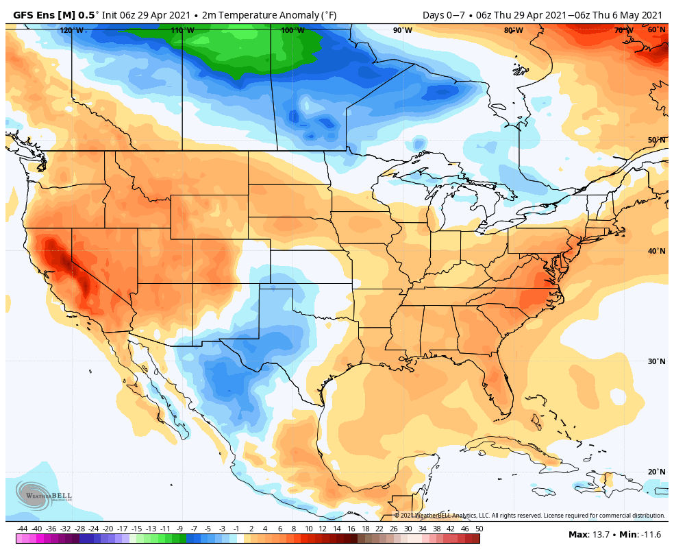
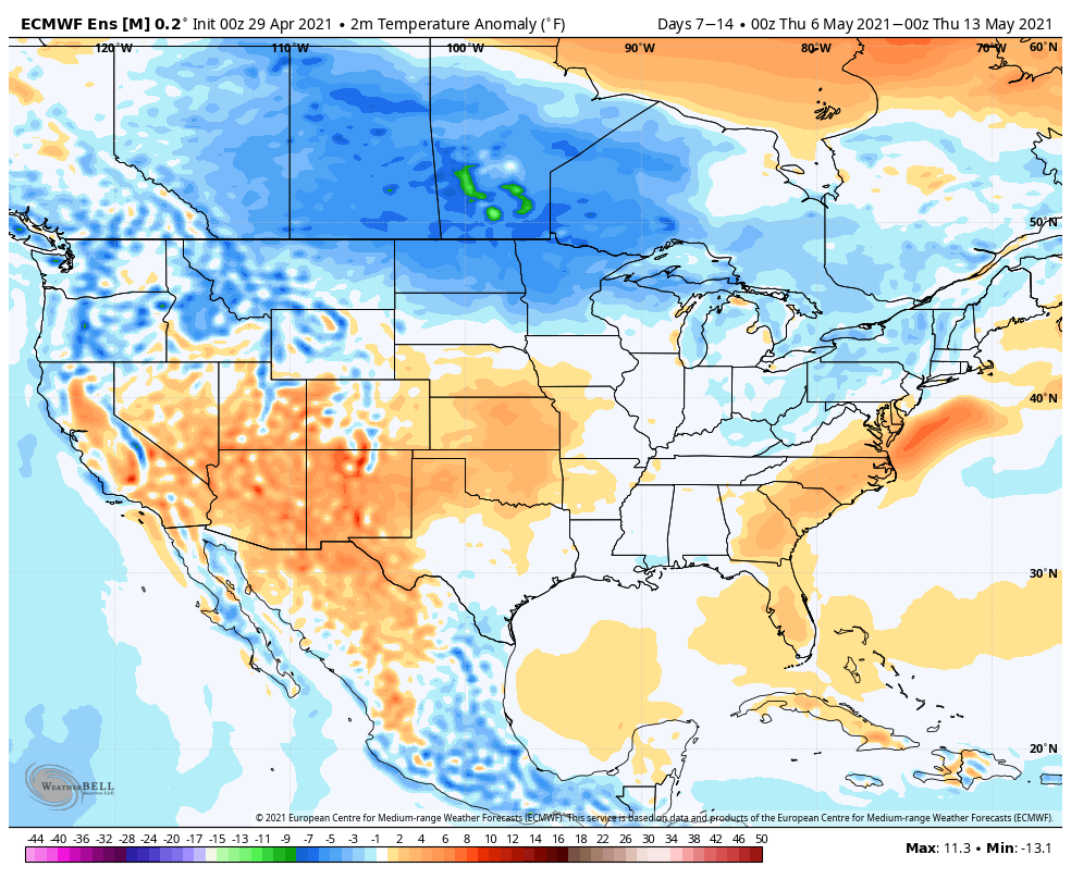
The GEFS is trending significantly cooler in the Week 2 timeframe and given where the MJO is heading, it wouldn’t surprise us if other models cool from where they currently are during this time period.

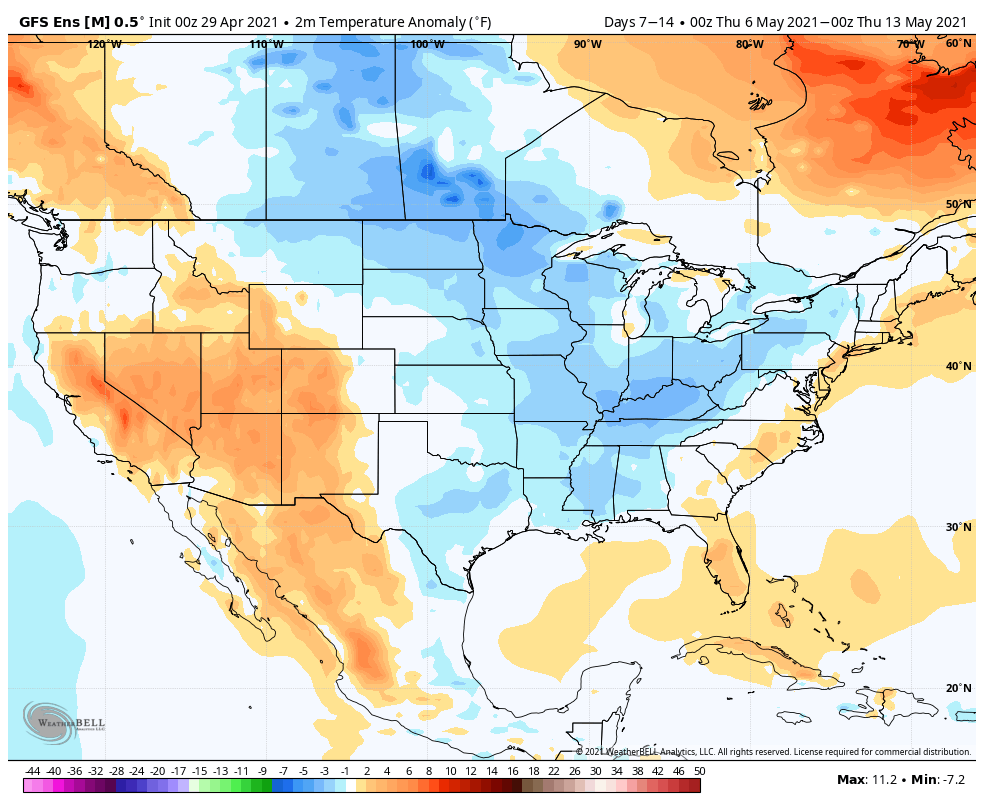
While the EPS is trending cooler Week 2, it’s not nearly to the magnitude of what the GEFS shows above.

Given the pattern drivers discussed to start, we should enter a rather active weather pattern into the 1st couple weeks of May. While these are likely to be fast moving storm systems (usually not depositing excessive rainfall amounts), the frequency of the systems will likely add up over time (above normal rainfall). The wetter trends depicted on the modeling are hard to ignore. I would also keep close tabs on that Week 2 timeframe for the potential of cooler trends to show up and feel the GEFS is doing the best job from this distance.

Note On The Spring Severe Weather Season And Long Range Update…

Updated 03.18.21 @ 6:40p

You must be logged in to view this content. Click Here to become a member of IndyWX.com for full access.  Already a member of IndyWx.com All-Access?  Log-in here.

We’ve Seen This Before…

Updated 02.20.21 @ 8:29a

Before we dive into the challenges late next week, the potential is still very much alive and kicking for a period of slick conditions to develop Sunday evening/ night. While we’ll likely be in the middle 30s during the majority of the time this light precipitation is falling, the concern remains, given the duration and magnitude of the cold air (ground is now reported frozen “8 to 12”), that any liquid precipitation that falls will freeze on untreated area roadways and sidewalks. If you have travel plans Sunday night, plan to give yourself plenty of extra time.

Light rain should arrive between 8p and 10p (west to east across the state) Sunday before ending as a bit of light snow (little to no accumulation expected as of now). Total precipitation should be 0.20″ or less for most with this event.

As we look ahead, the next item of possible trouble awaits for mid and late week. A cold front will push south of the area Wednesday night into Thursday morning. While this may generate a brief period of light rain transitioning to light snow, it’s what follows that’s of more interest.

Operational guidance (both the European and GFS) suggest this late week system will present a winter storm for our friends in the TN Valley, but we advise to tread with caution for now.

The reason? A strongly negative PNA.

You know the drill by now. This should lead to a more stubborn southeastern ridge and subsequent further north storm track.

Height anomalies during a (-) PNA period.

Over time, I’d suspect we’ll see just that- the models trending further north with this particular storm system.

As it is, ensemble guidance is already significantly further north than their respective operational counterparts. At the very least, another interesting case study is in front of us…

Stay tuned!

VIDEO: Long-Winded Update Of Where We Think The Pattern Is Going Into Early March…

Updated: 02.18.21 @ 7:08p

You must be logged in to view this content. Click Here to become a member of IndyWX.com for full access.  Already a member of IndyWx.com All-Access?  Log-in here.