Category: Plant24

Monday Evening Thoughts On Storm Potential Tonight – Wednesday…

Updated 02.26.24 @ 5:51p

The Storm Prediction Center (SPC) has expanded the ‘marginal’ risk area within their Day 1 Outlook. This is for the potential of isolated strong cells developing later this evening and through the overnight (large hail being the biggest concern from any stronger cell that pops), but this shouldn’t be a widespread severe weather event by any stretch of the imagination.

The Day 2 Outlook remains largely unchanged from this morning across our immediate area.
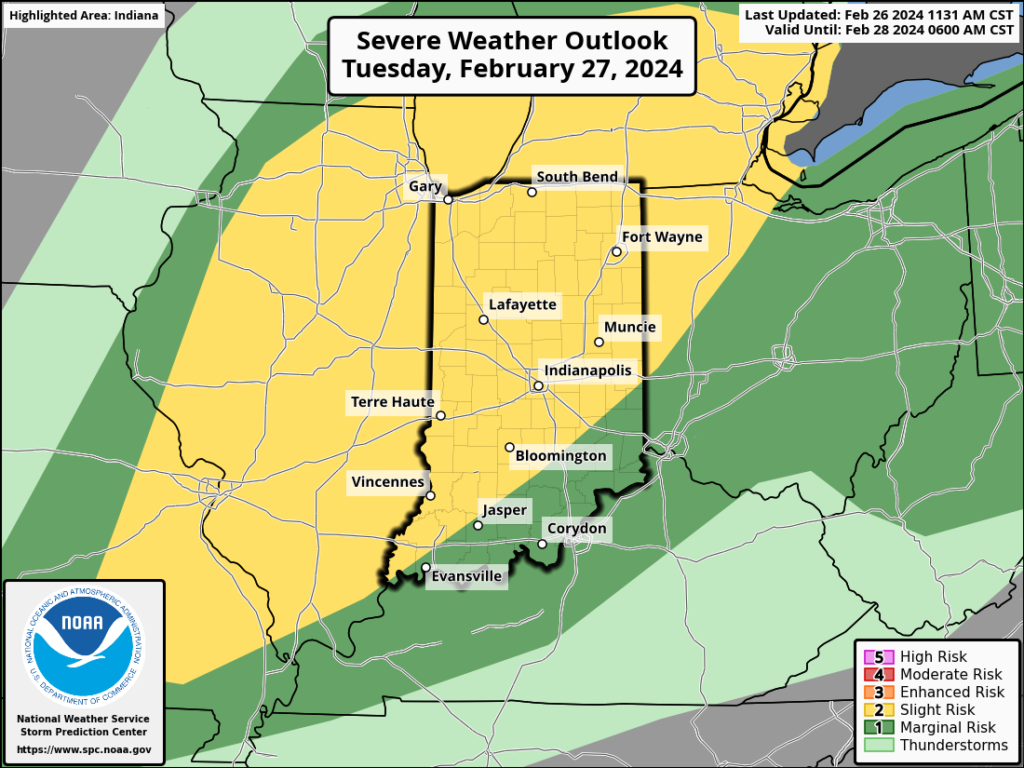
Concern remains that all modes of severe weather will be realized across northern IL and northern IN Tuesday evening into the overnight.

We want to reiterate that the majority of the daytime should be void of any sort of significant rain or storms across the state. It’s after 7p, and more so after 9p, that we expect discrete cells to initialize and roll across northern IN. These discrete cells will be capable of rotating (TOR potential remains), but also have the potential of damaging winds and large hail. The most widespread of evening convection should be focused north of the city, itself, but we’ll keep a close eye on tonight’s and Tuesday morning’s data.

We continue to believe a more pronounced squall line will march east across the state, including central and southern Indiana, during the overnight and predawn hours and it’s with this line that an elevated damaging wind threat will be hoisted. Timing this threat out features the 2a to 5a Wednesday time block from west to east. We recommend reviewing your severe weather safety plan and have a means of receiving the latest warning information should they be issued.
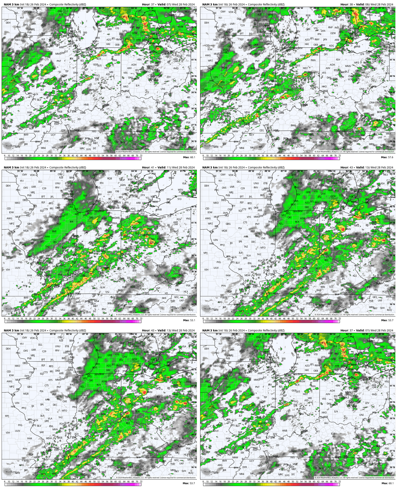
Showers and embedded thunder will remain widespread through the early morning hours before pushing off to our east by mid morning. By this time, we’ll be trending sharply colder (temperatures will fall off the cliff Wednesday morning), drier, but very windy.
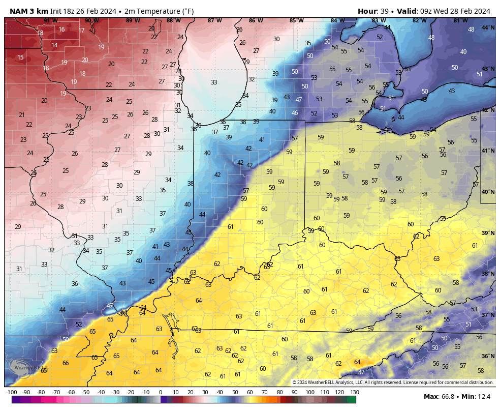
Predawn highs around 60° Wednesday will be shaved by 30° by late morning along with a biting northwesterly wind gusting 30-40 MPH.

High pressure will deliver a colder, but sunny Thursday before a weak system delivers a return of clouds and light (insignificant) showers to close the work week.

The weekend continues to look mighty nice, including a quick rebound in the mercury and another taste of spring ahead of our next approaching storm early next week.

Permanent link to this article: https://indywx.com/monday-evening-thoughts-on-tonight-wednesday/

VIDEO: Forecasting Record Warmth Today; Timing Out Rounds Of Storms Late Tonight – Wednesday AM…

Updated 02.26.24 @ 7:30a We’ll go from “chamber of commerce” type weather to open the work week, including pushing for a record high later this afternoon, to rounds of storms…

You must be logged in to view this content. Click Here to become a member of IndyWX.com for full access.  Already a member of IndyWx.com All-Access?  Log-in here.

Permanent link to this article: https://indywx.com/video-forecasting-record-warmth-today-timing-out-rounds-of-storms-late-tonight-wednesday-am/

Weekly #AGwx And #Severe Weather Outlook…

Updated 02.25.24 @ 7:55a

Though a bit earlier than usual this year, it’s time to “dust off” our dedicated weekly post aimed solely at looking at the potential of severe weather in the week ahead. You can expect this to be posted each Sunday morning moving forward through the spring and summer before sunsetting for another year come late September.

An anomalous pattern will dominate the period as we close February and open March. The eastern ridge will become stronger in response to a digging trough across the Western CONUS.
Well above average temperatures can be expected for the Plains and Eastern CONUS through the upcoming week. Cooling behind our midweek frontal passage will be brief before another significant warm-up late week.
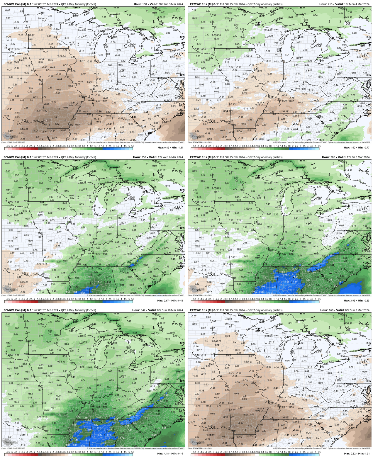
The upcoming 2-week period should yield above average precipitation to the majority of the forecast area (to well above average across the Southeast).

Forecast period: 02.25.24 through 03.03.24

The “headliner” system in the forecast period is an area of low pressure tracking into the Great Lakes region Tuesday into Wednesday (02.27 and 02.28). This will drag a trailing cold front through the Ohio Valley Wednesday morning into the afternoon (west to east).

The Storm Prediction Center includes most of the region in some sort of risk of severe weather Tuesday. The greatest risk of severe appears to include an area north and west of a rough line from Evansville northeast to Bloomington and Toledo, OH. While all modes of severe weather are in play, we remain most concerned for the threat of damaging straight line winds Tuesday PM.

Ingredients aren’t off the charts (rarely are this time of year), but parameters are sufficient enough to warrant the chance of strong to severe storms Tuesday into very early Wednesday morning before the cold front moves through the region and results in falling temperatures and a much more stable airmass engulfing the entire OHV through the day. Stay tuned as we continue to fine tune specific timing of storms.

Beyond this point, an area of high pressure will settle overhead, resulting in a much more stable pattern to close the week and head through the weekend. Expect sunshine to return and another quick warm-up to get underway during this period. Highs will zoom back into the 60s next weekend.

Looking ahead, we’ll need to monitor the threat of another potential strong-severe storm window during the early to middle stages of next week. Far too early for specifics, but similar ingredients appear in play which isn’t shocking given the ‘mean’ upper air pattern shown to open this post. We also want to reiterate the above to well above average precipitation expected throughout meteorological spring. Image 3 above highlights the wet look over the upcoming couple weeks.

Upcoming Storm Dates to keep an eye on:

  • 02.26 – 02.27
  • 03.03 – 03.05

*10-day rainfall projection: 1.25″ – 2.25″

Permanent link to this article: https://indywx.com/weekly-agwx-and-severe-weather-outlook-45/

VIDEO: Overall, Strong Signal For Unseasonable Warmth Remains On Charts Into Early March. Watching Storms Early Next Week…

Updated 02.24.24 @ 8a Any lingering light snow showers will quickly come to an end this morning and we’ll welcome sunshine back into the picture later today. Sunday will feature…

You must be logged in to view this content. Click Here to become a member of IndyWX.com for full access.  Already a member of IndyWx.com All-Access?  Log-in here.

Permanent link to this article: https://indywx.com/video-overall-strong-signal-for-unseasonable-warmth-remains-on-charts-into-early-march-watching-storms-early-next-week/

Taste Of Spring To Close February And Open March: Monitoring Storm Potential…

Updated 02.18.24 @ 10:59a

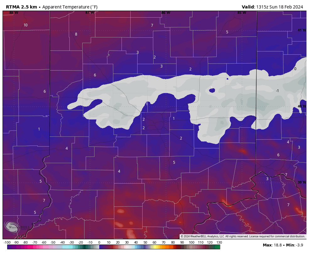
Though we dealt with a bitter start to the day, those strong and gusty southwest winds signal a regime change through the 1st half of the work week. Highs will pop into the 60s even by midweek- a far cry from this morning’s sub-zero “feels like” over the heart of the fresh snowpack.

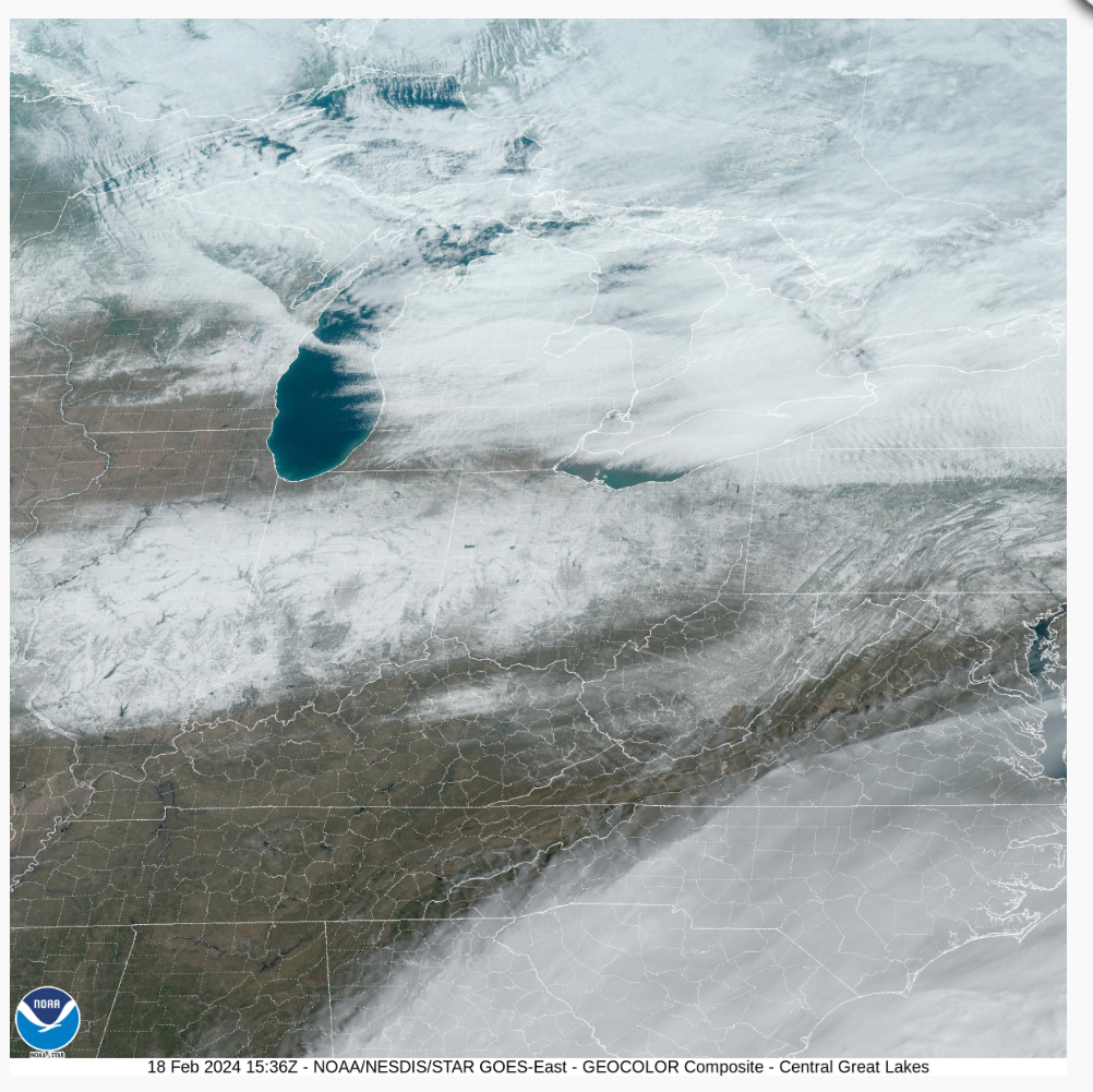
This morning’s visible satellite image shows clear skies across our region and the fresh snowpack.

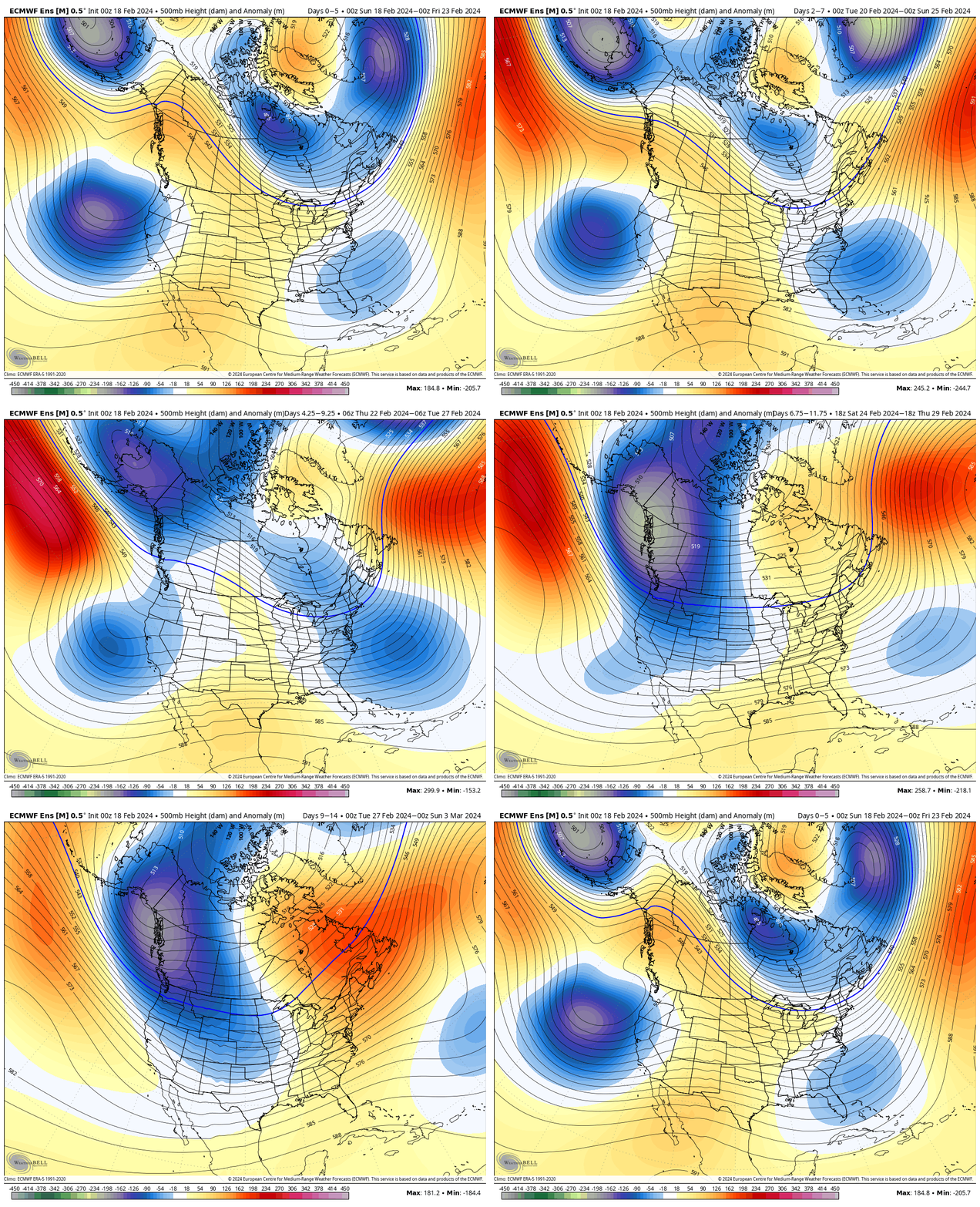
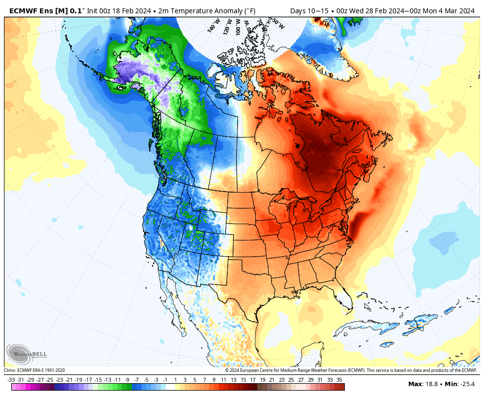
The upcoming 10-day period will feature an expanding ridge across the East and the ‘mean’ trough position settling into the West.

After another brief shot of cold air this weekend, a significant unseasonably mild pattern will arrive next week. Cold settles into the West.

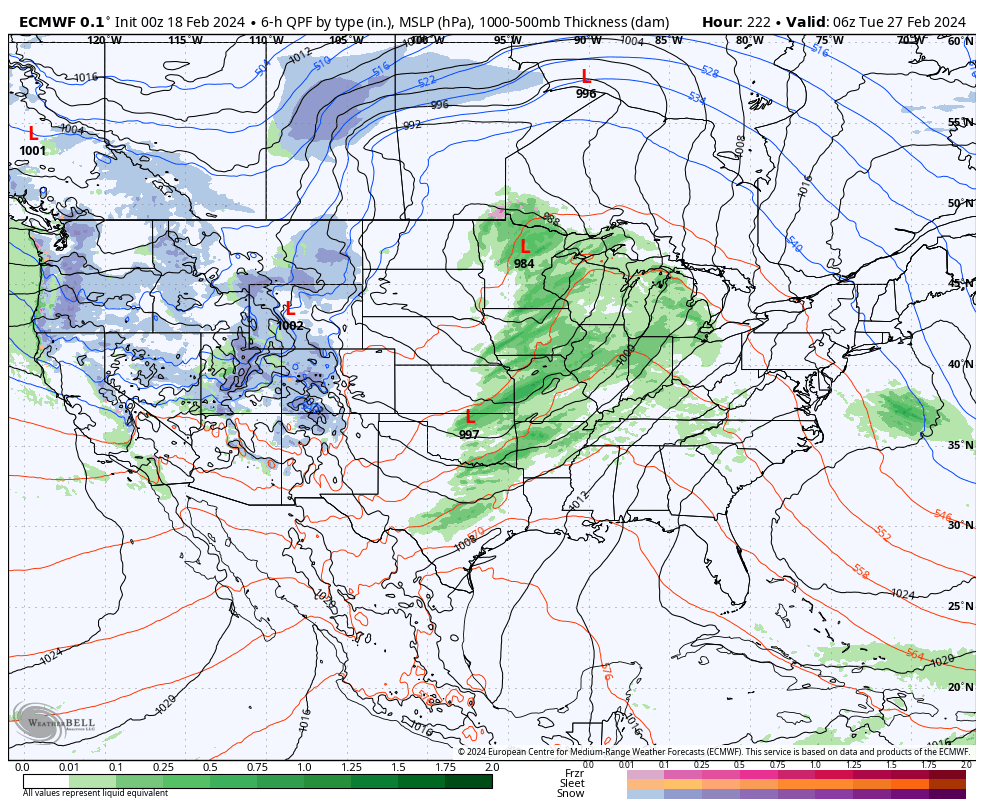
The developing upper air pattern will lead to a more active storm track to close February and open March. See the anticipated above normal precipitation pattern taking hold. This is likely a sign of what the balance of meteorological spring will feature.

In the week ahead, we continue to track a rain maker Wednesday night into Thursday and a brief “jolt” of cold for the weekend.

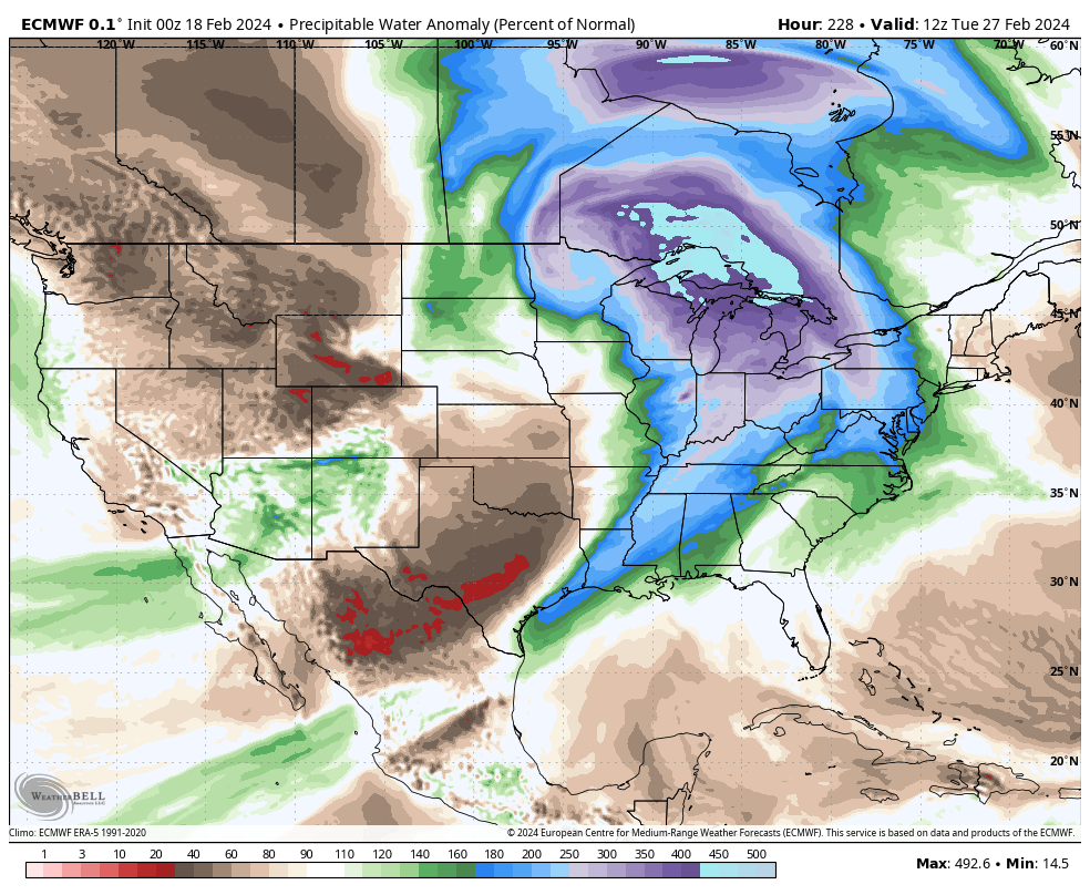
Looking ahead to next week, a more widespread and stronger storm should take aim on our area. Though still a ways off, the signal is one that looks like this feature will be able to tap into the Gulf of Mexico, allowing for a more widespread, potentially, heavier rain event and also the chance of storms.

Note precipitable water values (PWATs) are forecast nearly 300% of the norm.

As we get closer, we’ll have to keep tabs on instability levels and available energy for the prospects of storms. More on this Day 8-10 feature in the coming days. Make it a great Sunday!

Permanent link to this article: https://indywx.com/taste-of-spring-to-close-february-and-open-march-monitoring-storm-potential/