The short-term weather pattern will continue to be dominated by rather “boring” conditions for this time of year, along with much milder than normal air. A weak frontal system will swing through here Thursday and while a light shower is possible, that’s really the only significant (if you want to call it that) weather feature through the upcoming 7-10 days.
In addition to the rather quiet weather, relative warmth will dominate as we open December. When “normals” feature lows in the upper 20s and highs in the lower 40s, actual overnight lows will only fall into the low-mid 30s and highs will reach the middle to upper 50s.
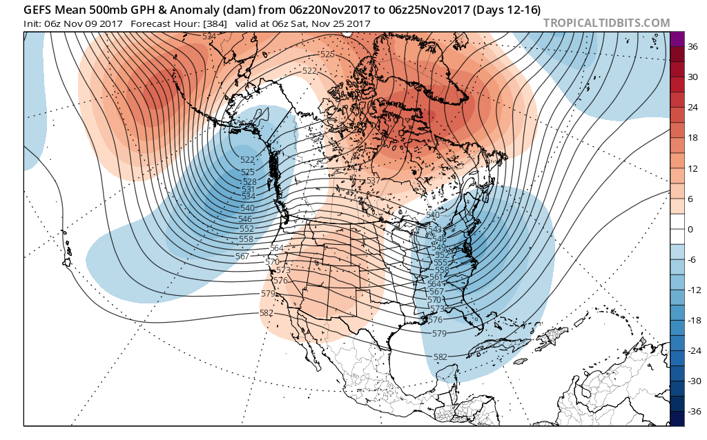
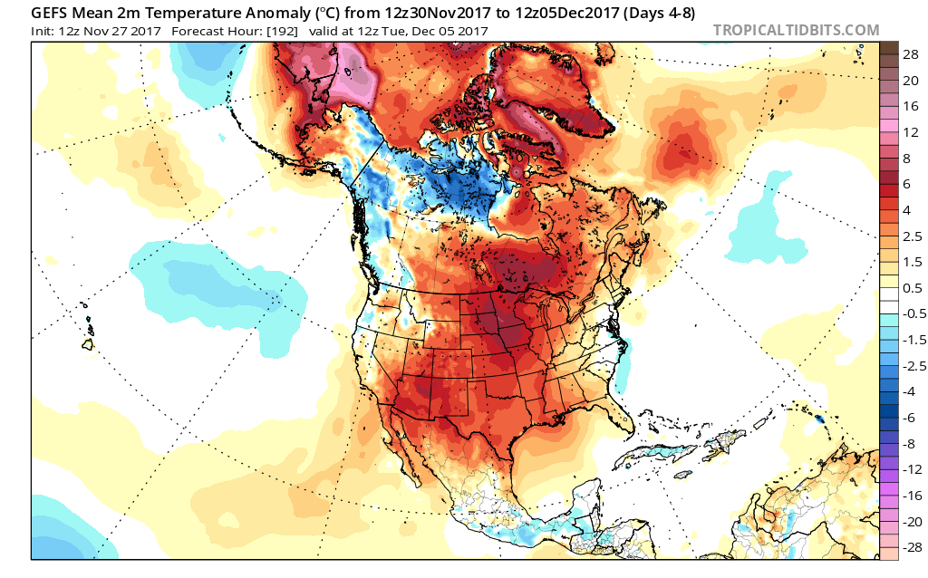 When we look ahead, the shelf life of this warmth is certainly limited. The GEFS showcases this shift in the pattern from a warm open to the month towards a much colder pattern very nicely. The GEFS has other model support, as well.
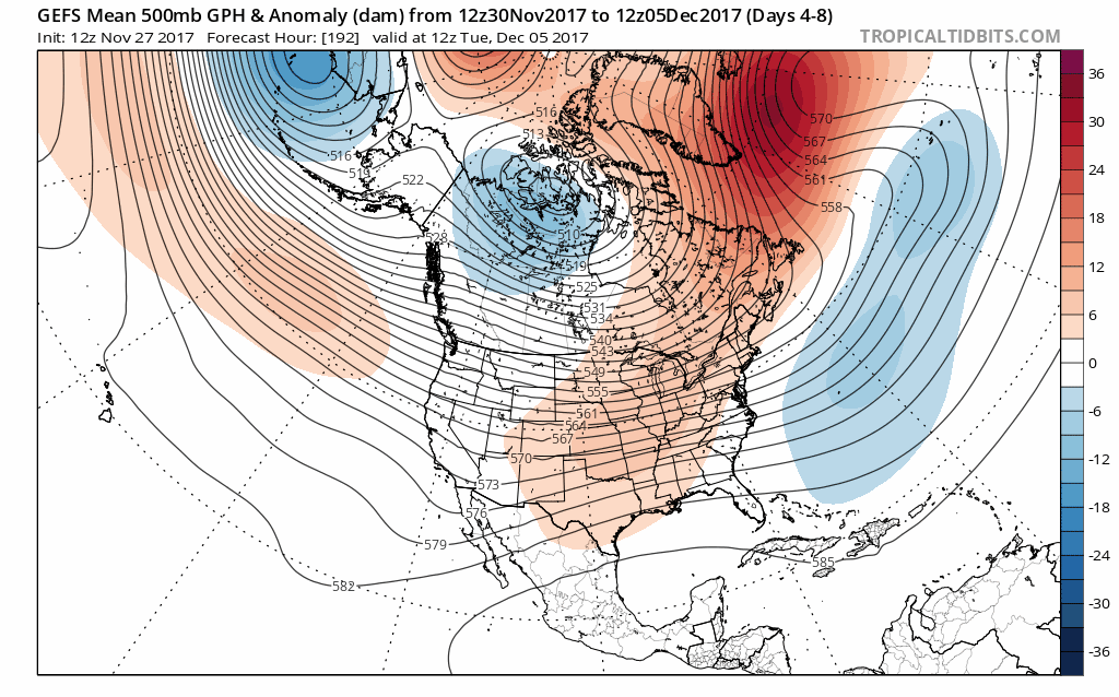 This is the type of dramatic shift in the overall pattern that not only threatens to “lock in” a colder than average regime, but potentially lead to plenty of wintry mischief to boot, and just in time for the holiday season.
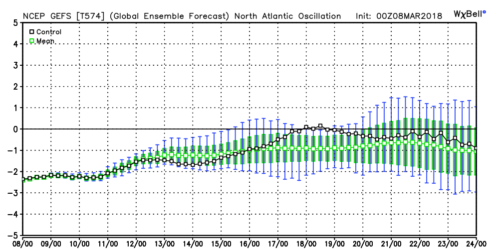
There’s teleconnection support for the wintry shift, as well, leading to further confidence of a significant move towards cold, and potentially snowy/ icy, conditions as the true holiday and Christmas season approaches.
 To summarize, while unseasonably quiet and mild conditions will rule in the short-term, Mother Nature sure seems to have an attitude of making up for “lost time” in the medium to longer range. This is the type pattern that we’ll have to monitor the potential of some sort of leader-follower scenario as the transition from warm to cold takes place, and given the blocky nature of the pattern, it sure seems like we’re heading into a busy time of things from a wintry perspective mid and late month.
Perhaps this will be the scene as Christmas time nears across the Mid West, including central Indiana? Time will tell…
 It should be no surprise that the GEFS 5-day temperature anomaly shows widespread below normal air centered on March 22nd.
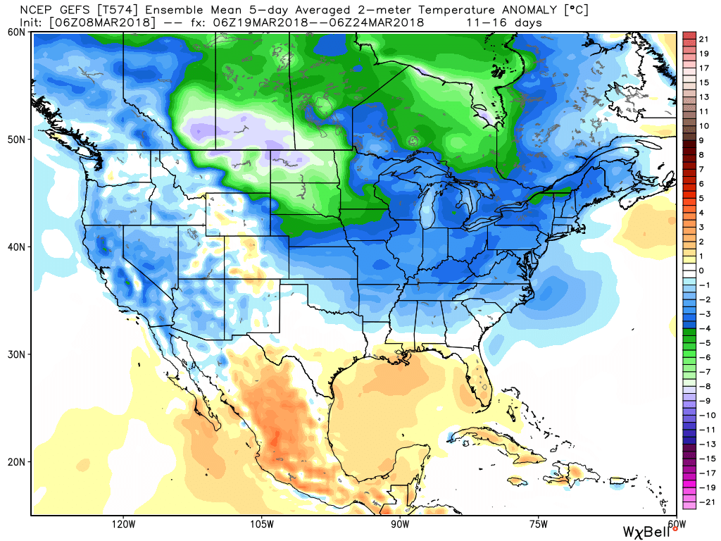 This doesn’t mean brief surges of warmth, originating in the southern Plains, can’t shoot into the Ohio Valley for a couple of days. Perhaps we’ll “luck out” and enjoy a briefly milder time for St. Patrick’s Day. This does, however, mean that overall we have a long, long way to go before “stick and hold” spring can arrive, locally, and the balance of the upcoming 2-3 weeks looks colder than average.
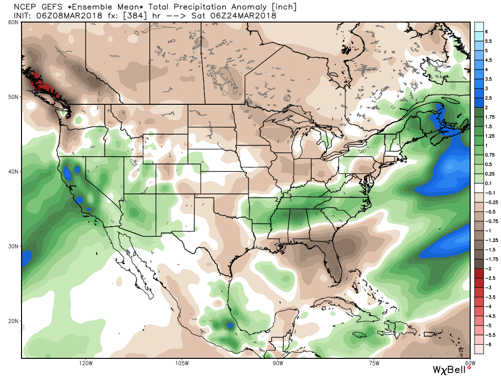

 Such a pattern illustrated above, per the European ensemble (image 1) and the GFS ensemble (image 2), would help drill a tongue of unseasonably cold air through the northern Plains, into the Mid West, and across the East.
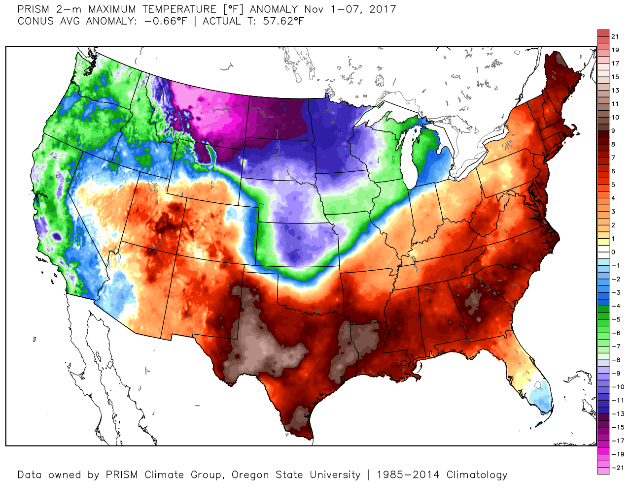
 We’ve been discussing early snow cover across Canada and the northern tier for weeks and how models would have to “correct” colder as they realize the air masses traveling over the snowpack won’t be able to modify as they normally would without that snowpack. The differences between this November and last are startling and show how the early snowpack is beginning to “feedback” on itself leading to early-season cold air.
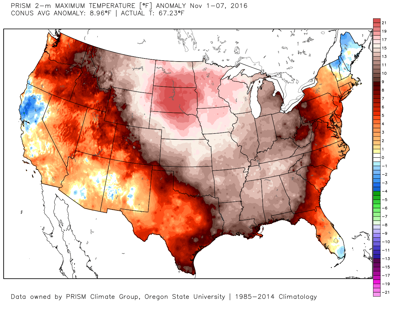 2017 snowpack and temperatures anomalies through the first week of November:
 Given the overall look to the pattern downstream, I anticipate the cold will continue to “press” and eventually overwhelm the pattern east as we progress through the second half of the month.