Wintry Mix Tomorrow Evening; Fresh Long Range Fun…

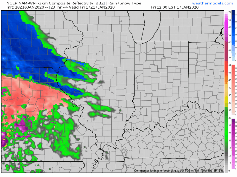
Friday will dawn dry, but the mid and high level cloud canopy will be a sign of things to come. These clouds will lower and thicken through the day and eventually give way to a wintry mix by evening. While there may initially be a period of snow (especially north of Indianapolis), the majority of the “overrunning” precipitation should fall as a mixture of sleet and freezing rain. In and around Indianapolis and points north, a light “glaze” of ice is possible Friday evening of up to .10″ (after the possibility of a coating of snow).

Dry air will likely have to be overcome at first, but a burst of snow is possible into the city around 5p to 6p before the transition over to the sleet and freezing rain mixture. Eventually, the icy mixture will transition to a cold rain prior to sunrise Saturday.

MUCH colder air will pour into the state Saturday evening with temperatures falling into the 10s prior to midnight Sunday morning and wind chills into the single digits.

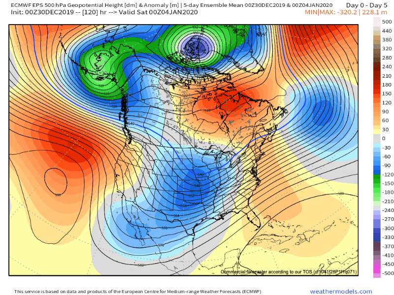
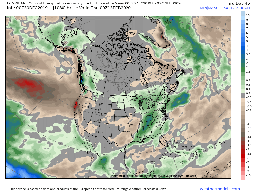
As we look longer term, we don’t see any reason to alter our ongoing thoughts of a colder pattern taking hold, overall, over the upcoming 10-14 day period (and likely into the first half of Feb.). We’ve covered our reasoning in previous posts (Phase 7 of the MJO, positive PNA, neutral EPO, etc.). What’s interesting to note is the rather stark difference in the handling of the EPO between the negative GEFS and positive EPS. The likely end result will be somewhere in between; hence our neutral EPO forecast. At the end of the day, it’s really not the EPO, PNA, or NAO that will drive the mean pattern, but the MJO. And with that said, Phase 7 of the MJO features a cold, stormy look.

The high latitude blocking screams for an active storm track across our neck of the woods (as does the slightly positive PNA and neutral EPO). Sure enough, the latest modeling is going towards this stormy look (active southern stream) in the medium to long range period.

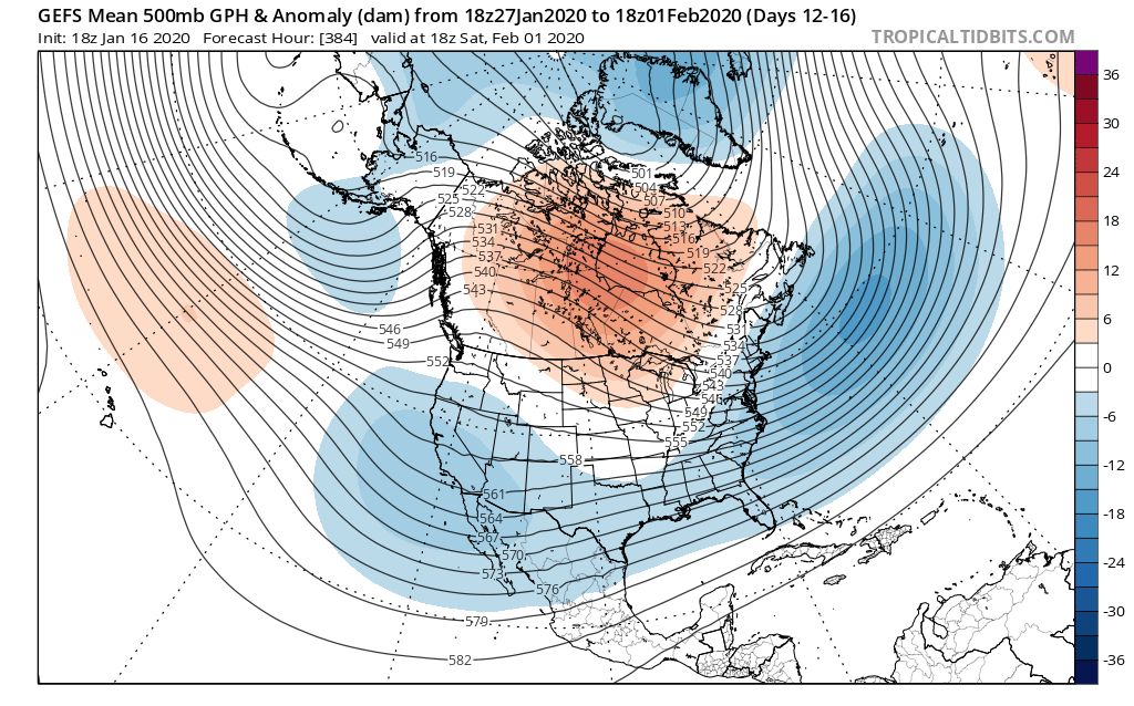
A great mentor once taught me to always be leery of ridges over Hudson Bay in the winter time. Time and time again, this pattern setup results in fairly widespread winter storm events through the Lower 48 and we think there is increased potential in this sometime during the Jan. 25-31 time period. While there’s no way to be specific, just keep a mental note in the back of your mind for this threat.

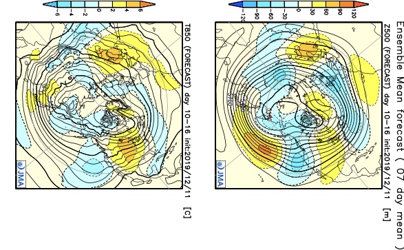
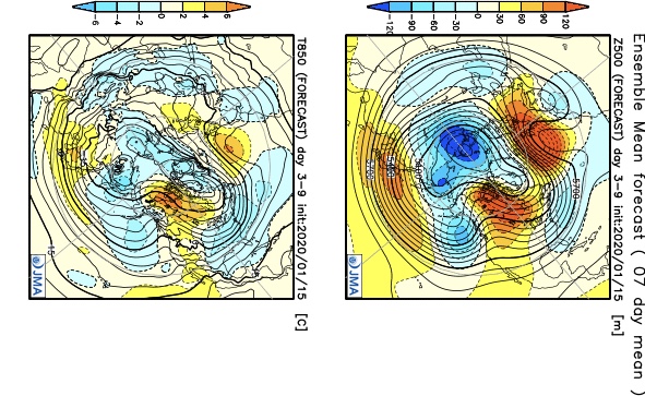
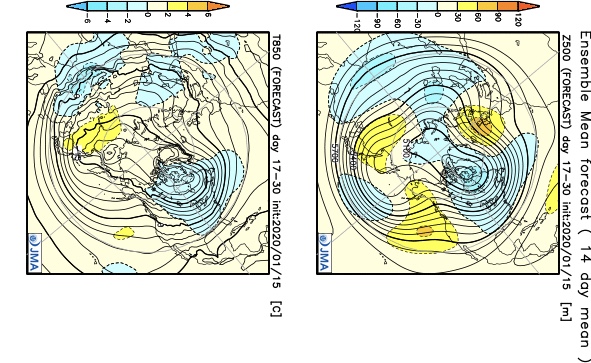
In closing, a review of the latest JMA Weeklies shows a significantly different pattern than what we’ve grown accustomed to as of late taking up residence through the bulk of the upcoming 3-4 weeks. Given the above, it would be tough to argue this look…

Week 1
Week 2
Weeks 3-4

Fresh video update will hit in the AM with new thoughts around tomorrow evening’s winter weather maker.

Important To Know What Lever To Pull And When…

As another year comes to a close and the winter pattern begins to “mature,” we thought we’d do a little rambling…

This evening’s rambles have to do with the variety of “drivers” that at times like to take control of our weather pattern. You hear us use terms like the MJO, EPO, AO, PNA, and NAO (amongst others) often, but at times, these various pattern drivers can have more impact than others, and at varied times of the year.

Traditionally, if the MJO (Madden Julian Oscillation) is highly amplified, that’s going to serve as the basis of our medium or longer range forecasts. However, if the MJO is in the null phase, other teleconnections can take control of the wheel. Sea-surface temperature configuration can give hints to the way these elements may behave during the season(s) ahead, but we caution each respective season takes on a flavor unique to it’s own. That’s what makes this business so fun, challenging, and, at times, frustrating. 🙂

It’s also important to understand when the ingredients noted above have the greatest impact on our immediate weather. We love to lean more heavily towards the NAO and AO mid-to-late winter into the spring, for instance. Case in point, a negative EPO and positive PNA can quickly trump a positive AO/ NAO this time of year, and vice-versa.

In the event you didn’t have a chance to see it Sunday, we released our January Outlook. We have a very stormy month outlined that includes cold “overwhelming” things as the month progresses. A lot of this has to do with the fact we think we see a “shake-up” with the MJO out of the warm phases and into the traditional cold phases of 8,1, and 2 taking shape during the 2nd half of the month. Additionally, we continue to believe the favorable north Pacific sea surface temperature configuration (for a cold Great Lakes and OHV) will begin to force the negative EPO/ positive PNA.

The NEW European Weeklies show the transitional time of things through the 1st half of the month, but note the building more persistent NW NA ridge during the 2nd half of the month and corresponding reflection of an eastern trough. Should the MJO be heading into Phase 8 around this time frame (and we think it will), this trough will likely correct stronger in future updates for late month.

The model sees the stormy time of things through the month and into February. (Important to note that even “warm” months this time of year can also feature above normal snow. Just see this December- nearly an inch above normal for the month). As things stand now, we see multiple opportunities for snow as January gets underway, including Saturday PM, and again Tuesday night into Wednesday.

Make it a great evening! We’ll be back early in the morning with a fresh video update.

Heavy Snow Tonight: Timing Out “Part 2” Monday And Looking Closer At The Late Month Pattern…

You must be logged in to view this content. Click Here to become a member of IndyWX.com for full access.  Already a member of IndyWx.com All-Access?  Log-in here.

VIDEO: 2-Part Storm Sunday Evening-Tuesday Morning; Active Times Through The Holiday Season…

You must be logged in to view this content. Click Here to become a member of IndyWX.com for full access.  Already a member of IndyWx.com All-Access?  Log-in here.

Latest Thoughts On Early Next Week; Long Range Update Into Early Jan…

Through the 11th, December is running 1.6° above normal in Indianapolis. This milder than normal theme is rather widespread so far this month through the Lower 48.

As we look ahead, there are continued reasons to believe the pattern will begin to go through more of a transition towards an ultimately more sustained cold pattern as January evolves. We think that transition really started early this week and will feature plenty of “back and forth” over the the next 2-3 weeks before settling into the more sustained cold regime. There will be storms and “rumors of storms” that we’ll have to track through the transitional period, including smack-dab in the heart of the holiday season this year.

The latest JMA Weeklies (update each Thursday morning) shows this “fight” over the next 1-3 weeks.

JMA Weeklies Day 3-9 shows the cold returning to our portion of the country.
The pattern warms significantly across the Plains in the 10-16 day time frame and some of this milder air will try and eject east into the Ohio Valley.

Without blocking in place, the way the JMA Weeklies handle the pattern is likely, but the Weeks 2-3 time period does have a chance to offer up a headache or two as the models may begin to adjust to an increasingly “blocky” time of things.

There are at least “hints” that some of the teleconnections that would promote more of a blocky pattern are beginning to align. We caution though that this does take time for these feature to mature and begin to ultimately have a greater impact on our pattern.

The latest GEFS insists on a developing negative EPO in the medium to longer range. We know this favors eastern cold. Eventually, this should, indeed, take place, especially due to the northeast Pacific SST configuration and help drive more long-lasting cold, locally.
Interestingly, the GEFS also depicts a developing negative NAO mid and late December. This can help result in more sustained cold across our portion of the country into the northeast.

As we revisit the latest SST configuration, there’s continued reason to be very excited about this winter if you’re a fan of colder and snowier than normal conditions. We always knew December would be the tough month before the pattern settles into the mean winter pattern late December into March. Now, time to just sit back and watch things unfold. 🙂

Now, back to the short-term. Despite forecast models very much still in (2) separate worlds, we’ve dug into analogs and looked through countless similar patterns from the past. As model consensus develops (hopefully sooner rather than later), let’s see if they (speaking specifically to the GFS and European) converge on this similar solution for best chances of accumulating snow:

We still have many details to sort through and we caution that this system is far from being etched in stone. You’ll want to keep close tabs on latest developments over the next couple of days. With that said, we’re looking for potential wintry impacts here across central Indiana beginning Sunday night and continuing through Monday.

This evening’s video update will focus solely on the Sunday-Monday system, including the latest model developments from 12z. Have a great Thursday!