VIDEO: Wintry Friday Gives Way To A Stunning Weekend…
You must be logged in to view this content. Click Here to become a member of IndyWX.com for full access. Already a member of IndyWx.com All-Access? Log-in here.
You must be logged in to view this content. Click Here to become a member of IndyWX.com for full access. Already a member of IndyWx.com All-Access? Log-in here.
Though few and far between this winter, every attempt from the EPO to go negative has been met with wintry challenges. That’s likely going to be the case yet again next week.
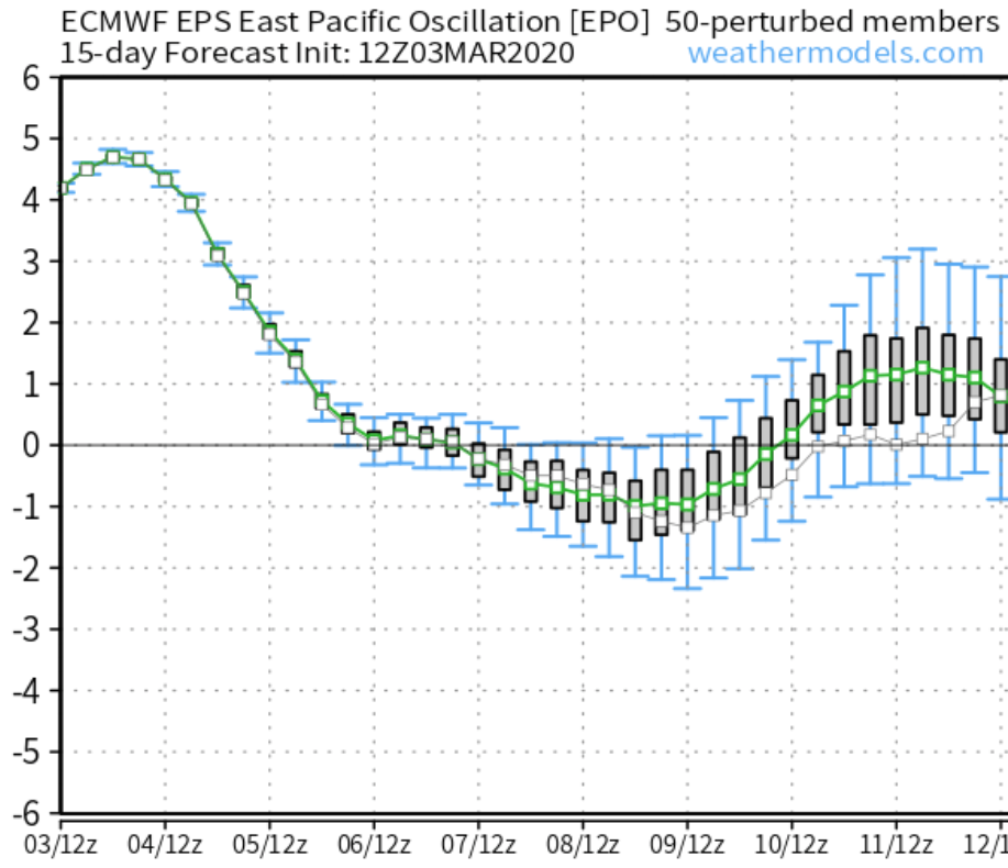
Note the negative dip in the EPO next week. This is what initially grabbed our attention last week (when at that time, looking out 2+ weeks away). Modeling has produced a variety of solutions for the middle of next week for quite some time now (the consistency has been impressive), but the details will vary, and continue to do so for the next several days.
The latest GFS is bullish on the wintry threat (especially for the northern Ohio Valley), but as mentioned above, don’t get wrapped up in the details pertaining to the specifics just yet…

It should be noted, there’s ensemble support as well for the threat of a late season winter event for at least portions of the northern Ohio Valley into the Northeast.
Longer range, it’ll be interesting to see if the NAO and EPO begin to trend negative. Even if the MJO doesn’t want to “play,” those 2 ingredients in tandem can create late season headaches. We note some of our long range, sub-seasonal data is trending towards a look for a colder April.
Interesting times ahead- as always.
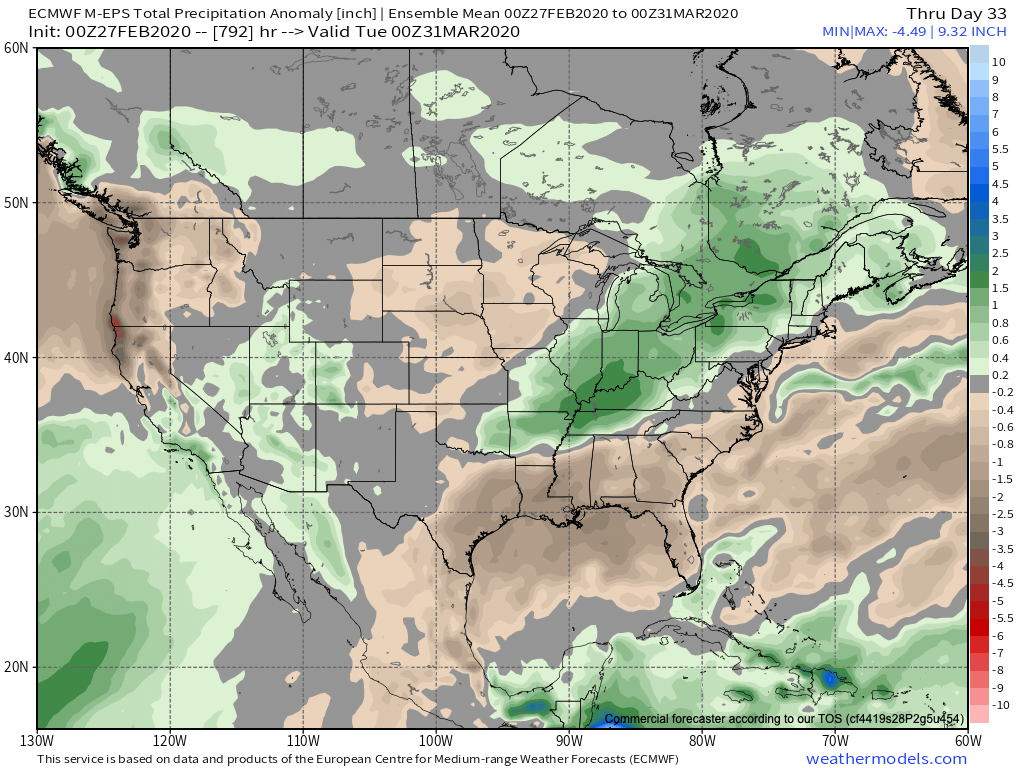
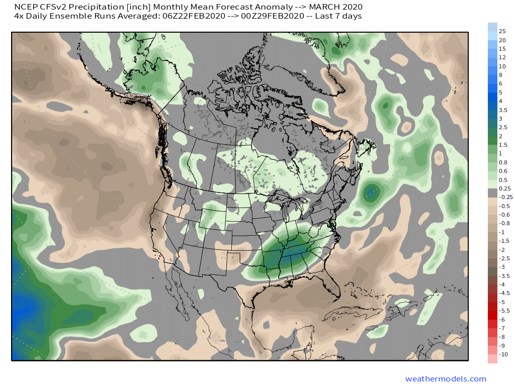
The majority of longer range models are bullish on a much warmer than normal month of March. Below you’ll see a snap shot of the latest JMA Weeklies, European Weeklies, and CFSv2. All are in relative agreement on a warm open to meteorological spring.


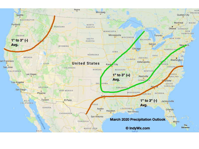
The other common theme? Strong signals for wetter, to much wetter, than normal conditions.
Note the first image of the JMA Weekly data is also leaning in the direction of wetter than normal conditions.
Indianapolis March “averages” include a low of 32.8°, a high of 51.7°, 3.56″ of rain, and 2.6″ of snow.
We’re leaning in the direction of a warmer than normal, wetter than normal month, as well. The reason? You guessed it- a predominantly positive EPO and the MJO that’s expected to rumble primarily through the warmer phases for this time of year.
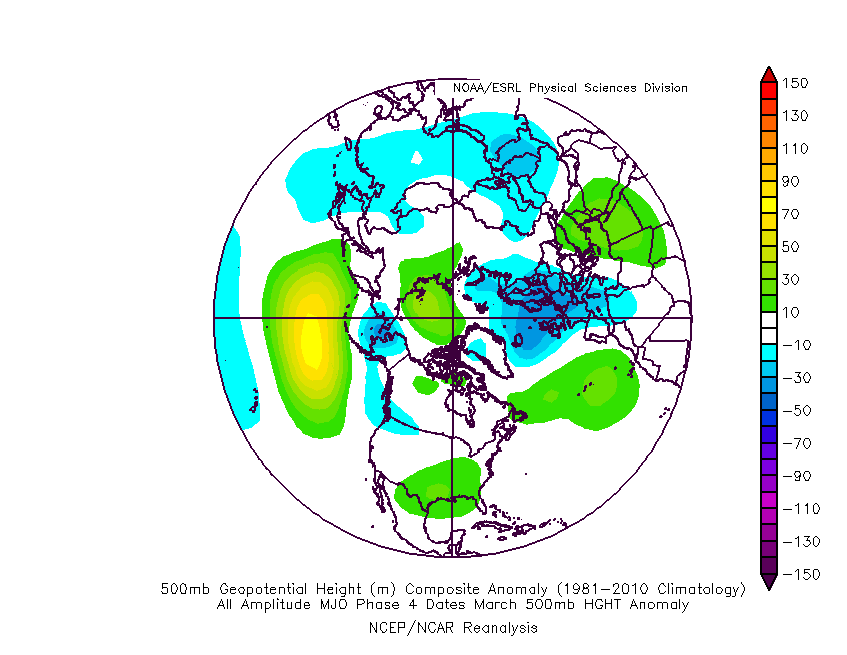
We’ll tackle the latter first. Note the latest MJO plot takes things through Phases 4-5. Those are notorious warm phases in March as shown by the composite 500mb analogs below.
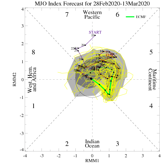

While the MJO plot above only goes out to mid-month, there are reasons to believe things won’t get into the cold phases and that we should cycle back into the warmer phases, or potentially remain in the “null” phase.
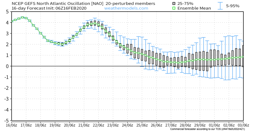
We’ll, of course, have to monitor the EPO for negative “jabs” that may try and take place, but think we’re looking at a predominantly positive EPO throughout the month. Additionally, the NAO (North Atlantic Oscillation) looks to also remain predominantly positive and this is also a warm signal for this time of year.
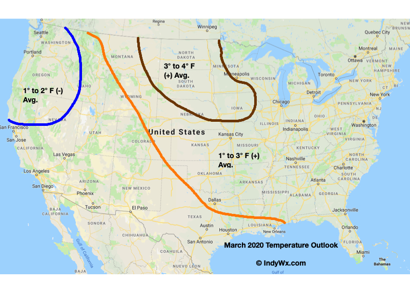
Accordingly, we’re leaning towards a warm, yet wet open to meteorological spring, including temperatures that should run 1° to 3° above normal across central Indiana.
With the exception of a rain maker blowing through the region Monday evening into Tuesday, we’re heading into a relatively quiet weather pattern for the upcoming 7-8 days. A couple of days of well below average temperatures will follow Tuesday’s cold front before weekend moderation takes place. With the shift in the pattern (albeit likely only for a brief period of time), we thought we’d look ahead to what may loom to close February and head into March.
As we’ve discussed in the past, the EPO and MJO are the keys to the pattern, and will continue to be through March. Some of the recent trends with both features would suggest cold is going to fight back as we head into late Feb and early March (spike positive in the EPO also boosts our confidence the pattern will warm over the weekend and into early parts of Week 2). This would likely be met with a return of an active storm track through our neck of the woods.

Both the GEFS and EPS paint a developing negative EPO as we close the month and welcome March. Secondly, the MJO is looking more and more like it’ll move out of the traditional winter warm phases and towards a much colder Phase 8. Collectively, these features should give pause to anyone thinking the kick-off to meteorological spring will be met with dry, warm weather. In reality, the opposite would more than likely result- stormy with colder than normal weather.
This is also the time we begin leaning more heavily on the influence a negative NAO can have on the pattern. Should this teleconnection get into the negative territory in March, then we’d be talking about a potential colder pattern lasting for 10-14 days towards one that would reload to result in colder, wintry conditions lasting into April. While not there yet, it’s certainly worth keeping an eye on in the coming days and weeks.
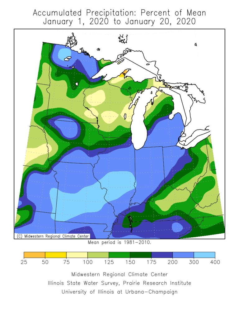
January is flying by! With only 10 days left in the month, Indianapolis is running a whopping 8.2° above normal along with more than 3″ above normal in the precipitation department (unfortunately for snow lovers, this excess moisture has fallen primarily as rain, as IND is running a deficit of 5.2″ in the snowfall department).
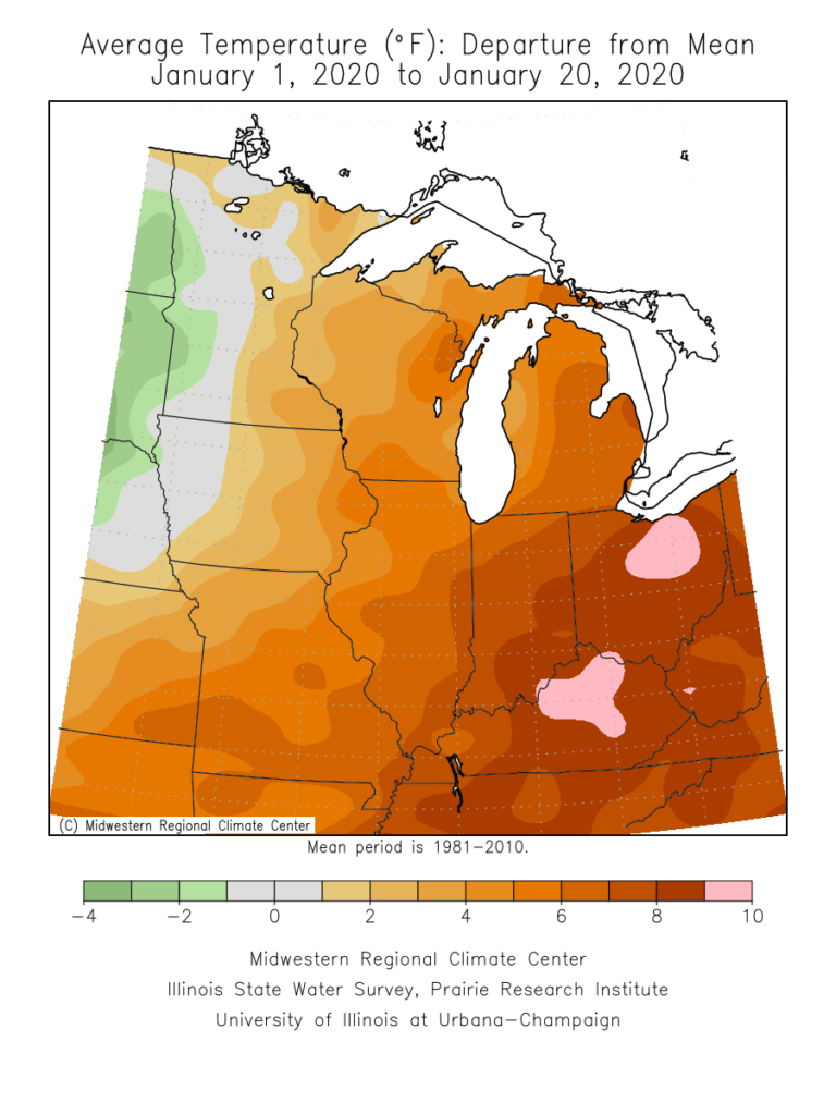
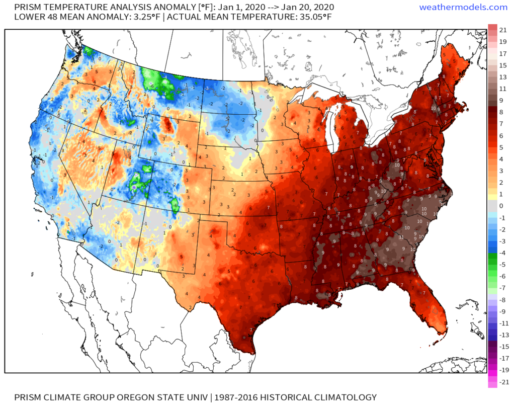
On a broader scale, here’s a look at the current month-to-date temperature anomalies for the Lower 48 as a whole:
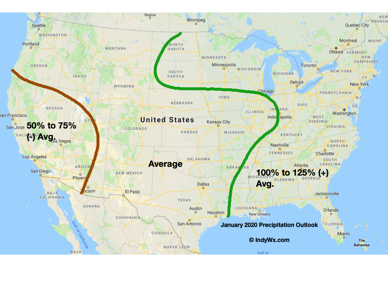
As a refresher, our January forecast looked like this:
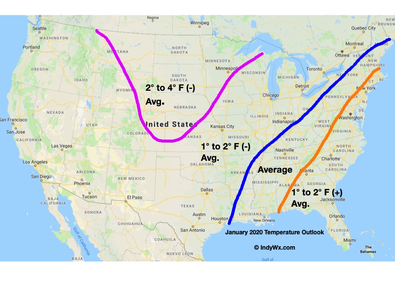
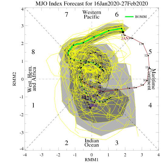
The baseline of this thinking had to do with the idea we had that the MJO would roll out of the warm phases (5 and 6) and strongly into the colder phases after mid-month. Secondly, the other driver was the thought that the current SST configuration in the north Pacific would “force” a negative EPO as the winter season matured.
While the MJO did, indeed, rumble out of the warmer phases just after mid-month, the EPO has not cooperated. Furthermore, instead of the MJO tracking into Phases 8, 1, and 2, it appears it wants to go into the “null” phase to figure out its ultimate destination for the 2nd half of winter (this will be key with Feb. and March). While this doesn’t necessarily support warmth, it doesn’t offer enough ammo to fight the warm signal from the strongly positive EPO.
Now that we’re beginning to turn the page to the 2nd half of winter, there are other items to begin paying closer attention to. In addition to the EPO and MJO, some of these features include the AO, NAO, and PNA. With that said, to drive more of a consistent colder than normal theme, we need to get the EPO at least into the neutral range as some of the other ingredients noted above transition into more favorable colder phases. With a strongly positive EPO, it’ll be tough to sustain well below average temperatures.
With all of that said, all hope is not lost for winter lovers. Climatology speaking, we’re in the coldest time of the year. Even in “marginally” cold patterns, or even “warm” patterns this time of year, wintry issues can create headaches. Secondly, it’s worth paying close attention to the MJO over the next couple of weeks as some of the data wants to take things out of the null phase and transition towards the traditionally colder phases of 8, 1, 2, and 3.
As it is, the next couple of weeks should present a fairly active storm track across the region. In the face of what should truly be a “torch” pattern, the saving grace (at least for fans of winter weather) has to do with the strong Hudson Bay ridge and tendency this kind of pattern has to force stormy times underneath. While far from a “slam dunk,” these kind of patterns can produce- even in the face of a strong positive EPO.
If you had to choose, would you rather have a bitterly cold and dry regime or seasonably mild with at least being on the playing field for wintry mischief over the next couple of weeks?
More in the AM, friends. Make it a relaxing evening! 🙂