Category: NAM Model

Wednesday Severe Threat Far From Etched In Stone…

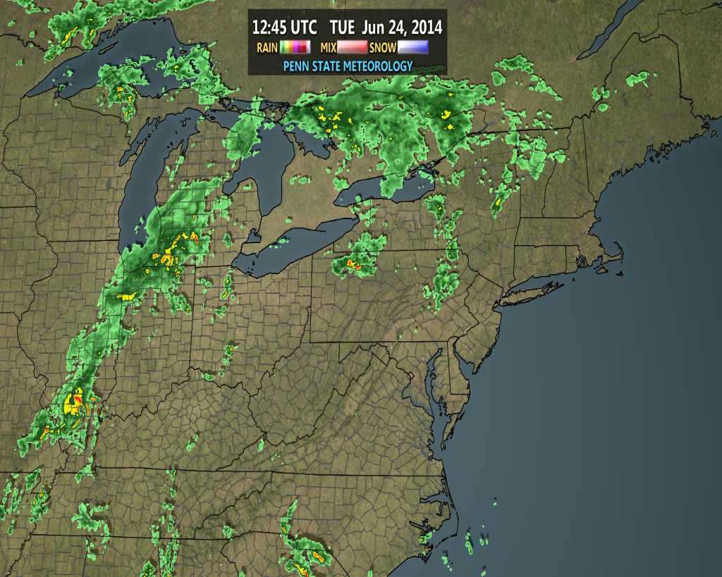
Many central Indiana neighborhoods picked up copious amounts of rainfall within a short time period this afternoon and evening.  We received 2″ here at the IndyWx.com HQ within just under 90 minutes.

Forecast radar 5am Tue

Forecast radar 5am Tue

The rest of the evening will feature a drier theme as the axis of slow moving, torrential, downpours presses east.  That said, a couple of “rumblers” may be present during the early Tuesday morning period as a boundary slowly sinks south. We’re not talking about widespread heavy rain and storms, such as this evening, but a couple of thunderstorms may rumble across central Indiana early Tuesday morning before we dry things out and introduce sunshine for the majority of your Tuesday.

Our attention will then shift to another round of heavy rain and thunderstorms Wednesday.  A severe weather outbreak will unfold to our northwest late Tuesday afternoon.  While this severe weather episode is likely to begin with individual severe thunderstorms (including potentially tornadic super cells), the activity should eventually morph into a mesoscale convective complex (otherwise referred to as a MCC in the wonderful meteorological world) during the night Tuesday as the storms roll towards our neck of the woods.

The Storm Prediction Center (SPC) highlights the region for a Slight Risk of severe weather Wednesday.

day3otlk_0730

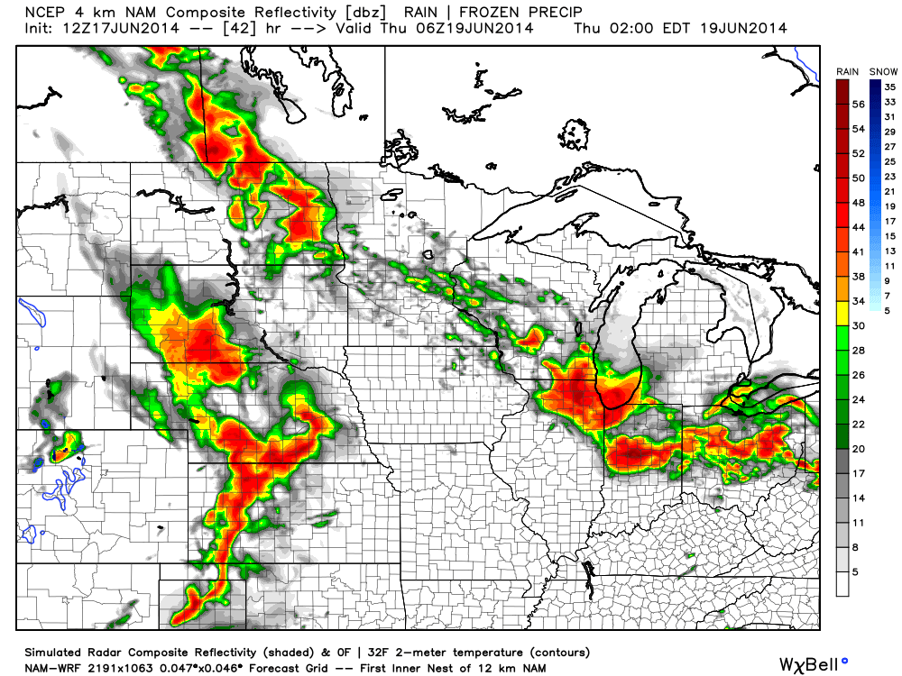
We want to stress that this particular severe weather episode is far from etched in stone.  Diving into our short to mid term forecast models would suggest the initial round of heavy rain and thunderstorms rumble into the state around 4-6am Wednesday- potentially in a weakened state when compared to what our friends and neighbors off to our north and west will experience Tuesday night.  Now it’s important that we insert the timing disclaimer to the equation as similar events in the past have been known to accelerate forward motion and arrive “ahead of schedule.”  (We’ll keep a close eye on the timing side of things and update Tuesday).

hires_ref_ky_37hires_ref_ky_43

We’re confident we’ll be dealing with heavy rain around these parts Wednesday morning along with plenty of thunder and lightning.  That said, there are many more questions than answers at the moment around whether or not severe levels will be reached, at least in our humble opinion.  Should severe weather be an issue, it would most likely come from the following two impacts- damaging straight line winds and large hail.  Again, we’re leaning more towards this initial round of showers and thunderstorms blowing into town in a weakening state.

Finally, there will be one more opportunity for strong to severe thunderstorms Wednesday afternoon, but this will be fueled by just how quickly the local air mass can warm and destabilize.  There are, again, questions around heating potential across the local area (central Indiana) and our thinking currently places a greater concern for damaging severe weather across southern Indiana into Kentucky (folks traveling to Louisville Wednesday afternoon would need to prepare for damaging severe potential).  Should we recover quicker than currently expected from Wednesday morning’s convection then we would need to hit the severe threat harder across central Indiana Wednesday afternoon.  Stay tuned for updates!

Storms will likely strengthen yet again Wednesday afternoon, especially across southern Indiana.

Storms will likely strengthen yet again Wednesday afternoon, especially across southern Indiana.

Permanent link to this article: https://indywx.com/2014/06/02/wednesday-severe-threat-far-from-etched-in-stone/

Sunday Morning Video Update; Storms Arrive This Evening.

We discuss the regime change from the low humidity, dry, feel to our air mass to one that turns increasingly muggy through the afternoon.  This sets the stage for a rainy, stormy week upcoming.  We think thunderstorms fire across central Indiana as early as 5-6 o’clock this evening.

Future scan radar suggests thunderstorms erupt as early as 5-6pm across central Indiana.

Future scan radar suggests thunderstorms erupt as early as 5-6pm across central Indiana.


Permanent link to this article: https://indywx.com/2014/06/01/sunday-morning-video-update-storms-arrive-this-evening/

Severe Weather Video Brief Tonight-Wednesday

The region remains under fire for severe weather potential, primarily for damaging straight line wind and hail per latest thinking.  The video uncovers when you can expect this and looks ahead to the all-important Memorial Day and Indianapolis 500 weekend!

The region is under fire for severe potential Wednesday.

The region is under fire for severe potential Wednesday.

Permanent link to this article: https://indywx.com/2014/05/20/severe-weather-video-brief-tonight-wednesday/

Tuesday Evening Video Brief; The Cool Down Is On!

Note how dramatic of a temperature shift is occurring to our west- temperatures are down more than 30 degrees from this same time last night.

t0

That cool air will filter into our region tonight and Wednesday.  As a matter of fact, we still think Thursday has the potential to remain in the 40s for the better part of the day.  The video below has more details on this and a look ahead to continued rainy times.

Permanent link to this article: https://indywx.com/2014/05/13/tuesday-evening-video-brief-the-cool-down-is-on/

Showers And Storms Then MUCH Cooler…

Tue.

Wed.

Thr.

Fri.

Sat.

Sun.

Mon.

 Status-weather-showers-day-icon

 Status-weather-storm-night-icon

 Status-weather-showers-scattered-icon

 Status-weather-showers-day-icon

 Status-weather-showers-day-icon

 Status-weather-clouds-icon

 Status-weather-clouds-icon

67/ 80

50/ 67

45/ 52

40/ 56

41/ 57

39/ 62

43/ 65 

Light

Moderate

Light

Light

Light

– – –

– – –

Stepping outside this morning you would think it was July or August.  Unseasonably warm conditions are coupling with dew points in the middle to upper 60s to help create quite the muggy feel to the central Indiana air mass once again.  This will help fuel showers and heavy rain producing thunderstorms today, especially during the PM.  Perhaps the most widespread rain and thunderstorms will arrive Wednesday into early Thursday as a wave of low pressure moves up along a cold front that will be just east of our region by that time frame.  We still forecast locally heavy rainfall amounts during the course of the next 48 hours, including widespread additional 1.25″-1.50″ totals.  The other big story will be the dramatically cooler temperatures that filter in tomorrow.  We’ve called Wednesday our transition day and that remains our idea now, as well.  Temperatures will likely fall through the afternoon and evening hours.  Speaking of cool, temperatures will remain in the 40s for the better part of your Thursday (hope you haven’t put those jackets and sweaters away just yet)!  We’ll slowly begin to shake the showers and clouds over the weekend and have trended more optimistic for Sunday’s forecast into early next week.

Most widespread shower and thunderstorm activity will likely occur Wednesday into early Thursday.

Most widespread shower and thunderstorm activity will likely occur Wednesday into early Thursday.

Permanent link to this article: https://indywx.com/2014/05/13/showers-and-storms-then-much-cooler/

Old Man Winter Isn’t Finished

Come this afternoon it’ll be tough to believe we were in the 70s over the weekend!  A cold front is moving through central Indiana this morning and resulting in showers.  Rain will continue in an off-and-on fashion today, becoming a bit more organized yet again later this afternoon and evening.  This will be in response to a wave of low pressure developing to our east, along the pressing strong cold front.

A look at the forecast simulated radar at 7pm this evening:

1

MUCH colder air will pour into the region today, complete with gusty northwest winds.  In fact, we’ll be in the 40s just after the lunchtime hour and the free-fall will continue.  30s arrive this evening and rain will begin to transition to wet snow.  Not all will see accumulation tonight, but a slushy accumulation of around half an inch will be possible where heavier snow persists.

A look at the forecast simulated radar towards 11pm-12am:

23

Temperatures will crash into the 20s by Tuesday morning.  I saw many folks at Lowes buying flowers yesterday…hopefully those folks aren’t planning on planting until later…

4

Tuesday will feature clearing skies, albeit unseasonably cold conditions.  We’ll remain in the 30s most of Tuesday, struggling to make it much above 40 by afternoon, along with a chilly northwest wind in place.  Lows Tuesday night/ Wednesday morning will drop into the lower to middle 20s.

Permanent link to this article: https://indywx.com/2014/04/14/old-man-winter-isnt-finished/

The Weekend Is Here!

After a few clouds this morning, we’re looking at increasing sunshine as we progress through the day.  Simulated satellite shows this well.

7am forecast satellite

1

2pm forecast satellite

2

Thankfully, this is a sign of things to come and a very nice (and warm) weekend is on tap!

High pressure will build in through the day, helping skies turn increasingly sunny.  A north breeze will keep temperatures cooler today than yesterday’s official downtown high of 74.

3

Most of Saturday will be dry and feature partly cloudy skies, but clouds will develop and a widely scattered shower will be possible during the afternoon and evening as moisture begins to increase.  Most will stay dry Saturday, however.

4

Sunday will be a windy and warm day, but with partly cloudy and dry conditions for the better part of the day.  Heavier rain and strong storms will develop to our west Sunday, but it’s really not until Sunday night into Monday when our immediate region will deal with this rainy and stormy weather.

5

  • Friday: Increasing sunshine; 65
  • Saturday: Partly cloudy; widely scattered PM shower; 43/ 71
  • Sunday: Partly cloudy and windy; developing nighttime rain/storms; 59/ 73

Permanent link to this article: https://indywx.com/2014/04/11/the-weekend-is-here/

Saturday Morning Thoughts…

Good morning and happy Saturday!  A weak weather system will move through the region and produce a couple of light showers this afternoon, but won’t be a big deal.  Rain will end as a couple of snow flakes.  Overall precipitation totals look less and less impressive with each model run, which wasn’t impressive to begin with.  Needless to say, don’t be concerned by any sort of significant rain or snow today.

Latest simulated radar off the NAM and HRRR shows the band of light precipitation pushing through the state this afternoon.

hrrr_ref_indy_12nam_ptype_slp_mc_7

While we’ll have a brief “set back” in the temperature department this weekend, early next week continues to look downright mild and very spring like.  Note our region flirting with 60s.  Impressively, a budding area of 70-degree warmth is expanding to our west.

nam_t2m_max_mc_22

Details remain quite sketchy in regards to nailing down the storm the middle of next week with any sort of confidence.  While we’ll continue to sort through the data and gain a better understanding of things over the weekend, we’re confident on a colder regime returning by the middle of next week.  Note the trough per the GFS ensembles returning to the east.  Much more later!

gefs_z500anom_nh_21

Permanent link to this article: https://indywx.com/2014/03/08/saturday-morning-thoughts/

Light Accumulating Snow Targets Areas Just North Of Indianapolis

Latest high resolution data overnight suggests we focus our attention from Indianapolis and points north for tonight’s light snow event.  Before that, be sure to get out today and enjoy the sunshine and one last day of relative warmth as highs zoom close to 50 for many throughout central Indiana on a gusty southwest wind this afternoon.

Light rain moves in this evening- initially around 6-7 for north-central Indiana, but may not reach the city, itself, until mid to late evening (more like 8 to 9 o’clock).  Rain will then mix with and change to snow (from north to south) during the overnight.  Our official accumulation idea looks very much like the latest high resolution NAM model.

hires_snow_acc_indy_11

Specific snowfall forecasts from a few select locations for tonight into early Sunday:

  • Indianapolis: 0.50-1″
  • Northern ‘burbs (Zionsville, Carmel, Westfield): 1″-1.5″
  • Lafayette: 2-3″

In other words, this isn’t anticipated to be a huge snow event by any means.  That said, we’ll keep a close eye on things as we fine tune the timing between the arrival of the cold air and departure of precipitation tonight.  We’ll fine tune later this evening if needed.

Enjoy your Saturday!

Permanent link to this article: https://indywx.com/2014/02/22/light-accumulating-snow-targets-areas-just-north-of-indianapolis/

Early 0z Runs Trending More Icy Vs. Snowy…

Quick post tonight just to alert you that early model runs off the 0z suite of data suggests less of   a snow threat and more of freezing rain/ sleet…

You must be logged in to view this content. Click Here to become a member of IndyWX.com for full access.  Already a member of IndyWx.com All-Access?  Log-in here.

Permanent link to this article: https://indywx.com/2014/02/16/early-0z-runs-trending-more-icy-vs-snowy/

IndyWx.com