Turning More Unsettled…
|
Tue. |
Wed. |
Thr. |
Fri. |
Sat. |
Sun. |
Mon. |
|
|
|
|
|
|
|
|
|
63/ 83 |
64/ 81 |
64/ 79 |
62/ 79 |
62/ 83 |
66/ 84 |
65/ 84 |
Cold Front Just North…A cold front will slowly sag south into central Indiana over the next 24 hours before stalling nearby. Some added energy will rotate along the boundary Wednesday and lead to somewhat more widespread coverage of thunderstorms across the region (scattered to numerous coverage). As far as today- look for more of those splash and dash afternoon and evening showers and thunderstorms, including some locally heavy downpours.
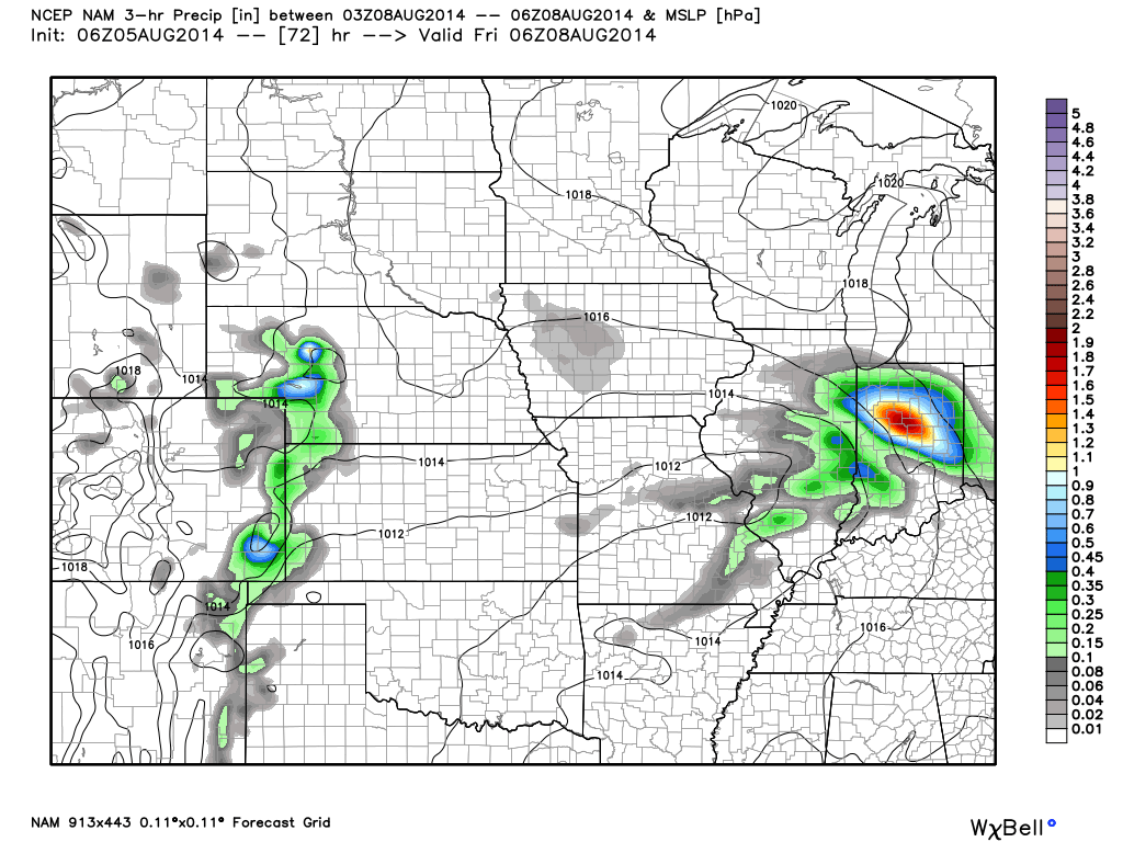
Best Rain Chances Friday? Model data continues to trend towards better chances of widespread moderate to heavy rainfall Friday in response to an area of low pressure moving along the frontal boundary. It’s important to note that there’s still some disagreement among forecast model solutions, but we feel increasingly confident on Friday offering up more in the way of widespread rains in response to this area of low pressure.
Drying Out This Weekend…High pressure will build into the region over the weekend supply drier air and increased sunshine. Perfect timing, heh?!
7-Day Precipitation Outlook:
- 7-Day Rainfall Forecast: 0.75″-1.25″
- 7-Day Snowfall Forecast: 0.00″