
You must be logged in to view this content. Click Here to become a member of IndyWX.com for full access. Already a member of IndyWx.com All-Access? Log-in here.
Category: Monthly Outlook
Permanent link to this article: https://indywx.com/video-unsettled-week-ahead-reviewing-our-may-outlook/
Apr 27
Finalized May Outlook: One Word? Volatile
Averages for May are as follows:
*High: 72.8
*Low: 52.6
*Rainfall: 5.05″
*Snowfall: Trace
When all is said and done, this is how we see the last month of meteorological spring shaping up:


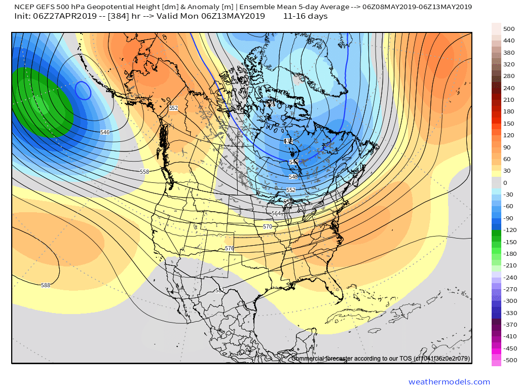
Medium and longer range guidance has been anything but consistent over the past few weeks for May, which doesn’t help in producing a monthly outlook. A large part of this may have to do with the renewed hyperactive MJO.

This can lead to volatile swings in the overall pattern as we get into the mid to late part of the month. Early on, confidence is higher in a “battle” setting up between late season anomalous cold across the north and budding summer-like warmth across the south.
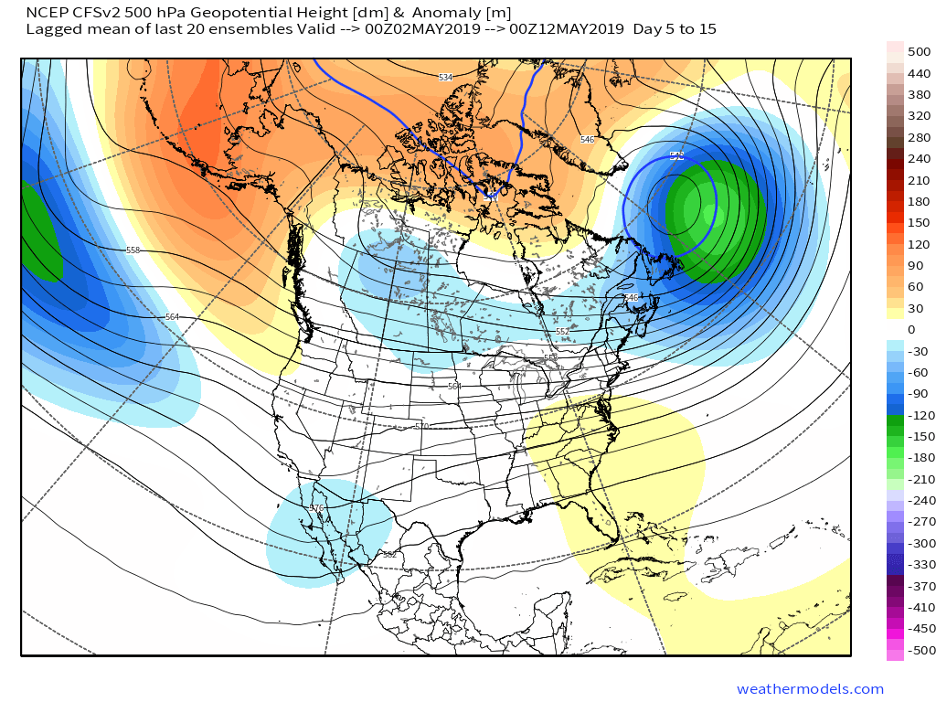
This will help add fuel to the fire in what should be an overall wet month across a large portion of the country.
With that said, we think ridging is likely to keep the extreme southeastern region drier than normal for the bulk of the month.
As we look towards mid-May, that battle between southeastern ridging and troughiness across the northern region continues to argue for active times remaining.
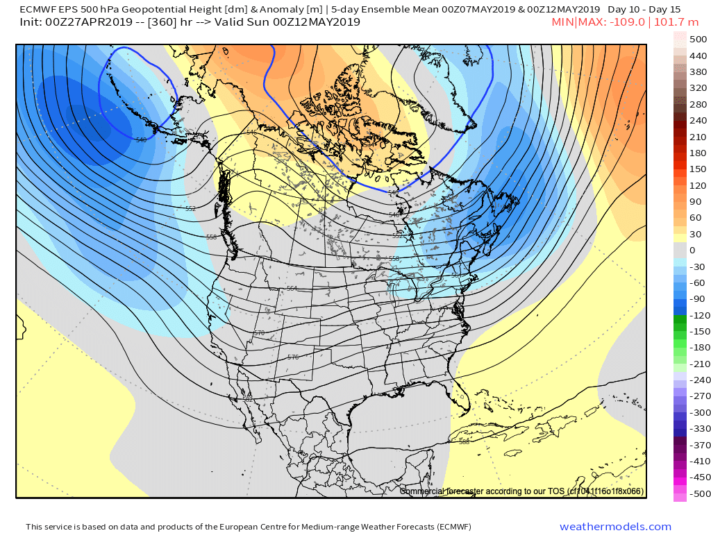
Speaking more specific to central IN and the greater OHV region overall, we think a cooler and wetter than normal month awaits. Unfortunately, delays are likely to continue from an agriculture/ Plant ’19 perspective…
Permanent link to this article: https://indywx.com/finalized-may-outlook-one-word-volatile/
Apr 25
Special Evening Video Update On Next Week’s Flood Threat…
You must be logged in to view this content. Click Here to become a member of IndyWX.com for full access. Already a member of IndyWx.com All-Access? Log-in here.
Permanent link to this article: https://indywx.com/special-evening-video-update-on-next-weeks-flood-threat/
Apr 21
Long Range Video Update: May Set To Open Warmer Than Average?
You must be logged in to view this content. Click Here to become a member of IndyWX.com for full access. Already a member of IndyWx.com All-Access? Log-in here.
Permanent link to this article: https://indywx.com/long-range-video-update-may-set-to-open-warmer-than-average/
Mar 27
Finalized April Outlook…
Averages for April are as follows:
*High: 63.4
*Low: 42.7
*Rainfall: 3.81″
*Snowfall: 0.2″
By the time all is said and done, this is how we see April shaping up:

Modeling continues to show April opening cooler than normal and we agree that this will be the case, including a wetter than normal pattern, as well.
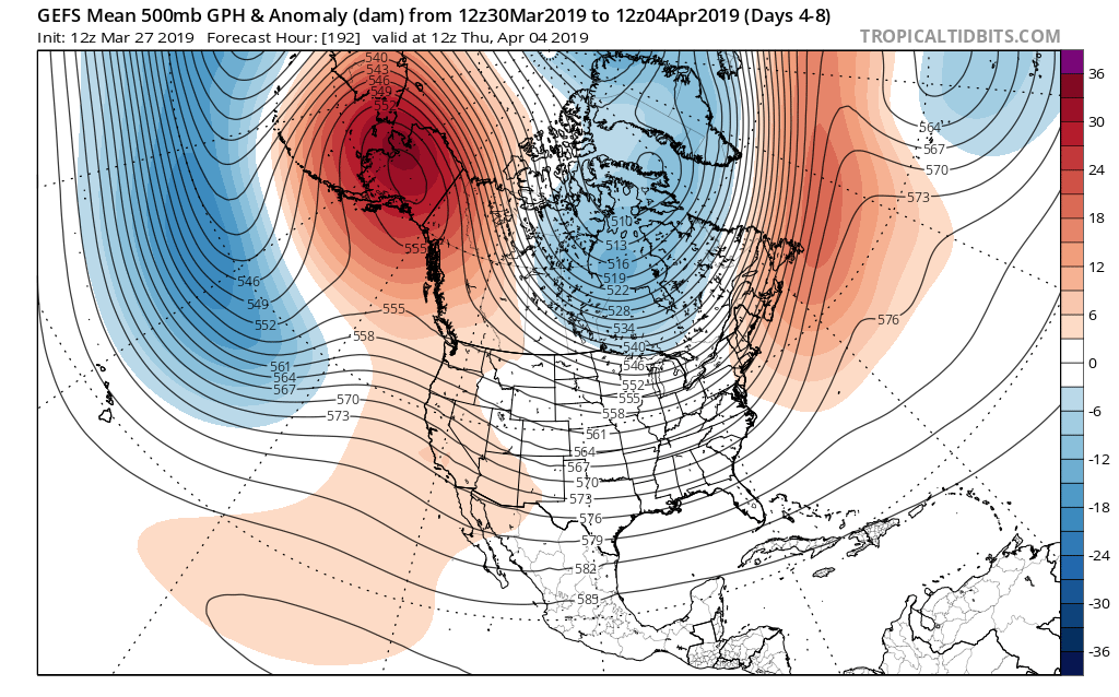
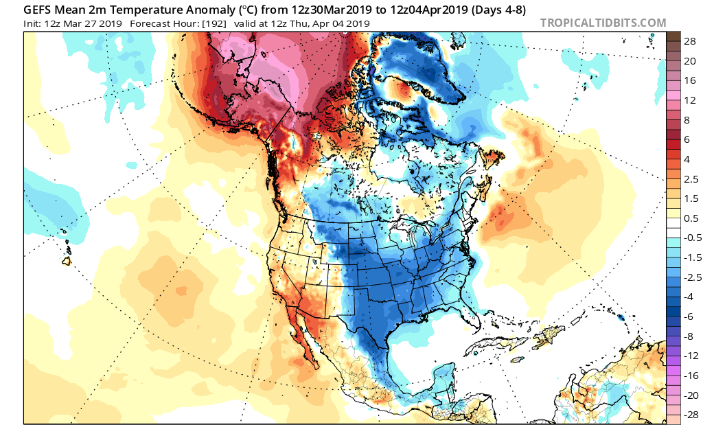

With that said, the persistent AK ridge begins to break down by the 2nd week of the month. This will lead to the early month chill being transient in nature and a significant flip to warmer than normal conditions during said timeframe, as well.
Note by the middle part of the month, a ridge is now forecast to be in the exact position the ‘mean’ trough position will locate itself for early month.
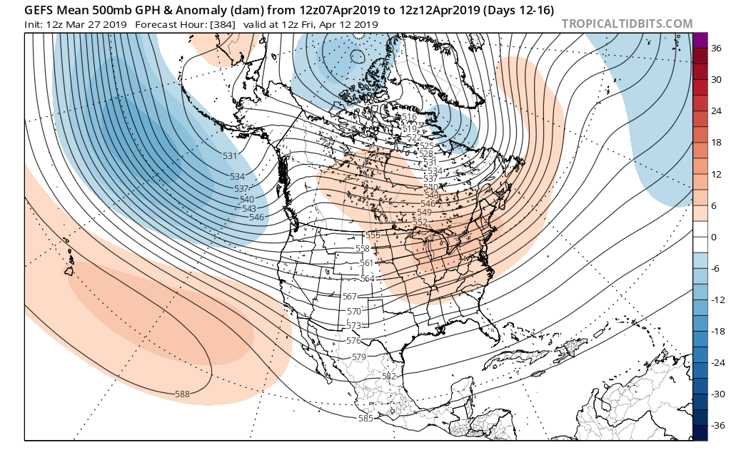
To no shock, it’s a vastly different temperature profile, as well. Now above normal warmth dominates. It’s easy to argue the model may not be warm ‘enough’ by this time over the OV and Northeast, with cooler anomalies across the SW.

The active pattern to open the month is expected to “settle down” for mid and late month as an upper level ridge dominates.
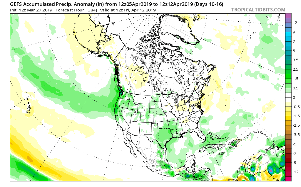
While the first week of April will likely run cooler and wetter than average, a rather significant flip in the pattern will result in drastically improved weather around these parts by mid and late April. By the time we get to month’s end, we think drier than normal conditions will rule across the northern Plains with warmer than average weather taking up shop across the Ohio Valley. A corridor of wetter than normal conditions is expected across the Intermountain West into the Lower MS River Valley.
Permanent link to this article: https://indywx.com/finalized-april-outlook/