
Top wind gusts today have reached 66 MPH at IND with numerous reports of downed trees and power lines throughout the northern half of Indiana.
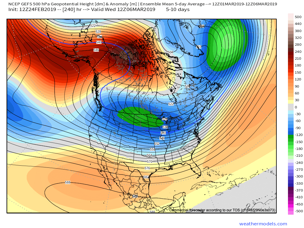
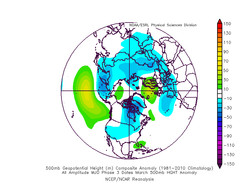
As we look ahead through the upcoming week, a couple of rather minor systems may deal light precipitation to the area, but it’s what lies ahead next weekend that’s already drawing interest. Unfortunately, modeling is trying it’s best for a “repeat” high wind event next Saturday.
The overall setup is eerily similar as a rapidly strengthening surface low tracks northeast into the Great Lakes region. This setup would once again support 50+ MPH gusts.

With the pattern change underway at this point, colder air will be more readily available and backside snow may be more “meaningful” next weekend. That’s something we’ll be keeping a close eye on.
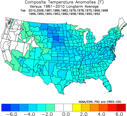
Winter weather enthusiasts will have a couple of weeks of at least being on the playing field for the possibility of late season accumulating snow, but it continues to look like that window closes quickly by mid-March as a true spring pattern takes hold.

For those who watch the operational data with each and every update (sometimes as much as 4 times per day)- tread with caution. While significant late season winter storms can result from such a pattern change that’s underway, it’s impossible to worry about specifics in this type of regime until within 4-6 days.
It would appear the pattern would support potential “fun and games” next Saturday, the 2nd, and possibly again in the March 5th-6th time frame.
Enjoy it while you have it, lovers of winter… Signals continue to point towards a significant shift to warmer times for the 2nd half of March.


 Rain and embedded thunder will likely be rather widespread early Monday, especially across the southern half of the state.
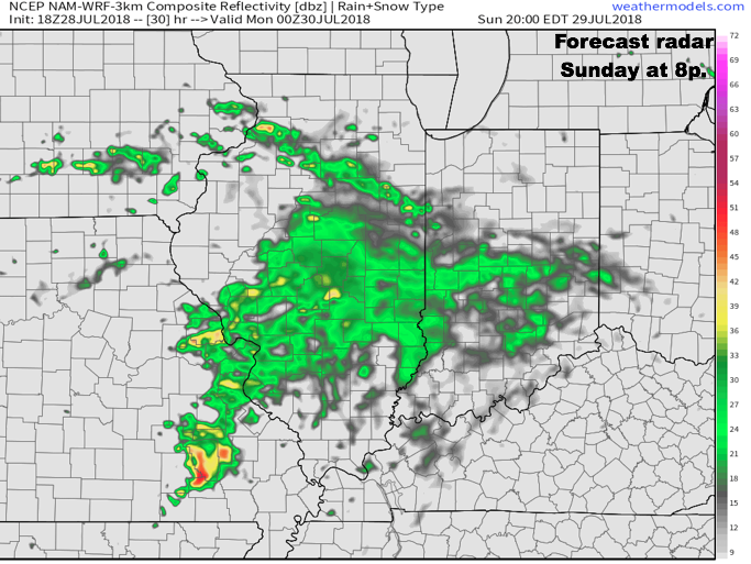
 Data continues to point towards the greatest coverage of rainfall arriving Monday night and Tuesday. We still expect a widespread 1″ to 2″ rain for central Indiana before things begin to wind down mid to late week. There will be locally heavier totals.
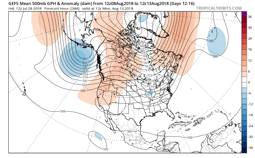
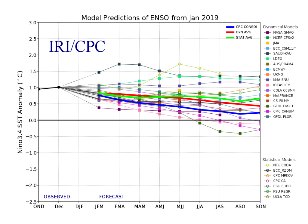
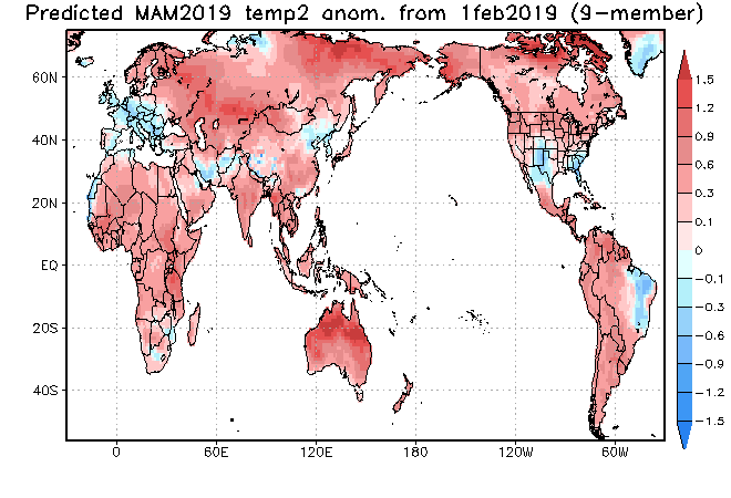
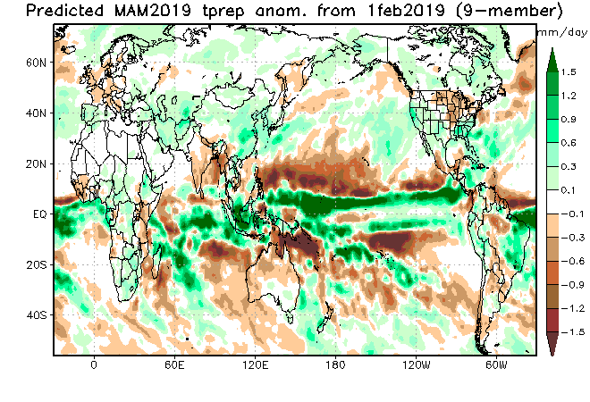
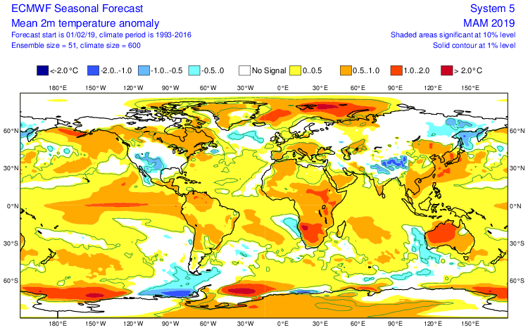
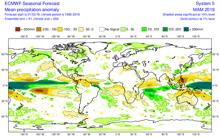
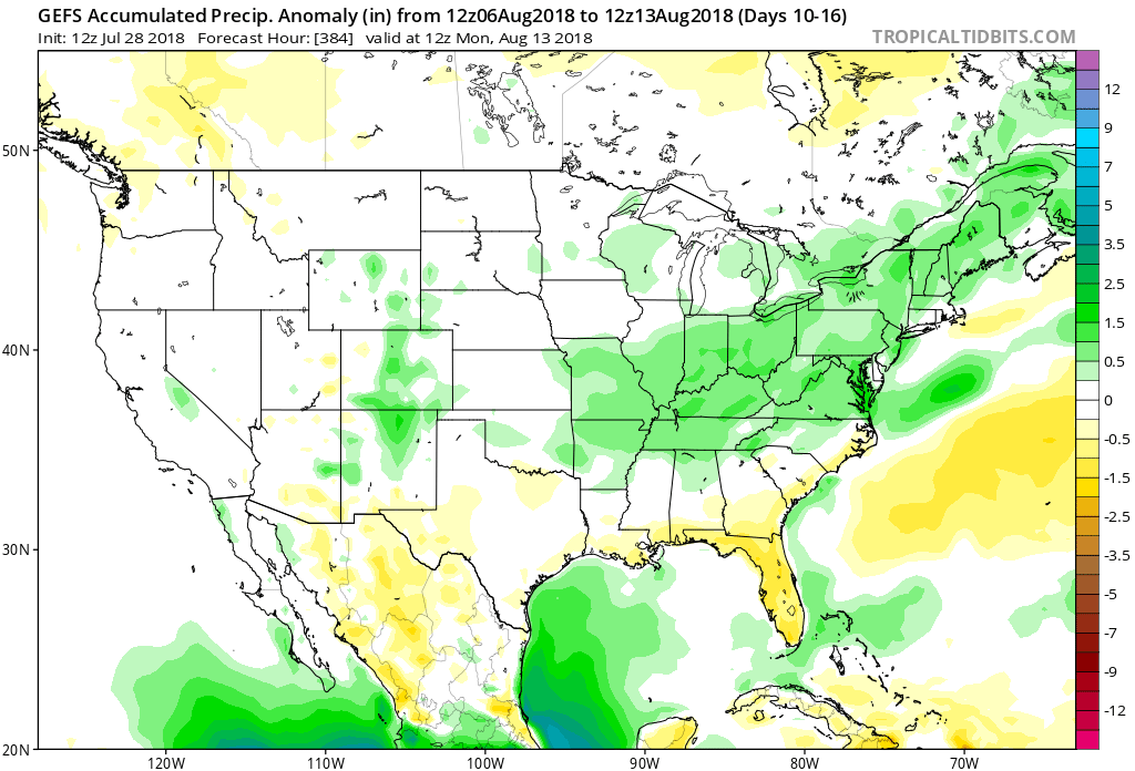 The model has support of a return to wetter times as noted from the latest JMA Weeklies, CFSv2, and European ensemble.
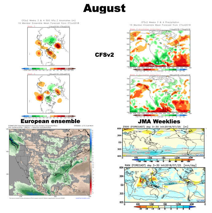 While the cool will relax as we rumble past the first couple days of the month (we’re in the “dog days” after all), I still think the worst of the heat is over for the summer and the headline for August will likely be a situation where we begin to make up for lost time in the precipitation department. That upper ridge centered to our west in the means will likely result in a continuation of rather active times from a precipitation perspective through the month and our idea is that we finish August with above normal precipitation across central Indiana for the first time since April…