
You must be logged in to view this content. Click Here to become a member of IndyWX.com for full access. Already a member of IndyWx.com All-Access? Log-in here.
Category: MJO
Permanent link to this article: https://indywx.com/video-hot-humid-weather-rolls-on-for-now-backing-up-our-mid-july-thoughts/
Jun 27
VIDEO: Heat And Humidity Carry The Day Now; Looking Ahead To The 1st Half Of July…
You must be logged in to view this content. Click Here to become a member of IndyWX.com for full access. Already a member of IndyWx.com All-Access? Log-in here.
Permanent link to this article: https://indywx.com/video-heat-and-humidity-carry-the-day-now-looking-ahead-to-the-1st-half-of-july/
Jun 25
VIDEO: Craving More Traditional Summer Weather? You’re In Luck, But Better Enjoy While We Have It…
You must be logged in to view this content. Click Here to become a member of IndyWX.com for full access. Already a member of IndyWx.com All-Access? Log-in here.
Permanent link to this article: https://indywx.com/video-craving-more-traditional-summer-weather-youre-in-luck-but-better-enjoy-while-we-have-it/
Jun 10
Cool Now, But What About Late-June?
Unseasonably cool, almost fall-like, weather will dominate our area this week, but what awaits as we move into the latter part of June?
We continue to see a highly amplified MJO and it’s forecast to swing into Phases 4-5 in the coming weeks.
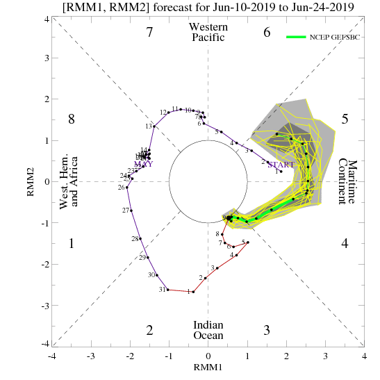
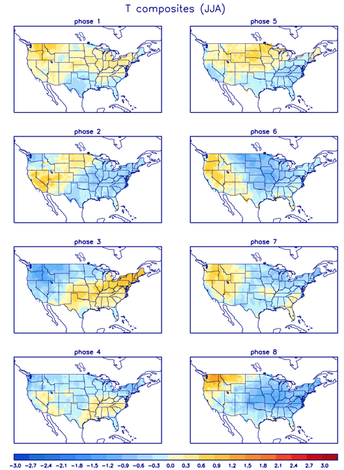
Neither of these phases argues for any sort of significant or long-lasting warmth anytime over the next few weeks across our immediate region.

To no surprise, the latest long range data continues to indicate an overall seasonable to cooler than average theme to close out the month of June. The European ensemble agrees.

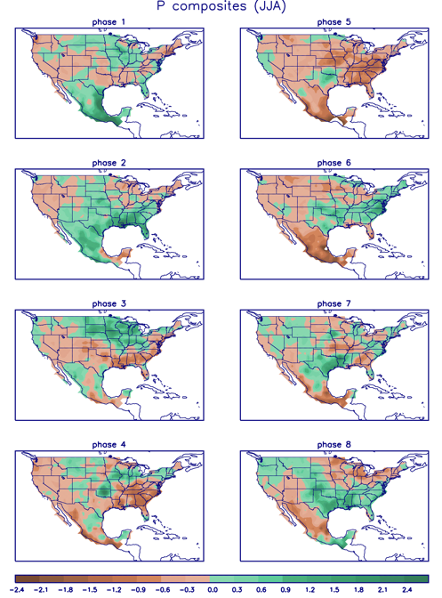
What about precipitation as we progress through the last couple weeks of the month? Phase 4 remains wet before things take on a drier theme during Phase 5. (It’s important to note though that if the MJO continues the overall high amplitude, unfortunately we would head into the wetter Phases 6-7 as we head towards the mid way point of summer).
Permanent link to this article: https://indywx.com/cool-now-but-what-about-late-june/
Jun 05
Long Range Update: Unseasonably Refreshing Pattern Set To Rule The Day…
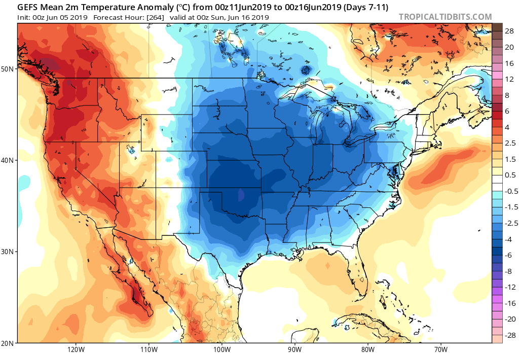
A few days into June, Indianapolis is running half a degree below normal and 0.57″ below normal in the rainfall department.


Coolest anomalies have been focused over the Great Lakes region. A good portion of the region is running below average early on this month in the rainfall department, with the exception being the eastern Great Lakes.
As we look ahead, the MJO is forecast to move through Phases 3 and 4 with its eyes set on Phase 5 late month.

The relative “transient” warmth now lines up perfectly with Phase 3, but note the cooler pattern that Phase(s) 4-5 typically delivers.
As a side note, there’s reason to believe this rather hyper MJO will continue, carrying us into the cooler Phases 6-8 as we move into the heart of the summer.
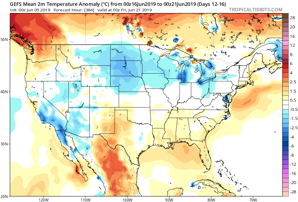
To no surprise, the medium and long range guidance is going towards a cooler than normal and unseasonably refreshing look as we move through the mid month period and into late June.
The Climate Forecast System agrees:

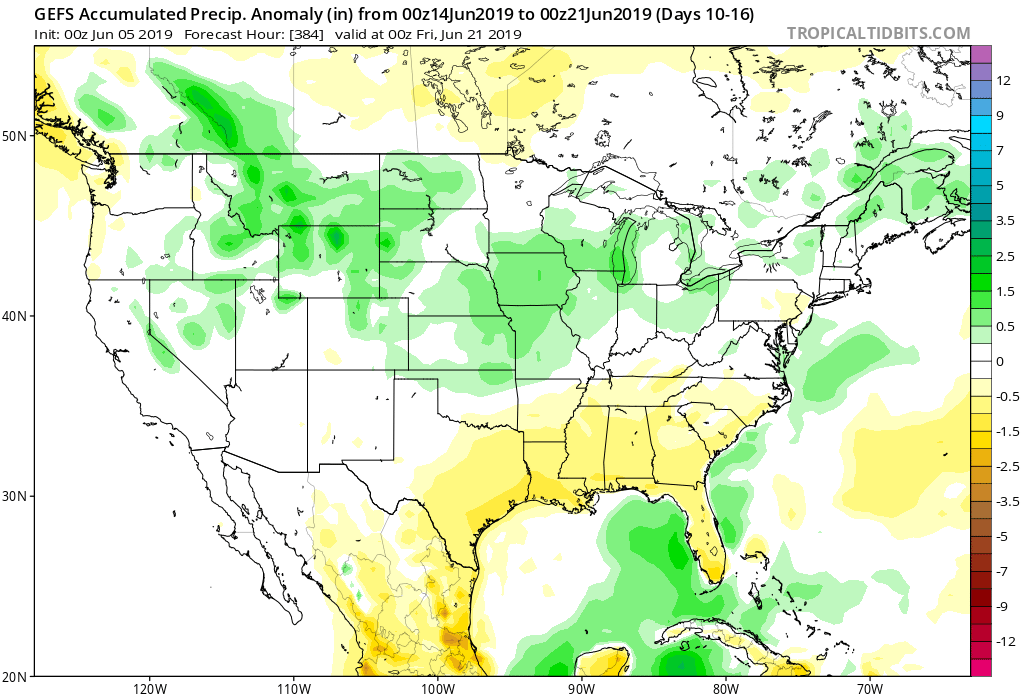
As for rainfall, we’ll use our short-term updates to handle the Weeks 1-2 period, but as we look ahead to mid-June, the pattern is expected to feature above normal rainfall across the Mid West and into the Ohio Valley and Great Lakes.
Permanent link to this article: https://indywx.com/long-range-update-unseasonably-refreshing-pattern-set-to-rule-the-day/