You must be logged in to view this content. Click Here to become a member of IndyWX.com for full access. Already a member of IndyWx.com All-Access? Log-in here.
Category: MJO
Permanent link to this article: https://indywx.com/video-stormy-saturday-night-trending-colder-next-week/
Dec 23
Unlocking The Puzzle?
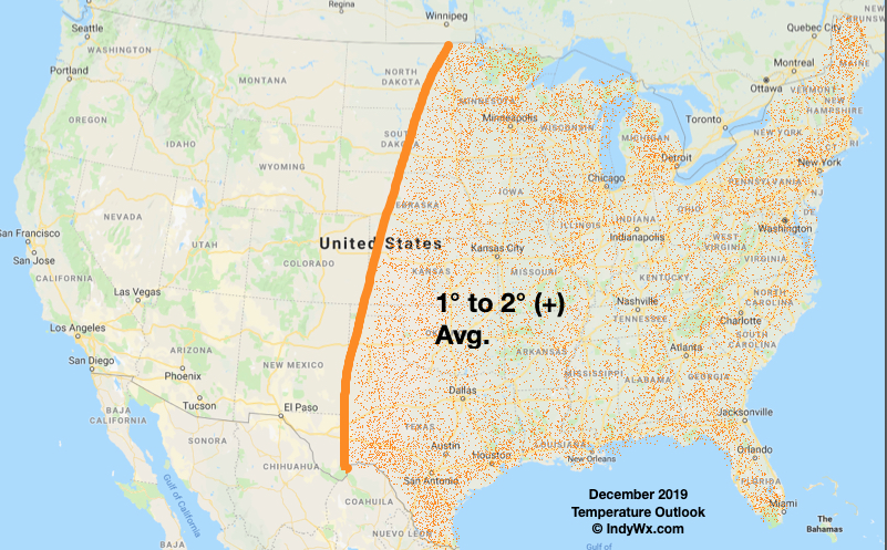
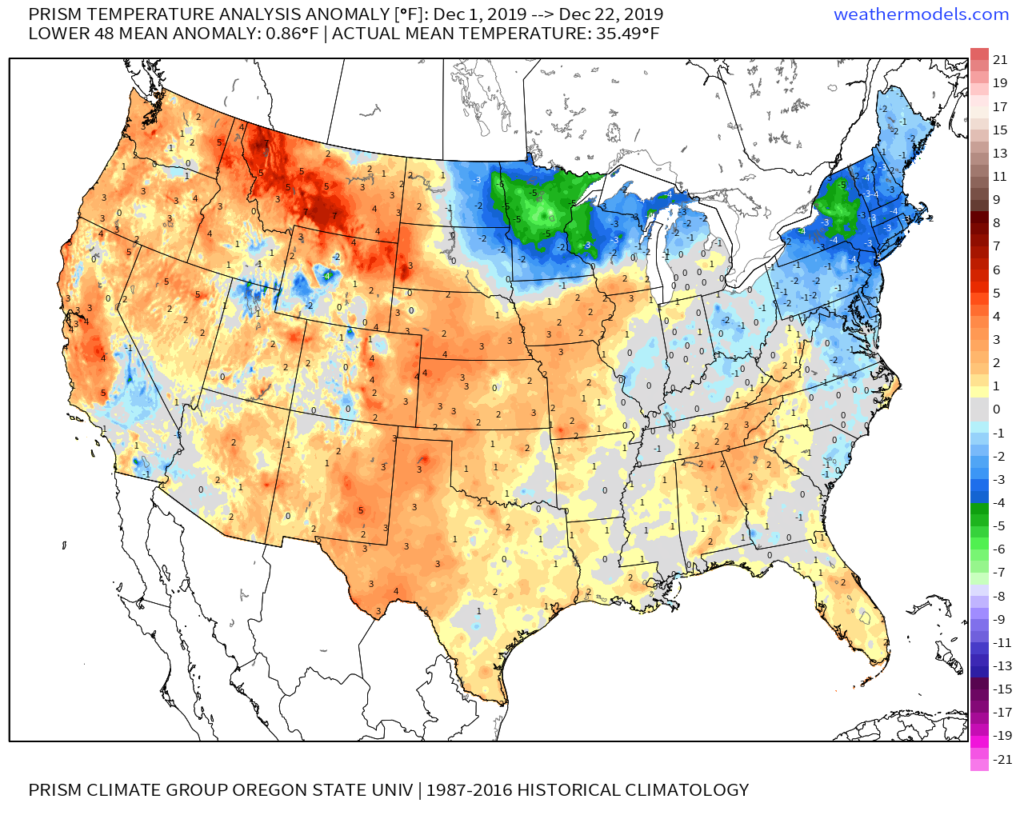
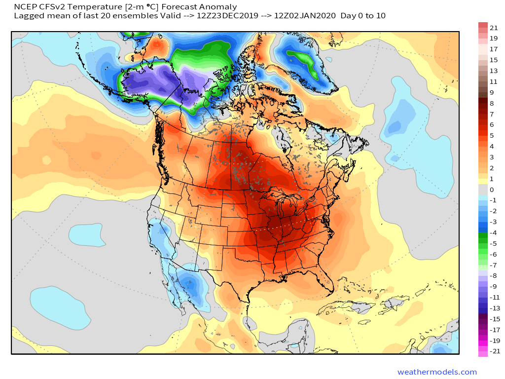
Before we take a look-ahead to January, reviewing our December forecast vs. reality (and what’s to come), shows that we’re in a strong position to grade well for the last monthly forecast of 2019- especially across the eastern half of the country.
IndyWx.com December Temperature Outlook:
Reality Month-to-Date:
Remainder of the month:
As we look ahead, at least until we get to mid and late winter (when the AO and NAO can begin having more influence on the pattern), I think we’ll go as the MJO sees fit. There are growing signals the MJO should begin to get more amplified as we get into the new year and this should play a significant role in the overall January pattern. The idea is a relatively warm open to the month (cooler than what we’ll see the next week, but still a touch milder than average) that trends colder as the month progresses.
The MJO looks like it will cycle into Phase 5 before “curling around” into Phases 6 and 7.

This would yield a transitional time of things from a predominant eastern ridge that gives way to expanding cold late Week 2 into Week 3.
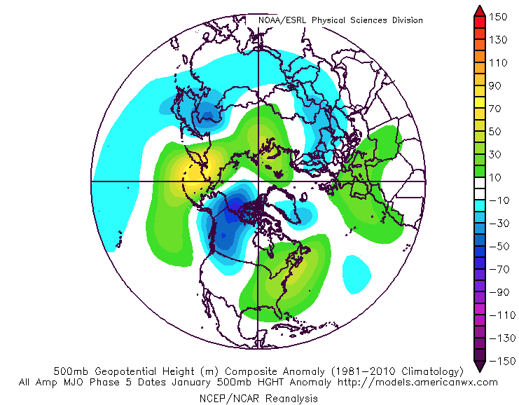


By the way, there are reasons to believe the amplitude would likely continue into Phase 8, 1, and 2, late month and into February. If so, this would result in cold overwhelming the pattern along with increased storminess (plenty of winter storm threats to boot). Truth be told, after a mild open to meteorological winter (nice to still cash-in on an early season snow event), there are plenty of reasons to believe we’re looking at winter to return with authority as January evolves.
Our complete January Outlook will be online Sunday.
Permanent link to this article: https://indywx.com/unlocking-the-puzzle/
Dec 21
VIDEO: Timing Out When The “Other Shoe Drops…”
You must be logged in to view this content. Click Here to become a member of IndyWX.com for full access. Already a member of IndyWx.com All-Access? Log-in here.
Permanent link to this article: https://indywx.com/video-timing-out-when-the-other-shoe-drops/
Dec 19
Long Range Update: Get Used To The Warmer Than Average Conditions
The short-term is as quiet as one could ever ask for this time of year. Accordingly, this is allowing us to look ahead to the potential of more active times on the horizon. Will that increasingly active regime be met with a return of the chill? Let’s dig in…
First and foremost, let’s look over the teleconnections and what light they’re shining on the pattern:

The Madden-Julian Oscillation has eyes on Phase 6 as we open January. This, too, would favor the “core” of the cold well to our northwest. We do, however, note the high latitude blocking that develops in Phase 6.
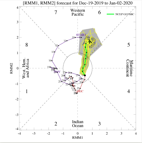
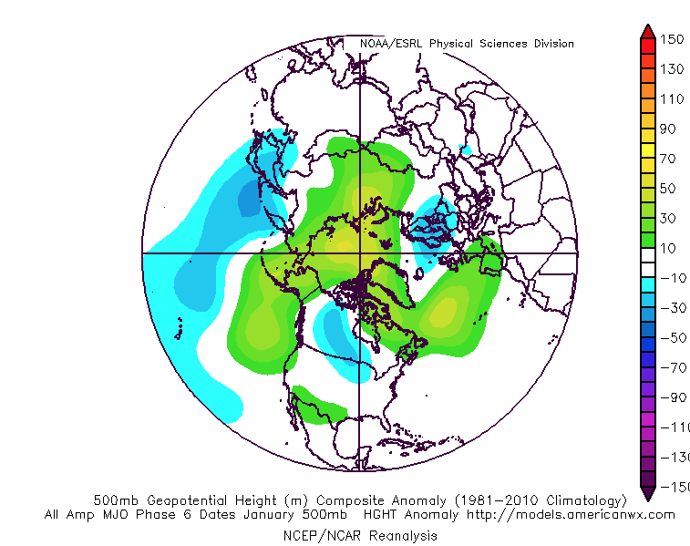
Given the above, to no surprise, the bulk of long range data paints above normal temperatures to open January. It appears as if what will be an increasingly busy pattern at that point will fall primarily in the form of rain as we ring in the new year thanks to storms cutting up west of our region.
The EPS, GEFS, and JMA Weeklies all suggest a warmer than normal pattern will be with us as we rumble through the first few days of the new year.

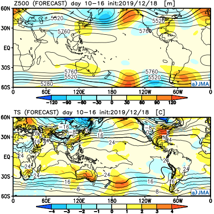
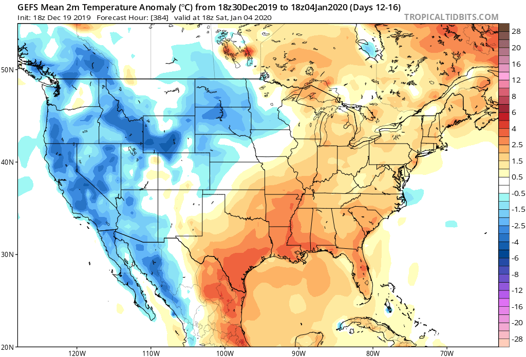
As we look ahead deeper into January, we do still believe the pattern will flip towards a colder than normal flavor, but we’re still a few weeks away from that change taking place. In the meantime, a quiet pattern with moderating temperatures (this week) will give way to even milder conditions the following week with a couple opportunities of rain to close the year and open January.
Permanent link to this article: https://indywx.com/long-range-update-get-used-to-the-warmer-than-average-conditions/
Dec 18
VIDEO: Snowstorm Review; Looking Ahead…
You must be logged in to view this content. Click Here to become a member of IndyWX.com for full access. Already a member of IndyWx.com All-Access? Log-in here.
Permanent link to this article: https://indywx.com/video-snowstorm-review-looking-ahead/
