You must be logged in to view this content. Click Here to become a member of IndyWX.com for full access. Already a member of IndyWx.com All-Access? Log-in here.
Category: MJO
Permanent link to this article: https://indywx.com/video-timing-the-arrival-of-rain-and-amounts-looking-ahead-to-early-march-changes/
Feb 16
Meteorological Spring A Couple Weeks Away, But Trends Suggest Winter’s Not Done…
With the exception of a rain maker blowing through the region Monday evening into Tuesday, we’re heading into a relatively quiet weather pattern for the upcoming 7-8 days. A couple of days of well below average temperatures will follow Tuesday’s cold front before weekend moderation takes place. With the shift in the pattern (albeit likely only for a brief period of time), we thought we’d look ahead to what may loom to close February and head into March.
As we’ve discussed in the past, the EPO and MJO are the keys to the pattern, and will continue to be through March. Some of the recent trends with both features would suggest cold is going to fight back as we head into late Feb and early March (spike positive in the EPO also boosts our confidence the pattern will warm over the weekend and into early parts of Week 2). This would likely be met with a return of an active storm track through our neck of the woods.

Both the GEFS and EPS paint a developing negative EPO as we close the month and welcome March. Secondly, the MJO is looking more and more like it’ll move out of the traditional winter warm phases and towards a much colder Phase 8. Collectively, these features should give pause to anyone thinking the kick-off to meteorological spring will be met with dry, warm weather. In reality, the opposite would more than likely result- stormy with colder than normal weather.
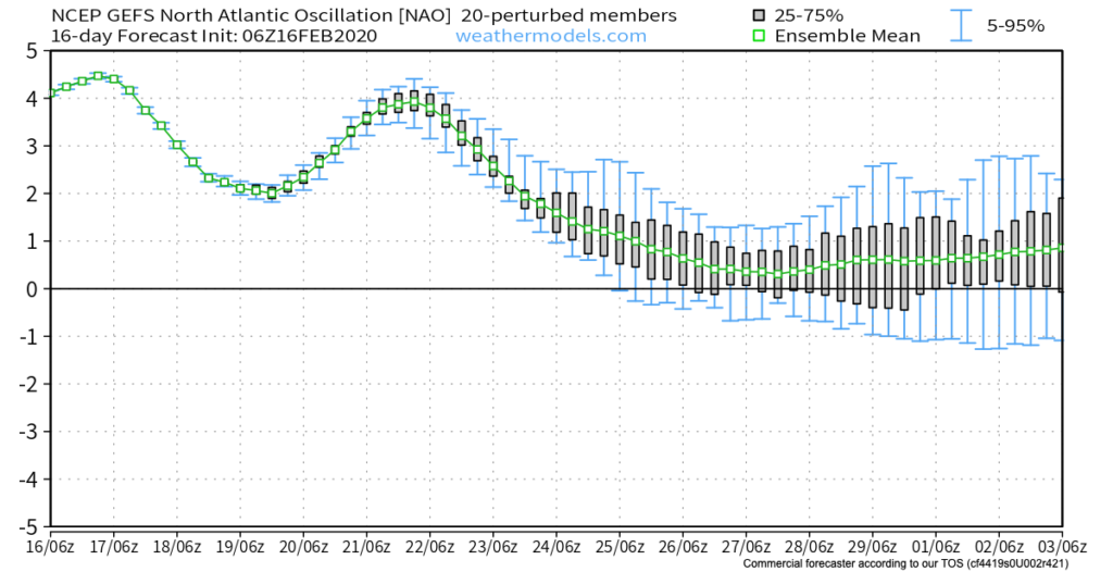
This is also the time we begin leaning more heavily on the influence a negative NAO can have on the pattern. Should this teleconnection get into the negative territory in March, then we’d be talking about a potential colder pattern lasting for 10-14 days towards one that would reload to result in colder, wintry conditions lasting into April. While not there yet, it’s certainly worth keeping an eye on in the coming days and weeks.

Permanent link to this article: https://indywx.com/meteorological-spring-a-couple-weeks-away-but-trends-suggest-winters-not-done/
Feb 14
VIDEO: Long Range Update Into Late Feb/ Early March…
You must be logged in to view this content. Click Here to become a member of IndyWX.com for full access. Already a member of IndyWx.com All-Access? Log-in here.
Permanent link to this article: https://indywx.com/video-long-range-update-into-late-feb-early-march/
Feb 12
VIDEO: Heavy Snow Builds In This Afternoon; Arctic Front Hits Tomorrow…
You must be logged in to view this content. Click Here to become a member of IndyWX.com for full access. Already a member of IndyWx.com All-Access? Log-in here.
Permanent link to this article: https://indywx.com/video-heavy-snow-builds-in-this-afternoon-arctic-front-hits-tomorrow/
Feb 04
VIDEO: Detailed Look At Multiple Rounds Of Wintry Precipitation, Including An Icy Set-Up Tomorrow Evening…
You must be logged in to view this content. Click Here to become a member of IndyWX.com for full access. Already a member of IndyWx.com All-Access? Log-in here.
Permanent link to this article: https://indywx.com/video-detailed-look-at-multiple-rounds-of-wintry-precipitation-including-an-icy-set-up-tomorrow-evening/
