You must be logged in to view this content. Click Here to become a member of IndyWX.com for full access. Already a member of IndyWx.com All-Access? Log-in here.
You must be logged in to view this content. Click Here to become a member of IndyWX.com for full access. Already a member of IndyWx.com All-Access? Log-in here.
You must be logged in to view this content. Click Here to become a member of IndyWX.com for full access. Already a member of IndyWx.com All-Access? Log-in here.
You must be logged in to view this content. Click Here to become a member of IndyWX.com for full access. Already a member of IndyWx.com All-Access? Log-in here.
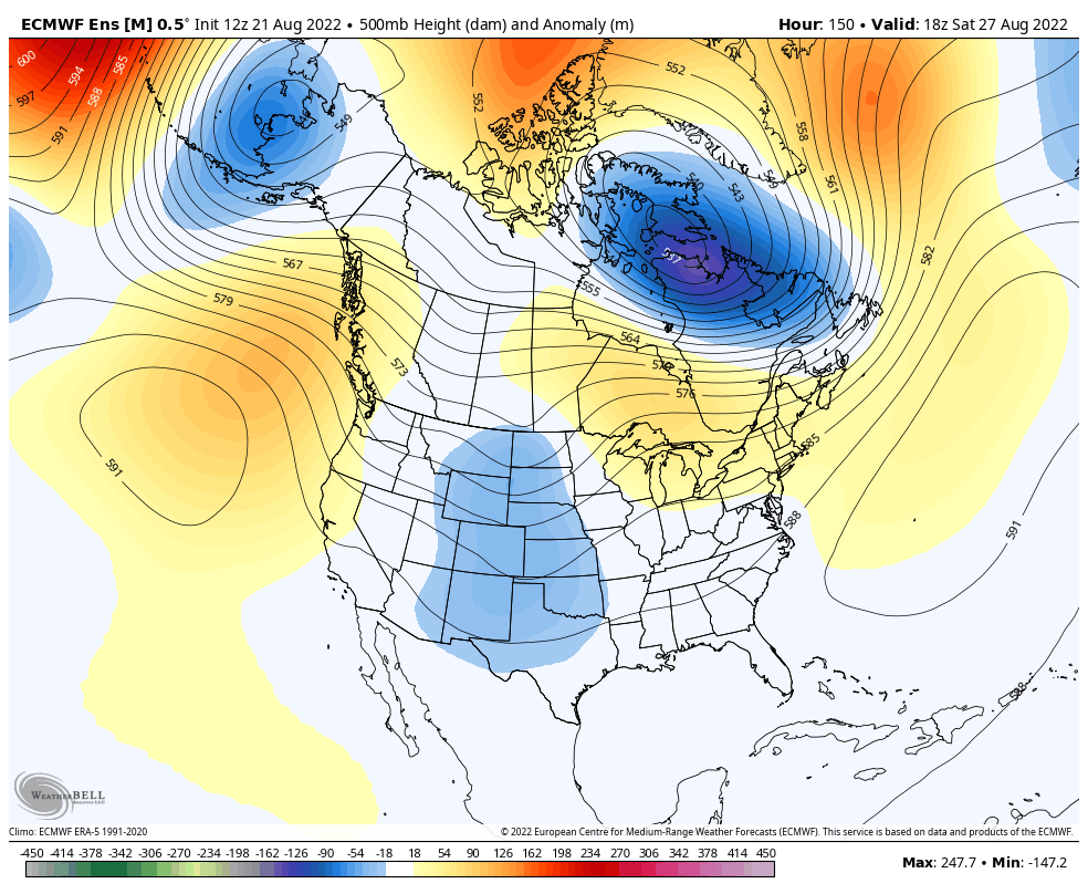
We’ve enjoyed quite the pleasant stretch of temperatures and humidity levels as of late, but there are increasing signs of a return of heat and humidity to close out August. In particular, we target the latter part of the week into early Week 2 for a stretch of 90° (plus?) to make a return visit as an upper ridge builds over the Great Lakes and Northeast.
For the most part, the pattern will also embrace a drier theme. As moisture levels return, isolated to widely scattered coverage of storms will likely return by the weekend, but we don’t envision any organized rain and storms through the upcoming week- after today.
This aligns with the pattern drivers (developing positive EPO and a hyper MJO into Phases 2 and 3). That said, there are growing indications the MJO will remain in an amplified state as we roll into September. If this is indeed the case, it appears as if we’ll move into Phase 4 early September. Certainly not set in stone but this is noteworthy as the correlation delivers an unseasonably cool stretch of temperatures for our area, including into the central Plains.
At times, the GFS can be too “quick” in displaying pattern changes, but should we get into Phase 4, we’ll have to pay attention for the threat of a shot of true early fall temperatures (at least for a couple of days) come early September. We’ll keep a close eye on things…