Sunday Morning Rambles: Thanksgiving Week Continues To Trend Active…

Updated 11.12.23 @ 11:13a

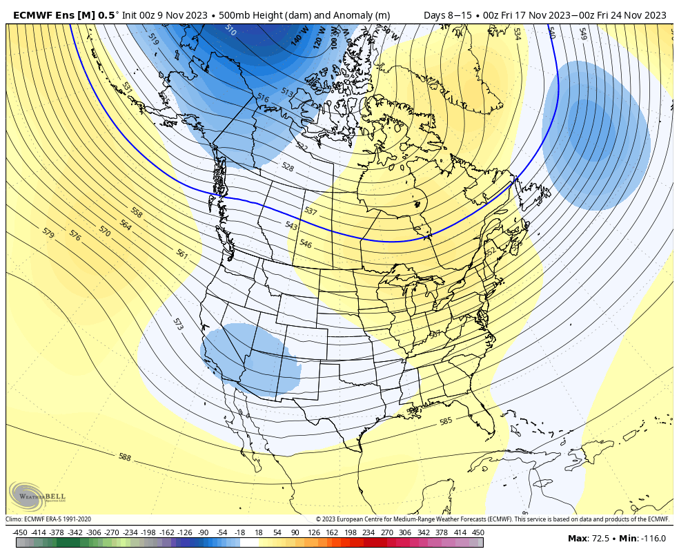
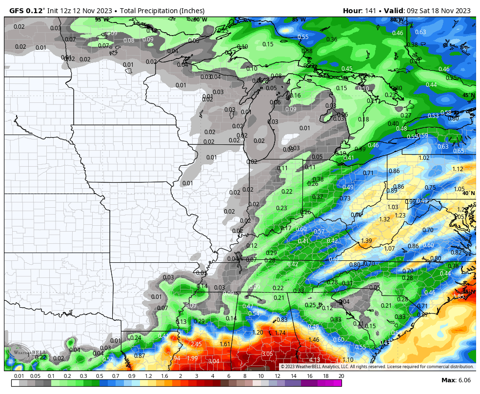
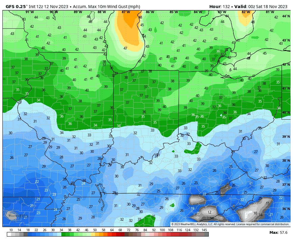
As quiet as this week will be, overall, it continues to look like Thanksgiving week won’t provide the same fortune. As mentioned yesterday, there’s no reason to waste time describing the day to day “rinse and repeat” regime up until Thursday. That’s when a frontal boundary will sweep through the Ohio Valley with gusty winds (30-40 MPH) and an opportunity of showers Thursday night into Friday. Moisture return continues to look unimpressive. Best chances of measurable rain (0.10” – 0.25”) will come from Indianapolis and points east during this timeframe.

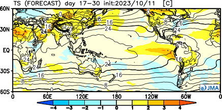
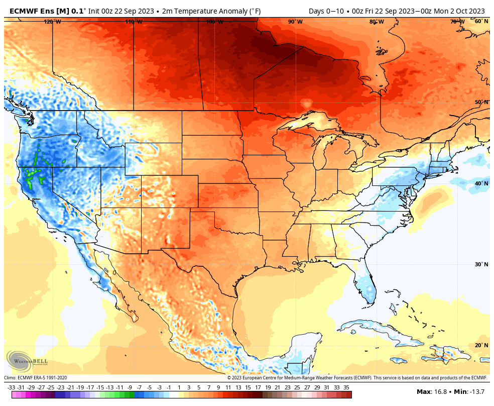
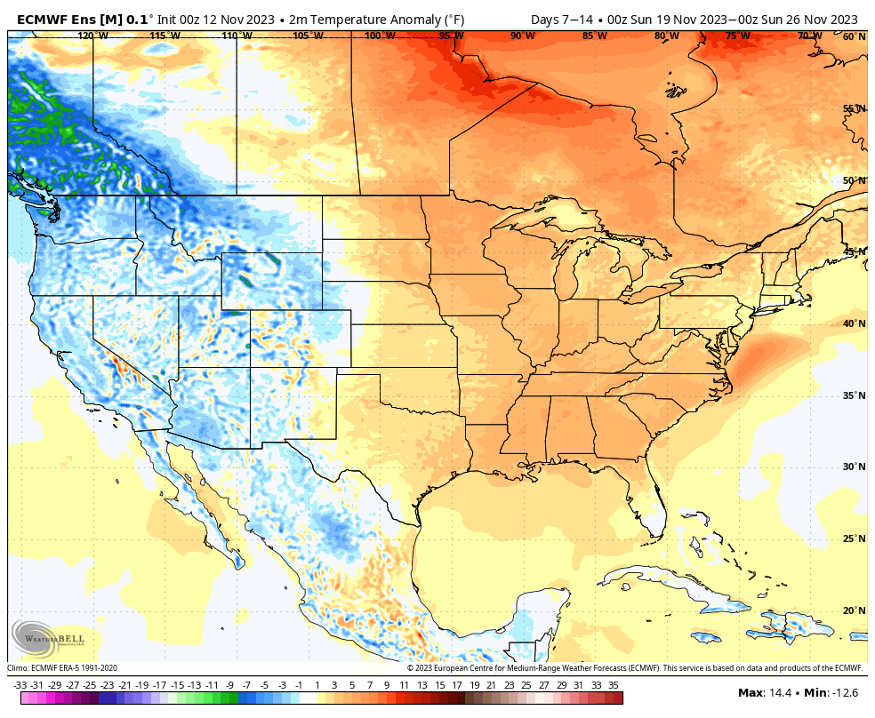
The next couple weeks will run milder to much milder than normal.

Week 1

Week 2

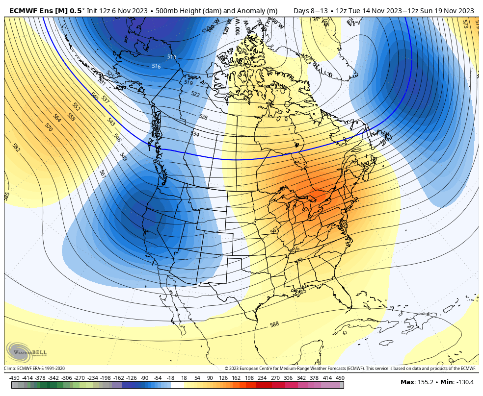
The quiet week we will enjoy this week will be replaced with a much more active time of things in the days leading up to Thanksgiving. Look for a potentially potent and large scale storm system impacting our weather with rain and gusty winds early to mid next week. Note the significant change between Week 1 and Week 2 precipitation below. More details to come as we go through this week.

Week 1 precipitation anomalies


Week 2 precipitation anomalies

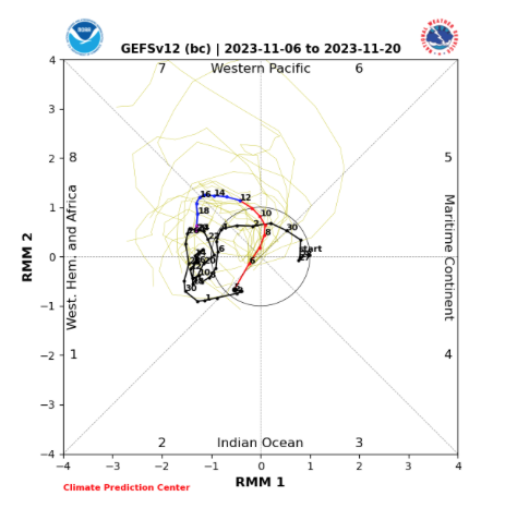
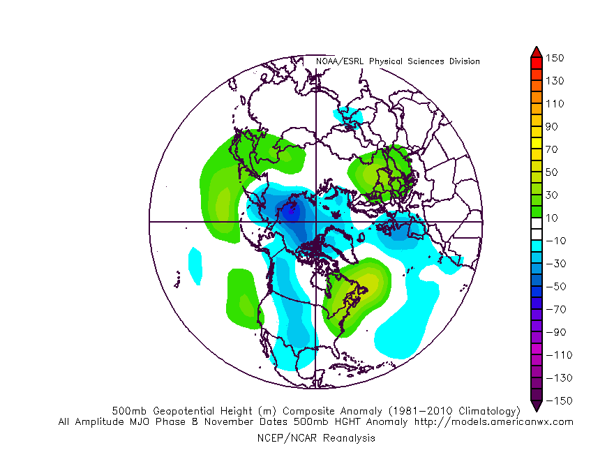
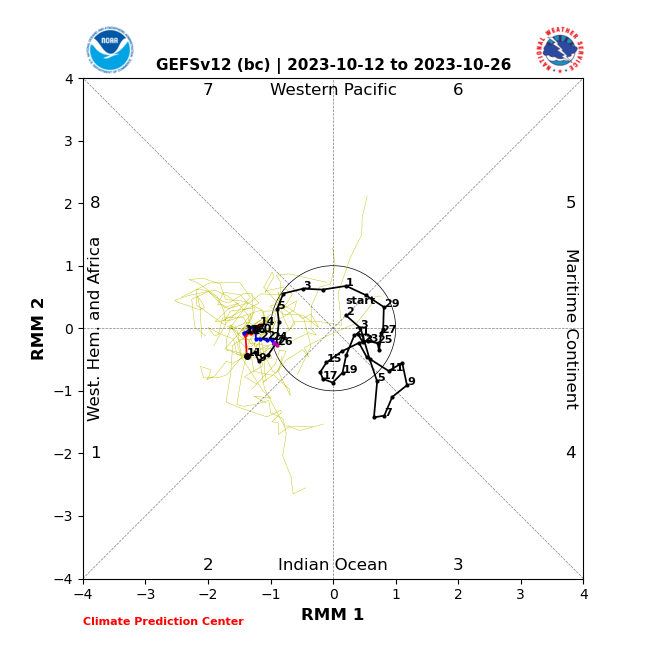
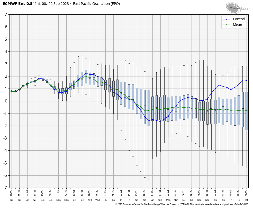
We watch the EPO trends closely for the threat of potentially colder changes longer term.

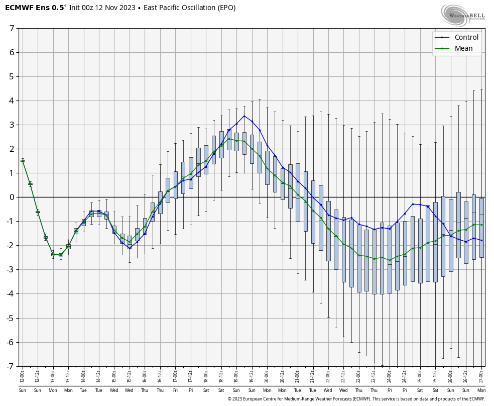
Until the PNA and MJO follow suit, “tread with caution” on any wholesale big colder shifts. All in all, this predominant regime should hold firm into the 1st half of December.

LR Update: Thanksgiving And Early December…

Updated 11.09.23 @ 10:49a

With Thanksgiving only 2 weeks from today (incredibly hard to believe), we’re able to start to get a better idea on the overall weather pattern as the “official” kickoff to the holiday season nears. The first point we want to drive home is that we should begin to see a much more active regime evolve during this 2 week period. From a temperature perspective, the pattern overall continues to look milder than average, but there will be a couple opportunities for transient pops of colder air, potentially around the all-important Thanksgiving holiday, itself.

Note how modeling sees the more active pattern evolving over the next 3-4 weeks (green represents above normal precipitation). – A significant change not only for our neck of the woods but certainly for our friends and neighbors down south (badly needed for a region suffering an expanding drought. Speaking of which, all of the dry/ droughty southern tier should reverse in significant fashion as the active Nino storm track gets going over the coming months. As the pattern continues to evolve into the ‘24 spring and summer, the south-central severe drought will be erased.

Despite attempts of troughs to roll into the Ohio Valley, they will struggle with staying power over the next 3-4 weeks. The latest JMA Weekly product and Euro/ GFS ensemble blend looks very solid given where the pattern drivers currently reside.

Week 1

Week 2

Weeks 3-4

The pattern drivers of a primarily positive EPO, negative PNA, and MJO in 8/1 (all unchanged from our post earlier this week) all suggest a predominant eastern ridge, western trough placement over the upcoming 2-3 weeks.

We’ll continue to keep close tabs on the regime, especially centered on 11/22 – 11/26.

Make it a great Thursday!

Side note: Confidence is increasing that this Nino will evolve into a central-based event which will up the chances of colder/ snowier prospects come late December and on into January. More on that later next week in a more extensive update specific to this transition.

An Overall Warm Ride Into The Thanksgiving Holiday; Any Changes On The Horizon?

Updated 11.07.23 @ 5:15a

Despite a weekend setback that will continue into the early portion of Week 2, updated forecast model data continues to scream that we’ll run above to well above normal as the Thanksgiving holiday nears.

The pattern drivers support the warmer than normal call over the next couple of days. Note the primarily positive EPO and negative PNA.

This should help keep the ‘mean’ ridge position across the upper Mid West and Great Lakes over the next couple of weeks.

We’ll keep close eyes on the negative trend of that EPO towards the end of the period (image 1 above) to see if it continues in the coming days. If so, there’s the potential we could pull the anticipated western trough east in perhaps a bit quicker fashion than models currently see (say the last week of November, potentially).

As it is, another big pattern driver, the Madden-Julian Oscillation will begin to rev up in the coming days. A circle through Phase 7/8 this time of year supports the warm signals shown from the PNA and EPO.

LR Update: Checking In On The Pattern Drivers To Close October…

Updated 10.12.23 @ 10:50a

As we roll into the second half of October, a look at the primary pattern drivers suggests there should be a lack of any sort of sustained above normal temperatures.

The PNA (image 1) should remain mostly in a positive state over the next couple weeks while the EPO (image 2) is expected to be in a neutral to negative state.

Furthermore, the MJO is forecast to sneak into Phase 1 late month. This is the correlation in October:

It’s hard to find much at fault with the NEW JMA Weeklies posted earlier today.

Temperatures

Week 1

Week 2

Weeks 3-4

Precipitation should run average to slightly below normal over the span of the upcoming (2) weeks:

Long Range Outlook Into October: Reason To Be Suspicious Of The Warm Look…

Updated 09.22.23 @ 10:41a

The pattern over the next 10 days will continue the same warmer than normal theme we’ve grown accustomed to as of late. Keep in mind that “normals” have now fallen into the lower to middle 70s for highs and lower 50s at night. Certainly far from a “blow torch,” but temperatures will run 5° to 10° above the norm as we put a bow on September.

Short-term rain chances will be handled in our daily videos. Guidance continues to differ widely on our mid week system. Needless to say, we’re not overly optimistic on the wetter solutions as of now, but will closely monitor to see if more consistency develops down the road.

As a whole, the pattern continues to look drier than normal over the next couple weeks overall.

Week 1

Week 2

While guidance continues to look warm into early and mid October, I have to raise an eyebrow based on the latest teleconnection trends. We note the EPO trending negative while the PNA pops positive. These drivers should force a colder look Week 2 into Week 3 and I would suspect guidance will cool significantly as we get closer.

Further down the road, it’ll be important to keep tabs on western Pacific typhoon activity and the Madden Julian Oscillation. There are signs we may finally start to see the MJO become more of a player in the pattern towards mid October. Time will tell.

In the meantime, keep a close eye on guidance Week 2 into Week 3 as this will be the first real test case to revisit so far this meteorological fall season…