Updated 05.08.21 @ 11:16a
You must be logged in to view this content. Click Here to become a member of IndyWX.com for full access. Already a member of IndyWx.com All-Access? Log-in here.

May 08
Updated 05.08.21 @ 11:16a
You must be logged in to view this content. Click Here to become a member of IndyWX.com for full access. Already a member of IndyWx.com All-Access? Log-in here.
Permanent link to this article: https://indywx.com/video-heavy-rain-arrives-overnight-additional-frosty-mornings-ahead-next-week/
May 07
Updated 05.07.21 @ 8a
Many find themselves waking up to the upper 30s this morning.

While certainly chilly by May standards, we’ll be even colder tomorrow morning. This will come behind a passing upper level disturbance that will likely kick up another round of scattered thunder (some storms may contain small hail) this afternoon and early evening. Lows Saturday morning may rival records in spots. The record low in Indianapolis tomorrow morning is 31° set in 1976 and 1947.
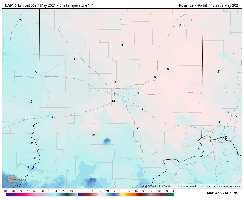
We still anticipate a Mother’s Day soaker (rain may begin around sunset Saturday after what should otherwise be a very nice day), including embedded thunder. Rainfall totals with this system will check-in between 1.5″ and 2″ for most, including locally heavier totals above 2″. The axis of heaviest rain is forecast from Indy and points north with the latest American model guidance and central and southern portions of the state from the European guidance. Expect the consensus of modeling to improve on precisely where the heaviest totals setup over the next 24 hours.
The primary purpose of this morning’s post is to look at the chilly start to May and where we think things are headed for the 2nd half of the month.
The “revved up” MJO (into the traditionally cold May phases) initially is what tipped us off to the cold open to the month. For those that have been paying attention to the modeling, you could see how the data had to continue correcting colder and colder up until “real term.” Officially, we’re running 1.6° below normal so far, but with the cool in the week ahead, that will grow much more impressive in the days to come.

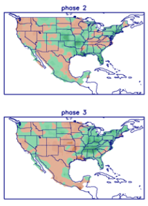
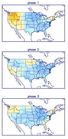
This should come as no surprise with us set to move strongly into Phases 2-3 over the course of the upcoming 7-10 days. Note greatest temperature departures from normal occur across the Ohio Valley in these phases in May.

What’s more interesting is what transpires after this period (mid and late May). The MJO is expected to head into the “null phase” for a time.

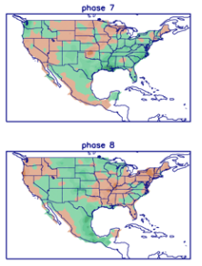
One could extrapolate the data and build a case we’re headed for phases 7-8 to close the month. If so, things would moderate (against the norms) by Phase 8.

This is something we’ll watch. If we do, indeed, get into Phase 8 prior to Memorial Day, we’d expect the heat to build to close the month. The transition will likely be less significant though. The thinking here is still relatively cooler than normal mid-month before moderating closer to and/ or slightly above normal prior to Memorial Day.
From a precipitation perspective, the pattern continues to look quite active for the foreseeable future.
Permanent link to this article: https://indywx.com/may-opens-chilly-but-where-do-things-go-later-this-month/
May 04
Updated 05.04.21 @ 7:55a
You must be logged in to view this content. Click Here to become a member of IndyWX.com for full access. Already a member of IndyWx.com All-Access? Log-in here.
Permanent link to this article: https://indywx.com/video-active-weather-pattern-into-early-next-week/
May 01
Updated 05.01.21 @ 4:14p
You must be logged in to view this content. Click Here to become a member of IndyWX.com for full access. Already a member of IndyWx.com All-Access? Log-in here.
Permanent link to this article: https://indywx.com/may-2021-outlook-same-theme-for-some-while-the-pattern-changes-for-others/
Apr 29
Updated: 04.29.21 @ 7:42a
Before we dig into some of the wetter trends being shown on the majority of forecast models, let’s review the basis of the medium to longer range forecast through the 1st half of May.
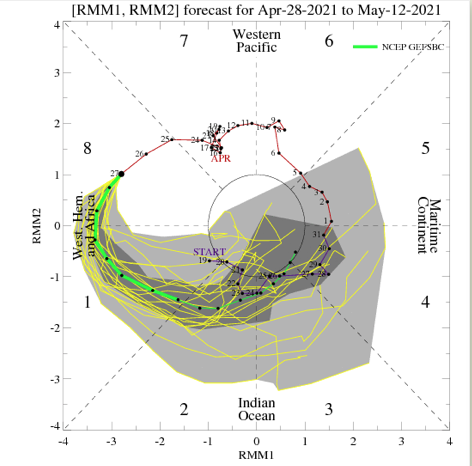
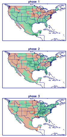
We’ll start with the MJO (Madden-Julian Oscillation). This is forecast to be quite amplified into May, swinging through Phases 1, 2, and 3. These are cooler than normal phases this time of year. Phases 2 and especially 3 are wet.
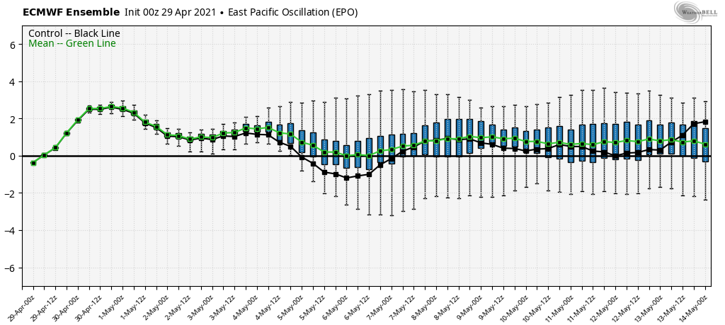
The 2 primary teleconnections we lean on this time of year include the EPO (East Pacific Oscillation) and PNA (Pacific North American pattern). While we still keep close tabs on the NAO, the influence it has begins to wane compared to late winter into mid spring. In any event, the EPO is largely forecast positive (a warm signal) while the PNA is forecast negative (also a warm signal).

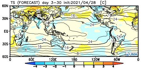
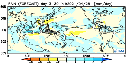
Let’s dig into the data. As it’s Thursday, we’ll start by taking a look at the new JMA Weeklies. Wetter than normal with seasonal temperatures sum up the upcoming 3-4 weeks.
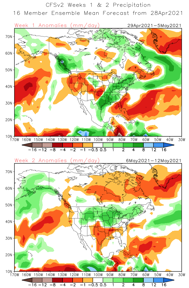
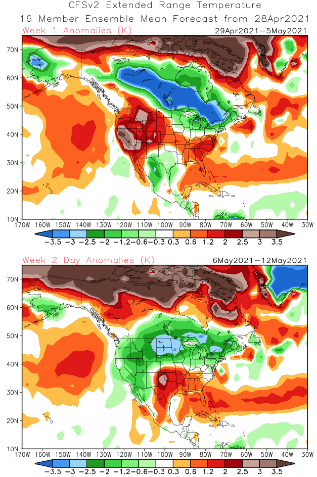
The CFSv2 Weeklies show a wet, cool (compared to normal) theme for our neck of the woods. Warmth is constant across the Southeast.
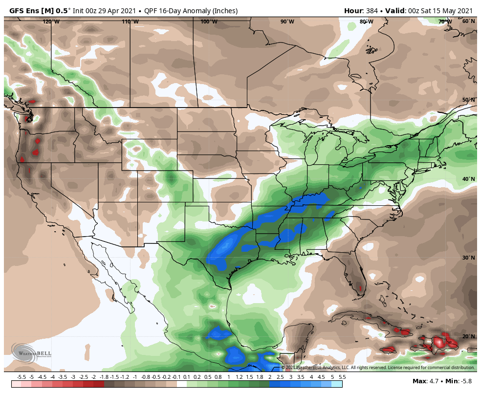
The GEFS and EPS are in relatively good agreement as we look at the upcoming couple of weeks. Both show a wetter than normal pattern from TX into the Northeast, including the Ohio Valley and Great Lakes.
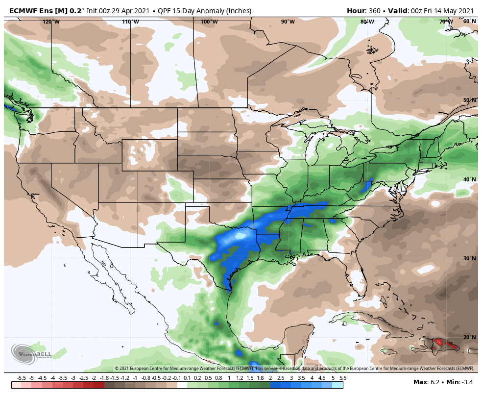
The GEFS is trending significantly cooler in the Week 2 timeframe and given where the MJO is heading, it wouldn’t surprise us if other models cool from where they currently are during this time period.
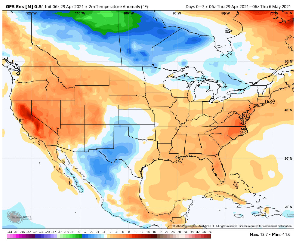
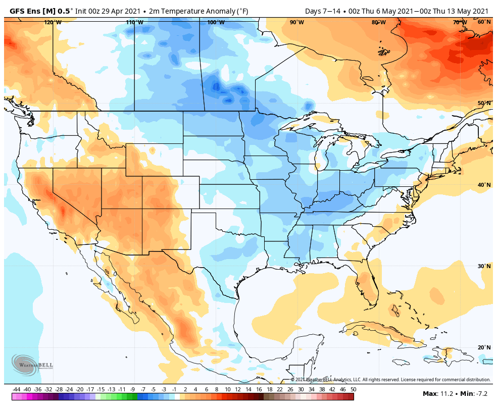
While the EPS is trending cooler Week 2, it’s not nearly to the magnitude of what the GEFS shows above.
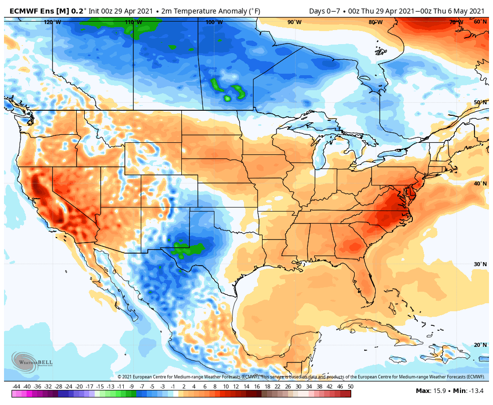
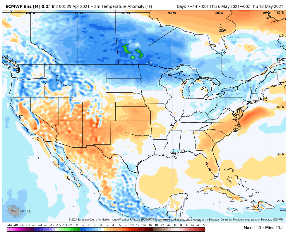
Given the pattern drivers discussed to start, we should enter a rather active weather pattern into the 1st couple weeks of May. While these are likely to be fast moving storm systems (usually not depositing excessive rainfall amounts), the frequency of the systems will likely add up over time (above normal rainfall). The wetter trends depicted on the modeling are hard to ignore. I would also keep close tabs on that Week 2 timeframe for the potential of cooler trends to show up and feel the GEFS is doing the best job from this distance.
Permanent link to this article: https://indywx.com/long-range-update-wetter-may-trends-and-mjo-influence/