Updated 04.22.22 @ 7:50a
You must be logged in to view this content. Click Here to become a member of IndyWX.com for full access. Already a member of IndyWx.com All-Access? Log-in here.

Apr 22
Updated 04.22.22 @ 7:50a
You must be logged in to view this content. Click Here to become a member of IndyWX.com for full access. Already a member of IndyWx.com All-Access? Log-in here.
Permanent link to this article: https://indywx.com/video-gorgeous-weekend-long-range-update-into-mid-may/
Apr 14
Updated 04.14.22 @ 5:23p
While we should see a period of significant moderation in the 8-10 day period, yet again, this is likely to only be a 2-4 day, transitional spike. This is likely a byproduct of the lag effect of a positive NAO (North Atlantic Oscillation), but notice what happens longer term: a moderately negative NAO returns as we go into next weekend and beyond.
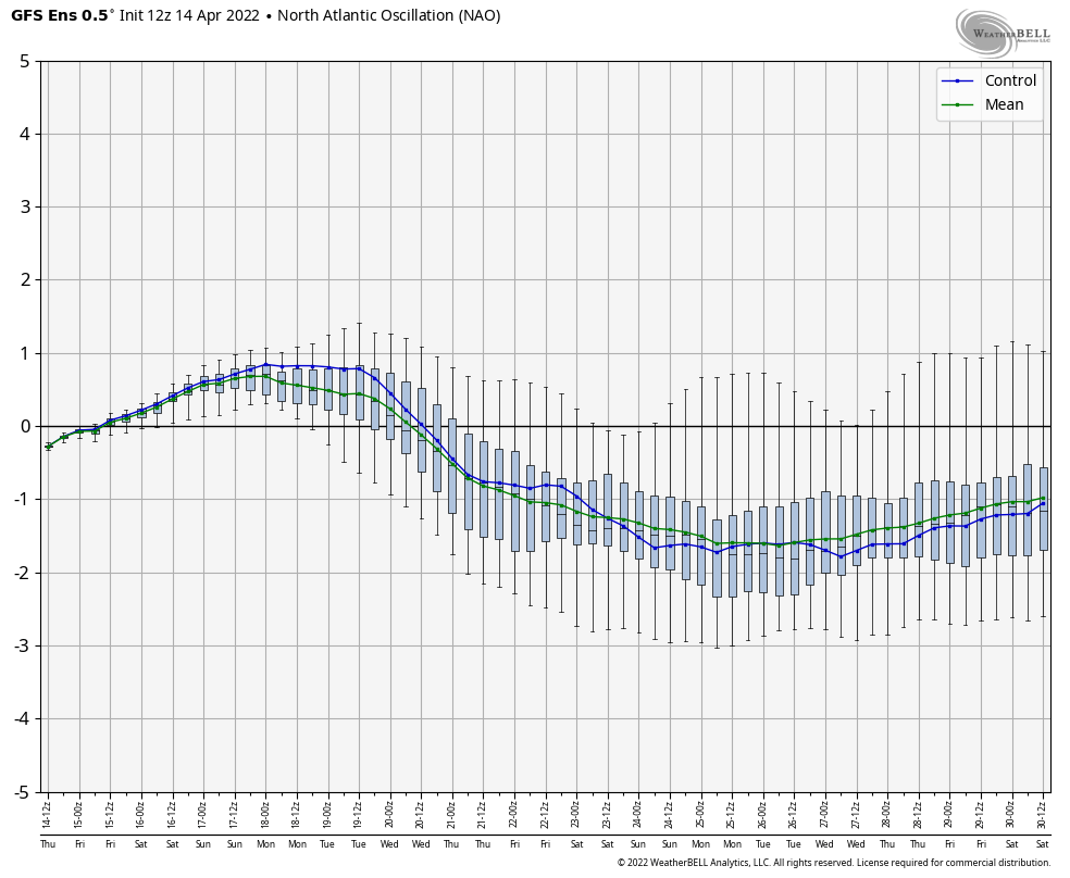
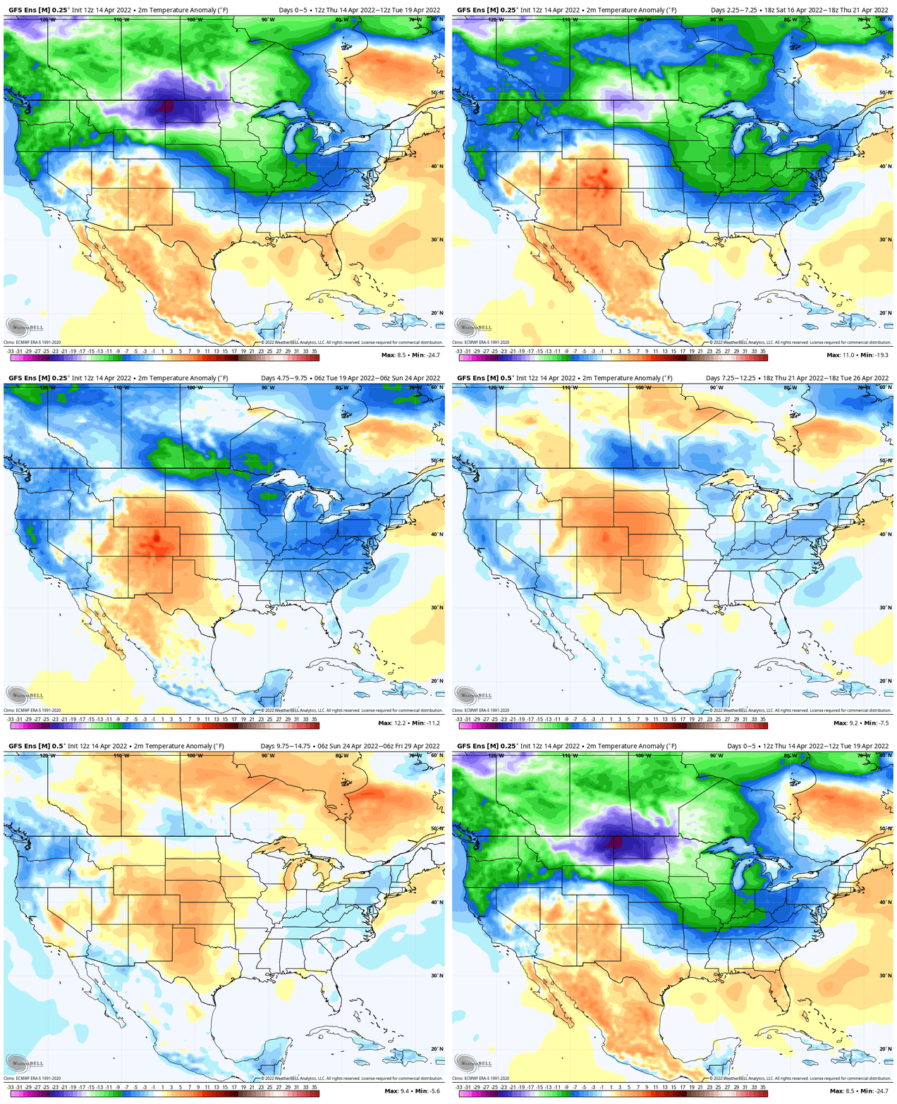
The transitional warm-up that will show itself next weekend and into early Week 2 will likely take a back seat to a renewed chilly (by late April standards) time of things before we close out the month. Ensemble guidance is picking up on this.
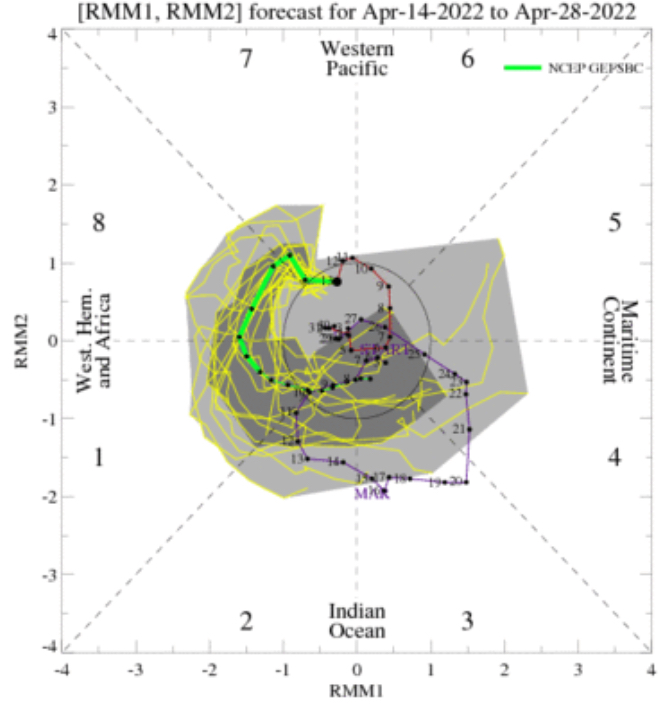
Then you add in the expected MJO movement over the next couple of weeks. Guidance shows us moving into Phase 1 late month. This is a phase in April that loves to drive more of a tendency for a trough over the East.
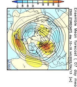
Longer range models, including the JMA and CFSv2 Weeklies, show the cooler look to wrap up the month, relative to normal. Given the alignment between the NAO and MJO, it’s hard to argue with this idea.

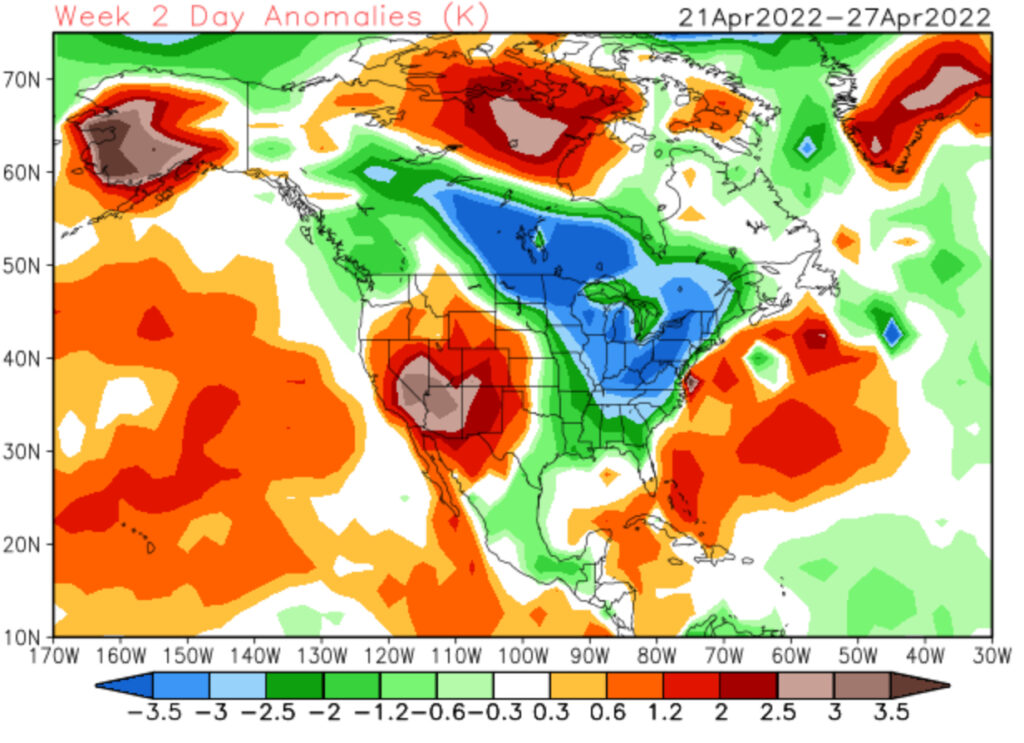
There will be more frequent opportunities for late season frost compared to normal as we wrap up April. Precipitation over the next couple of weeks should balance out close to average as a whole.
Permanent link to this article: https://indywx.com/long-range-discussion-never-trust-a-sustained-warm-up-with-a-negative-nao-this-time-of-year/
Apr 09
Updated 04.09.22 @ 8:51a
You must be logged in to view this content. Click Here to become a member of IndyWX.com for full access. Already a member of IndyWx.com All-Access? Log-in here.
Permanent link to this article: https://indywx.com/video-stunner-of-a-sunday-dialed-up-timing-out-rain-and-storm-chances-in-the-week-ahead-and-looking-at-another-shot-of-winter-like-conditions-week-2/
Apr 07
Updated 04.07.22 @ 8:46p
You must be logged in to view this content. Click Here to become a member of IndyWX.com for full access. Already a member of IndyWx.com All-Access? Log-in here.
Permanent link to this article: https://indywx.com/video-long-range-outlook-into-late-april/
Apr 05
Updated 04.05.22 @ 6:48a
We’ve already handled the jab of unseasonable chill and even opportunity for wet snow showers late week so want to focus more on what lies ahead. The idea here has been that a mid month warm up would pave the way to more sustained spring like temperatures for the 2nd half of April. While the mid month warmup is still certainly on track, the longevity and duration of such is now met with a much, much lower confidence.
The good news? A significant warmup is still dialed up next week. (This will be extra sweet coming on the heels of what will be a rough go of things with out of season chill and snow showers later this week). Highs in the 70s and even low 80s are a good bet next week.

A potent frontal system looms late next week that we’ll have to watch for the threat of severe weather. More on that ahead in our shorter term products as we get closer. The passage of this front will also likely usher in another airmass that’s set to run below, to well below normal. Frost potential is alive and kicking week after next (remember we also have to deal with frost/ freeze conditions this upcoming weekend) with this kind of pattern. The NAO takes a negative hit which also supports the temperature reversal from what will be such a warm stretch next week…

Remember, we’re only the messenger…
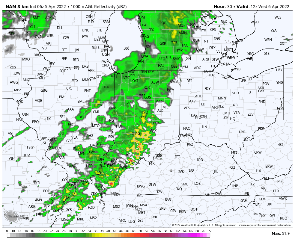
In the shorter term, today isn’t looking nearly as wet as once thought. There will be a few showers around, but the steadier, more persistent rain will fall to the southeast of central Indiana.
More widespread rain and even a couple embedded storms are slated to impact our neck of the woods Wednesday morning.
Permanent link to this article: https://indywx.com/yet-again-warmth-likely-only-a-tease/