Trend Hasn’t Been Our Friend As Of Late Around The Holidays; Reason To Believe This Year Is Different?
Updated 10.07.23 @ 6:09a
Though officially, we’re only a couple weeks into autumn, attention here has begun to shift towards the potential predominant pattern as we push into the holiday season.
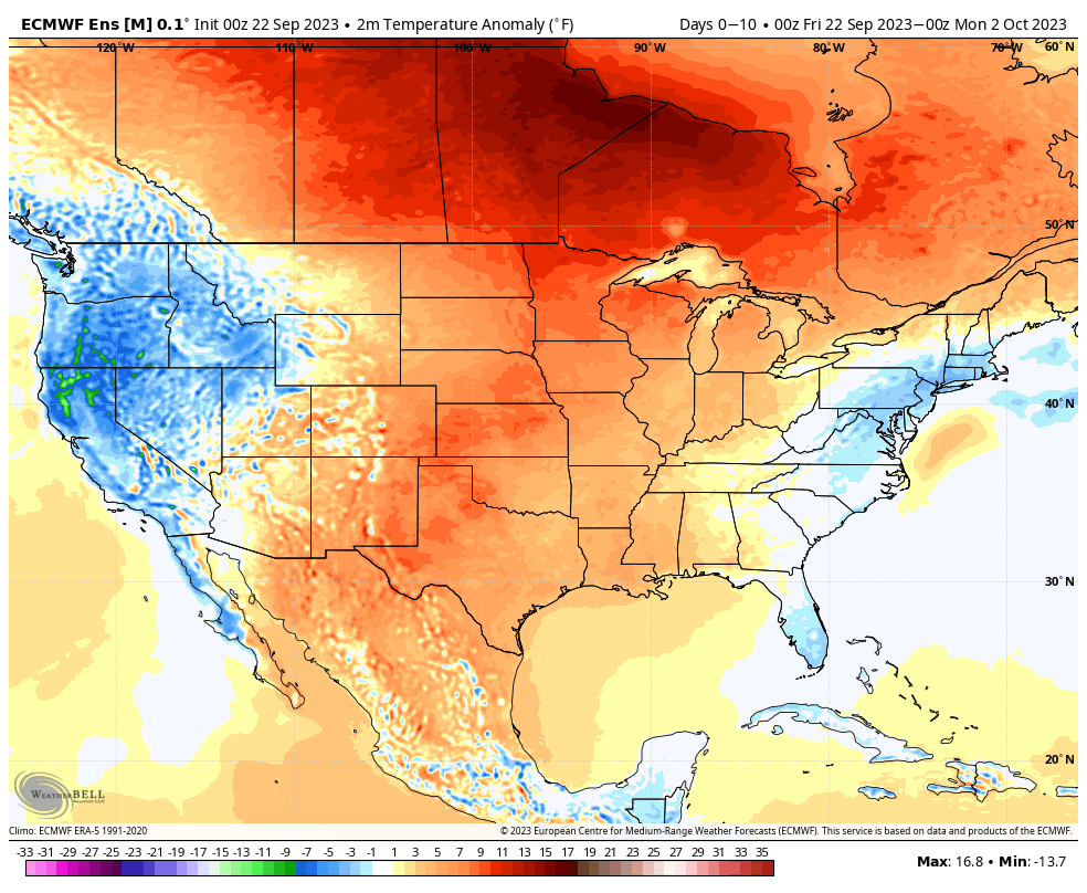
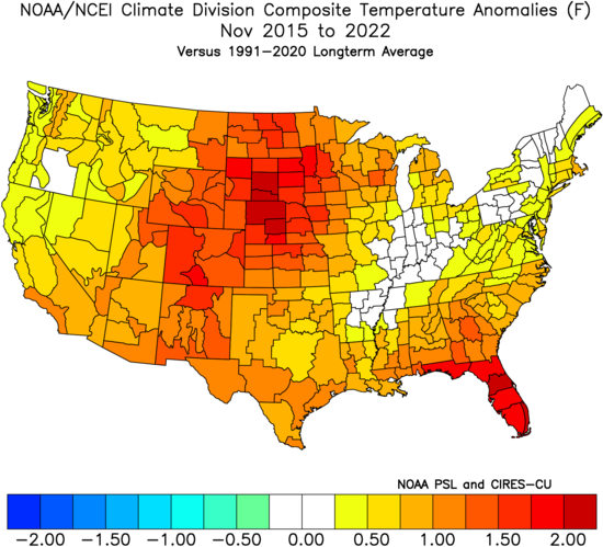
A quick, simple look back over the most recent November and December patterns is a sight that generates anxiety for most winter lovers. At a time when the majority of even non-winter lovers would like snow (i.e. the holidays), well above normal temperatures, and almost record warmth has become all too common over the years.
November 2015-2022
December 2015-2022
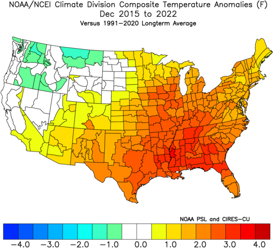
Is there reason to believe that could be different this year, especially with our base transition to El Nino? Simply put, not so fast my friend. El Nino winters are notorious for getting off to slower, warm starts. Our research shows that many times November can start cold but that the December pattern flips warmer around these parts. That’s, obviously, not to say it “has” to be that way. Many other factors contribute to the overall regime, but just that when you simply bundle all 1st year Nino events together, it’s more typical than not to find things play out such as illustrated above.
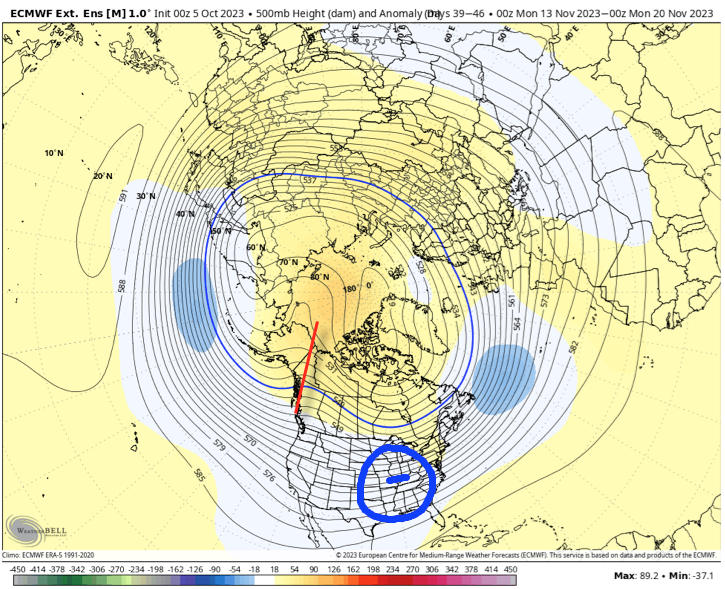
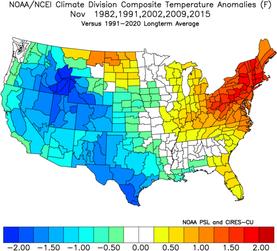
Let’s take a more specific look at our analog package (’82-’83, ’91-’92, ’02-’03, ’09-’10, and ’15-’16) and see what that suggests may be in store as we begin to set our eyes on the holidays.
November: Slightly above normal, locally. Unseasonably cold west and unseasonably warm New England are the headliners.
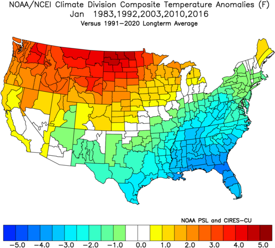
December: Greatest warm anomalies are centered over the Ohio Valley, in what otherwise is a large-scale warmer than normal regime from the Plains east.

January: The pattern begins to really flip around with cold bleeding southeast as the northern Plains and Northwest turn warmer than normal.
What does this all mean to me? While there’s only one that knows the future, if I was a betting man, I’d lean towards another holiday season that features above normal temperatures and most likely a greater than normal chance of below average December snowfall. I’d anticipate a few cold shots in November and the possibility of one or 2 accumulating snow events that gives way to the overall warmer idea in December. There’s always the chance the pattern begins to shift that last week of December for the colder January look… That’s the hope we’ll leave you with in this post in what otherwise will likely be a warmer than normal month as a whole.