Updated 08.31.23 @ 7:45a The extended stretch of calm, quiet conditions will allows us to start looking ahead to the upcoming winter in earnest over the upcoming several days. We’ll…
You must be logged in to view this content. Click Here to become a member of IndyWX.com for full access. Already a member of IndyWx.com All-Access? Log-in here.
You must be logged in to view this content. Click Here to become a member of IndyWX.com for full access. Already a member of IndyWx.com All-Access? Log-in here.
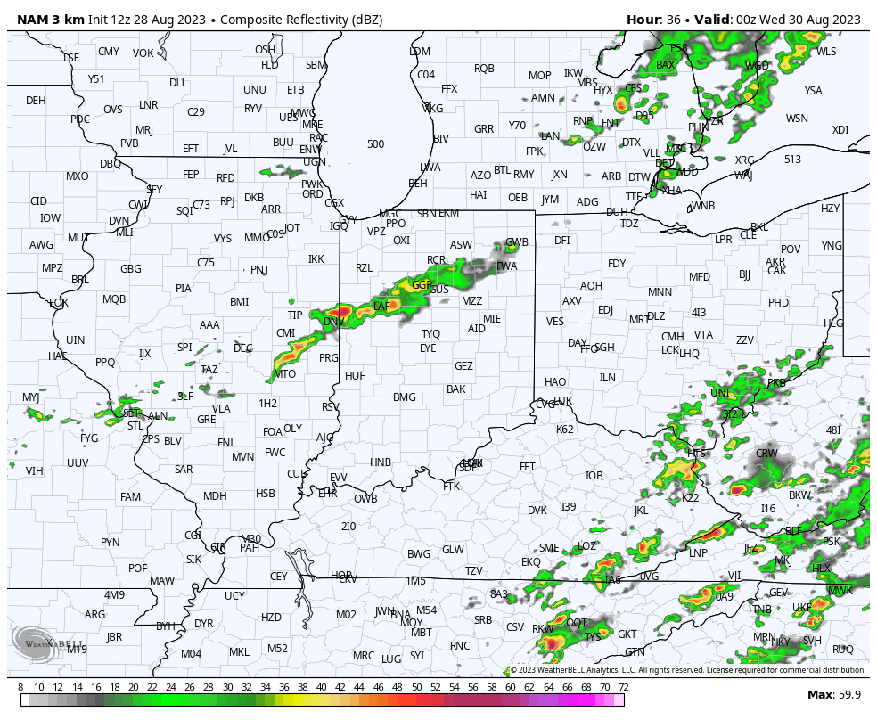
A weakening band of showers will push into north-central Indiana later this evening. A quick shower May move through the city but most should remain dry as the associated secondary cold front passes through the area. This frontal passage will serve up dry, cool air reinforcements that will carry us into the start of our Labor Day weekend. Overnight lows into the 40s can be expected.
A quick shower is possible this evening, primarily north of the city
Our “hint” of fall will quickly fade through the holiday weekend and into next week as the upper ridge builds northeast. This won’t only deliver unseasonably hot and humid conditions but will keep us much drier than normal. In fact, after today, I don’t see any meaningful chances of precipitation for at least the upcoming 10-day stretch.
A secondary cold front will drop southeast across the state Tuesday. While we’re not anticipating any sort of widespread significant rain and storms with this frontal passage, it will be the best opportunity for rain over the next 10-14 days, overall. Best chances of precipitation will come after 5p from a weakening line of showers and storms to our northwest.
Best chances of measurable rain will be to the northwest of immediate central Indiana.
Reinforcing dry, cool air will filter into the region as we close the work week and get set to head into the Labor Day weekend. Here’s a bit of advice: please be sure to make time to get outside and enjoy this pleasant airmass as major changes await over the weekend and into next week. Until then, our late week stretch will feature overnight lows dipping into the upper 40s and lower 50s.
The upper ridge will begin to build back northeast over the holiday weekend and with it will come another round of unseasonably hot, humid conditions. While it might not be quite as miserable as what we dealt with last week, chances are that we’ll have to contend with several days of 100°+ heat indices and “jungle-like” humidity with an extended period of rain-free days deep into the Week 2 timeframe. Buckle up.
We’re only a few days away from meteorological fall. Despite what the calendar says, Mother Nature will provide “bonus” heat and plenty of dry times as we rumble through the next few weeks.
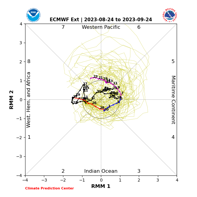
The Madden Julian Oscillation (MJO) looks to “wake up” and amplify into the notorious warm phases for September.
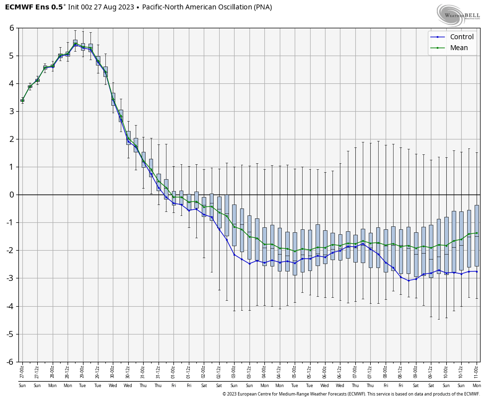
The PNA (Pacific North American pattern) is going to crash negative and fits right into the warm pattern driver theme.
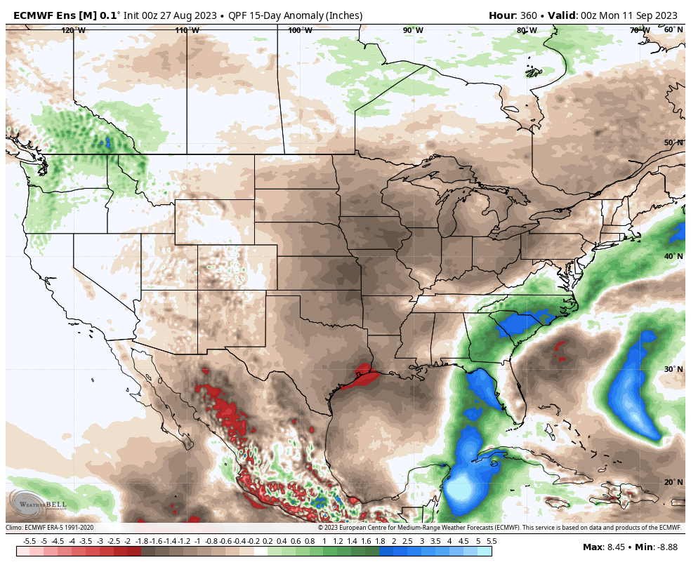
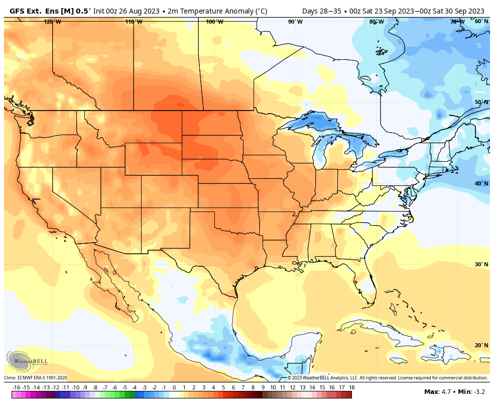
Medium and long range modeling shows the upper ridge building and expanding northeast with time over the next couple weeks. Unseasonably hot weather will accompany this pattern evolution.
Widespread drier than normal conditions should also prevail through the upcoming few weeks.
Even as we progress into the final few days of the month, extended long range guidance maintains the warm to hot theme.
It’s really not until we get to October that the pattern should begin to change in more significant fashion and make up for lost time with respect to cool, crisp air…