During wholesale pattern transitions, operational data will struggle at times, including some wild run-to-run swings. Earlier this week, the European wanted to put early next week in the lower 50s. At the same time, the GFS suggested lower single digits. Precisely, it was a difference of 46° between the two models for a high?!
We note the teleconnections (in particular, the EPO) are aligning in a manner conducive for widespread cold.
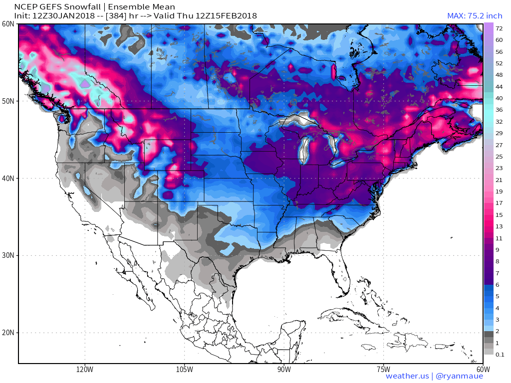
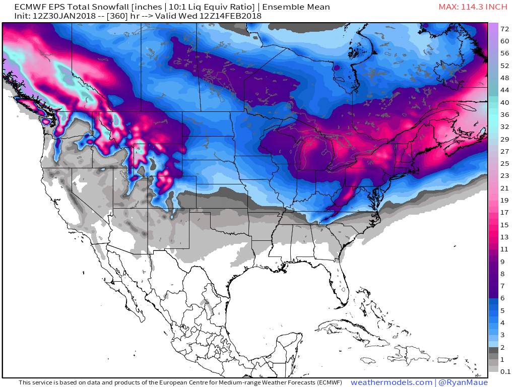
 The GEFS might be a bit quick on dropping the arctic hammer, but the consistency of the model is impressive. Meanwhile, the European (even it’s ensemble data) has been much less consistent and has really been struggling the past couple of winters, overall, as a whole.
While we can argue as to just how cold it’ll get through the early part of February, the overwhelming message is that a prolonged colder than normal pattern will develop during this time period.
 Let’s also keep in mind that the initial cold onslaught is coming in the face of the MJO still rumbling through the warm phases. We note the European is consistently having to correct towards a more “amped up” MJO- swinging into the cold phases as we approach mid-month. And it’s mid-February that continues to have us concerned for the potential of truly nasty, severe cold.
 As for snow, it’ll come in this pattern. Again, don’t get caught up in the operational output, but understand that the pattern over the upcoming 7-10 days favors numerous fast-moving snow systems. While most of these will be light, we’ll have to keep a close eye on things as the potential exists for one of these waves to spin up a moderate event.
As we look ahead to Week 2, the potential is there for a more widespread significant phased interior threat prior to the dumping of the bitterly cold air for mid-month.
As it is, both the GEFS and EPS “mean” paint a bullish signal for piling snow up over the next couple weeks…


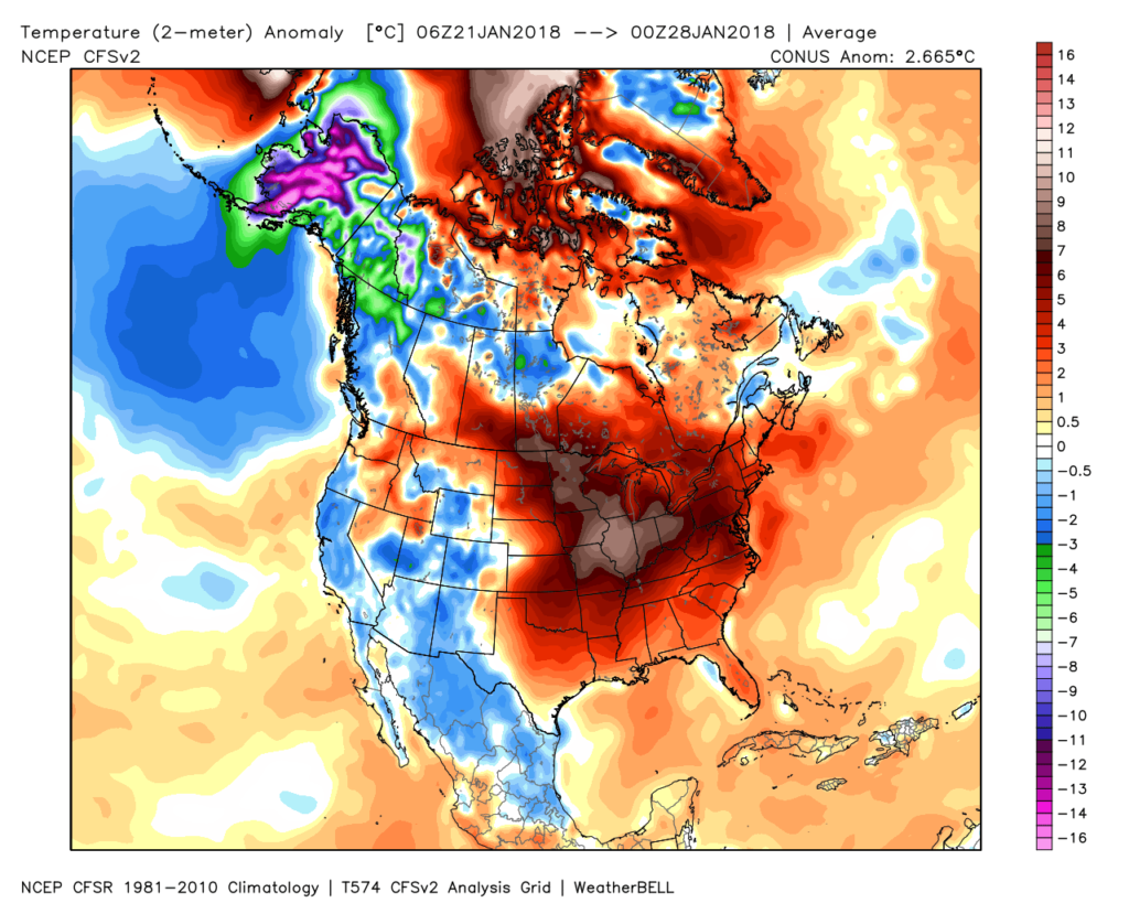 Despite the milder air over the past week, January, as a whole, is still running 4° below average at Indianapolis- a byproduct of just how frigid the first half of the month was.
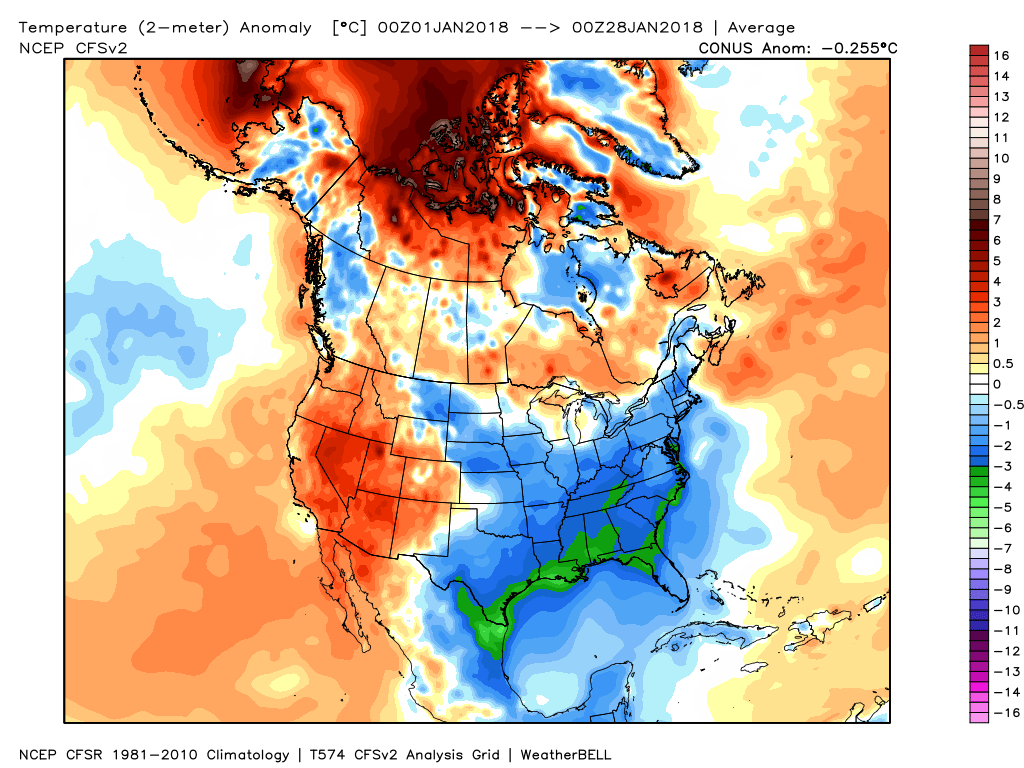 While the January thaw has been nice, times are changing and winter sure seems to be reloading for a very active second half.
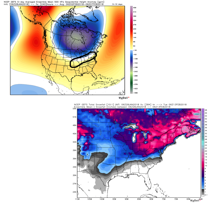 Once we get a snowpack laid down, arctic highs oozing southeast will likely lead to bitterly cold air. Recall our expectation for this pattern to yield at least (1) night of double-digit below zero lows, but it’s more towards mid-month that we think the severe cold takes hold.
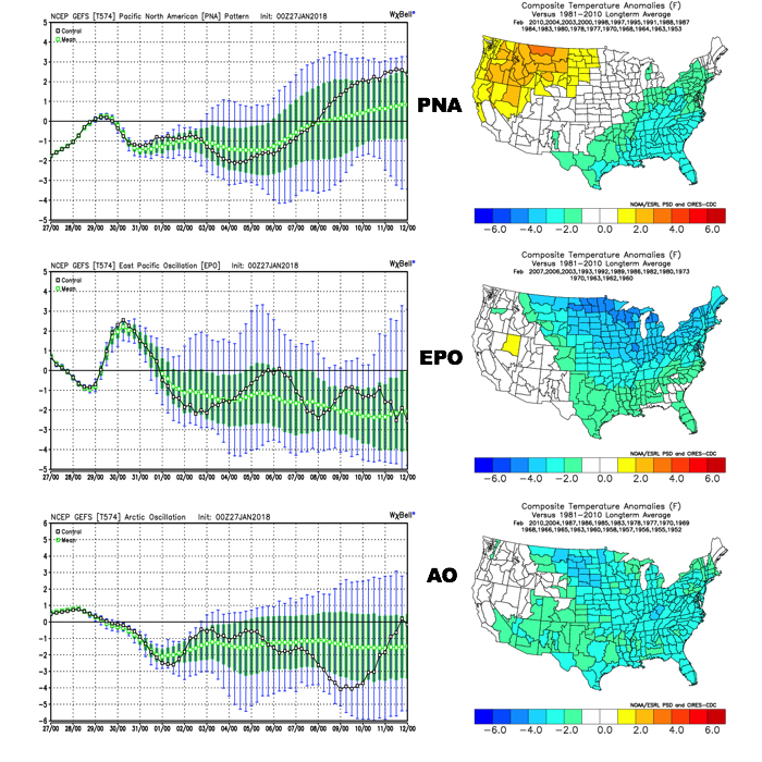 The Madden-Julian Oscillation (MJO) is forecast to rotate into the colder phase 8 as we rumble from early to mid February. Given the amplitude of the MJO, it should continue to rumble right through the cold phases of 1,2, and 3.
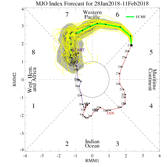
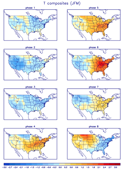 All of these moving pieces that lead up to extended periods of cold, wintry conditions are part of a bigger outcome low solar, easterly QBO winters deal up. What we should experience with this setup is a 6-7 week period of wintry conditions, including times of severe cold. It appears to be a snowier version of what we went through late-December through mid-January. Hang in there, spring will come…eventually.
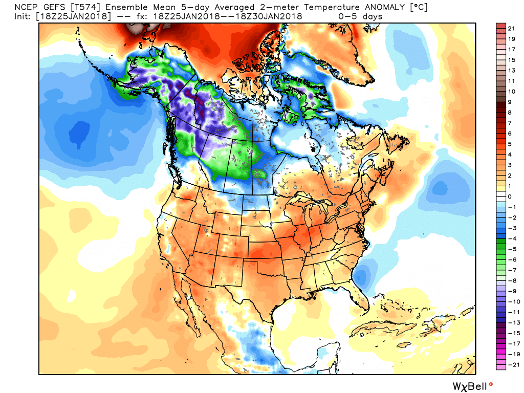 While we’ll deal with light rain Saturday morning, light snow Monday with upper energy and a transient shot of cold air, the primary message through next Wednesday is that our weather pattern will be rather benign considering we’re in the “heart” of winter. In fact, our current 7-day reflects (3) days of highs of 50°, or greater. That’s impressive for late January, and you have our full permission to enjoy every minute of it!
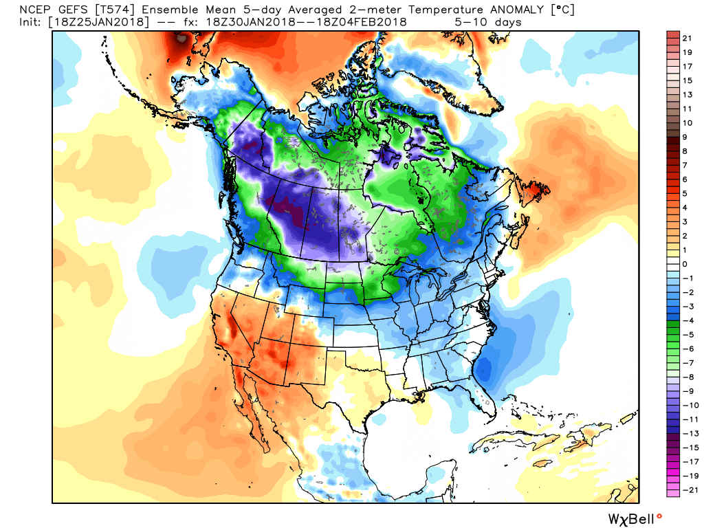
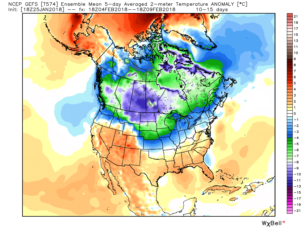 A combination of ingredients will come together to initially lead to a very active/ stormy period for the first half of February. Within this initial couple weeks of the month, we expect an expanding snowpack to encompass the Mid West and Ohio Valley region. While we can’t get specific on any one particular storm more than two weeks out, confidence is higher than normal on the pattern putting down greater than average amounts of the white stuff. Snow enthusiasts, locally, have to be “salivating” over the resistance put up from the eastern ridge and the resurgent cold pressing into the Plains and Midwest. A busy interior storm track seems like a good bet.
 Eight mornings so far this winter have plunged below zero. We’ll see if we can add another to that list this morning (IND is officially at 0° as we write this).
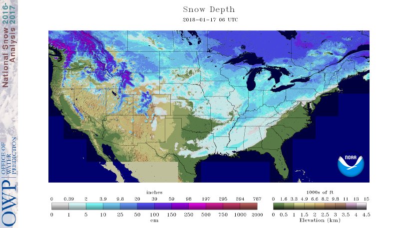 If you’re sick and tired of the cold, wintry conditions relief is on the way. We’ll turn “less cold” through late-week and above normal over the weekend (around 40° Saturday and into the upper 40s Sunday).
 A storm system will cut into the ridge Sunday with showers (image 1) followed by “backlash” snow showers and gusty winds Monday (image 2).
 Thereafter, models see another storm that will approach the region late next week. Since cold air won’t be readily available, it’ll take the perfect track to get impactful wintry conditions from this next event. We’ll monitor things closely next week. With this near Day 10, models will continue to struggle with timing, track, and intensity over the next few days.
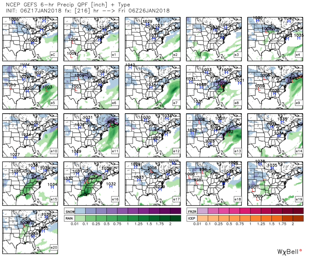 As a whole, the second half of January should run milder than average. However, as we all know, that doesn’t mean we won’t have wintry challenges to deal with. The upcoming (10) days illustrates that nicely. Looking ahead, we note the MJO is forecast to rumble through the warmer phases (especially if you’re reading this from the eastern regions of the country- where we expect warmth to be most anomalous into early February).
 Other teleconnections also support a relaxation of the cold, and warmer times, overall, with the exception of the Arctic Oscillation which remains negative through the period.
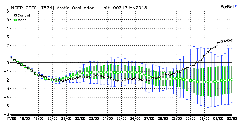 It should be noted that the longer range data and overall trends, supported by our analogs, suggest winter roars back with authority as we get into February. In fact, winter might not be so quick to leave this year either. Data paints a cold, wintry open to meteorological spring this year, but we’re getting way ahead of ourselves. It is only mid-January, after all.