There’s a lot of interest (no matter the time of year) in the medium to long range weather pattern. With operational modeling updating up to (4) times per day during this time range, there’s always at least some degree of fluctuation between model runs. At times, that fluctuation is more significant than others. It’s at those times when it’s more important than ever to lean on analogs, teleconnections, and other pattern drivers.
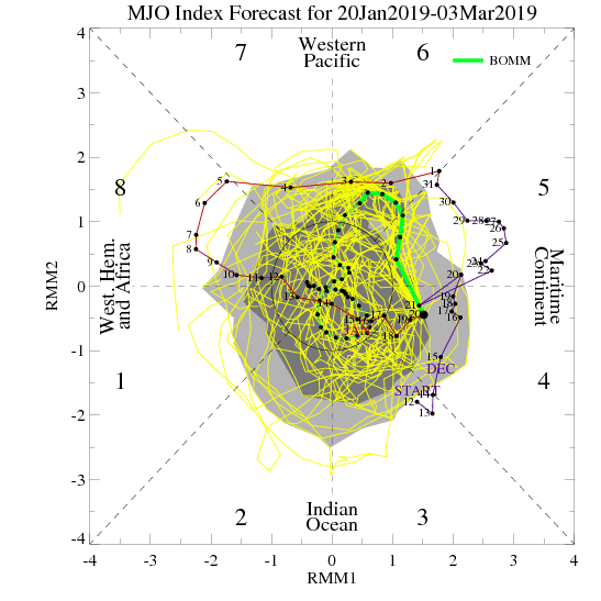
Recall that the MJO has been hyper active for the better part of this season- and has played a significant role in the winter pattern through the 1st half of this season. When the MJO features significant amplitude, it’s imperative that we pay close attention.
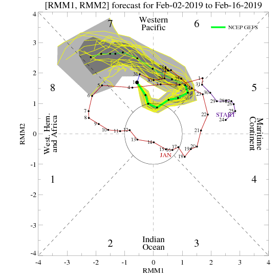

With that said, we note today that the models handle the current MJO pulse much differently between one another over the next couple of weeks.
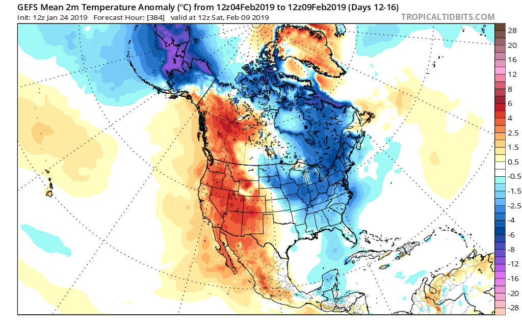
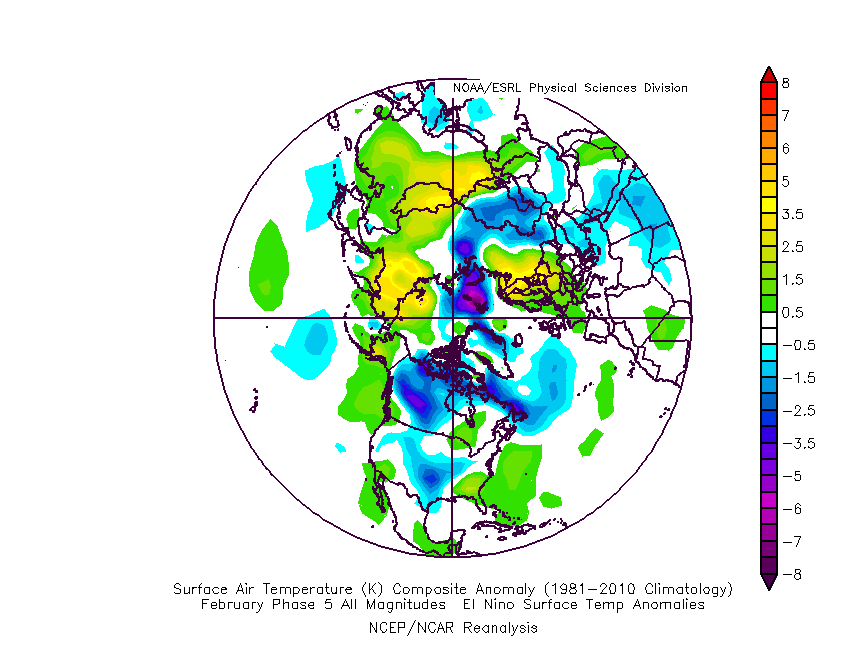
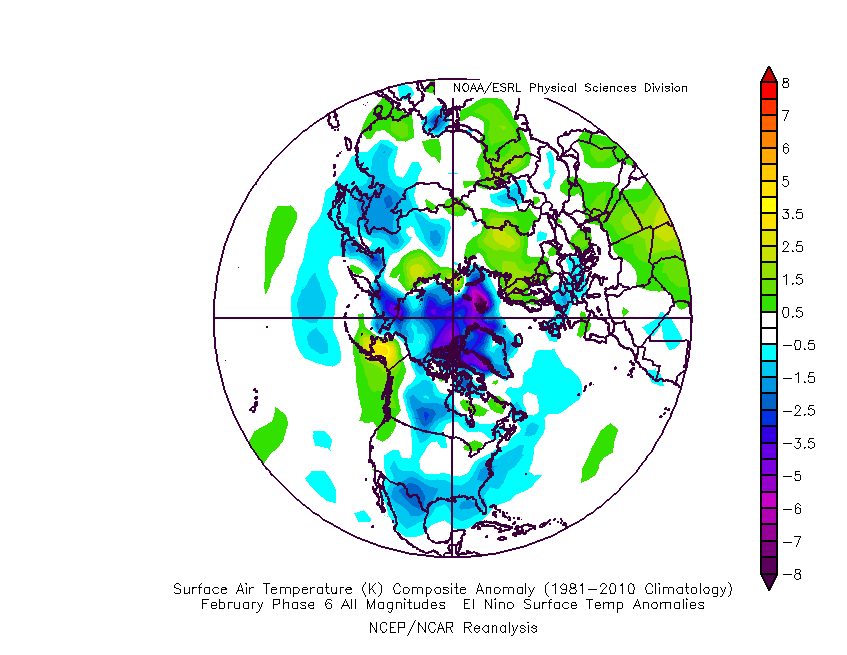
For example, let’s go with the GEFS (image 1), curling the MJO into Phase(s) 6 and 7. From a temperature perspective, this is how that would be reflected at the surface


With that said, the European is more bullish heading into Phase 8 by mid-February. If correct, that opens the door for more significant (and widespread) cold.
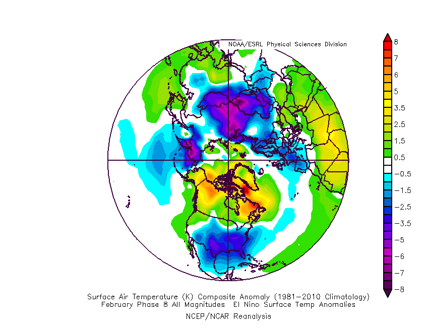
We’ll continue to keep a very close eye on the MJO over the next week, or so, and hope for better overall agreement between the data. However, given a balance of current teleconnections, SSTs, and MJO, we continue to believe the pattern over the next few weeks will transition from a “battle zone” initially towards one that features cold overwhelming the region by mid-month.
There will likely be rather wild temperature swings through the first 1/3 of the month and that will help power the active pattern. At the end of the day, we expect well above normal precipitation, near-average to slightly colder than normal temperatures, and above average snowfall during the month of February here across central Indiana.


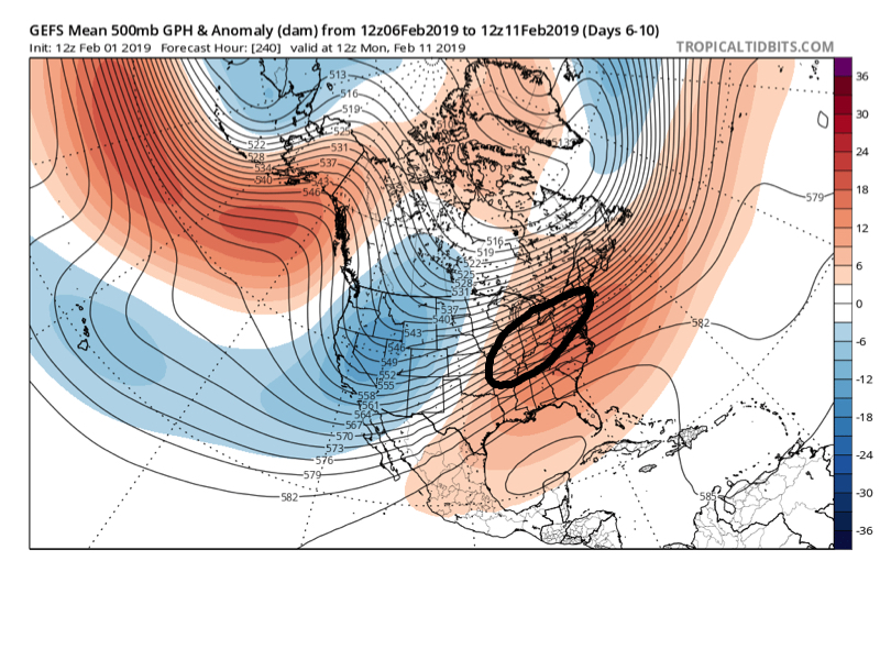

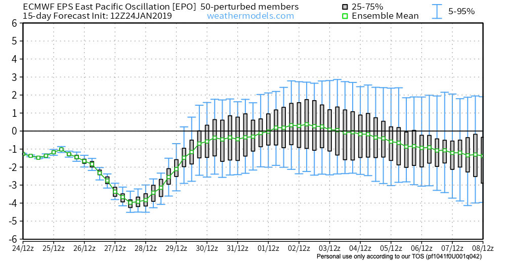
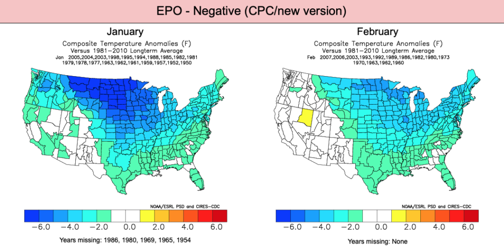
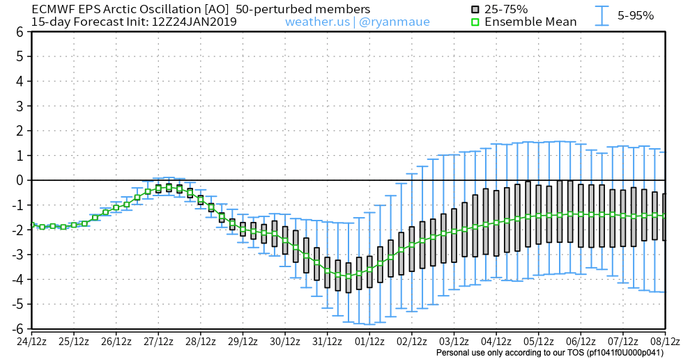
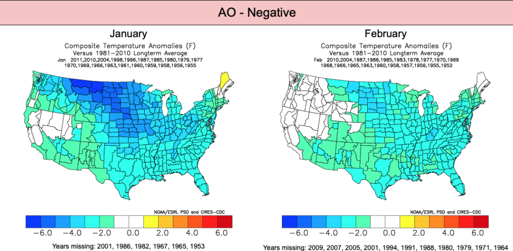
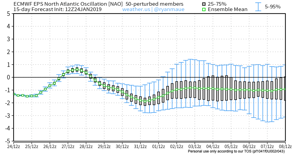

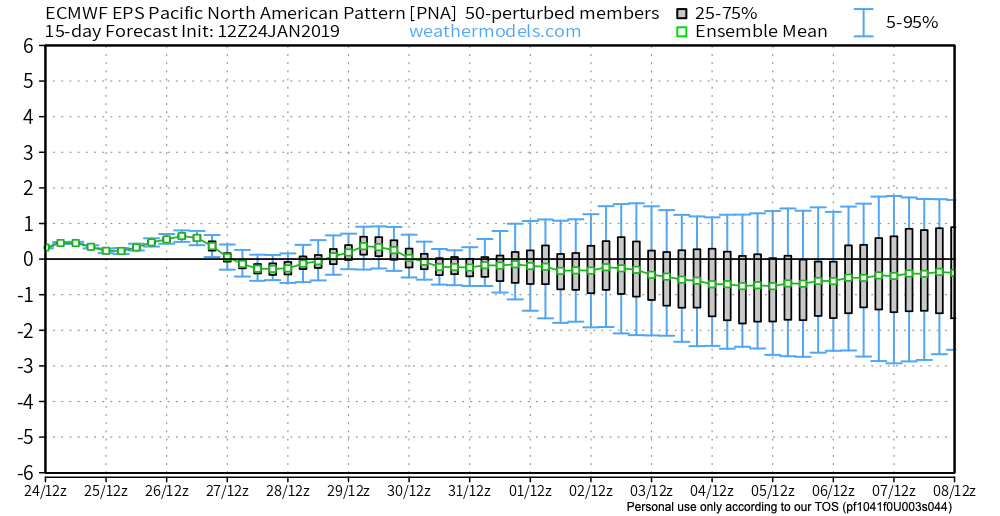
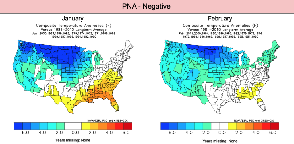
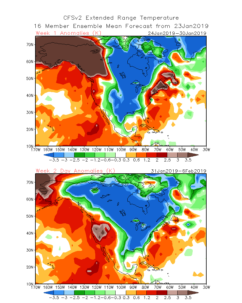
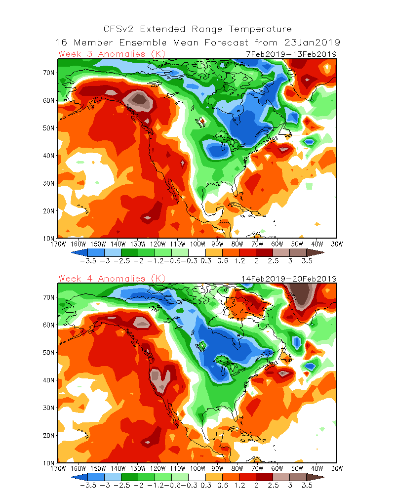
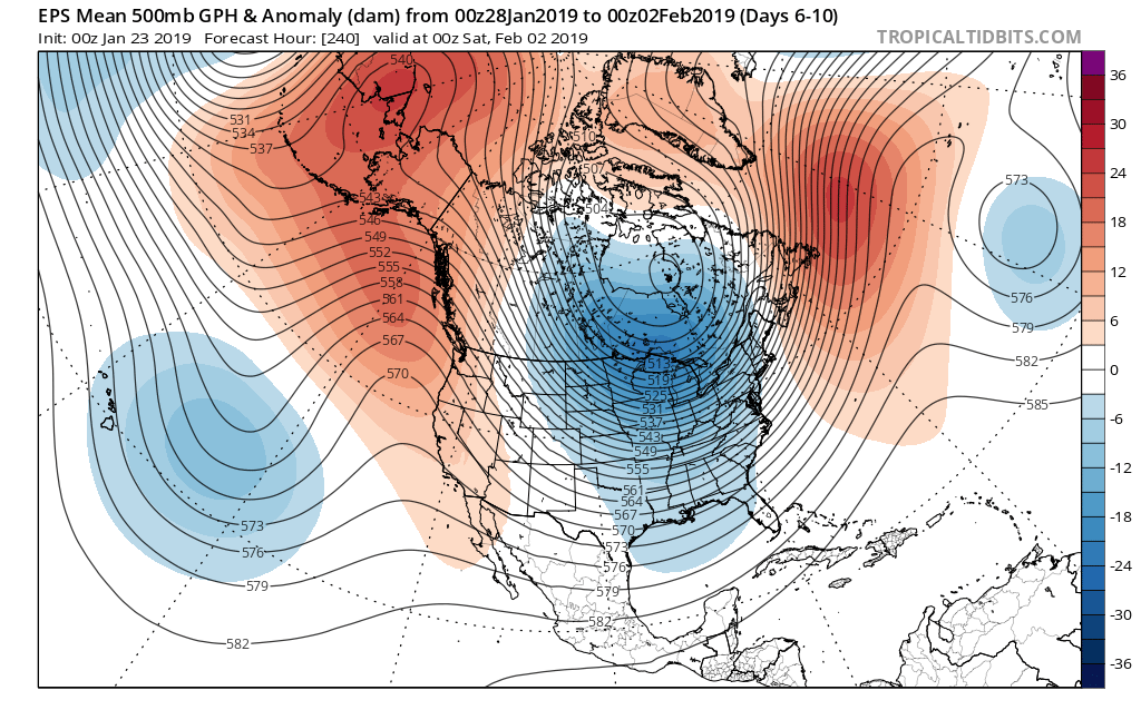
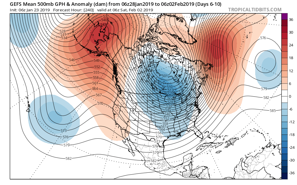 We’ve been discussing the opportunity where we see the flow slow enough to allow one or two of these clipper systems in the medium to longer range to deepen into a stronger storm system. That may be the case late weekend into early parts of next week and it’s something we’re keeping a close eye on. In addition to measurable snow, the potential is on the table for notable cold in the 6-10 day period, including multiple days below zero. In the extreme, this is the type pattern that could lead to double digit below zero cold across central Indiana- not including the wind chill.