
Category: Long Range Discussion
Permanent link to this article: https://indywx.com/tuesday-morning-video-heavy-rain-and-looking-ahead-to-a-wintry-threat-late-weekend-for-some/
Feb 04
+ AO Supports Current Warmth; Active Pattern Shows No Signs Of Letting Up Into Early March…
After the record-setting cold that gripped the Mid West and Ohio Valley for a few days, the recent “spring fling” has been welcomed with open arms by many! There are multiple reasons behind the warmth, especially with such a strong Arctic Oscillation (AO) in place.
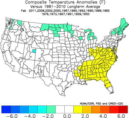
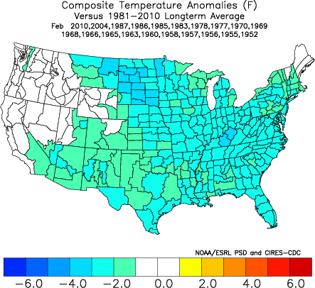
We note the strongly positive AO (image 1) and the respective temperature anomalies that should result (image 2).

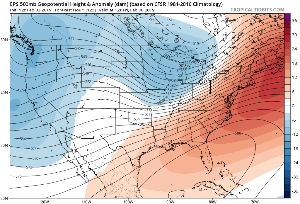
To no surprise, model data is bullish on the southeastern ridge holding firm this week.
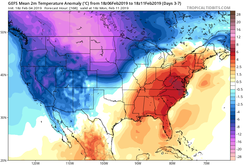
The resistance put forth by the southeast ridge, combined with the renewed arctic air building across the Northern Rockies/ Northern Plains will continue to yield a very active storm track through the Ohio Valley. We expect precipitation to remain well above normal through month’s end, continuing into early March.
As we look ahead, we note modeling is trending the AO neutral and negative for mid and late month.

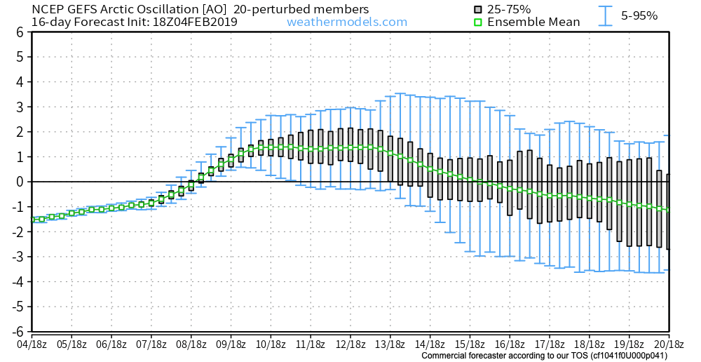
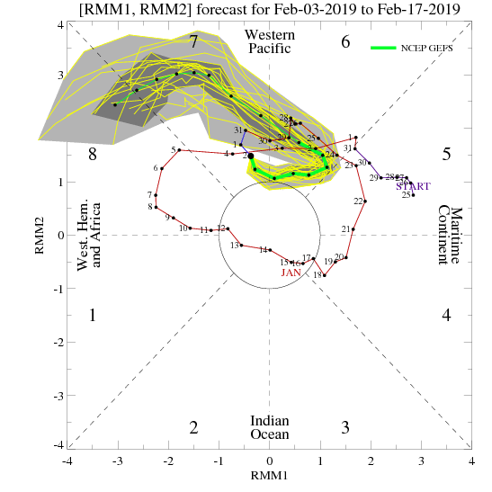
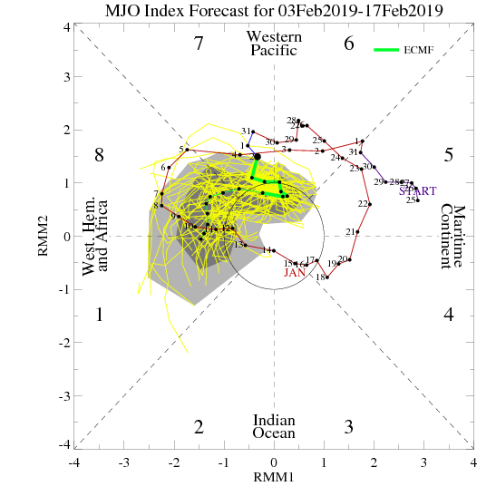
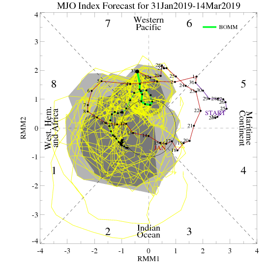
As this is taking place, the MJO is forecast to swing into Phase 8.

Phase 8 in mid to late February is a very cold phase.
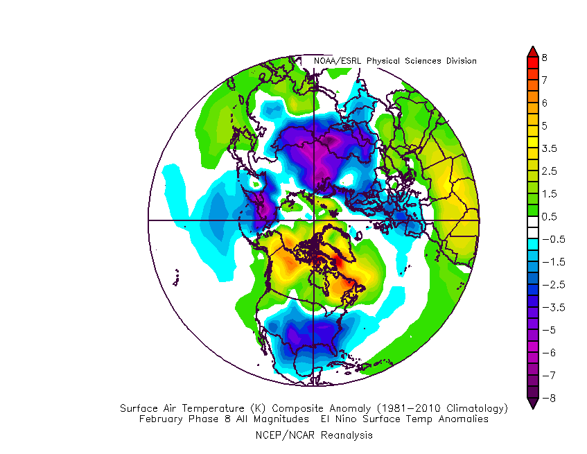
Should the AO continue to trend negative, that will only raise confidence that cold will return.
Warmth (relative to normal) will continue to rule the day through midweek before we go into more of a transitional period this weekend into next week. Though certainly colder than this week, I’m not quite ready to buy into the idea that the southeast ridge will go quietly into the night. A couple of winter threats loom late weekend into next week, but confidence is low in the specifics. It’s when we get to the last (2) weeks of the month that we think cold will regain control, along with more widespread wintry threats of significance…
Permanent link to this article: https://indywx.com/ao-supports-current-warmth-active-pattern-shows-no-signs-of-letting-up-into-early-march/
Feb 04
Monday Morning Video: Heavy Rain And Freezing Rain Potential Grabs The Headlines…
You must be logged in to view this content. Click Here to become a member of IndyWX.com for full access. Already a member of IndyWx.com All-Access? Log-in here.
Permanent link to this article: https://indywx.com/monday-morning-video-heavy-rain-and-freezing-rain-potential-grabs-the-headlines/
Feb 03
Pre Super Bowl Rambles: Stormy Pattern Shifts To A Return Of Significant Cold?
In the short-term, there’s no getting around the very active pattern in place. As we’ve been discussing, we’ll find ourselves “smack dab” in the middle of a battle ground between a stubborn southeast ridge and building cold to our northwest. The fight in between will yield well above normal precipitation over the next couple of weeks.
Over the upcoming (10) days, expect a roller coaster ride in the temperature department as the battle takes place. While the most anomalous warmth is taking place now (IND is on pace to set a new record high temperature before the end of the day), relative warmth will continue to dominate into midweek before colder air presses and wins out.
After Monday’s light rain, we’re targeting (3) opportunities for significant precipitation across the region:
I. Tuesday night-Wednesday (still may include a risk of freezing rain across north-central communities).
II. Wednesday night-Thursday morning
III. Thursday night-Friday morning (ending as light snow)
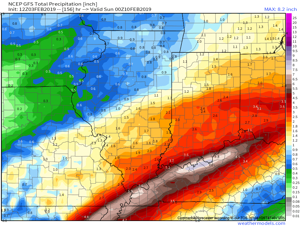
When all is said and done, model data is in agreement on significant rainfall totals across central Indiana (2″ to 3″ amounts will be common by Friday).
Thereafter, confidence is high on colder air returning as we close the week and head into next weekend.

Guidance suggests that we still need to remain abreast of the potential of a more widespread wintry event late next weekend and this is something we’ll continue to keep close tabs on as we progress through the upcoming week. As of now, this doesn’t appear to be a major event, but stay tuned.
As we look ahead, we’ll have to continue keeping a close eye on the MJO. Today’s update shows the majority of data swinging things into Phase 8 by mid to late month. Should that come to fruition, prospects of another significant cold spell loom large…

Fun times ahead- no matter how you look at it! 
Enjoy the game!
Permanent link to this article: https://indywx.com/pre-super-bowl-rambles-stormy-pattern-shifts-to-a-return-of-significant-cold/
Feb 03
Sunday Morning Video Update: Walking Through The Active Week Ahead; Looking Towards Mid-Feb…
A new week has dawned and with it will come a very busy weather pattern. Thankfully, today we’ll enjoy a “hint of spring,” including temperatures approaching the 60 deg. mark…
You must be logged in to view this content. Click Here to become a member of IndyWX.com for full access. Already a member of IndyWx.com All-Access? Log-in here.
Permanent link to this article: https://indywx.com/sunday-morning-video-update-walking-through-the-active-week-ahead-looking-towards-mid-feb/