Looking Ahead To The 2nd Half Of September…
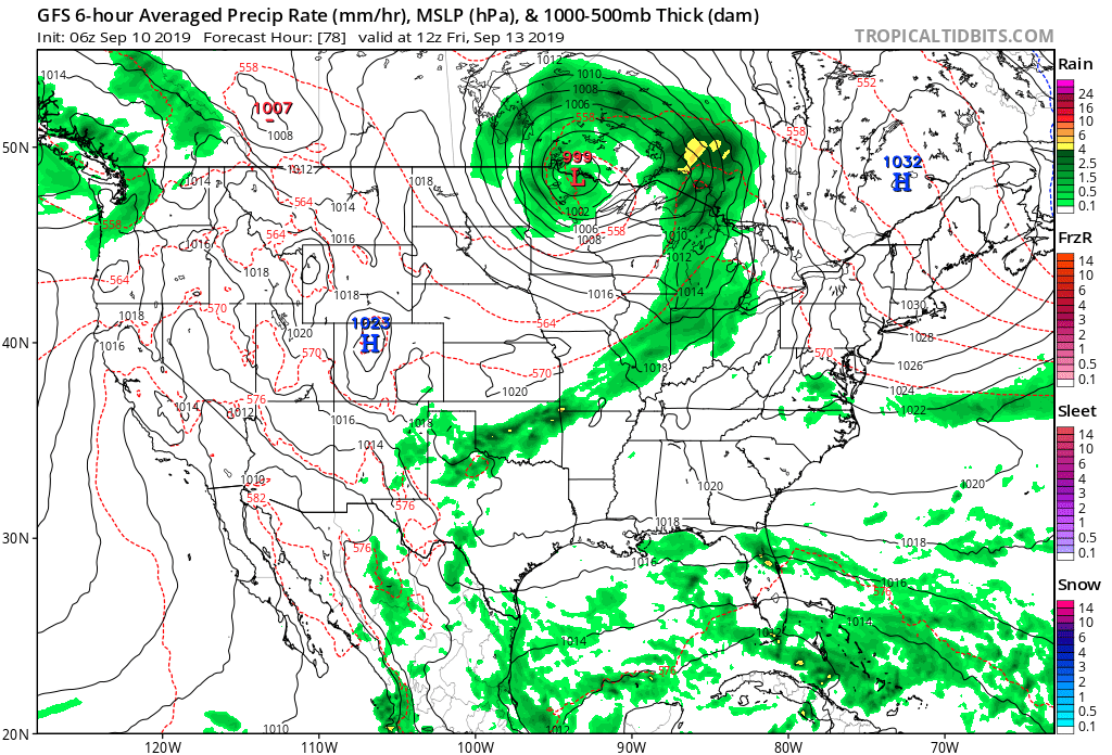
A gorgeous mid September day awaits, with plentiful sunshine and unseasonable warmth. A cold front sits off to our northwest. Meanwhile, a disturbed area of weather in the Bahamas will be monitored for the potential of further development late week into next week as it eventually moves into the Gulf of Mexico.
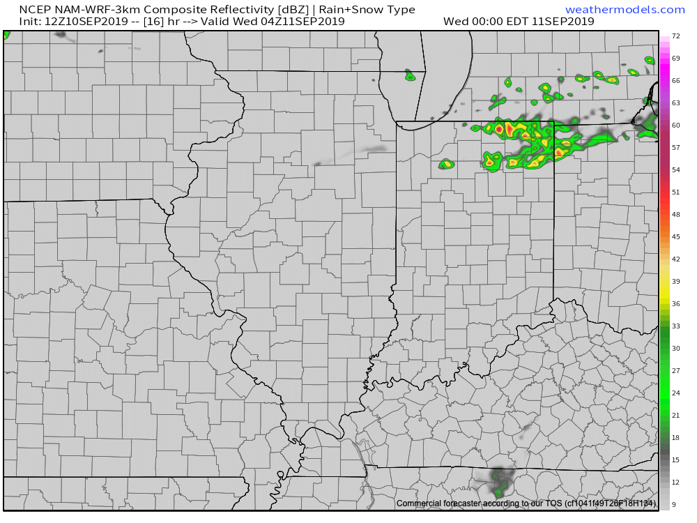
We’ll remain quiet across central Indiana today, but notice a flare up of thunderstorm activity across northern parts of the state tonight. Some of this shower and thunderstorm activity will drift south into central Indiana early Wednesday, but “widely scattered” will be the appropriate word to describe the coverage and many won’t see a drop of rain.
Scattered showers and thunderstorms will remain in the forecast Thursday into Friday before a cold front sweeps through the area. This front will lead to lower humidity as we head into the weekend, but temperatures will remain above average. While some will make it through the rest of the week without seeing a drop of rain, others may pick up 0.25″ to 0.50″ with those scattered downpours.
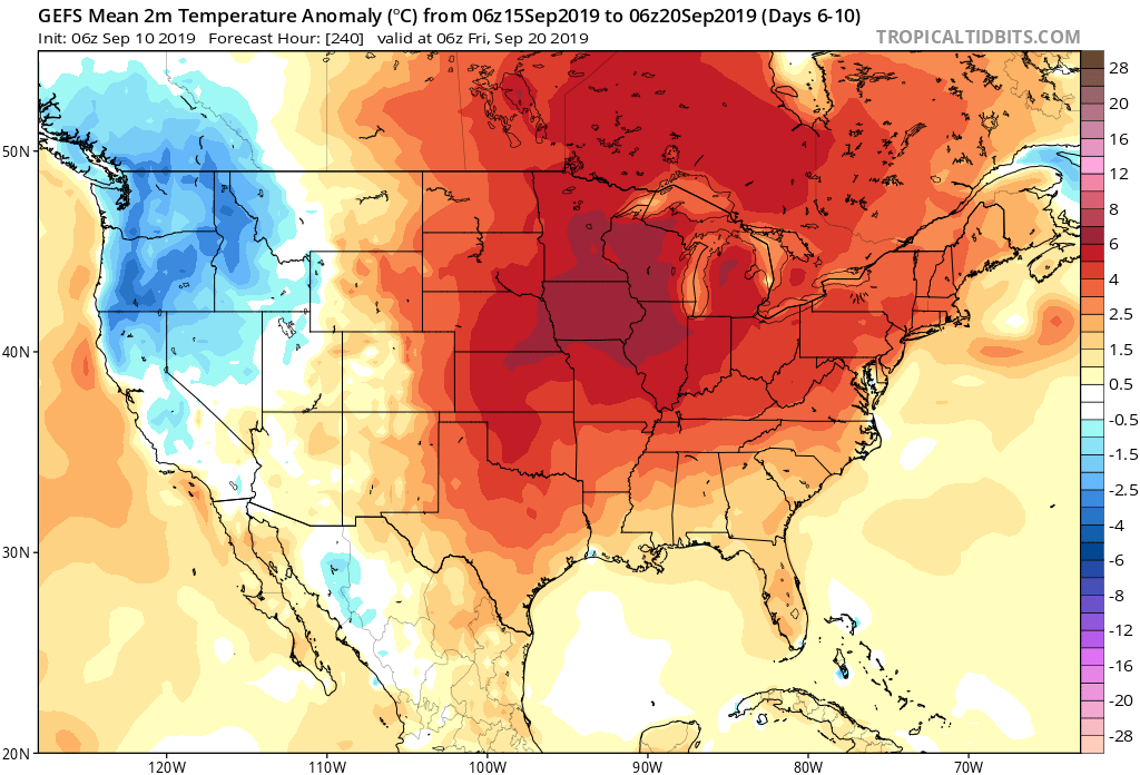
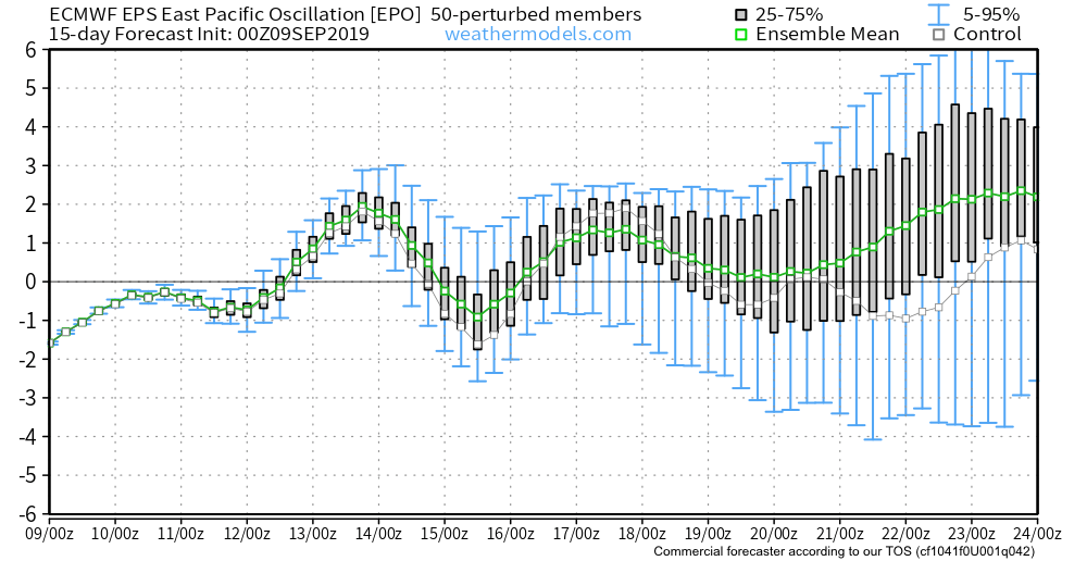
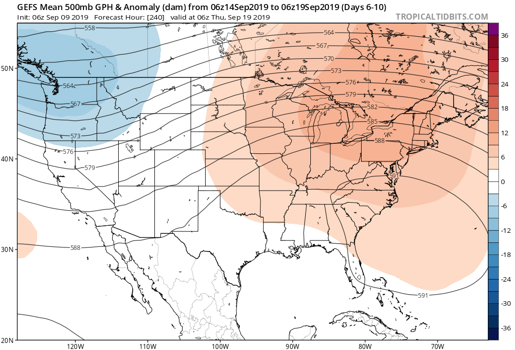
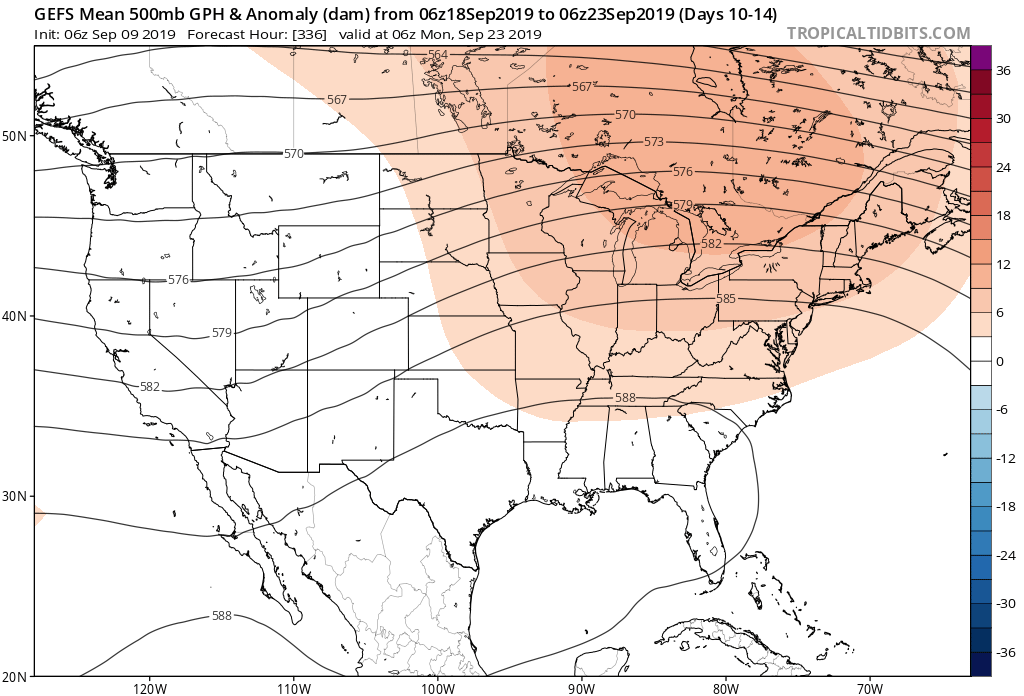
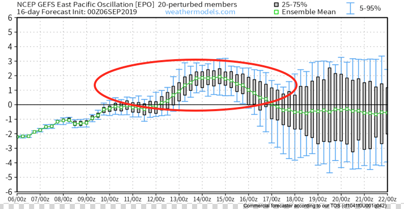
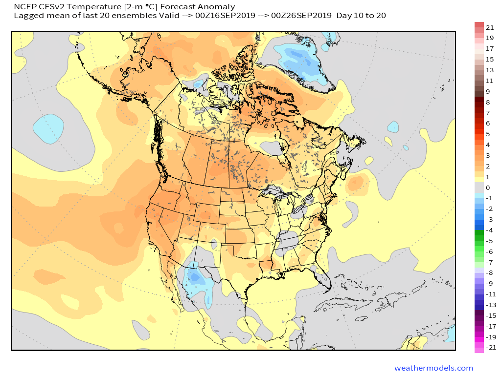
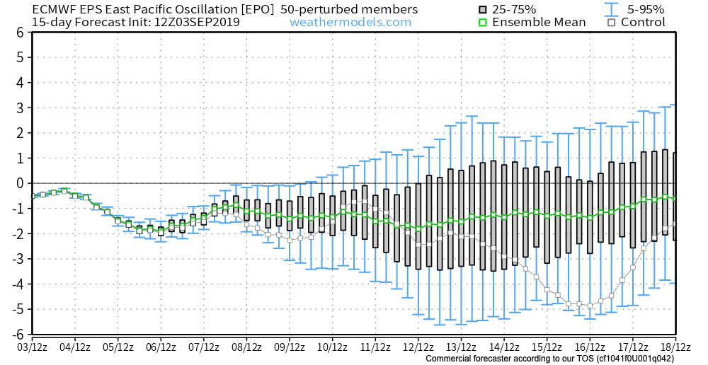
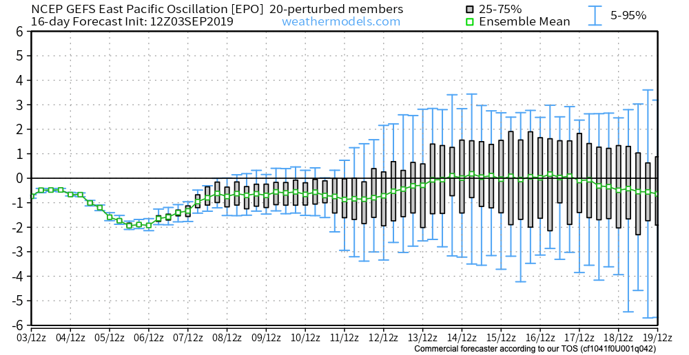
As we look ahead to the 2nd half of September, a warmer to much warmer than average pattern is anticipated to continue. A big reason behind the warmth is the predominantly positive EPO.
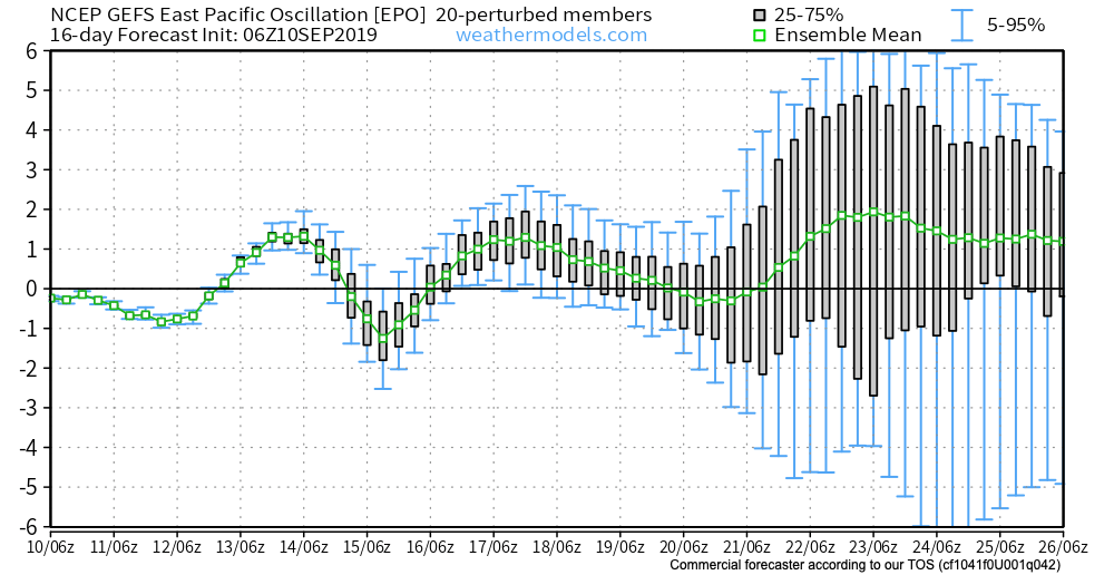
A true blow torch of a pattern will result into the late month stretch. Eventually, we should see a pull back of the heights into the NW and western Canada and more of an eastern trough showing up in the means, but this isn’t likely to take place until the last couple of days of this month or early October. Until then, expect an overall summer-like feel.