You must be logged in to view this content. Click Here to become a member of IndyWX.com for full access. Already a member of IndyWx.com All-Access? Log-in here.
Category: Long Range Discussion
Permanent link to this article: https://indywx.com/video-additional-storm-chances-before-a-gorgeous-late-week-weekend/
Aug 18
New Thoughts Around The Upcoming Winter…
While we’re still a couple months away from debuting our official annual Winter Outlook, we’re deep in research mode for what the ’19-’20 winter season may produce across central Indiana.
The very warm northeast Pacific sea surface temperatures are of the upmost interest.
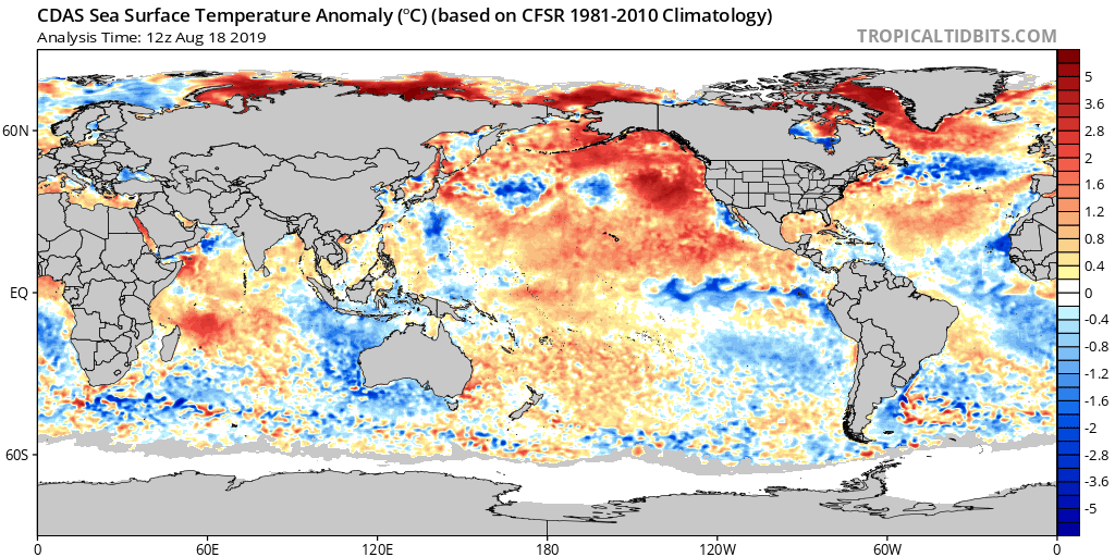
Note how the northeast PAC waters continue to warm:

These warm waters continue to “raise an eyebrow” and will have likely have a rather significant say in what ultimately takes place later this winter across a widespread portion of the country.
We don’t have to think too terribly far back to the infamous ’13-’14 winter and what the “warm blob” produced:
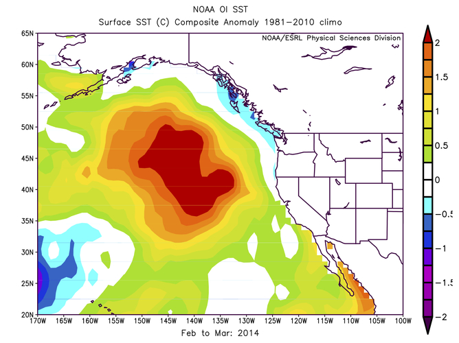
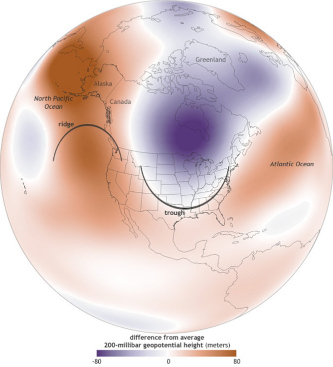
Some of the new climate models are going to a similar look at 500mb for the upcoming winter season:
In fact, one could easily make the argument with such anomalous ridgBing across western Canada, there should be more of a downstream effect (more of a significant trough across the eastern portion of the country).
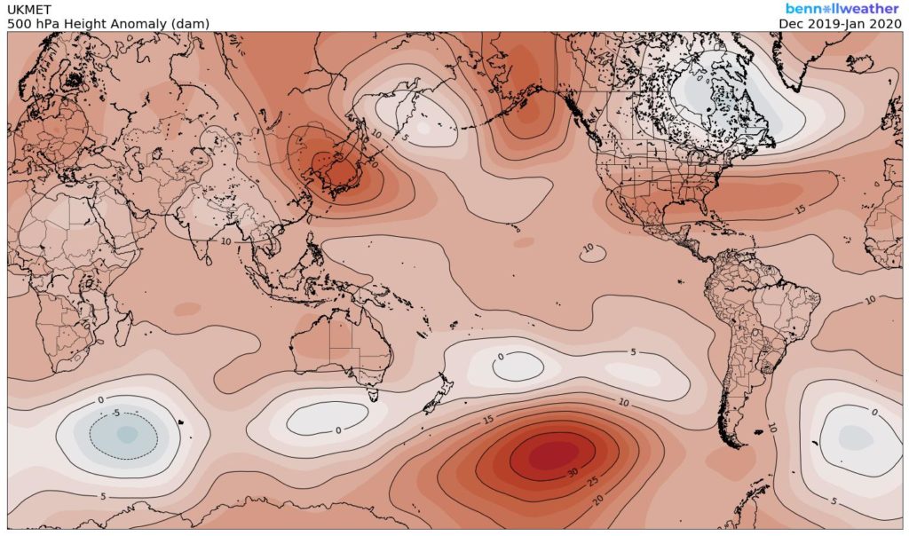
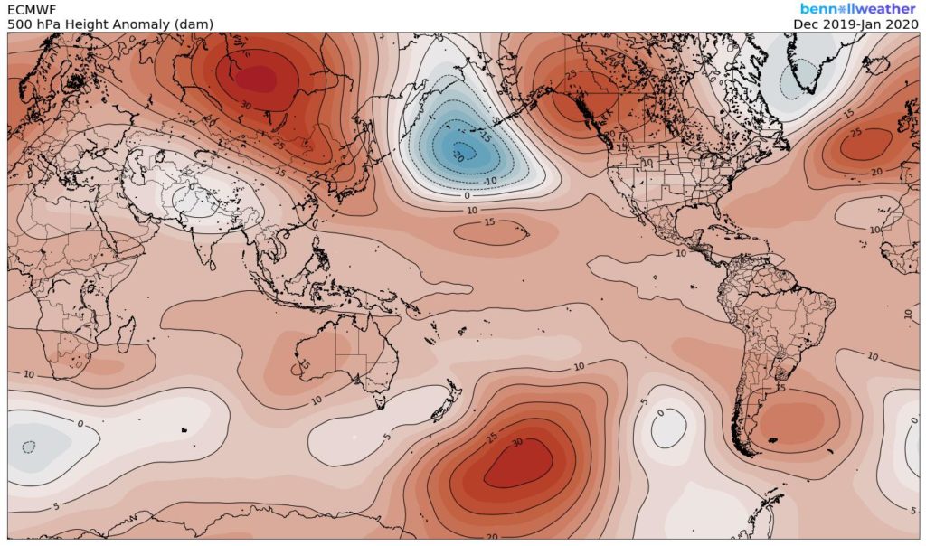
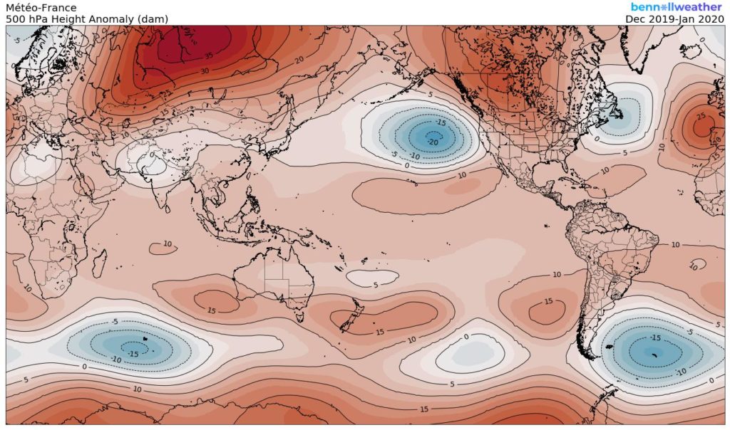
While there will be many more factors that we’ll have to build into the upcoming winter outlook, the warm NE PAC waters most certainly argue (and strongly at that) for a rather persistent western Canada/ NW Conus ridge and more of an eastern trough…
Permanent link to this article: https://indywx.com/new-thoughts-around-the-upcoming-winter/
Aug 15
Wetter Times Set To Go Along With The Warmer Pattern?
As we look to crank up the heat into the 2nd half of August, there’s growing confidence we may also add wetter times into the regime.
The most recent Drought Monitor Update shows ‘abnormal’ dryness extending through the majority of the state. While we await another update this morning (8a eastern), it’s likely to include more of central Indiana that missed out on beneficial rainfall over the past week.
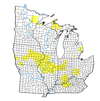
With that said, there’s growing reason to believe that an increasingly moist southerly flow will not only produce better chances of rain to close the work week and head into the weekend, but longer term as well (into the Weeks 2-3 time period).
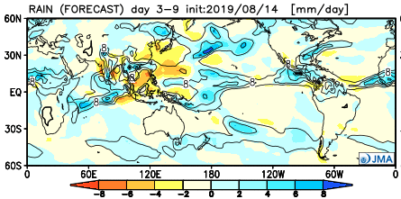
Note how the NEW JMA Weeklies are much wetter across our region not only in the more immediate term, but into the Weeks 3-4 time period, as well:
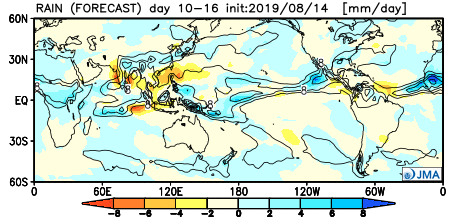

The GEFS is also showing the flip to wetter times:
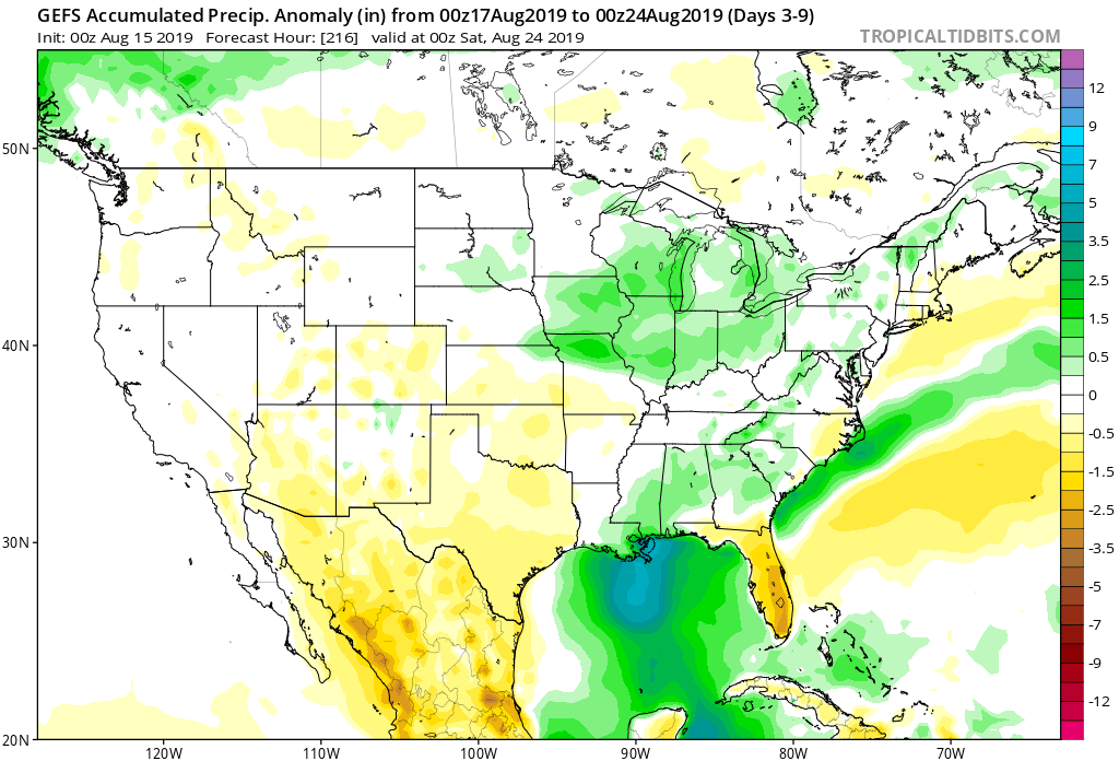
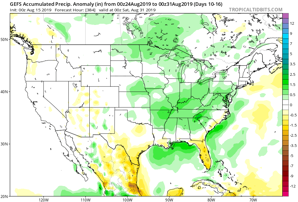
A lot of this likely has to do with the modeling seeing the impact of a Bermuda High that will help assist in steering Gulf moisture northward through the 2nd half of the month. Additionally, a fairly active storm track is expected (especially for this time of year) to our northwest and this will result in more frequent opportunities for rainfall across not only central Indiana, but a large chunk of the Ohio Valley, as a whole.
Permanent link to this article: https://indywx.com/wetter-times-set-to-go-along-with-the-warmer-pattern/
Aug 14
Changes Afoot…
Month-to-date, a negative EPO (East Pacific Oscillation) has dominated. The result has been for a cooler regime across the central into the interior Northeast.
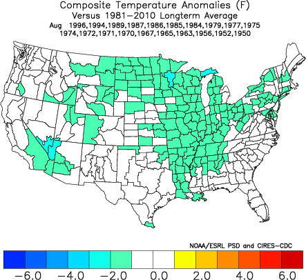
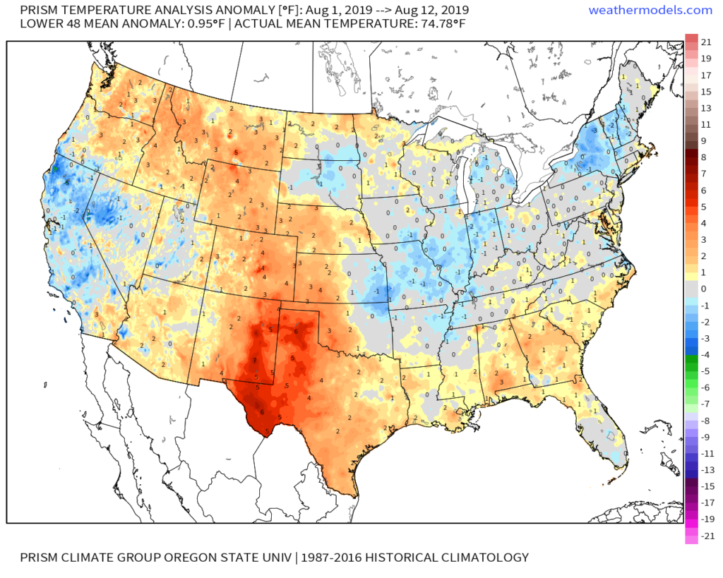
That said, big changes are taking place with the EPO and it’s set to swing strongly positive as we head into the 3rd and 4th week of the month.
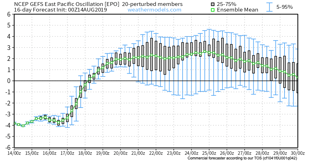
This correlates to a MUCH warmer/ hotter pattern across not only our portion of the country, but a large chunk of the Lower 48.

To no surprise, we see a building heat wave showing up on the medium to long range models with more consistency beginning this weekend, continuing into next week. This is the type regime that can lead to lows in the lower 70s and highs in the lower 90s for several consecutive days.
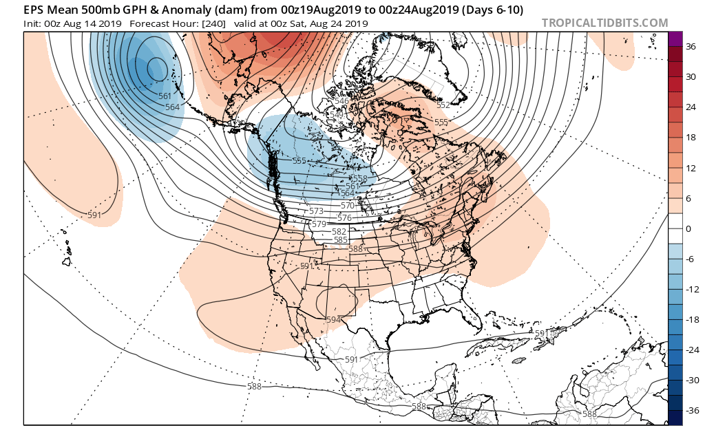
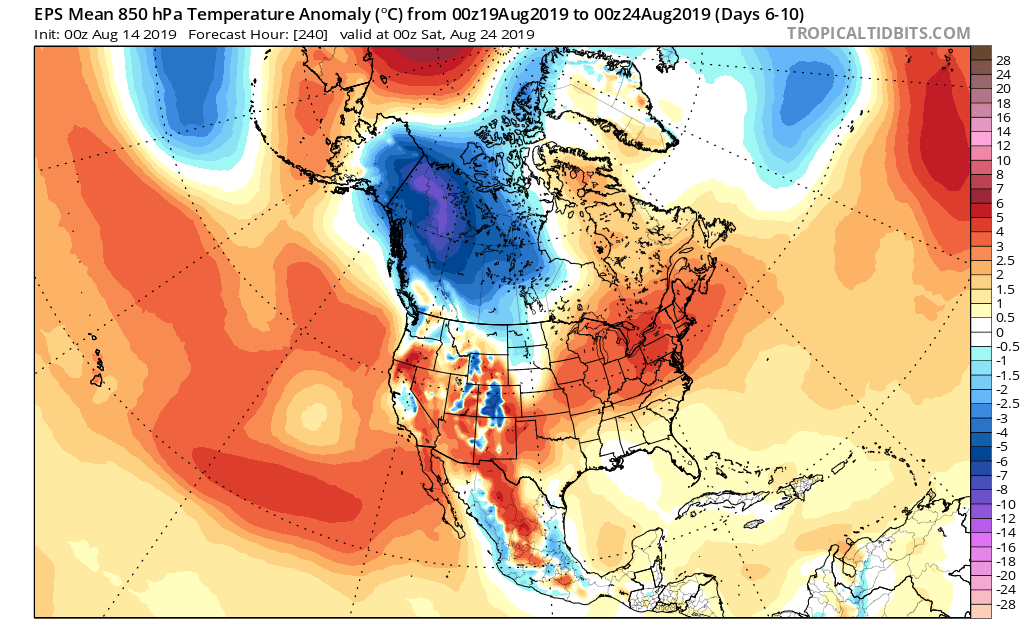
How long does the warmer pattern last? It’s all up to the EPO. As long as that baby stays positive, bet on the warmth.
Permanent link to this article: https://indywx.com/changes-afoot/
Aug 12
VIDEO: Severe Weather Event Tonight; A Lot Of “Noise” With Regard To The Late August Pattern…
You must be logged in to view this content. Click Here to become a member of IndyWX.com for full access. Already a member of IndyWx.com All-Access? Log-in here.
Permanent link to this article: https://indywx.com/video-severe-weather-event-tonight-a-lot-of-noise-with-regard-to-the-late-august-pattern/
