Long Range Update: Making Sense Of The “Noise” Into Mid-Late September…
Over the past couple of days we’ve noted a tremendous amount of chaos within the medium range forecast models for next week. At times, the American data was suggesting October-like chill while the European data painted a picture that would make mid-summer proud. The end result will likely end up being a blend of the two extreme solutions (cooler, most certainly, but not to the extent once forecast off the GFS- and a far cry from the extreme heat shown from the European). We’ll handle that with our short to medium term updates from here on out.
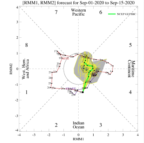
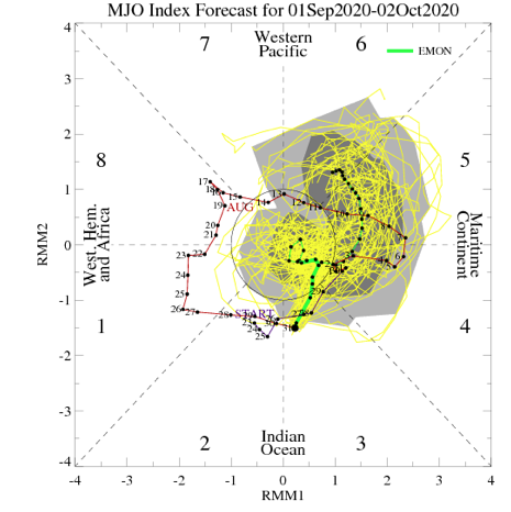
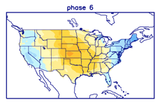
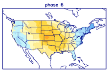
As we look ahead to mid and late September, the baseline of our forecast remains unchanged and that’s the idea that the MJO will move into Phases 5 and 6. At first, this is a cool phase for the time of year, but once to around the 18th-20th, we flip the script to a drastically warmer period, compared to average. Note the (2) MJO analogs below:

This is very similar to what the latest CFSv2 and European Weeklies show:


After what will likely be a much more active and wetter week ahead, the following couple of weeks take on a dry look from the models:


Interestingly, Phase 5 of the MJO is also a dry phase this time of year, locally:

Much more throughout the weekend!