You must be logged in to view this content. Click Here to become a member of IndyWX.com for full access. Already a member of IndyWx.com All-Access? Log-in here.
Category: Long Range Discussion
Permanent link to this article: https://indywx.com/evening-video-update-timing-out-weekend-rain-and-looking-ahead-to-a-chilly-open-to-may/
Apr 24
Looking Ahead Into May: Extended Cooler Than Normal Regime; What About Precipitation?
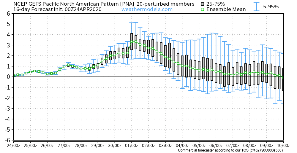
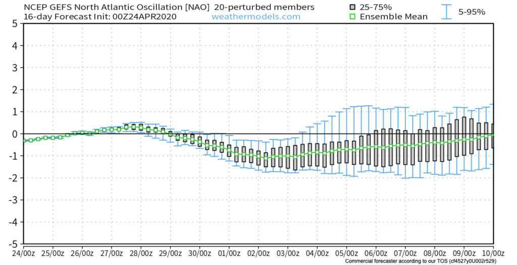
The 2 big teleconnections (at least that we lean heavily on this time of year) both favor our cooler than normal regime lasting into the early to middle part of May. That’s not to say, there won’t be periods of warmth getting into the region ahead of cold fronts, just that in the overall sense, temperatures should continue to run below normal into the 1st half of May.
We can thank the positive PNA and negative NAO.
After data aligned in handling the MJO movement into early May, disagreement has returned, and we’ll need to keep a close eye on this. Hopefully, by the time we release our official May Outlook (next week), agreement will return.
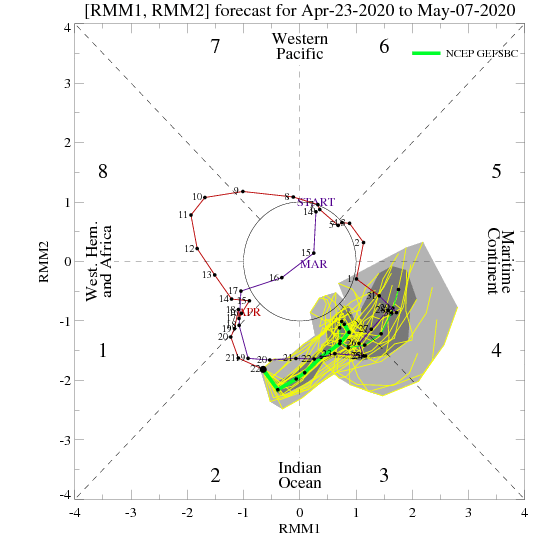
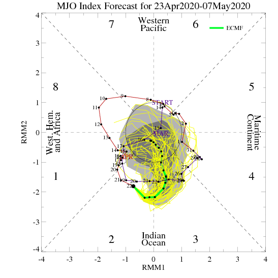
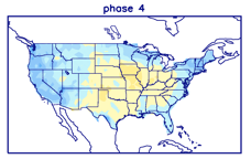
If, indeed, we do get things into Phase 4 (such as the GEFS shows), a warmer pattern should emerge towards the end of the 1st week of the month. Again, we’ll monitor these trends closely.
The latest European Weeklies remain cool into mid-May.
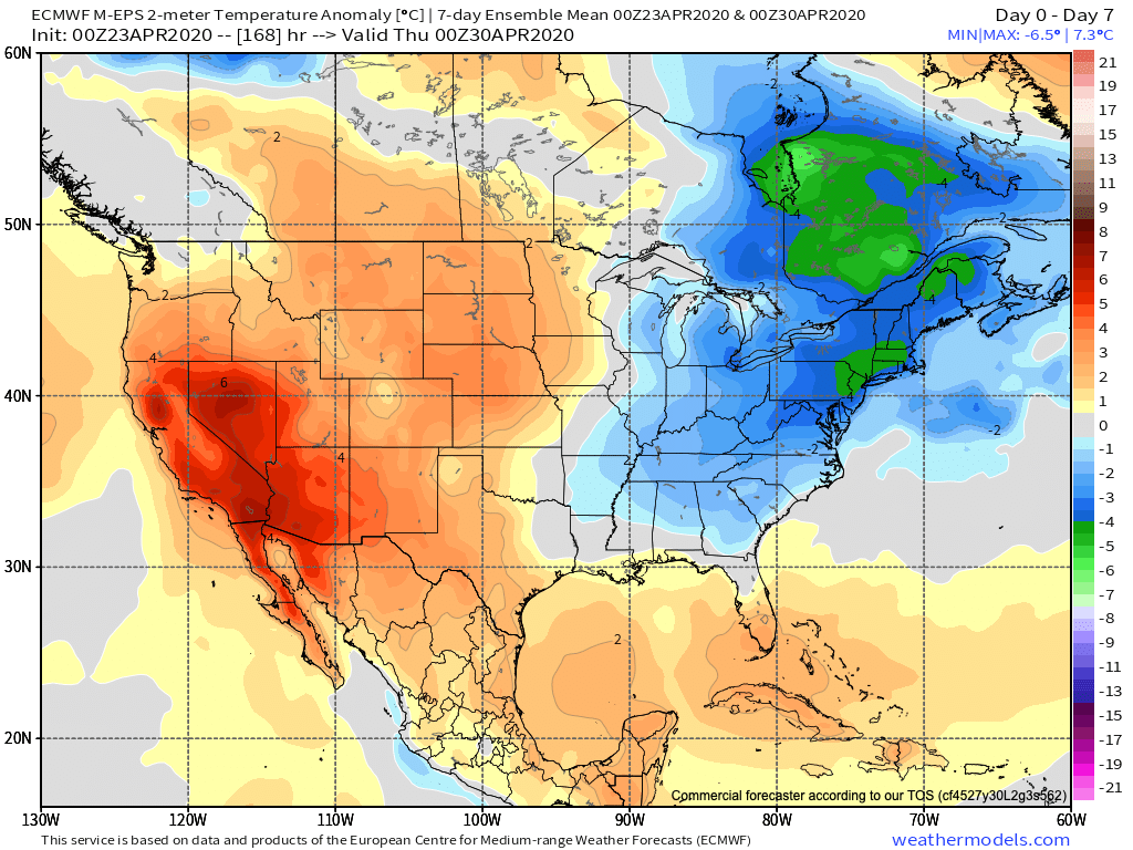
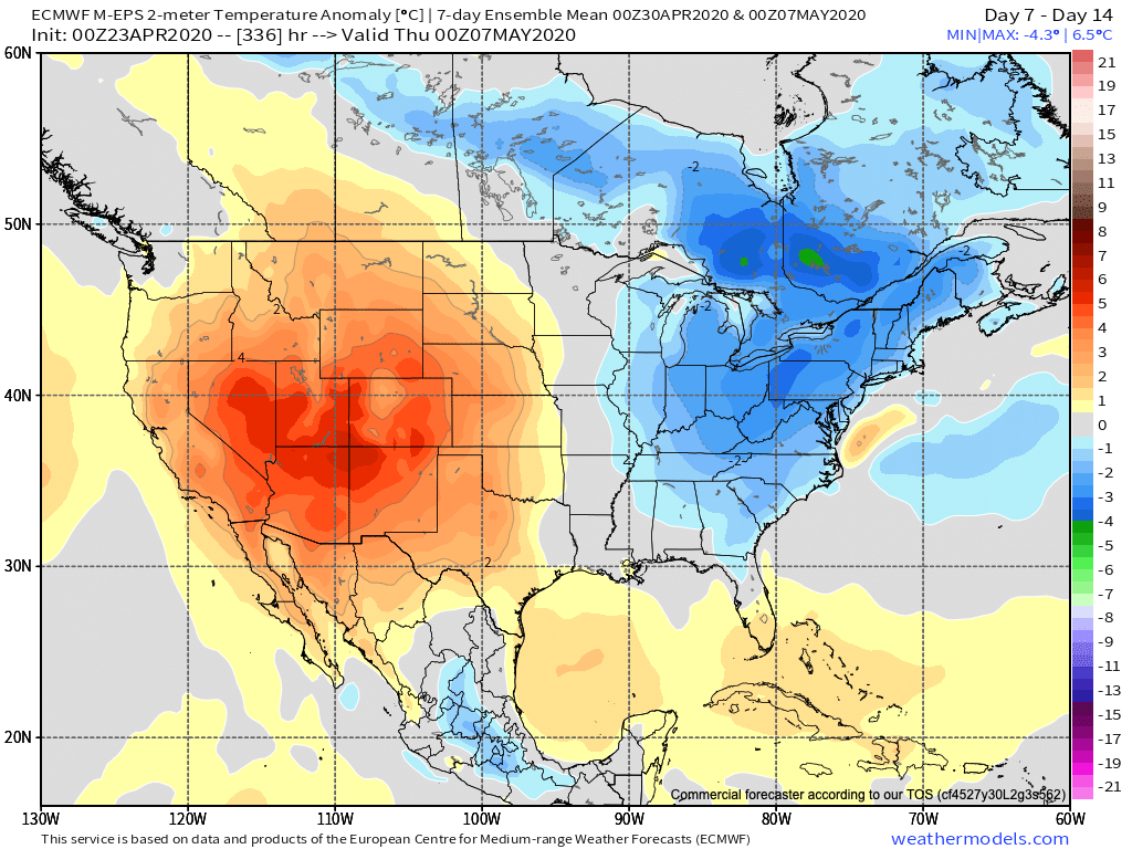
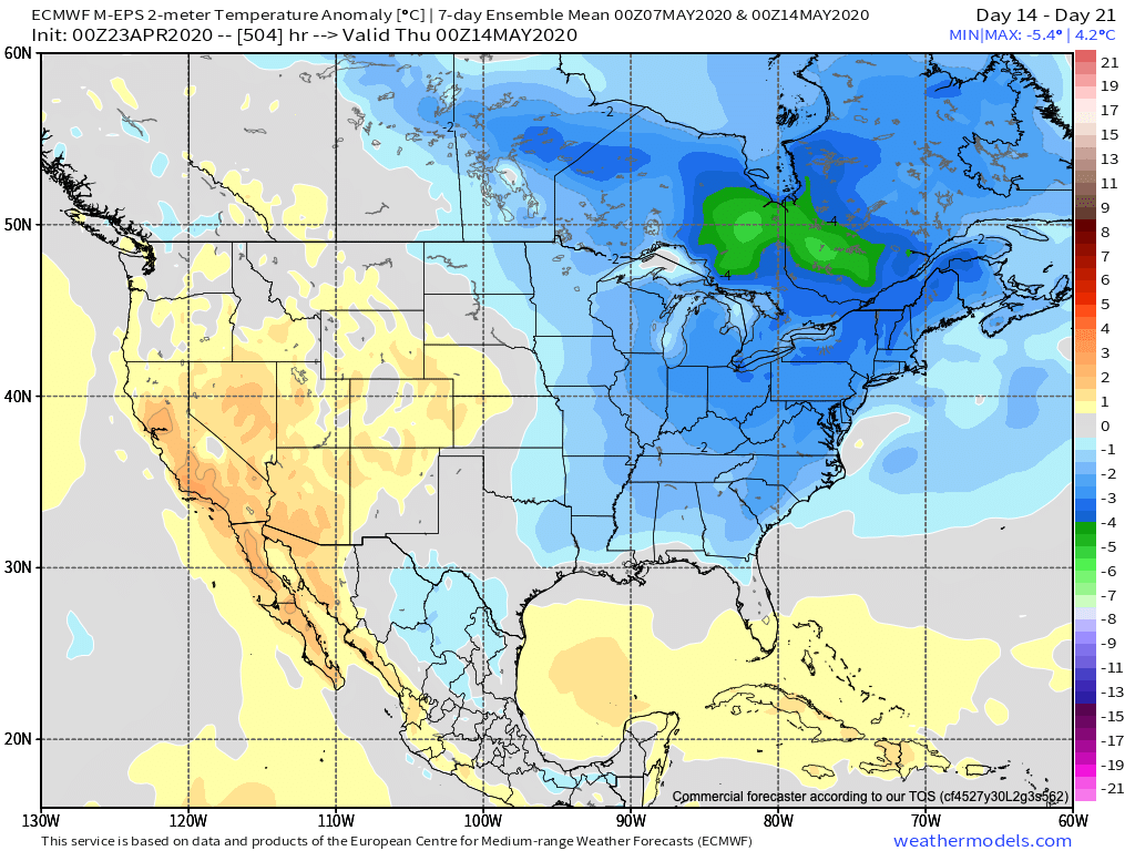
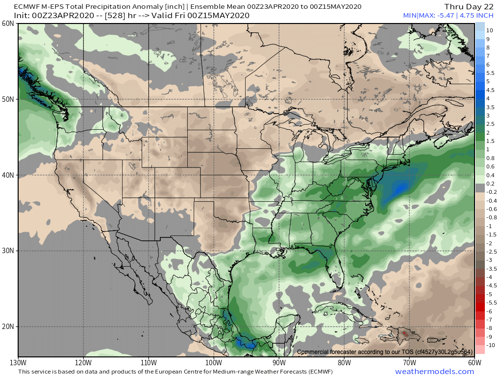
After the recent dry stretch through the majority of the month, the pattern should transition towards a more active/ wetter than normal time of things over the next 2-3 weeks.
Permanent link to this article: https://indywx.com/looking-ahead-into-may-extended-cooler-than-normal-regime-what-about-precipitation/
Apr 23
Detailing 2 Late-Week Systems; Looking Into Early-May…
You must be logged in to view this content. Click Here to become a member of IndyWX.com for full access. Already a member of IndyWx.com All-Access? Log-in here.
Permanent link to this article: https://indywx.com/detailing-2-late-week-systems-looking-into-early-may/
Apr 20
Things Turn Much More Active This Week…
You must be logged in to view this content. Click Here to become a member of IndyWX.com for full access. Already a member of IndyWx.com All-Access? Log-in here.
Permanent link to this article: https://indywx.com/things-turn-much-more-active-this-week/
Apr 19
VIDEO: Pattern Turns More Active By The 2nd Half Of The Week; Early May Ideas…
You must be logged in to view this content. Click Here to become a member of IndyWX.com for full access. Already a member of IndyWx.com All-Access? Log-in here.
Permanent link to this article: https://indywx.com/video-pattern-turns-more-active-by-the-2nd-half-of-the-week-early-may-ideas/
