Updated 11.03.21 @ 9:50p
Quick-Hitter Highlights of the ’21-’22 Winter season:
I. Expecting a fast, cold, and wintry start to the season.
II. Active times continue, but expecting a pull back in the cold mid and late winter.
III. Overall, expecting a slightly warmer than normal winter, locally.
IV. Forecasting 20″ of snow at IND this winter (first flake to last flake- average is 25.5″).
A weak La Nina is expected to dominate headlines, globally, this winter. We know no Nina, Nino, or La Nada event is going to behave identical but we can look back at the archives and pull together analogs to perhaps get some sort of indication of what the coming months will dish up!
In short, we expect an active storm track through the Ohio Valley and upper Mid West this winter. A “typical” La Nina pattern (remember the disclaimer above, however) features a wet and cold Northwest with an active jet stream pushing frequent storm systems through the Ohio Valley and interior Northeast. Many times, the aforementioned jet stream pattern can lead to an unseasonably warm and dry south-central into the Southeast- overall.
There are certain wild cards that can create headaches in any winter, including the NAO, AO, MJO activity, and Pacific patterns (namely, PNA and EPO).
In our research looking back at La Nada and weak Nina events, there’s a clear tendency for fast starting winters. We’ve been sharing this idea through the summer months and continue to believe a rather significant and perhaps dramatic shift towards cold, wintry conditions looms to wrap up November and head into December.
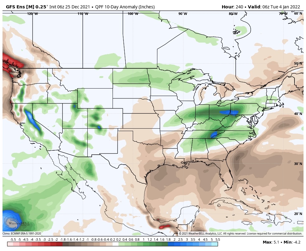
Getting right to the point, we lean towards December featuring average temperatures that range close to 3° below normal and features above average snowfall of 7″ to 10″ across most central Indiana reporting sites, including IND (where the Dec. average is 6.4″).
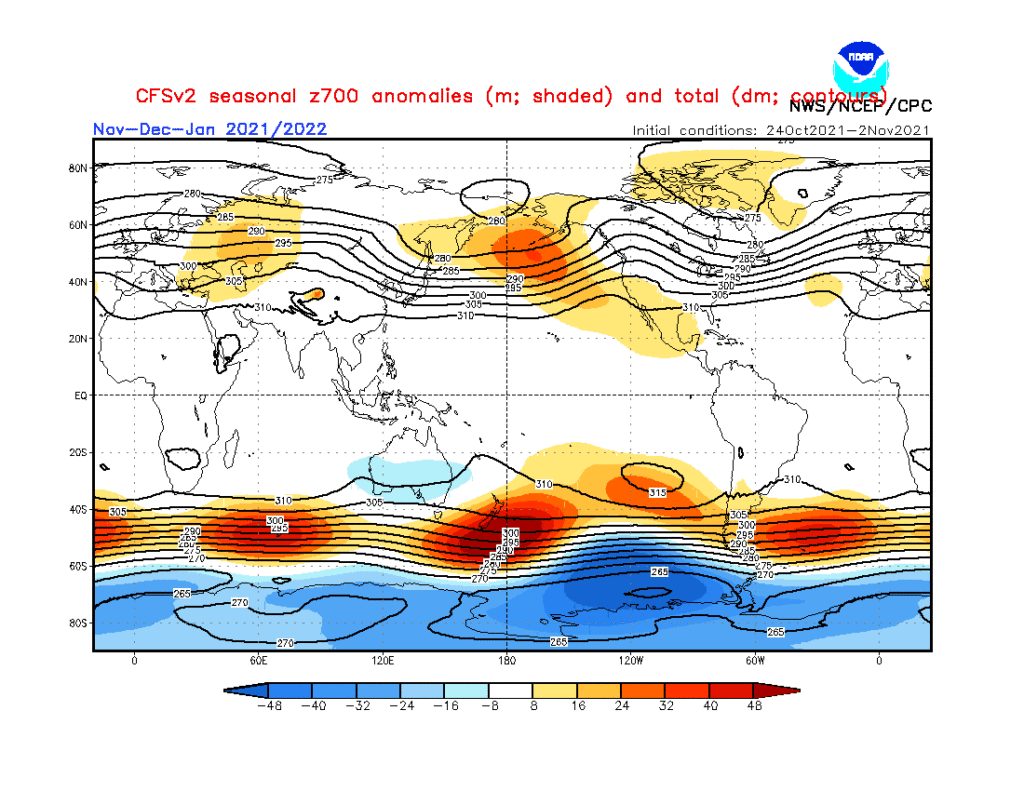
The way the CFSv2 seasonal handles the evolution in the upper levels over the course of the late fall into early spring makes sense to us.
Note how the trough begins to pull back into the West towards mid and late winter. While the active storm track will likely continue to keep us on the playing field for the “perfect marriage of moisture and cold,” the overall pattern should lead to more of a wet/ warm/ mixing issue as compared to cold being able to maturely lock-in to provide an above average snow season across central and southern portions of the state. Across the northern 1/3 of the state, that’s a different story as early season lake effect will also add up!
The idea here is that while we get off to a fast start this winter, it likely will transition towards a milder regime just after the New Year and continue for the better part of the remainder of the winter. That’s not to say we won’t get transitional cold blasts (as is the case in any winter around these parts), but what should be a pattern that drives persistent cold to open meteorological winter is likely to shift in a manner that pulls that cold into the West and opens us up to relatively milder times though continued active for the remainder of January and February. This is based on the current and expected development of sea surface temperatures in the central Pacific, as well as the anticipated MJO activity.
The wild card that can *potentially wreck havoc in this idea 🙂 is that NAO and AO, especially as we get into the 2nd half of winter. Unfortunately, there’s no way to peg those tendency’s with any sort of accuracy this far out.
The IndyWx.com 2021-2022 Winter Outlook for Indianapolis includes a total of 20″ of snow (first flake to last flake) and temperatures (meteorological winter: Dec. through Feb) that run 1.5° above normal.
Happy snow, y’all!