
The new JMA Weeklies are in and highlighted by the following:
- Heat relief on the way through Week 1
- Core of heat, relative to normal, backs west through the period
- Active NW flow regime to open July
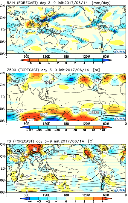
Week 1:
The JMA Weeklies really try to emphasize the “transient” nature of the pattern and associated dry, hot weather some folks were becoming concerned about only a couple of days ago. Week 1 is highlighted by a much wetter regime through the Ohio Valley and most of the East. As the ridge pulls back west, a cooler regime returns to our region, while the Southwest bakes with anomalously hot weather.
 Week 2:
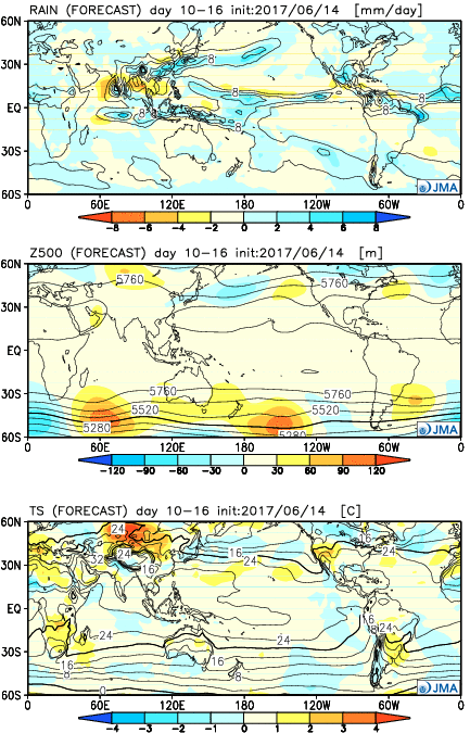
The pattern favors wetter than normal conditions across the upper Mid West, including Great Lakes. The mean upper ridge is forecast to remain out west. Fittingly, the warmest temperatures, relative to average, will be confined to the west.
 Weeks 3-4:
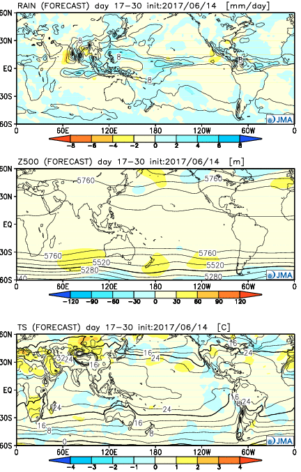
As we push into July, the upper pattern sets-up in a manner that will require us to keep a very close eye on storm potential. With a northwest flow aloft, we’ll have to be mindful of the potential of storm clusters impacting the region- tracking northwest to southeast. Through the balance of the period, the hottest weather should remain to our west, relative to normal.
 Week 2:
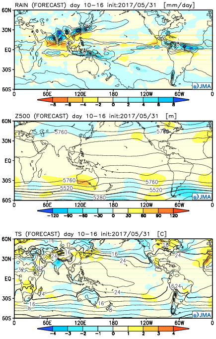 Weeks 3-4
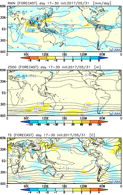
 Week 2:
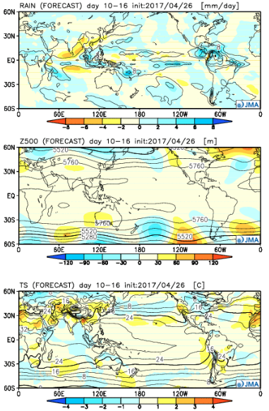 Weeks 3-4:
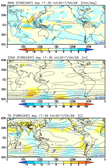
 Week 2:
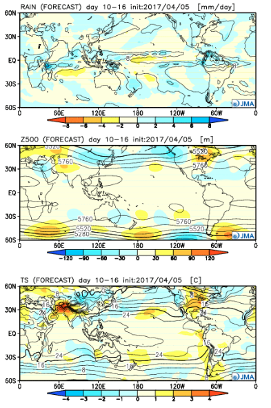 Weeks 3-4:
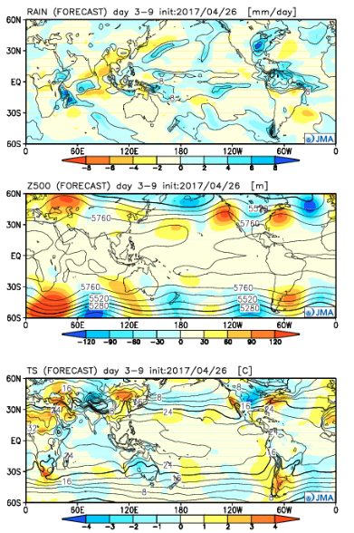
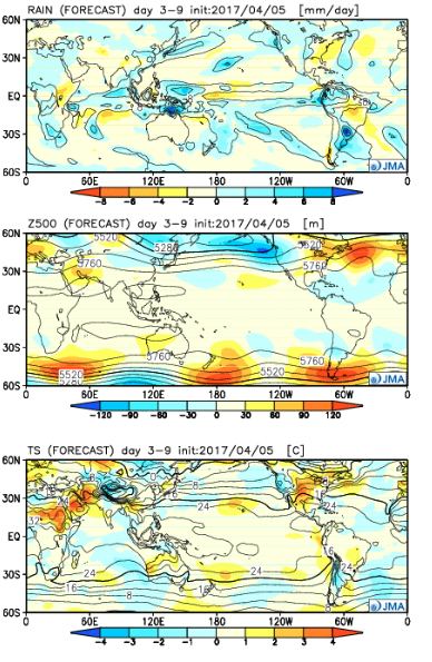
 The big picture is one that shows a drier pattern developing across the East during Week 1, but we caution that this drier regime doesn’t look to “lock” in. Data suggests we get back to an active pattern between Week’s 2-4, biased wetter than normal in the Mid West and Plains. The other screaming message is that a busy severe season should continue through the period. Cold sets up across the Pacific Northwest, associated with the “mean” trough position, while spring-like warmth continues to build across our region in overall terms. We know what that means as storms eject off the Rockies and track east…