Saturday Morning Rambles: Unsettled Weekend And Looking Ahead…
It was a tale of two worlds across the state on Friday. Despite a couple of non-severe, gusty showers that impacted western portions of the state Friday evening, the majority of the “excitement” took place in the eastern half of the state. Multiple large hail, wind, and tornado reports were included along with heavy rain. When we look at storm total rainfall through 8a today, we note widespread 2″ to 3″ amounts across eastern Indiana. Muncie recorded amounts in excess of 3″!
 As we look ahead, our weekend weather will continue to be dominated by a “cut off” area of low pressure. As it meanders around the region, shower and thunderstorm chances will remain. Aerial coverage of rain will reach greatest heights during the afternoon and evening hours today and Sunday. With the colder air aloft, don’t be surprised if a few of the stronger showers produce hail.
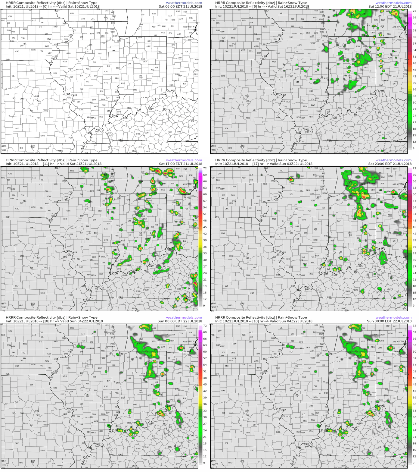 Additionally, highs today will run close to 10° below the average high of the mid-80s.
As we open up the new week, showers and embedded thunder will also be around Sunday before the upper low begins to lose it’s influence on the region. We’ll maintain shower chances into the new work week, but overall coverage should be diminished Monday.

A couple of cold fronts will make a run at the Ohio Valley over the upcoming week. The first will pass through during the midweek stretch, followed by a stronger frontal passage as we get ready to head into the weekend. Each front will provide a shower/ thunderstorm threat. A stronger push of pleasantly refreshing air should arrive behind front number 2 as we head into next weekend.
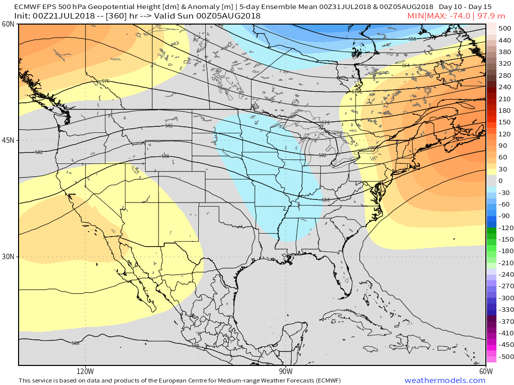
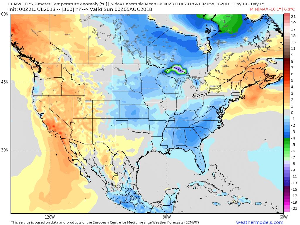
On the temperature note, models continue to show a cooler than average pattern as we open August.
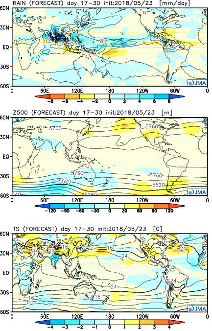
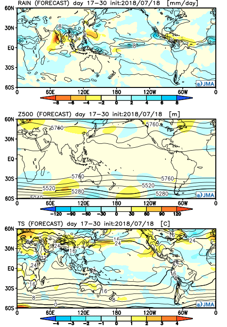
 Longer term, the NEW JMA Weeklies suggest the worst of the summer heat is now behind us as they keeps the Weeks 3-4 time period unseasonably refreshing…
 Week 2
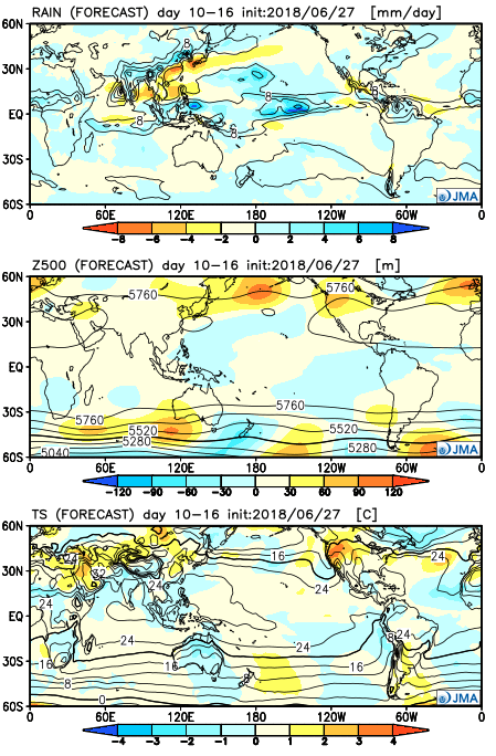 Weeks 3-4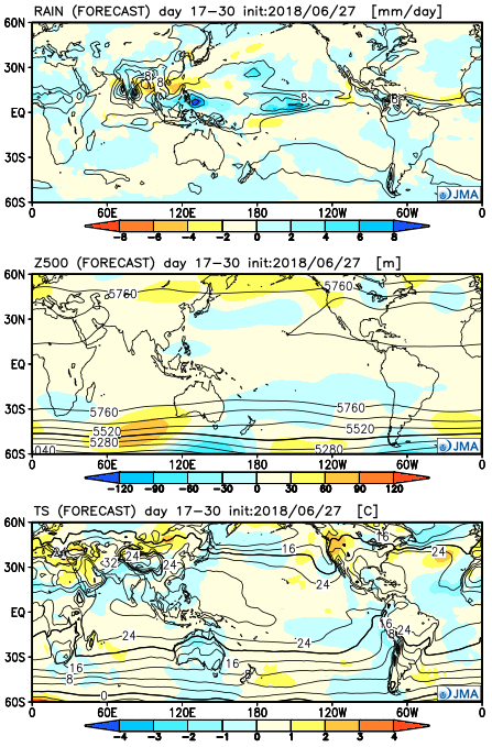
 Week 2
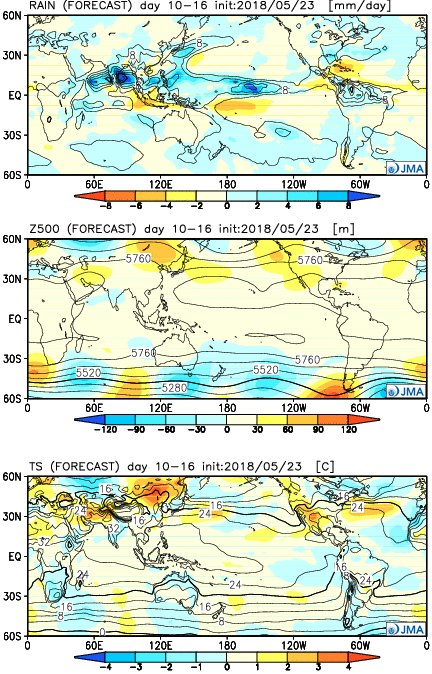 Weeks 3-4