Deeper Look Into The Long Range…
You must be logged in to view this content. Click Here to become a member of IndyWX.com for full access. Already a member of IndyWx.com All-Access? Log-in here.
You must be logged in to view this content. Click Here to become a member of IndyWX.com for full access. Already a member of IndyWx.com All-Access? Log-in here.
You must be logged in to view this content. Click Here to become a member of IndyWX.com for full access. Already a member of IndyWx.com All-Access? Log-in here.
Thursday features updated weekly products from both the JMA (morning) and European (evening). We’ll update this post tonight once the European Weeklies are in.
The updated JMA Weeklies show a hot open to September as a significant upper ridge takes up residence over the eastern portion of the country. While the upper Mid West gets in on heavy rain, it’s a rather dry pattern, locally. Sure we’ll have typical “splash and dash” variety of storms through the Labor Day weekend, but nothing worth cancelling any of your outdoor plans. In fact, we recommend incorporating a visit (or two) to the pool over the weekend as well above average warmth and humidity dominate.
Week 1
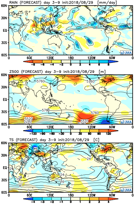 “Transitional period” summarizes this timeframe. The upper ridge begins to retrograde during Week 2, but it’s still a warmer than average pattern. It’s a rather dry pattern, as well.
Week 2
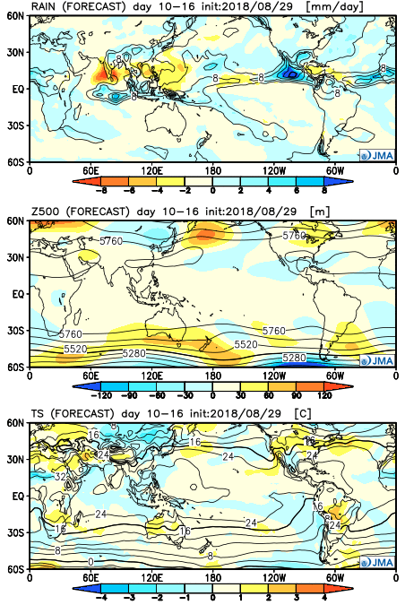 Craving a more “fall-ish” regime? The model says you’re in luck towards the middle of September and would make sense with some of the larger pattern drivers we’re beginning to see behind the scenes. The ridge axis shifts west and allows a cooler than normal pattern to descend into the central part of the country.
Weeks 3-4
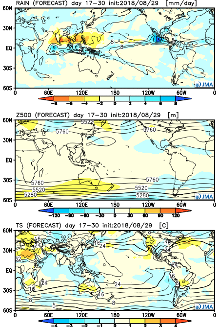
Summer has been dry, thus far, for central Indiana. With the last month of meteorological summer on the doorstep, will that continue?
Before we discuss further, let’s check-up on precipitation anomalies at IND (through July 28th).
We have discussed the upcoming shift to a wetter regime that will develop Sunday into the first half of next week. A Saturday evening update continues to point towards increasing rain chances arriving as we rumble into Sunday evening. As expected, this morning’s high resolution NAM was likely a bit too excited on the initial wave of moisture and has come around to a “more realistic” idea in our opinion.
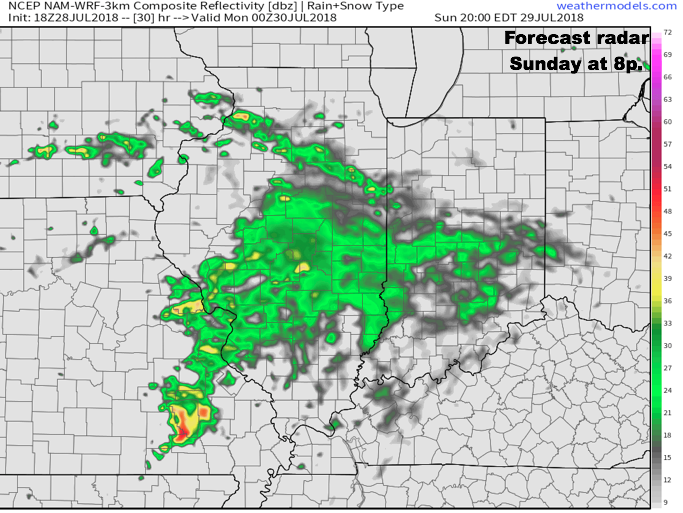 Rain and embedded thunder will likely be rather widespread early Monday, especially across the southern half of the state.
 Data continues to point towards the greatest coverage of rainfall arriving Monday night and Tuesday. We still expect a widespread 1″ to 2″ rain for central Indiana before things begin to wind down mid to late week. There will be locally heavier totals.
As we look ahead, we think the balance of the month of August will feature an upper ridge across the western portion of the country that will keep our immediate region in an active northwesterly flow aloft. Perhaps the GEFS is seeing this best at the moment (important to note the model has been consistent with respect to run-to-run updates as of late). This is a wet signal this time of year…
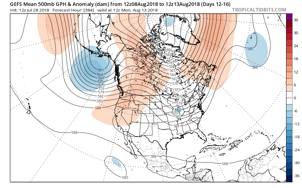
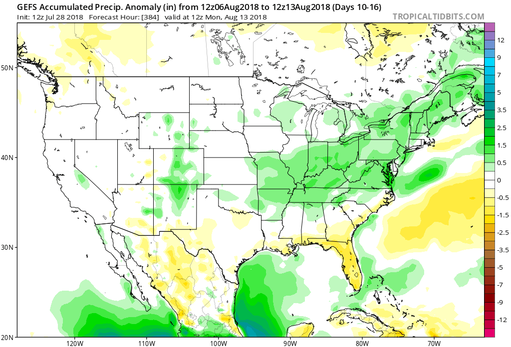 The model has support of a return to wetter times as noted from the latest JMA Weeklies, CFSv2, and European ensemble.
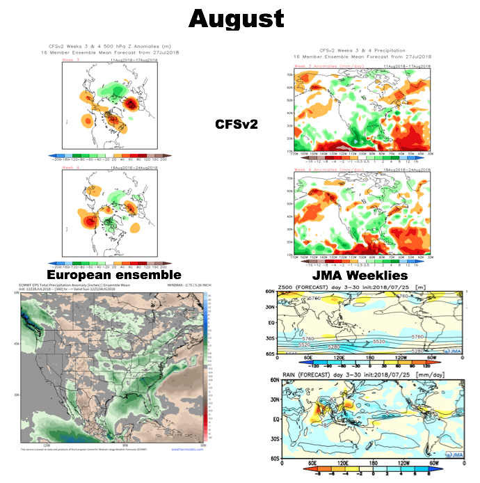 While the cool will relax as we rumble past the first couple days of the month (we’re in the “dog days” after all), I still think the worst of the heat is over for the summer and the headline for August will likely be a situation where we begin to make up for lost time in the precipitation department. That upper ridge centered to our west in the means will likely result in a continuation of rather active times from a precipitation perspective through the month and our idea is that we finish August with above normal precipitation across central Indiana for the first time since April…
You must be logged in to view this content. Click Here to become a member of IndyWX.com for full access. Already a member of IndyWx.com All-Access? Log-in here.