Category: JMA

Dissecting Today’s Severe Potential; Winter Returns & Looking More In-depth At The New JMA Weeklies…

The Storm Prediction Center (SPC) has significantly expanded the “slight risk” area to include a large portions of the state.


While a fresh batch of heavy rain will move into central Indiana later this morning (another 1″ to 2″ is a good bet for most communities), the focus shifts to a window where severe thunderstorms will be possible during the early to mid afternoon.

A warm front will lift north through central IN late morning and this will allow relatively warm and moist air to briefly surge as far north as a Logansport to Fort Wayne line.

Note dew points will spike to 60 to 63 degrees over much of central and eastern IN this afternoon.

It’s during the 1p to 5p window when we’re most concerned for the chance of a few severe thunderstorms ahead of the cold front. Damaging winds are of greatest concern, but anytime you have a warm front hanging around central Indiana with these kinds of setups, the potential of a tornado is in the back of your mind. I don’t foresee this being a major tornado outbreak whatsoever, but parameters do suggest the chance of a quick spin-up tornado is present, as well during this timeframe.

The cold front will crash into Indianapolis between 4p and 5p and you’ll certainly know it.

Strong and gusty northwest winds will blow sharply cold air into the region this evening and tonight. In fact, highs in the lower to middle 60s this afternoon will be into the 20s before midnight. Lows Friday morning will fall into the 10s and highs Friday will only top out in the lower 20s with wind chill values in the single digits most of the day.

After a dry open to the weekend, we continue to monitor the potential of a light wintry event Sunday into early Monday. This doesn’t appear to be a big deal, but the chance is there for an inch or two of snow for portions of the central and northern Ohio Valley during this timeframe.

Additional challenges await early and mid next week, but we’ll save those for updates later this afternoon or evening.

JMA Weeklies

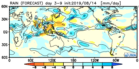
The updated JMA Weeklies are in and in short suggest the southeast ridge continues to put up a fight over the next couple of weeks before getting “squashed” in the Weeks 3-4 timeframe.

This is in line with our thinking of the “transitional” period beginning this upcoming week. We think cold will begin to “push,” but isn’t ready to lock-in as of yet. There will be cold readily available to present more of a wintry potential with storms that track through the region when compared to this week, but we think it’s the period from 2/17 through early March that has the capability of featuring more sustained cold.

That’s a strong signal being painted by the JMA Weeklies in the Weeks 3-4 timeframe for widespread cold. Given that the MJO is forecast to swing into Phase 8 by this timeframe, along with the NAO/ AO looking to dip negative, the widespread cold look is a good idea to us during this particular time period.

Permanent link to this article: https://indywx.com/dissecting-todays-severe-potential-winter-returns-looking-more-in-depth-at-the-new-jma-weeklies/

Long Range: Cold Pattern Isn’t Going Anywhere Fast…

We’ll save our short-term discussions for the severe and high-impact arctic outbreak on deck and focus our attention in this post to the upcoming several weeks. In short, we don’t expect the cold pattern to break anytime soon. Could there be a day or two of “relaxation?” Yes, but from an overall perspective, confidence is higher than normal on the colder than average pattern continuing through the month of February.

Let’s dig in to the teleconnections:

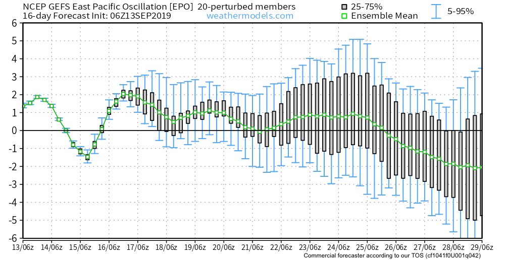
EPO

AO

NAO

PNA


Given the teleconnections in agreement pointing towards a cold pattern, it shouldn’t come as a surprise that the majority of data is also on the cold train as we flip the page into February:

CFSv2 Weeklies

Weeks 1 & 2

Weeks 3 & 4

JMA Weekly

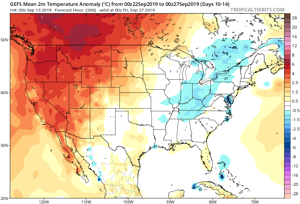
GEFS

While we aren’t licensed to show the European Weeklies, the new update runs with a cold pattern into early March. This falls in line with the overall consensus of longer range data, backed up by teleconnections.

Though not nearly at the amplitude of a few weeks ago, the MJO (Madden-Julian Oscillation) is forecast to move through Phases 5 and 6 in the coming weeks before going back into the “null” phase.


Phases 5 and 6 this time of year would suggest colder anomalies are more likely around our neck of the woods:

Given the above, we continue to think a colder than average “2nd half” of winter looms for the region. We lean heavily on the NAO, EPO, and AO state(s) this time of year and all would point towards a cold time of things moving forward, overall. The latest European Weeklies are interesting from a couple of fronts- initially very cold and then progressively stormy. The idea here is that we remain quite wintry through February and into early March before this pattern breaks. While we may not see a “repeat” visit of the Vortex, it wouldn’t surprise us to see another major arctic outbreak again this winter (after next week), but that likely comes later, and towards the end of the game before we snap into spring.

Buckle up; we think we have a long way to go this winter…

Permanent link to this article: https://indywx.com/long-range-cold-pattern-isnt-going-anywhere-fast/

VIDEO: Long Range Update; And Looking At This Weekend’s Snow Storm…

Tonight’s video update focuses on the long range and reviews some of the fresh short-term data churning on this weekend’s snow storm.

You must be logged in to view this content. Click Here to become a member of IndyWX.com for full access.  Already a member of IndyWx.com All-Access?  Log-in here.

Permanent link to this article: https://indywx.com/video-long-range-update-and-looking-at-this-weekends-snow-storm/

NEW JMA Weeklies Highlight Overall Mild Pattern…

Winter has been on hold over the past few weeks, and there’s really nothing that looks to shake that up anytime soon (at least through the upcoming 10-14 days).

The new JMA Weeklies are in this morning and they continue to highlight the mild times:

Week 1

Week 2

Weeks 3-4

This is a rather dramatic reversal from what this particular model was saying only last week- when it was bringing winter back with authority by Week 2 on.  One could easily argue that even out to the Weeks 3-4 time frame that this certainly isn’t an ideal look for “stick and hold” cold to eventually push into the East.

There is a lot going on “behind the scenes” right now and this isn’t us saying winter’s over before it really even began, but it continues to look more and more likely that any sort of sustained cold and potentially snowy times will have to remain on hold until potentially late month.  The roaring PAC jet will likely continue to have it’s say until then…

(More later tonight on some of the items that argue for winter to get going as we progress into late January and beyond).

Permanent link to this article: https://indywx.com/new-jma-weeklies-highlight-overall-mild-pattern/

Deeper Look Into The Long Range…

You must be logged in to view this content. Click Here to become a member of IndyWX.com for full access.  Already a member of IndyWx.com All-Access?  Log-in here.

Permanent link to this article: https://indywx.com/deeper-look-into-the-long-range/