Long Range Update: Latest EPO/ MJO Implications…

Before we dig into the late-February pattern, there’s no let-up in sight with respect to our current active weather pattern. Just next week alone, we’re tracking (3) systems:

I. Sunday

II. Wednesday

III. Thursday-Friday

This is all part of the big battle taking place between a persistent southeast ridge and western trough. The tight thermal gradient between these features will help “fuel” continued active times, and above average precipitation next week. As mentioned this morning, at times we’ll have to deal with bouts of moderate-heavy rain, and at others, sleet, snow, and freezing rain.

An active weather pattern will continue as the ‘mean’ storm track cuts right through the Ohio Valley next week.

Looking ahead, we continue to build our longer range forecast by using “base ingredients” that feature a 50-50 split of the MJO (Madden Julian Oscillation) and EPO (East Pacific Oscillation).

The MJO maintains a warm look, rolling things into Phase 5-6 over the next few weeks.
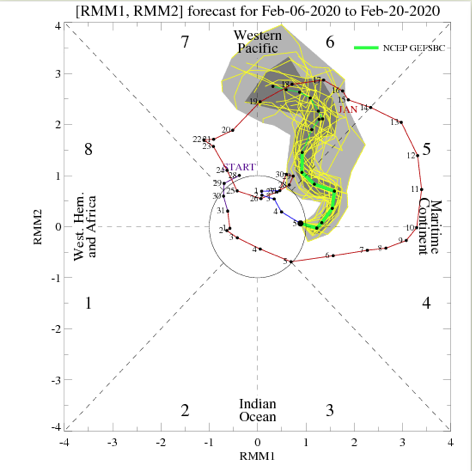
As you know by now, these are warm phases- especially across the eastern portion of the country.
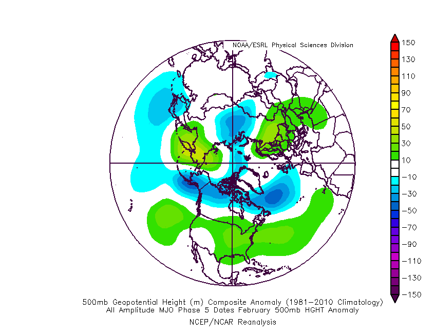
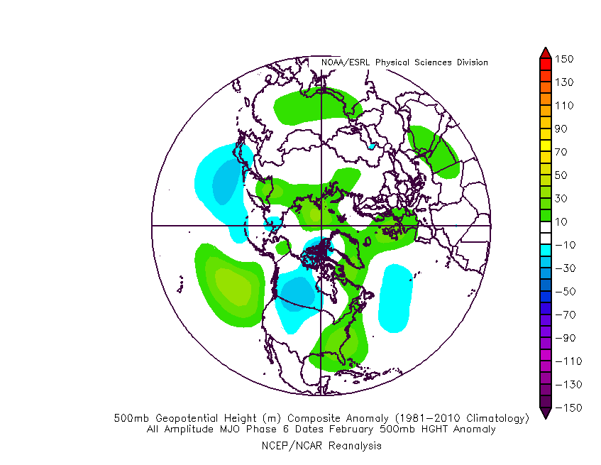
The “saving grace” for fans of at least being on the playing field for a chance of wintry weather in such warm MJO phases is the negative EPO. There’s great model agreement that this negative EPO will continue into the middle part of the month and this will keep us on our toes for wintry implications as storms track through the region. Conversely, there’s reason to buy into a “blow torch” regime to close the month, as the EPO flips positive and combines with the Phase 5-6 of the MJO.
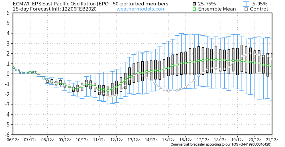
To no surprise, given the above, we see the new European Weeklies showing a warming trend (after the fight over the upcoming week) for late-February.

The JMA Weeklies from this morning (for the Weeks 3-4 time frame) would agree.

Wintry Mix Tomorrow Evening; Fresh Long Range Fun…

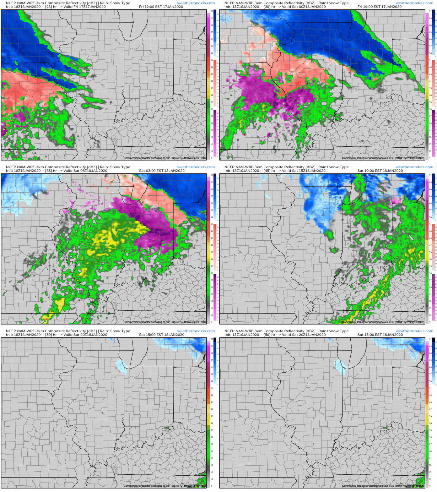
Friday will dawn dry, but the mid and high level cloud canopy will be a sign of things to come. These clouds will lower and thicken through the day and eventually give way to a wintry mix by evening. While there may initially be a period of snow (especially north of Indianapolis), the majority of the “overrunning” precipitation should fall as a mixture of sleet and freezing rain. In and around Indianapolis and points north, a light “glaze” of ice is possible Friday evening of up to .10″ (after the possibility of a coating of snow).

Dry air will likely have to be overcome at first, but a burst of snow is possible into the city around 5p to 6p before the transition over to the sleet and freezing rain mixture. Eventually, the icy mixture will transition to a cold rain prior to sunrise Saturday.

MUCH colder air will pour into the state Saturday evening with temperatures falling into the 10s prior to midnight Sunday morning and wind chills into the single digits.

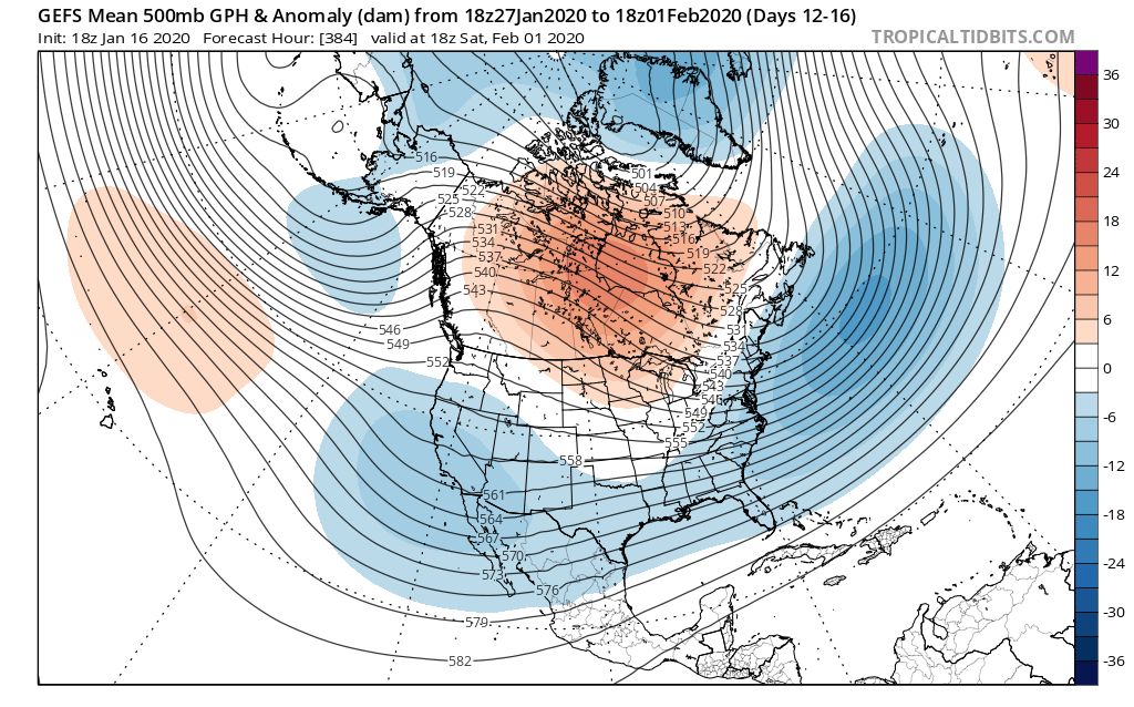
As we look longer term, we don’t see any reason to alter our ongoing thoughts of a colder pattern taking hold, overall, over the upcoming 10-14 day period (and likely into the first half of Feb.). We’ve covered our reasoning in previous posts (Phase 7 of the MJO, positive PNA, neutral EPO, etc.). What’s interesting to note is the rather stark difference in the handling of the EPO between the negative GEFS and positive EPS. The likely end result will be somewhere in between; hence our neutral EPO forecast. At the end of the day, it’s really not the EPO, PNA, or NAO that will drive the mean pattern, but the MJO. And with that said, Phase 7 of the MJO features a cold, stormy look.

The high latitude blocking screams for an active storm track across our neck of the woods (as does the slightly positive PNA and neutral EPO). Sure enough, the latest modeling is going towards this stormy look (active southern stream) in the medium to long range period.

A great mentor once taught me to always be leery of ridges over Hudson Bay in the winter time. Time and time again, this pattern setup results in fairly widespread winter storm events through the Lower 48 and we think there is increased potential in this sometime during the Jan. 25-31 time period. While there’s no way to be specific, just keep a mental note in the back of your mind for this threat.

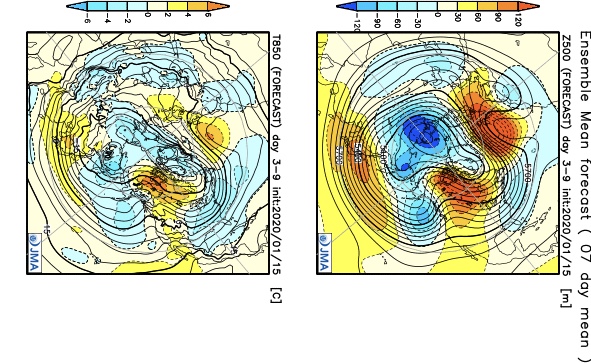
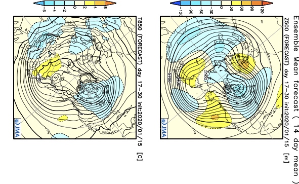
In closing, a review of the latest JMA Weeklies shows a significantly different pattern than what we’ve grown accustomed to as of late taking up residence through the bulk of the upcoming 3-4 weeks. Given the above, it would be tough to argue this look…

Week 1
Week 2
Weeks 3-4

Fresh video update will hit in the AM with new thoughts around tomorrow evening’s winter weather maker.

Long Range Update: Get Used To The Warmer Than Average Conditions

The short-term is as quiet as one could ever ask for this time of year. Accordingly, this is allowing us to look ahead to the potential of more active times on the horizon. Will that increasingly active regime be met with a return of the chill? Let’s dig in…

First and foremost, let’s look over the teleconnections and what light they’re shining on the pattern:

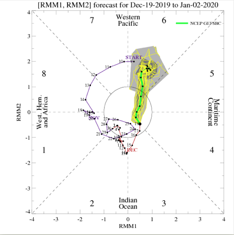
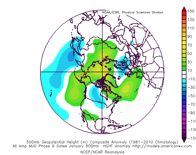
The Madden-Julian Oscillation has eyes on Phase 6 as we open January. This, too, would favor the “core” of the cold well to our northwest. We do, however, note the high latitude blocking that develops in Phase 6.

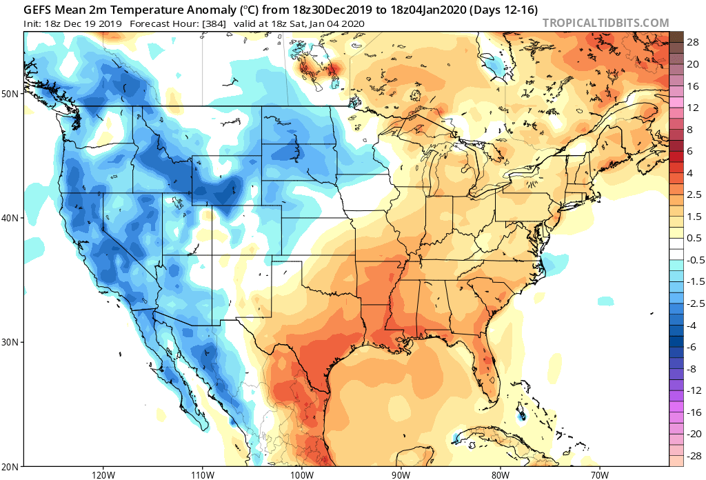
Given the above, to no surprise, the bulk of long range data paints above normal temperatures to open January. It appears as if what will be an increasingly busy pattern at that point will fall primarily in the form of rain as we ring in the new year thanks to storms cutting up west of our region.

The EPS, GEFS, and JMA Weeklies all suggest a warmer than normal pattern will be with us as we rumble through the first few days of the new year.

As we look ahead deeper into January, we do still believe the pattern will flip towards a colder than normal flavor, but we’re still a few weeks away from that change taking place. In the meantime, a quiet pattern with moderating temperatures (this week) will give way to even milder conditions the following week with a couple opportunities of rain to close the year and open January.

Latest Thoughts On Early Next Week; Long Range Update Into Early Jan…

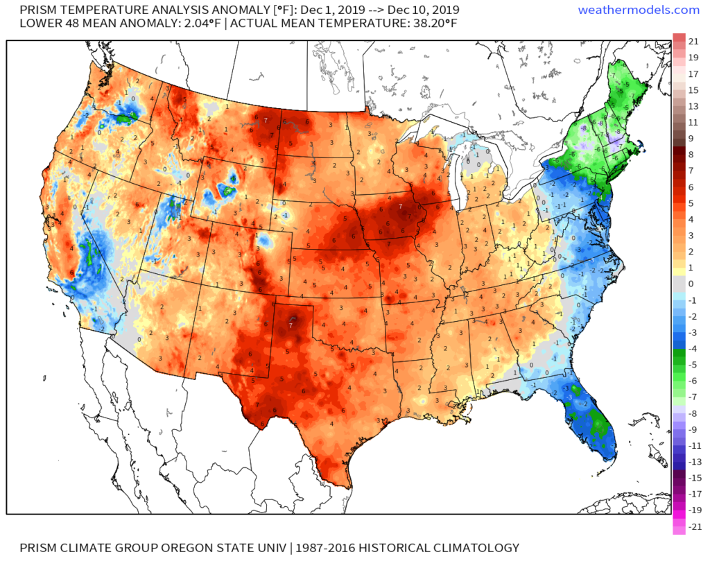
Through the 11th, December is running 1.6° above normal in Indianapolis. This milder than normal theme is rather widespread so far this month through the Lower 48.

As we look ahead, there are continued reasons to believe the pattern will begin to go through more of a transition towards an ultimately more sustained cold pattern as January evolves. We think that transition really started early this week and will feature plenty of “back and forth” over the the next 2-3 weeks before settling into the more sustained cold regime. There will be storms and “rumors of storms” that we’ll have to track through the transitional period, including smack-dab in the heart of the holiday season this year.

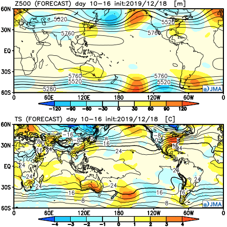
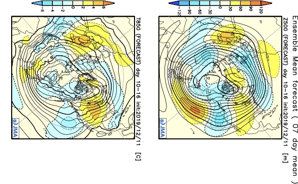
The latest JMA Weeklies (update each Thursday morning) shows this “fight” over the next 1-3 weeks.

JMA Weeklies Day 3-9 shows the cold returning to our portion of the country.
The pattern warms significantly across the Plains in the 10-16 day time frame and some of this milder air will try and eject east into the Ohio Valley.

Without blocking in place, the way the JMA Weeklies handle the pattern is likely, but the Weeks 2-3 time period does have a chance to offer up a headache or two as the models may begin to adjust to an increasingly “blocky” time of things.

There are at least “hints” that some of the teleconnections that would promote more of a blocky pattern are beginning to align. We caution though that this does take time for these feature to mature and begin to ultimately have a greater impact on our pattern.

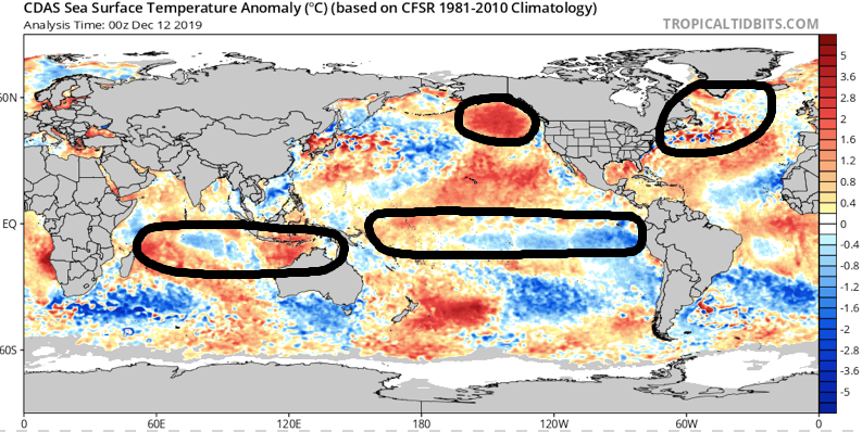
The latest GEFS insists on a developing negative EPO in the medium to longer range. We know this favors eastern cold. Eventually, this should, indeed, take place, especially due to the northeast Pacific SST configuration and help drive more long-lasting cold, locally.
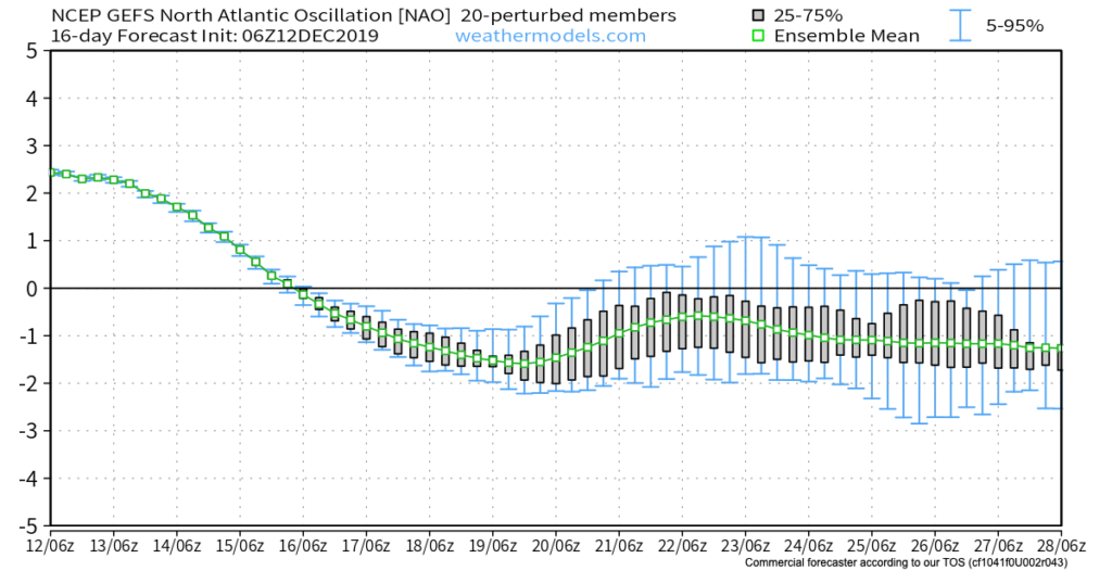
Interestingly, the GEFS also depicts a developing negative NAO mid and late December. This can help result in more sustained cold across our portion of the country into the northeast.

As we revisit the latest SST configuration, there’s continued reason to be very excited about this winter if you’re a fan of colder and snowier than normal conditions. We always knew December would be the tough month before the pattern settles into the mean winter pattern late December into March. Now, time to just sit back and watch things unfold. 🙂

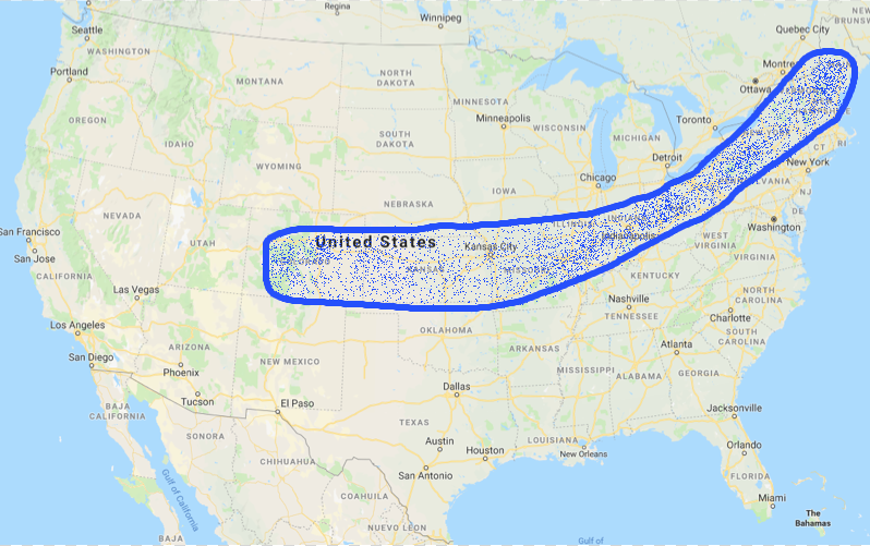
Now, back to the short-term. Despite forecast models very much still in (2) separate worlds, we’ve dug into analogs and looked through countless similar patterns from the past. As model consensus develops (hopefully sooner rather than later), let’s see if they (speaking specifically to the GFS and European) converge on this similar solution for best chances of accumulating snow:

We still have many details to sort through and we caution that this system is far from being etched in stone. You’ll want to keep close tabs on latest developments over the next couple of days. With that said, we’re looking for potential wintry impacts here across central Indiana beginning Sunday night and continuing through Monday.

This evening’s video update will focus solely on the Sunday-Monday system, including the latest model developments from 12z. Have a great Thursday!