Updated 01.04.24 @ 6:46a Enjoy the last couple of quiet days while you have them. Skies will slowly brighten later today, but otherwise anticipate mostly cloudy and seasonably cold conditions.…
You must be logged in to view this content. Click Here to become a member of IndyWX.com for full access. Already a member of IndyWx.com All-Access? Log-in here.
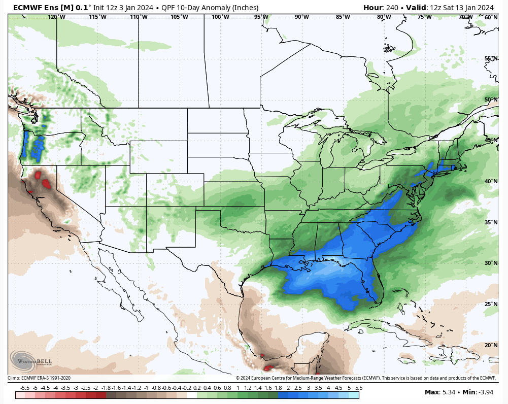
Today’s 12z guidance continues to reflect quite an active and stormy period of weather kicking off this weekend, continuing through mid-January. This is a byproduct of all of the high latitude blocking that develops over the span of the next 6-10 days.
The negative PNA is putting a real wrench in any one of these “meaningful” area of low pressure systems, Saturday’s excluded, from being totally on the wintry side. Look for above normal precipitation over the upcoming 6-10 days with plenty of mixing events going on.
Speaking of that, we don’t have any changes to our thoughts on the first two systems:
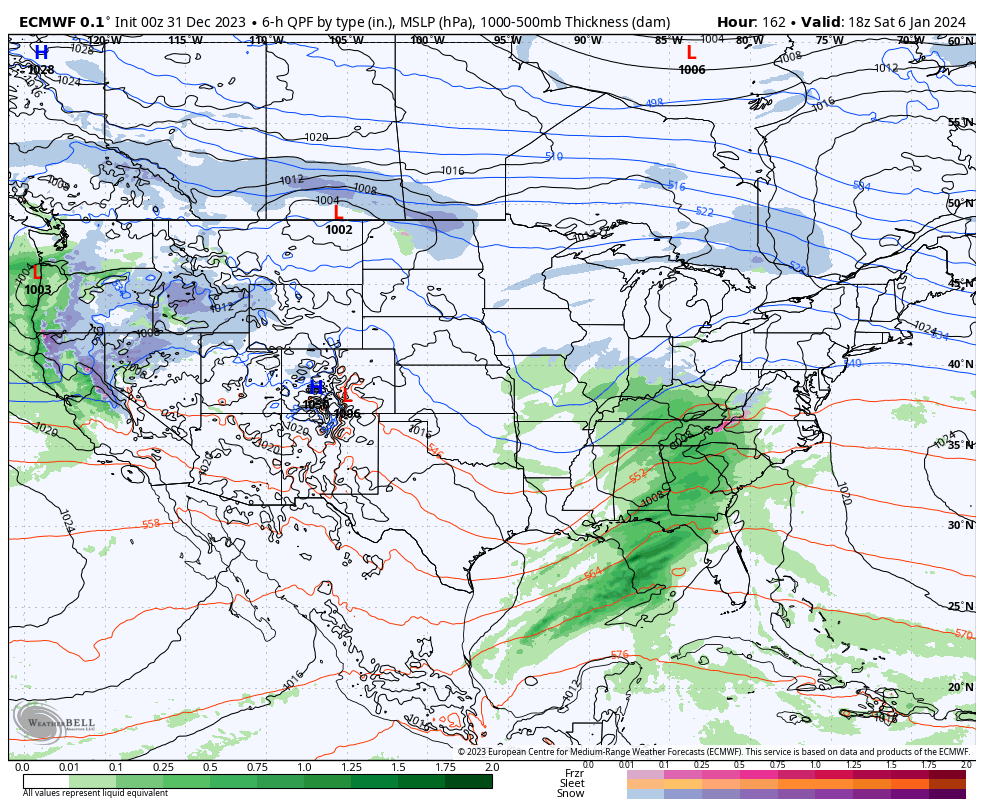
Saturday- light snow should overspread the region through the morning hours with light accumulation, primarily on grassy and elevated surfaces. We’ll firm up snow numbers over the next 24 hours. Note, additional light snow, potentially mixed with light rain, should fall Saturday night into Sunday as upper level energy scoots across the state.
Monday night/ Tuesday- after a calm open to the work week, clouds will increase Monday PM and give way to a wintry mix of rain, sleet, and snow across the state Monday night into Tuesday morning. As warm air advection kicks into high gear, the wintry mix will transition to a cold rain for central and southern IN. Further north, it’s a tougher call with mixing issues hanging on longer. Heavy precipitation and strong/ gusty winds can be expected Tuesday. We all turn colder Tuesday night with rain transitioning back to wind-whipped snow/ snow showers that will continue Wednesday with additional light accumulation expected.
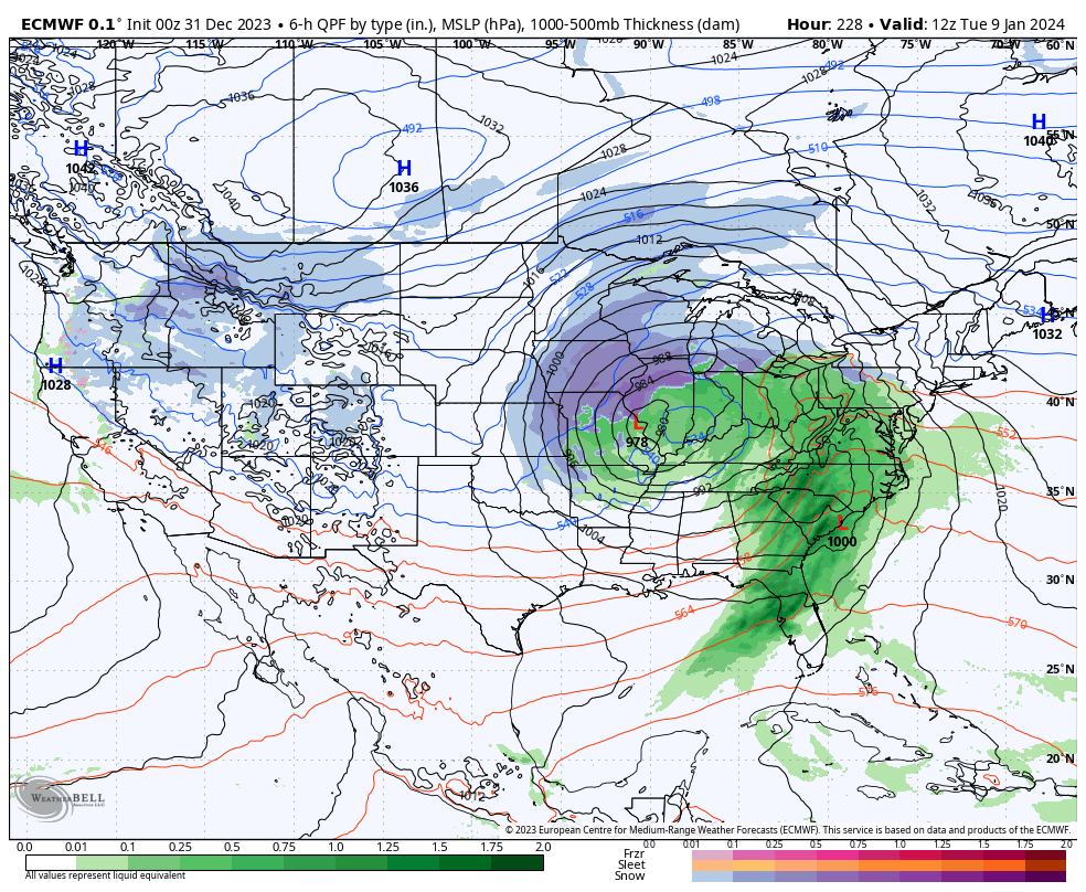
Wednesday night/ Friday- another potential significant area of low pressure will impact the region during this particular time period with additional heavy precipitation (likely another mixed bag event) and strong winds.
Well above normal precipitation is expected across a large chunk of the East over the upcoming 10 days.
The initial dump of bitterly cold, arctic, air will target the West through the 6-10 day period before making an attempt to bleed east (likely in modified fashion) during this period. Per our longer range discussions, the MJO will have the primary say in our late January pattern and we’ll have fresh long range thoughts posted prior to week’s end.
Updated 01.03.24 @ 7:03a After a quiet start to the year, a much busier weather pattern is set to take foot over the span of the upcoming weekend, continuing throughout…
You must be logged in to view this content. Click Here to become a member of IndyWX.com for full access. Already a member of IndyWx.com All-Access? Log-in here.
We’re heading towards a “special” pattern over the next couple weeks, especially for winter weather enthusiasts. The potential in the said pattern is mighty, but can potential become reality? Thankfully, we have a quiet open to the month to track all of the possibilities that begin to take their position this upcoming weekend.
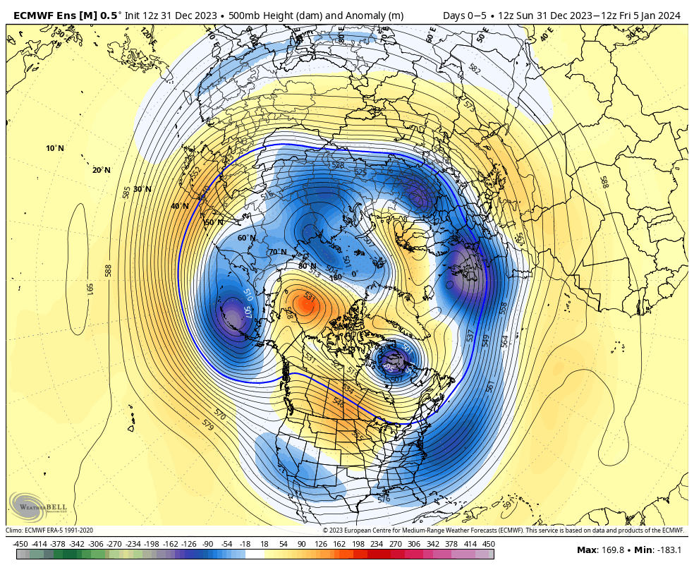
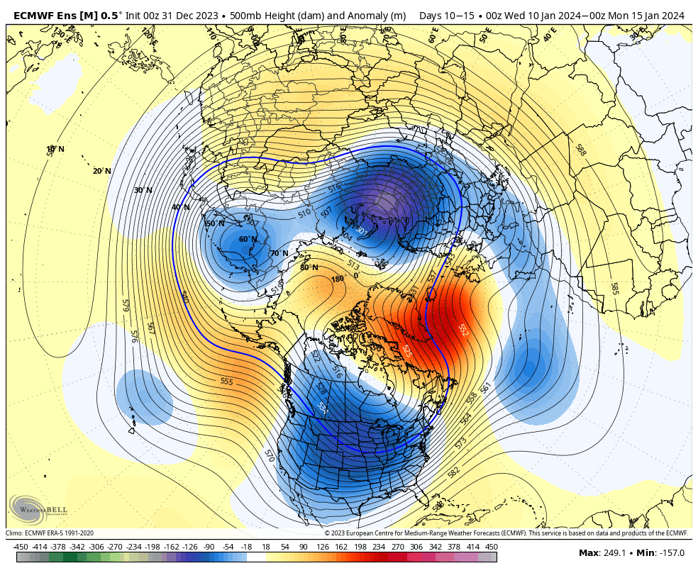
It’s easy to become enamored with the expansive trough and coast to coast cold that follows in the 10-15 day range (by the way, truly bitter air should arrive during this period), but what’s more interesting to me is the building Greenland Block. That kind of block usually promotes all sorts of wintry “fun and games” here and across a large chunk of the country. It’s also note worthy as it tends to lead to more sustainable wintry conditions. Perhaps the “extreme and nothing in between” cold solution/ lean for the latter part of January may have merit?
While far too early for specific details, the stormy shift appears to be a good call with the initial storm taking aim on the region this upcoming weekend, followed by a second system that also has the potential of producing wintry weather the early and middle part of the following week. Simply put, the threat of winter storm(s) is growing over the course of the upcoming 10 days.
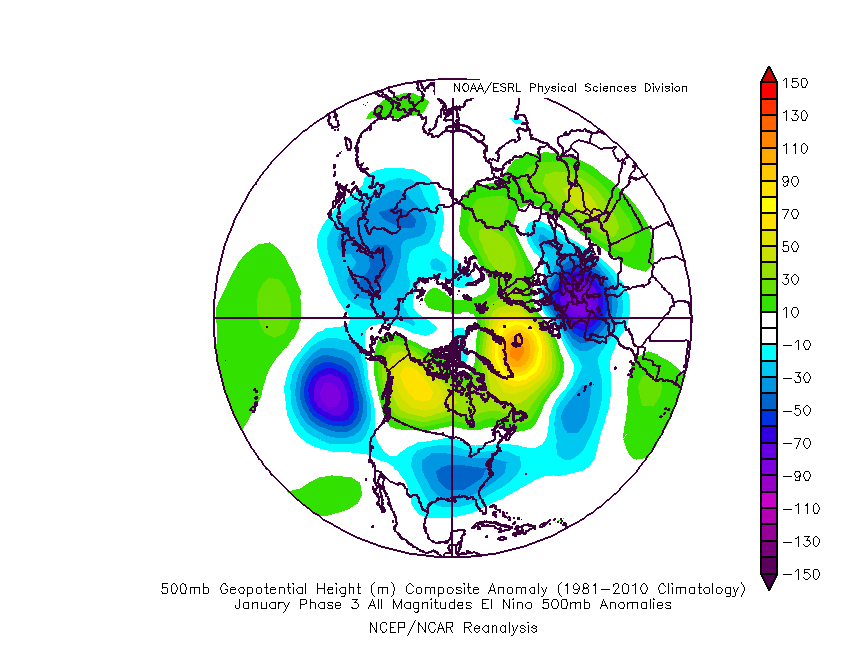
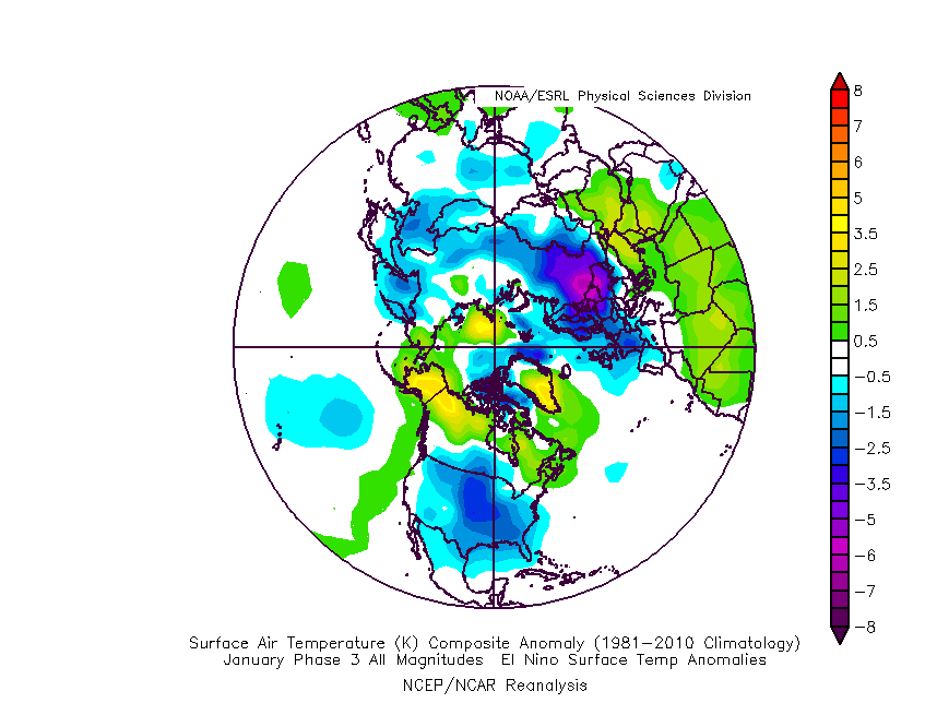
The MJO is rolling right into the notorious cold (for this time of year) phase 3 as we open up the new year.
The composite analog for phase 3 in January from an upper air and surface temperature anomaly standpoint:
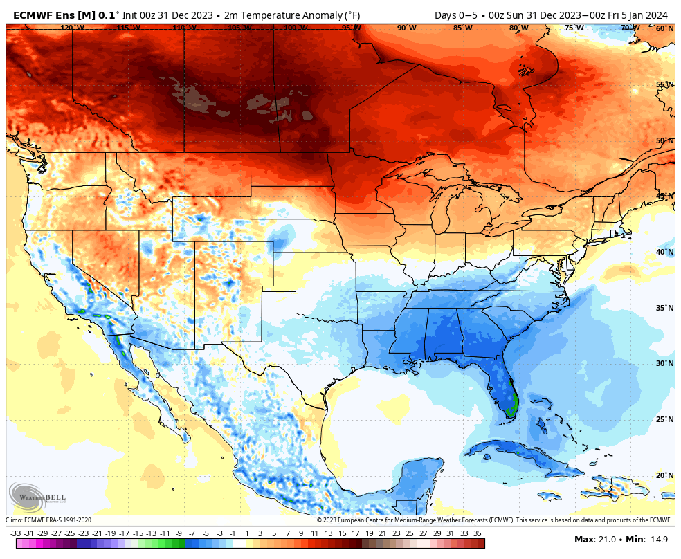
Ensemble guidance shows the widespread colder than normal temperatures overspreading the country. Like clockwork, this is almost identical to the Phase 3 analog above.
After a quiet week, we’ll watch 2 storms in the 5-10 day period. The first comes along next weekend. While still far too early to get detailed, this one does have potential to serve up some wintry mischief to the Ohio Valley, including central Indiana.
The second storm follows and it’s behind this feature that more of a truly arctic air mass will get involved in our pattern.
The pattern will stay busy as the arctic air presses in. At the same time, note the Greenland block beginning to form. Winter weather enthusiasts have to be chomping at the bit by that 10-15 day look. Needless to say, we can expect a rapidly expanding snow pack across the Lower 48 over the next couple weeks.
Thereafter, all eyes will remain on the MJO. Do we roll into the “null phase,” such as what the European suggests or swing through the traditionally mild/ warm phases such as the American guidance portrays? Stay tuned…