
I. Upper level energy will pinwheel across the region tonight into Wednesday and result in helping rain showers (this afternoon and evening) transition to snow showers (tonight and Wednesday).
A couple of heavier snow squalls could result in a quick coating to less than 1″ of snow for some areas overnight into Wednesday.

 II. The next item we continue to monitor has to do with an initial piece of energy that will scoot across the Ohio Valley Friday. This is ahead of a more significant storm that will likely develop over the weekend and models continue to fluctuate on how they handle things. For now, we’ll maintain a rain/ snow mix Friday, but simply can’t get more specific than that. There are ways this could deposit a stripe of accumulating wet snow for some of the region, but it’s premature to try and nail down where this may occur.
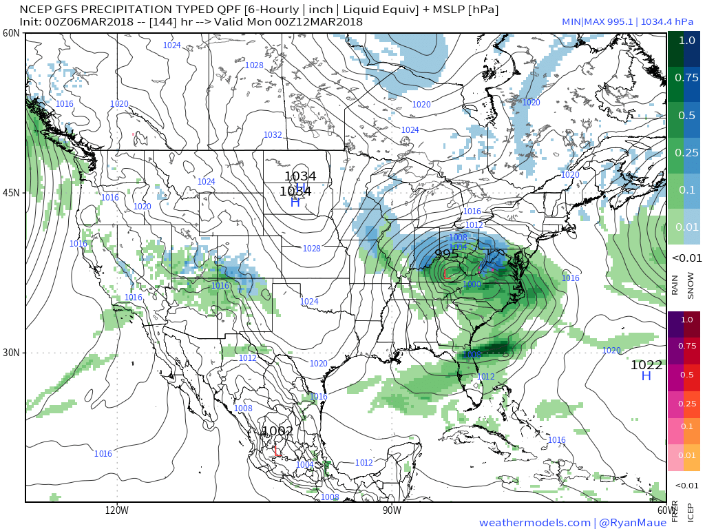
 III. We also have to continue to keep a close eye on what transpires Sunday. We favor one surface low tracking along the Ohio River into the Appalachians before a secondary low takes over along the Mid Atlantic coastline Monday. Again, a swath of wet snow north of the low’s track Sunday into early Monday.
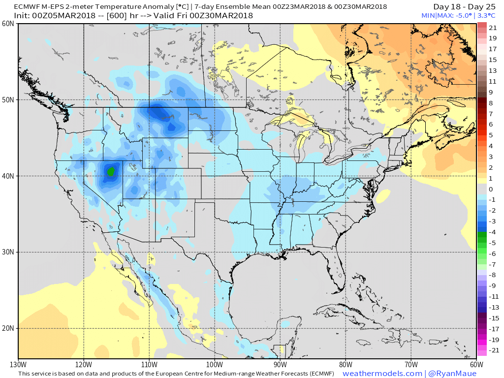
 IV. While we should see warmth eject out of the southern Plains in the Week 2 time frame, the large majority of data says this will only be temporary and that cooler than normal temperatures will persist through the balance of the upcoming several weeks. With late season high latitude blocking in place it’s hard to disagree with that idea. Once blocking sets up (especially late in the season), it can be like “pulling teeth” to get any sort of sustained warmth. Just an idea here.

Courtesy of weathermodels.com

Courtesy of weathermodels.com
Courtesy of weathermodels.com

Courtesy of weathermodels.com