
I. Upper level energy will pinwheel across the region tonight into Wednesday and result in helping rain showers (this afternoon and evening) transition to snow showers (tonight and Wednesday).
A couple of heavier snow squalls could result in a quick coating to less than 1″ of snow for some areas overnight into Wednesday.

 II. The next item we continue to monitor has to do with an initial piece of energy that will scoot across the Ohio Valley Friday. This is ahead of a more significant storm that will likely develop over the weekend and models continue to fluctuate on how they handle things. For now, we’ll maintain a rain/ snow mix Friday, but simply can’t get more specific than that. There are ways this could deposit a stripe of accumulating wet snow for some of the region, but it’s premature to try and nail down where this may occur.
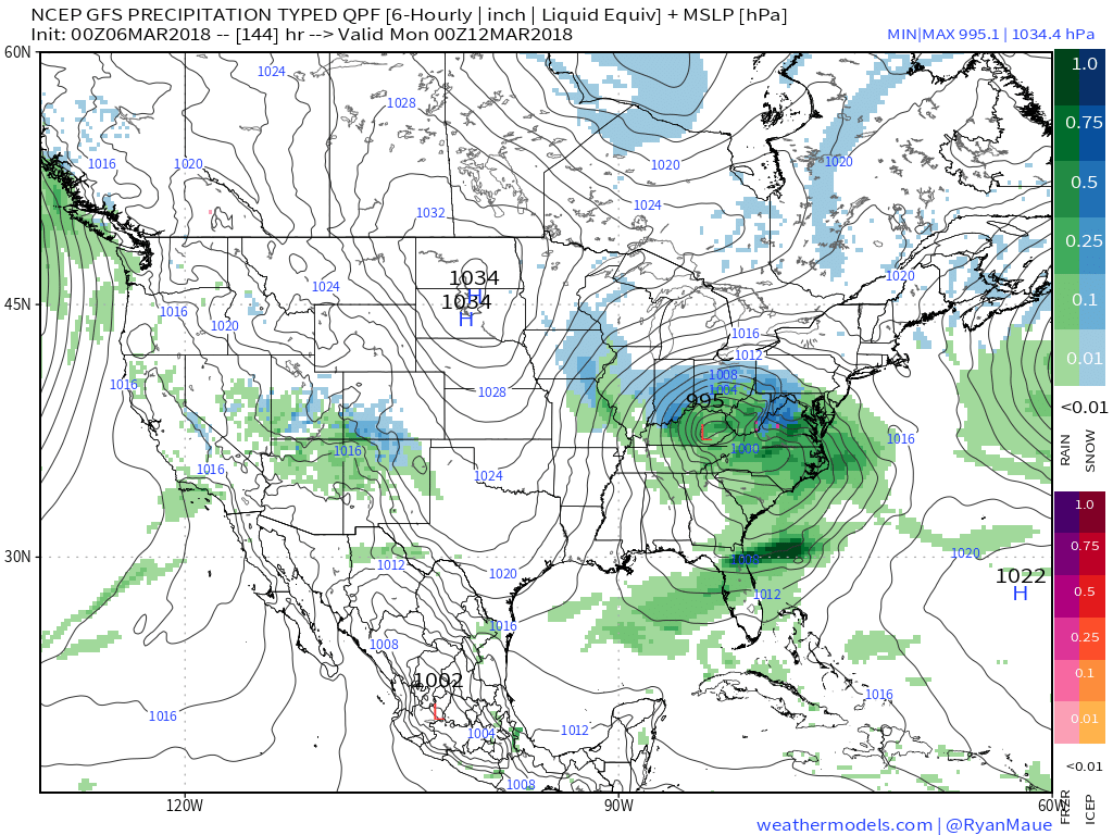
 III. We also have to continue to keep a close eye on what transpires Sunday. We favor one surface low tracking along the Ohio River into the Appalachians before a secondary low takes over along the Mid Atlantic coastline Monday. Again, a swath of wet snow north of the low’s track Sunday into early Monday.
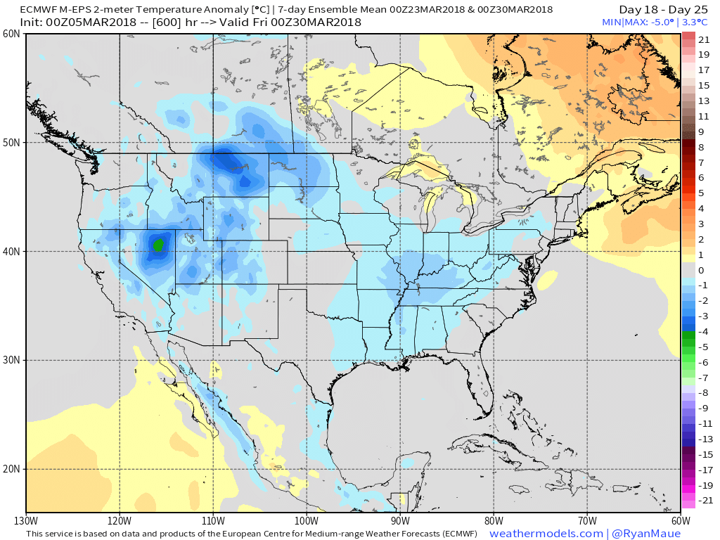
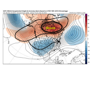
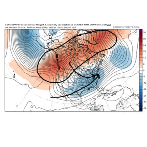
 IV. While we should see warmth eject out of the southern Plains in the Week 2 time frame, the large majority of data says this will only be temporary and that cooler than normal temperatures will persist through the balance of the upcoming several weeks. With late season high latitude blocking in place it’s hard to disagree with that idea. Once blocking sets up (especially late in the season), it can be like “pulling teeth” to get any sort of sustained warmth. Just an idea here.

Courtesy of weathermodels.com

Courtesy of weathermodels.com
Courtesy of weathermodels.com

Courtesy of weathermodels.com
 The early spring “fling” has lulled many into believing winter’s finished. While the worst of the winter is certainly behind us, we continue to think a dose of “reality” awaits as we progress through the better part of the first half of March. To be more specific, we feel the period March 6th through the 20th will offer up below average temperatures and an active pattern- capable of producing wintry threats.
 Sure enough, modeling is going to the pattern that will produce below normal temperatures (doesn’t appear to be anything particularly frigid, but colder than average, nonetheless) through mid-month.
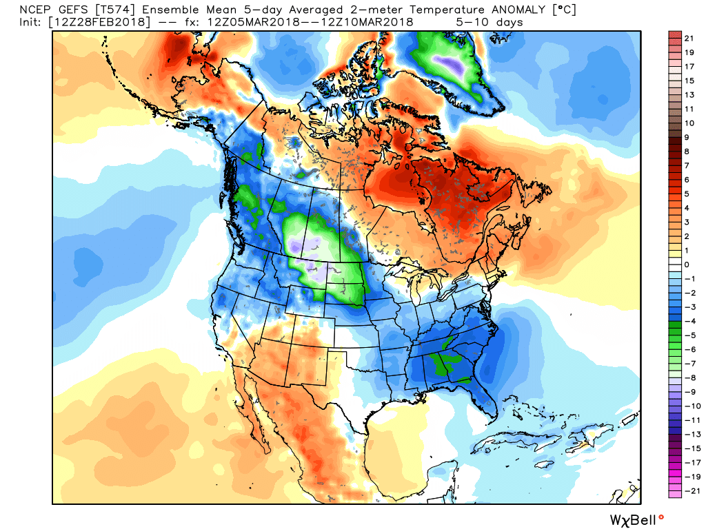
 With blocking in place, an undercutting jet will serve to deliver an active storm track.
 Keeping in mind March winter events need multiple items to come together to create impactful situations, it’s also important not to simply “buy in” to the idea that just because it’s been warm lately that winter is finished. March can be a wild month, as long-time Hoosiers are aware. The pattern we’re heading into over the next 10-14 days is one that’s been void most of the winter (high latitude blocking in place) and can serve as the player needed to flip a “nuisance” variety late-winter event to one that’s much more significant. We’ll need to remain on guard for the potential of one or two “more significant” wintry events as we move through the first couple weeks of the month.
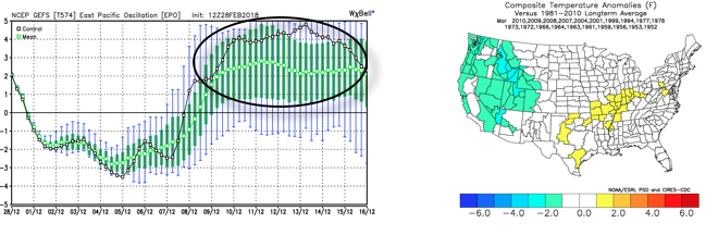 The end result is one that should promote colder than average times over the next couple weeks, overall, along with an active storm track. With blocking in place, the potential of one or two more significant late-winter events are on the table, and we’ll have to fine tune specifics as the individual storms come. While confidence is high that someone within the Ohio Valley region is likely to still deal with a big-hitter event, there’s no way to get specific until the individual players are on the field. Thereafter, the pattern should begin to transition to one more conducive for “stick and hold” spring conditions during the latter portion of the month.
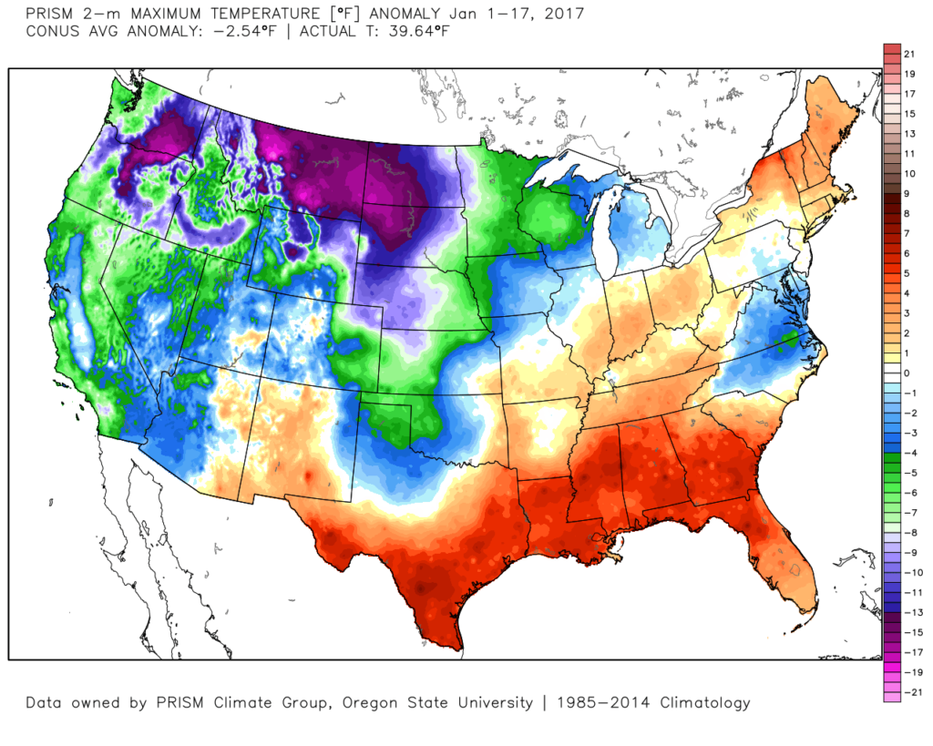 The second week of the month warmed significantly and continues, overall, for the next week.
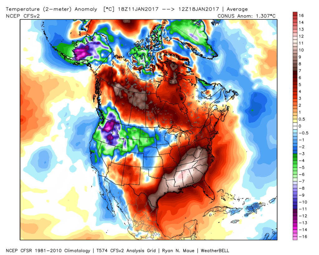 The mid-January warmth is attributed to a roaring PAC jet which is currently helping flood the country with temperatures much more like spring than the dead of winter. We continue to forecast 60+ this weekend across central IN.
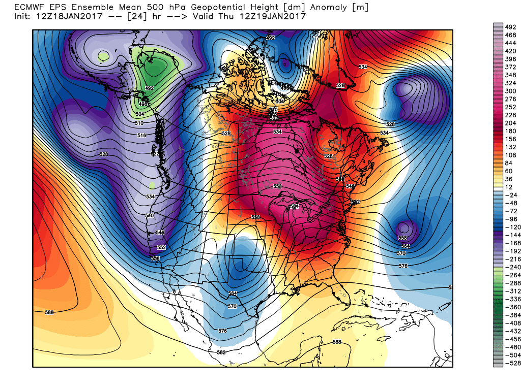 This Weekend:
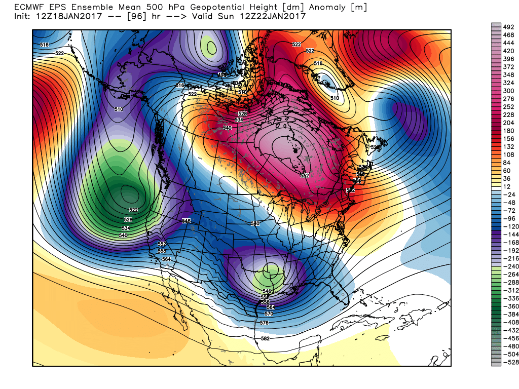 Next Thursday:
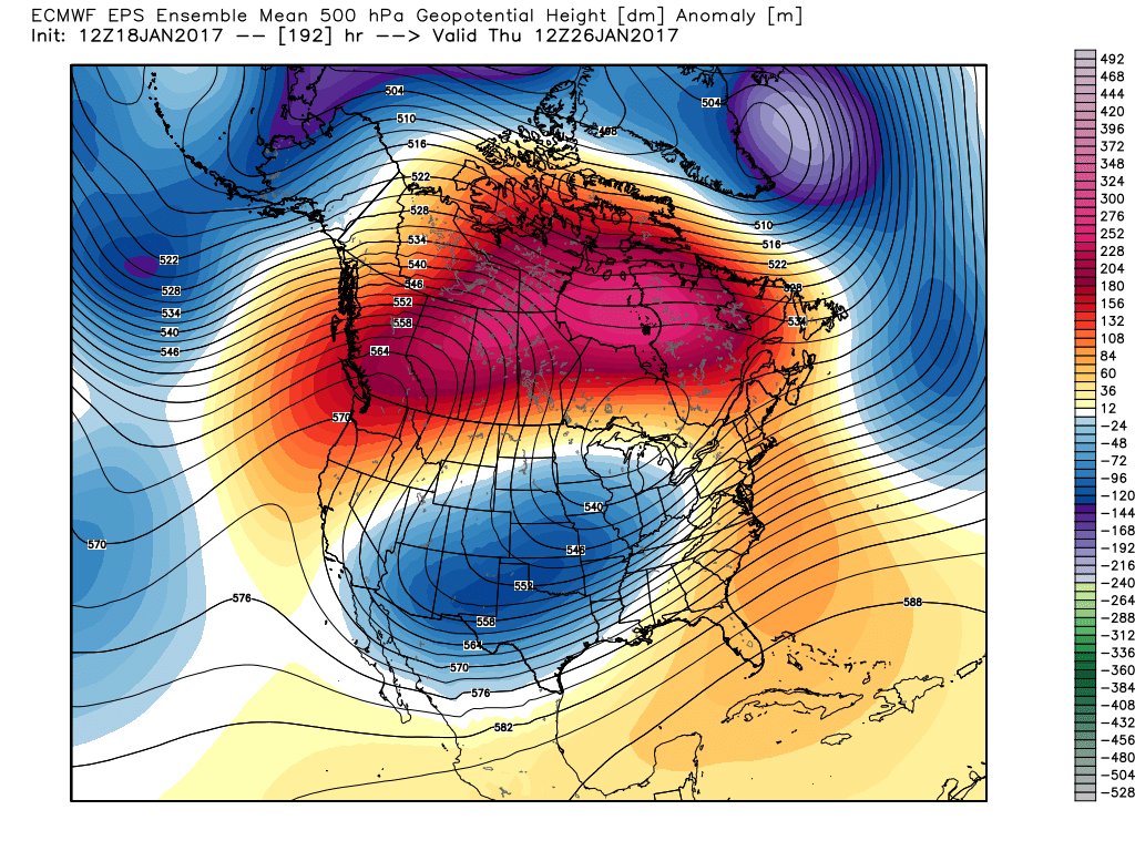 Next Weekend:
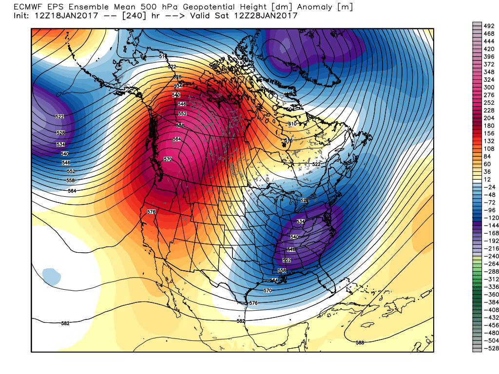 The pattern begins in the short-term with a look that will power anomalous warmth through the weekend, along with renewed rain chances Thursday night into Friday (another 1″+ for most), but begins to shift next week towards the colder look. The 2nd (weekend) storm system will be significant and poses a severe risk to the southeast region. Modeling has backed away on the heavy rain threat Sunday, but showers will be around early next week along with very windy conditions (40+ MPH gusts). Blocking is forcing the low south. By the time we get to next weekend, the pattern has done a 180 and in a position to drill unseasonably cold air back into the central and eastern portions of the country.
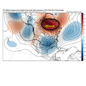
 The Weeklies also show this pattern in the longer-term. While we can’t show the European data here (due to licensing), we can show the JMAs. Again, note the high-latitude blocking.
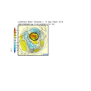 Active times are ahead as a busy storm track develops. Perhaps the scene for many will look a little something like this as we push into the Christmas season…
 In the meantime, gas up the snow blower and sharpen the snow shovel. If our idea is correct, a snowier than average December will come out of this blocky pattern.